Smoky Mountain Motorcycle Spring Road Report April 2013

Smoky Mountain Motorcycle Spring Road Report April 2013 – Current conditions for motorcycle touring and Blue Ridge Parkway riders;

Roads affected:

  • Blue Ridge Parkway
  • US 441 through Great Smoky Mountains National Park
  • Cherohala Skyway
  • Fires Creek Road near Hayesville, NC
  • US 276 / NC 215 south of Waynesville, NC
  • US 70 / 25 north of Hot Springs, NC
  • NC 28 north of Franklin
  • NC 197 near Bakersville
photo - Spring on the Blue Ridge Parkway

Spring on the Blue Ridge Parkway

Blue Ridge Parkway – One by one the incidents of road damage sustained over the winter are being or have been repaired. One significant situation remains – the closure of the Blue Ridge Parkway near Mt. Mitchell. Most recent reports indicate it will be resolved mid-May.

Photo-mt-mitchell-highest-in-east

The observation tower atop Mt. Mitchell is worth the trip, but you have to approach from the north until the road is fixed. Pick a sunny clear day.

A section of the Blue Ridge Parkway on this long high lonely stretch of road has been subsiding and slipping down the mountainside for several years. Frequent riders will remember the noticeable dip in the road just south of the entrance to Mt. Mitchell State Park at NC 128. A slide occurred here several years back, it was important to address this situation before another took out the pavement again.

Photo-Peaks-of-Otter-Lodge

The Peaks of Otter Lodge on the Blue Ridge Parkway will reopen soon.

The Peaks of Otter Lodge north of Roanoke is currently closed, though a new concessionaire has taken the contract and it is expected to open soon. Bluffs Lodge at Doughton Park in NC  will remain closed this season, looks like the campground will be open. The Pisgah Inn opened early south of Asheville. Crabtree Falls visitor center is closed this year.

For a detailed list of Parkway facilities and schedule go here – http://www.nps.gov/blri/parknews/blue-ridge-parkway-releases-2013-season-opening-schedule.htm

Download a free printable detour map here – http://smokymountainrider.com/Downloads/parkway-closure-2013.pdf

US 441 through Great Smoky Mountains National Park – Open

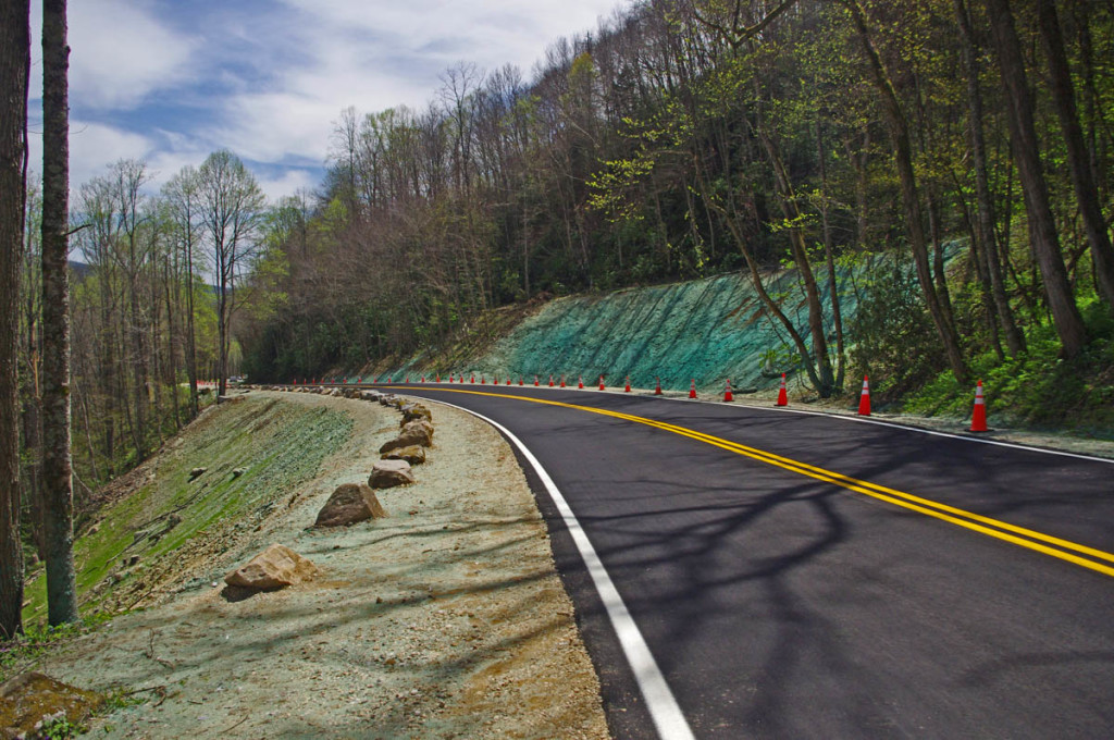
photo - reapir on US 441

The newly repaired section of US 441 in Great Smoky Mountains National Park

Work to repair a landslide on the North Carolina side of the only paved road crossing the park was completed a month ahead of schedule. The remained of the road is open though  a few of the roadside attractions like Chimney Tops are closed. Several of the unpaved roads in the park may not open this year due to cutbacks including Heintooga Ridge Road and Balsam Mountain Road.

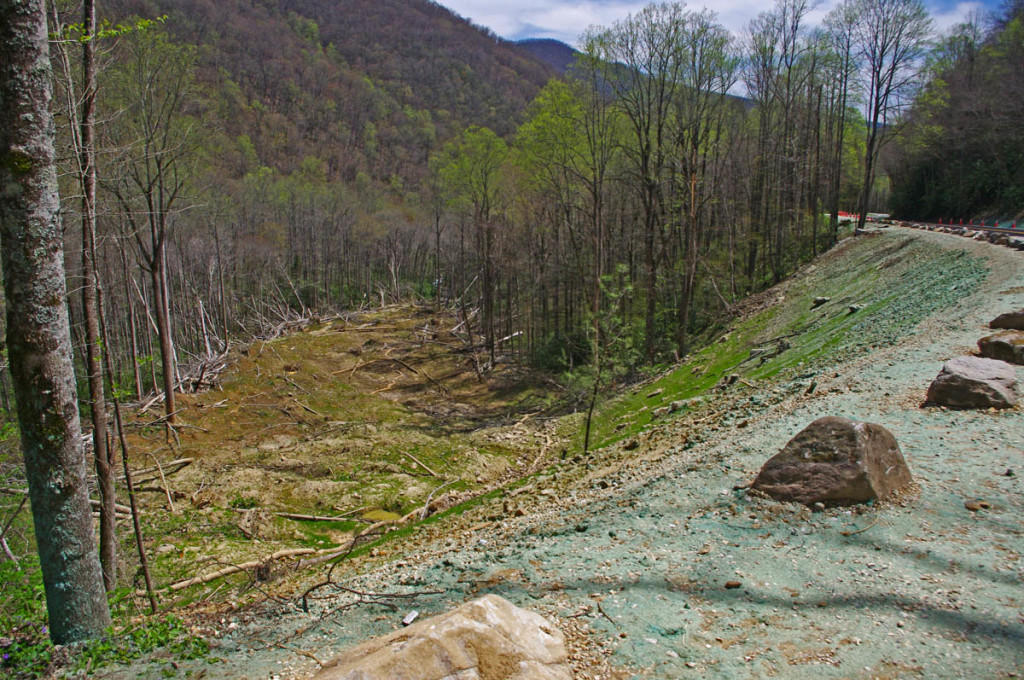
photo - View of the slide damage below the repairs.

View of the slide damage below the repairs.

Cherohala Skyway – one lane closed, work continues

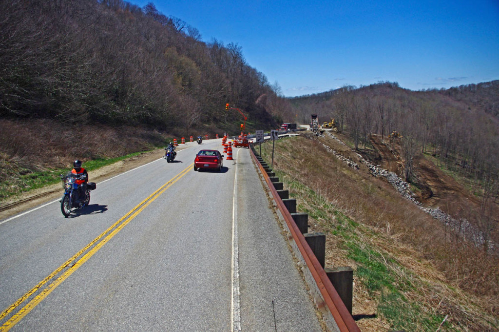
photo - Cherohala Skyway repair work

Work at the landslide on the Cherohala Skyway is progressing well.

Work on the landslide on the Cherohala Skyway is progressing well. Located on the North Carolina side close to the state line, one lane is closed with traffic regulated through the construction zone with temporary traffic lights and a short delay. Expect to encounter trucks hauling fill on the North Carolina side of the ride. You’ll find a little gravel on the road near the detour, but it is generally clean and in great condition.

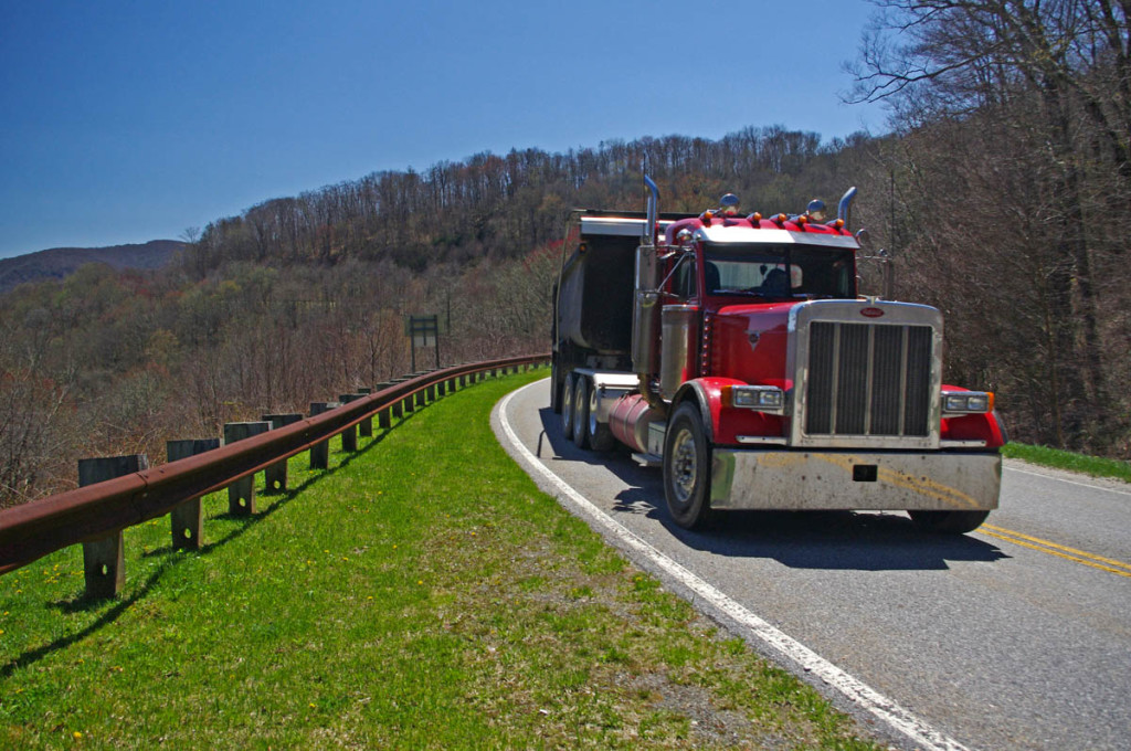
photo - truck on the Cherohala Skyway

You will run into trucks hailing fill on the North Carolina side of the slide.

Fires Creek Road – closed for bridge work

A little known road north of Hayesville, NC, and one of my personal favorites to get away from the congestion on US 64, the road is closed for bridge work through October. Such a nice ride. If I scout a better detour, will post.

NC 215 / US 276 – conditions 

These two classic roads south of Waynesville / Maggie Valley both intersect the Blue Ridge Parkway at their midpoints. Each was repaved last year and are very popular rides.
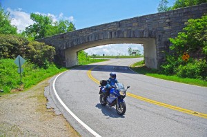
Great Motorcycle Rides in North Carolina - Pisgah Triangles - US 276

Great Motorcycle Rides in North Carolina – Pisgah Triangles – US 276 junction with the Blue Ridge Parkway. As both NC 215 and US 276 connect, you can always hop up and take a quick break with the best of views.

US 276 got a decent paving job and is in good condition. Be wary of gravel in the tight turns on the steep section climbing to reach the Blue Ridge Parkway on the north side. The roadsides were lined with fresh gravel, and it gets kicked into the road by cars and trucks on some of the sharpest curves. Not bad, but be alert.

NC 215 got a “tar and chip” coating which leveled and filled the potholes and cracks, but the surface remains loose in the higher sections. It has improved significantly over the winter. Still watching this road closely as there has been paving equipment parked on the roadside for a few weeks now. A top coat of new asphalt would make this road so much nicer, it could be the destination ride of the season. Will continue to monitor closely and keep my fingers crossed.
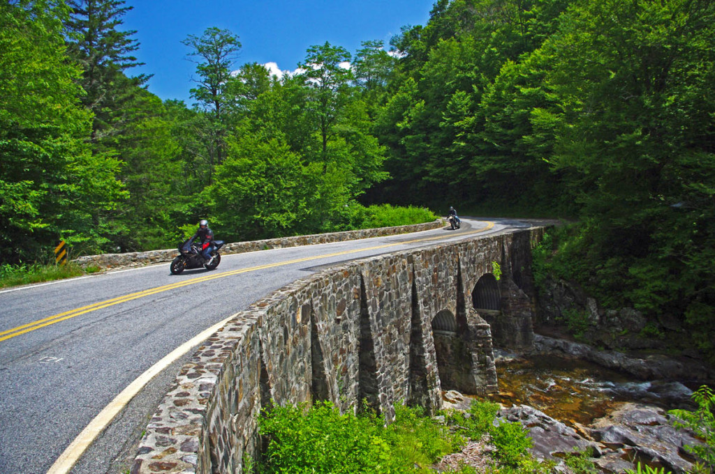
The higher you go the better it gets on NC 215.

The higher you go the better it gets on NC 215. The road crests where it meets the Blue Ridge Parkway, then plunges down the other side of the gap.

US 70 / 25 north of Hot Springs, NC
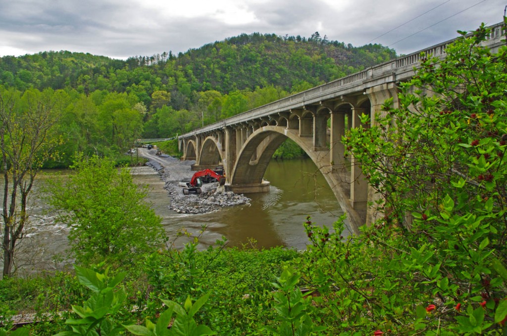
photo-wolf-creek-bridge

They don’t make ’em like that anymore! Look at that beautiful 1928 architecture. Detour via Fugate Road. The best thing about the detour is you get to see the bridge!

The bridge across the French Broad River will remain closed this year at the state line between North Carolina and Tennessee. This section of road connects Hot Springs, NC to Newport, TN. Use Fugate road as a detour. More info / photos here – http://smokymountainrider.com/?p=4239

NC 28 north of Franklin, NC –

One lane closed, sometimes short delays until May 1 as road is widened in this section north of town.

NC 197 near Bakersville, NC –

Bridge replacement through June 30. Detour marked.

____________________________________________________________________

wayne busch - Smoky Mountain Motorcycle Rider.com

Wayne Busch

– Wayne Busch lives in Waynesville, NC, where he produces the most detailed and comprehensive and up-to-date motorcycle pocket maps of the Blue Ridge and Smoky Mountains to help you get the most of your vacation experience. See them here – AmericaRidesMaps.com

Total Rider Tech Logo

Learn Total Control

Wayne is an advanced motorcycle instructor for Total Rider Tech teaching Lee Parks Total Control Advanced Rider Courses. Isn’t it time you looked into advanced rider training to ride more confidently and safely? It can transform your mountain riding experience.  Total Rider Tech

____________________________________________________________________

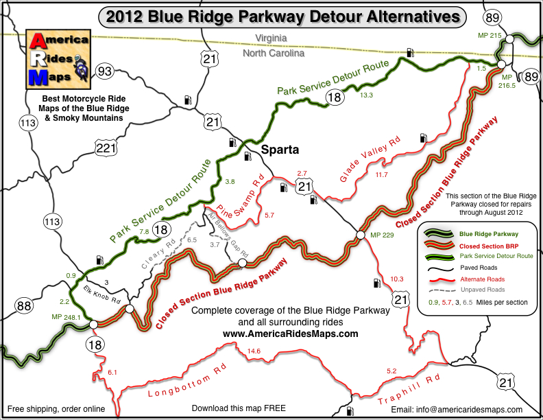
Wayne’s 2012 Blue Ridge Parkway Alternative Detours for Motorcycles

map-brp-detour-2012

Don’t get caught up in the traffic on the Park Service Detour Route 

These roads allow you to take the shortcuts (or the long way round) that will keep you riding!

Get your free copy! Instructions at bottom of page.

photo-parkway-closed-signs-nc18

30+ miles of the Blue Ridge Parkway is closed for most of 2012 near the NC / VA border. Detour via NC 18.


There is one significant detour on the Blue Ridge Parkway for 2012. To my surprise, it’s an extension of the detour that closed this middle section of the road near the North Carolina / Virginia border last year. While I found a much better detour route for motorcycle touring in 2011, 2012 is a real challenge in this very rural area where a paved road is a rarity.

photo-stone-walls-on-brp

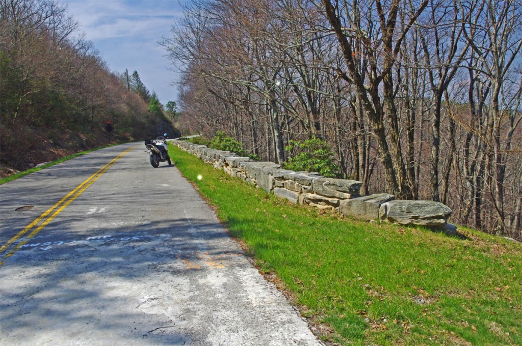
The Blue Ridge Parkway is closed for maintenance, repair, and rebuilding of the historic stone walls found in this 30+ mile section.

The Blue Ridge Parkway will be closed to traffic (including bicycles) in 2012 from Milepost 216.5 near Cumberland Knob to Milepost 248.1 for repair of historic stone walls (see photo). While the wall shown may not seem impressive, this is where the Blue Ridge Parkway was born back in 1930-40. The early masonry work you see on the overpasses, bridges, and walls was done by master masons brought over from Europe. A few third generation descendants continue this restoration work today.

photo-brp-barricade

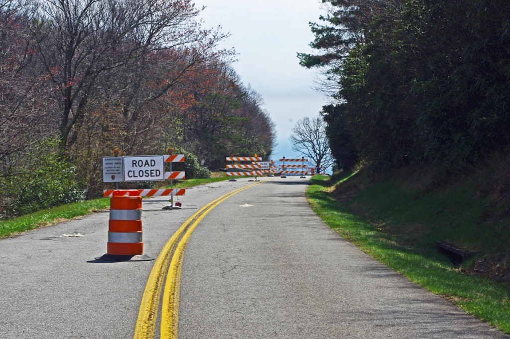
4 Road Closed signs, barrels, barricades, flashing lights, locked gate, - seriously closed!

Last year’s detour was north of the Blue Ridge Parkway through Sparta. I knew of a longer though much better route on the south side and produced a free downloadable map of it. It was fun. That route is included on the map. This years extension of the closure means there is no good way to bypass it completely on the south side of the Blue Ridge Parkway.

photo-sparta

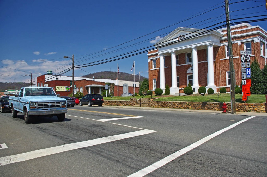
The Allegheny County Courthouse is the cornerstone of downtown Sparta. It's a small crossroads town, little of interest to me.

The 2012 Park Service detour route is simple, just one road – NC 18 which intersects the Blue Ridge Parkway at two points. It’s the easy, elegant solution passing through Sparta. While NC 18 could be a decent motorcycle ride, it’s curvy and rolling, the lack of paved roads in the area means it also carries all the traffic. Few cars and trucks are able to maintain the 55 mph speed limit and there’s always that one or two that can’t seem to get much above 40 mph and the lines back up behind them. It can be frustrating to ride when you can’t enjoy the curves at a proper motorcycle pace.

photo-sparta

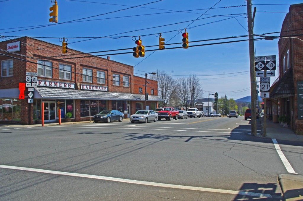
There - now you've seen Sparta. Don't feel like you've missed much if you bypass it.

Nor is there a compelling reason to go into Sparta. It’s a historic town at the crossroads of NC 18 / US 21, but I saw no places which looked enticing to eat at (one coffee shop), and the 2 gas stations require you to leave NC 18 and go a short distance on US 21. There’s a little museum, but miss Sparta and you won’t miss much.

map-brp-detour-2012

Download this map and print your copy or save it in your phone!

The roads show on the map offer alternatives to avoid most of the standard route and should save you some time. They will at least help you avoid getting caught up in any traffic that could get backed up on the official detour. For those on adventure bikes I’ve included a couple non-paved options that will let you get your wheels dirty on gravel roads.

Downloads:
Use http://americaridesmaps.com/downloads/BRP-detour-2012.pdf for a map you can print on a standard sheet of paper.

Use http://americaridesmaps.com/downloads/BRP-detour-2012.jpg for an image file you can store in your cell phone, iPad, or GPS.

__________________________________________________________________

Wayne Busch

Wayne Busch - Cartographer

Total Rider Tech Logo

Learn Total Control

– Wayne Busch lives in Waynesville, NC, where he produces the most detailed and comprehensive and up-to-date motorcycle pocket maps of the Blue Ridge and Smoky Mountains to help you get the most of your vacation experience. See them here – AmericaRidesMaps.com

Wayne is an advanced motorcycle instructor for Total Rider Tech teaching Lee Parks Total Control Advanced Rider Courses. Isn’t it time you looked into advanced rider training to ride more confidently and safely? It can transform your mountain riding experience.  Total Rider Tech

____________________________________________________________________
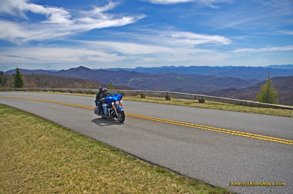
Blue Ridge Parkway Rockslide Update for Motorcycles – photos

It has been the year for rock slides. There were 6 major ones in southern region of the Smoky Mountains. Interstate 40 near the North Carolina – Tennessee state line is still being worked on with one lane closed. Be aware traffic backs up there on Fridays and weekends, 30 minute delays are advertised. If you’re planning on staying on the north side of Great Smoky Mountains National Park (link to map – .pdf) factor the delays into your travel time, or better yet, stay on the south side of the park.

Photo from Blue Ridge Parkway this morning

I was out on the BMW this foggy morning. Traffic is increasing on the Blue Ridge Parkway, especially motorcycles.

The fence and gates are still visible at the Dragon near Deals Gap even though the rock slide there has long been resolved. It’s a reminder of when the road was first closed, then open only from 8 Am to 8 PM. It’s been open since August and you can plainly see where the rock slide happened along the lake. I still stop at the pull off to take photos occasionally.

Photo - rock slide site on the Blue Ridge Parkway

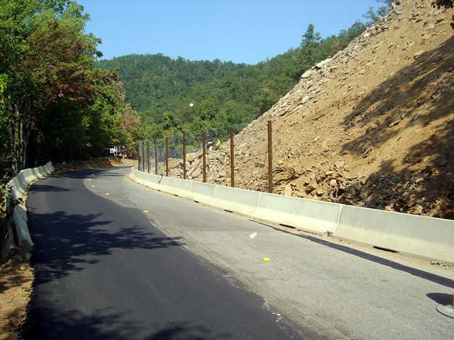
Little change is evident from the road. Most of the work is going on above, terracing and stabilizing the slope.

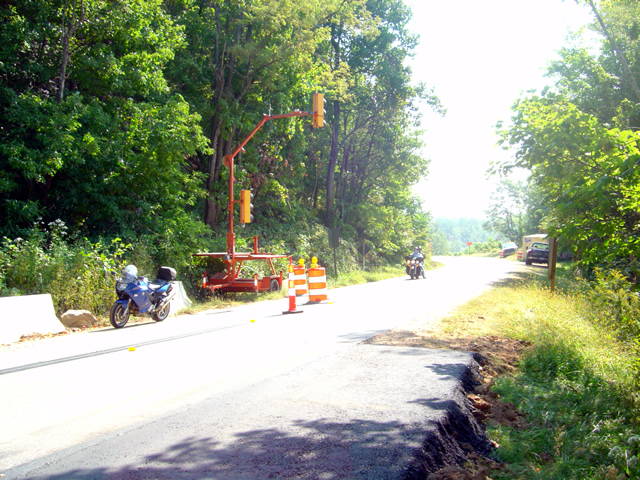
The rock slide on the Blue Ridge Parkway near Mt. Pisgah is yet to be resolved completely. It was supposed to be done by the start of September. The road is open for travel, but only one lane. Timed temporary traffic lights are positioned on each side of the work area to regulate traffic, and the duration of the delays seems to have been decreased. It used to 5 minutes, but now it feels like less. Maybe I’m used to it.

Photo - traffic lights on the Blue Ridge Parkway

Temporary timed traffic lights manage the traffic through the work area. It seems like they've decreased the wait times.

Looking at the photos I took today and comparing them to the last set, there is little visible difference at the rock slide site. As I’m up there often, I can see subtle signs of progress. While it looks pretty devastated along the road, it’s comparatively minor in contrast to the amount of work that has been done to terrace and stabilize the slope above. They were still drilling rock today so there’s work yet to be finished.

Photo - motorcycles pass the rock slide on the Blue Ridge Parkway

The delays are short, there's nothing challenging, motorcycles of which there are plenty have nothing to worry about.

Also be aware there is another delay for tunnel work as you reach Mt. Pisgah. Another set of temporary traffic lights controls traffic there as well. The scaffolding came down weeks ago, the road bed has been freshly paved, and when I passed today they were raking the edges of the road. It appears this delay is nearly over.

So long as I’m relating Blue Ridge Parkway road conditions, there is still paving going on north of Asheville. I thought they were done here when I passed through a couple weeks ago and raved about how nice the pavement was. When I went through a couple days ago they were putting another layer of fresh asphalt on top of the already wonderful road that was there. It’s SO nice! I hit two delays, one near Craggy Gardens and another further south, but they were not long waits. This second coat is going down fast so it won’t be long before they move out of there.

I’ll sum all this up in the somewhat monthly newsletter I put out (subscribe bottom right of page). There are a few paving projects I need to ride out and check on. If you have any info to add, please send it to me.

_______________________________________________________________________________
Wayne Busch

Wayne Busch - Cartographer


– Wayne Busch lives in Waynesville, NC, where he produces the most detailed and comprehensive and up-to-date motorcycle pocket maps of the Blue Ridge and Smoky Mountains to help you get the most of your vacation experience. See them here – AmericaRidesMaps.com