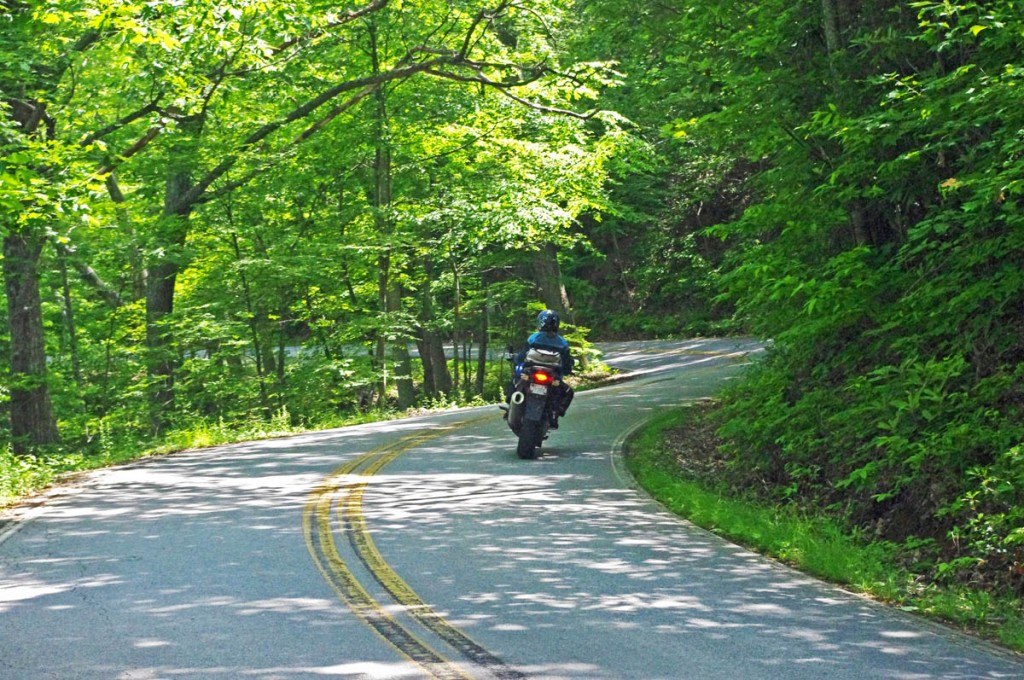
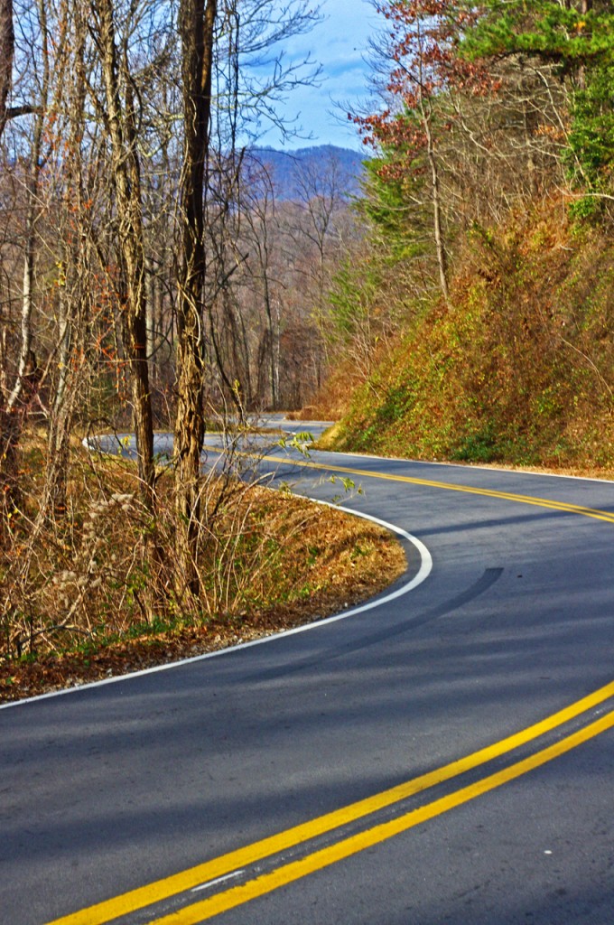
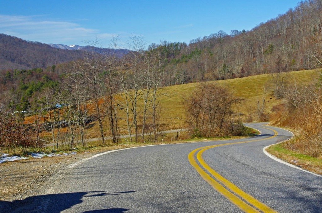
Best Blue Ridge Parkway Overlooks by Motorcycle

Best Blue Ridge Parkway Overlooks by Motorcycle – Waterrock Knob

Waterrock Knob Overlook
Elevation – 5820 feet
Milepost – 451.2
Best Blue Ridge Parkway Overlooks by Motorcycle - Waterrock Knob

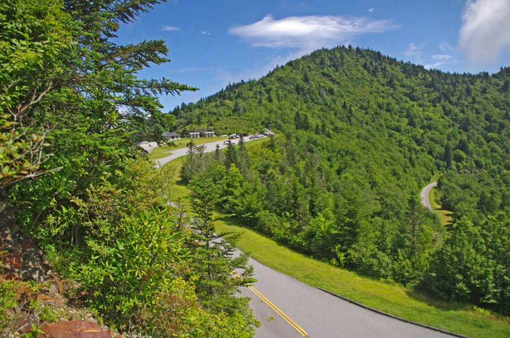
Best Blue Ridge Parkway Overlooks by Motorcycle – Waterrock Knob is a beautiful spot with outstanding views

Easy to find, convenient to reach from nearby towns of Waynesville and Maggie Valley, Waterrock Knob is a popular stop when motorcycle riding on the Blue Ridge Parkway.
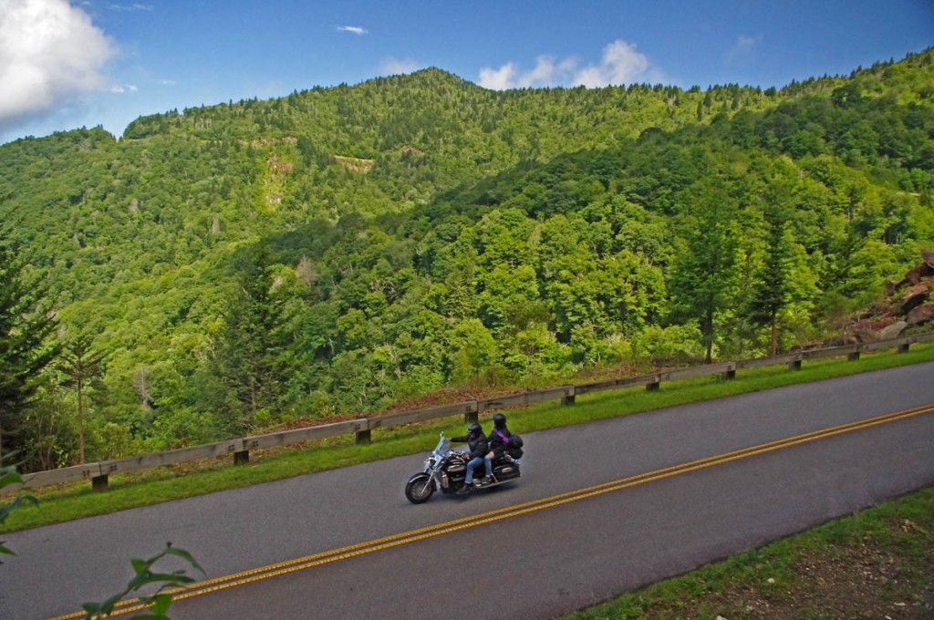
Best Blue Ridge Parkway Overlooks - waterrock knob view

Best Blue Ridge Parkway Overlooks – It’s a steady climb to Waterrock Knob from either direction on the Blue Ridge Parkway. It’s only 18 miles from the south end of the ride.

Once you’ve passed the highest point on the Blue Ridge Parkway it’s all downhill to the southern end at Great Smoky Mountains National Park just outside Cherokee, NC.
Best Blue Ridge Parkway Overlook by Motorcycle - Waterrock Knob

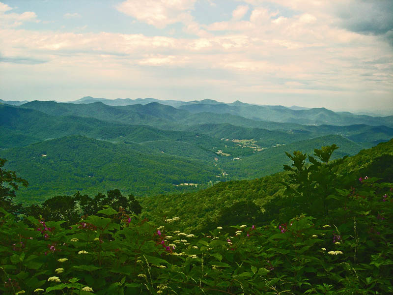
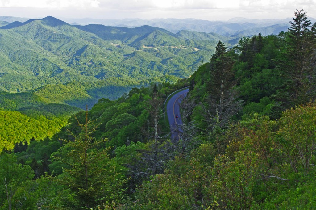
Best Blue Ridge Parkway Overlook by Motorcycle – Waterrock Knob – view looking south into South Carolina and Georgia.

It’s hardly time to pull in the clutch and coast – there are a few good mountains you’ll need to climb along the way. One of them is Waterrock Knob.
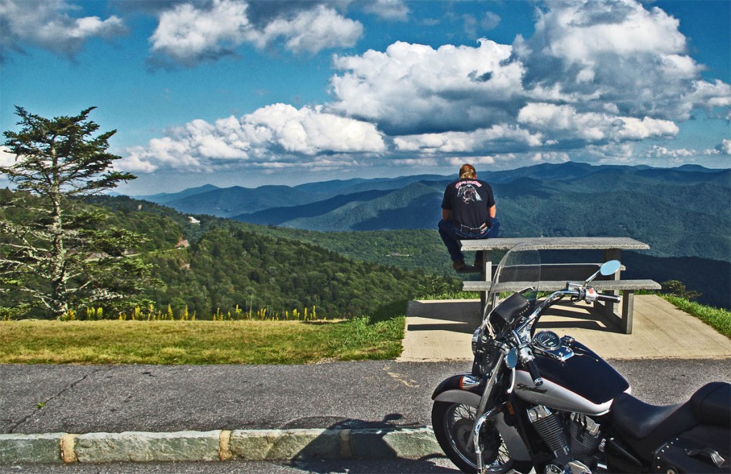
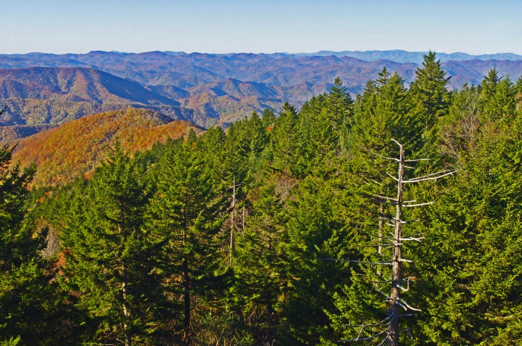
Best Blue Ridge Parkway Overlooks by Motorcycle - Waterrock Knob view

Best Blue Ridge Parkway Overlooks by Motorcycle – Waterrock Knob view – looking east into South Carolina. Clear days provide outstanding views. Take some time and enjoy.

Just 10 miles from the south end of the Blue Ridge Parkway, Waterrock Knob is a large overlook sitting near the mountain top with outstanding views both east and west. On clear days it’s easy to spot Harrah’s Casino in Cherokee almost 20 miles distant.
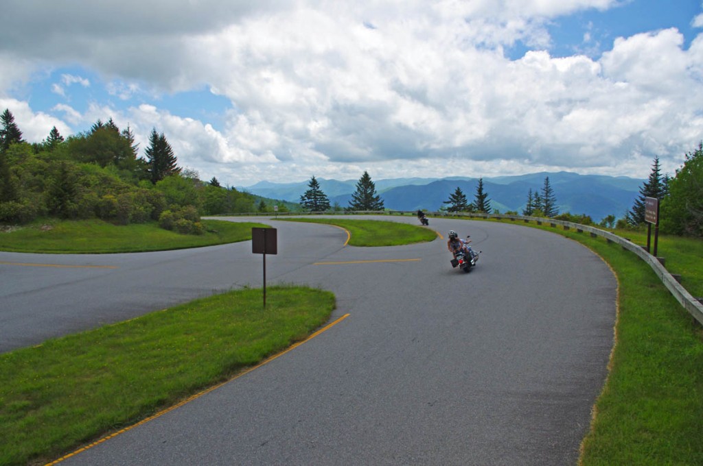
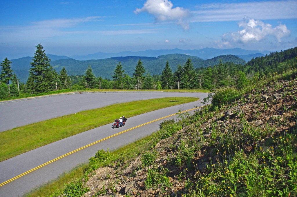
Best Blue Ridge Parkway Overlooks by Motorcycle - Waterrock Knob  - the turn

Best Blue Ridge Parkway Overlooks by Motorcycle – It’s easy to spot the short access road that leads to Waterrock Knob as the parkway divides here for one brief section

The overlook is located on a short spur road that is well marked and easy to spot – the road briefly becomes divided here with a median as you reach the top of the climb.

Best Blue Ridge Parkway Overlooks by Motorcycle - west view

Best Blue Ridge Parkway Overlooks by Motorcycle – looking west, you can see the casino in Cherokee almost 20 miles distant

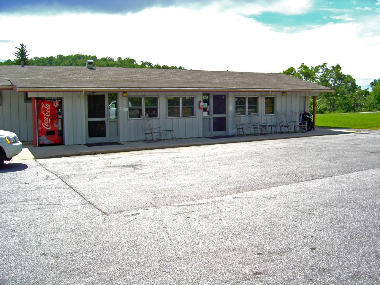
The overlook has a large parking lot, bathrooms, and a Blue Ridge Parkway Visitor Center. A  strenuous footpath makes a 1 mile climb to the top of the mountain. There are several picnic tables and it’s a nice place for it.
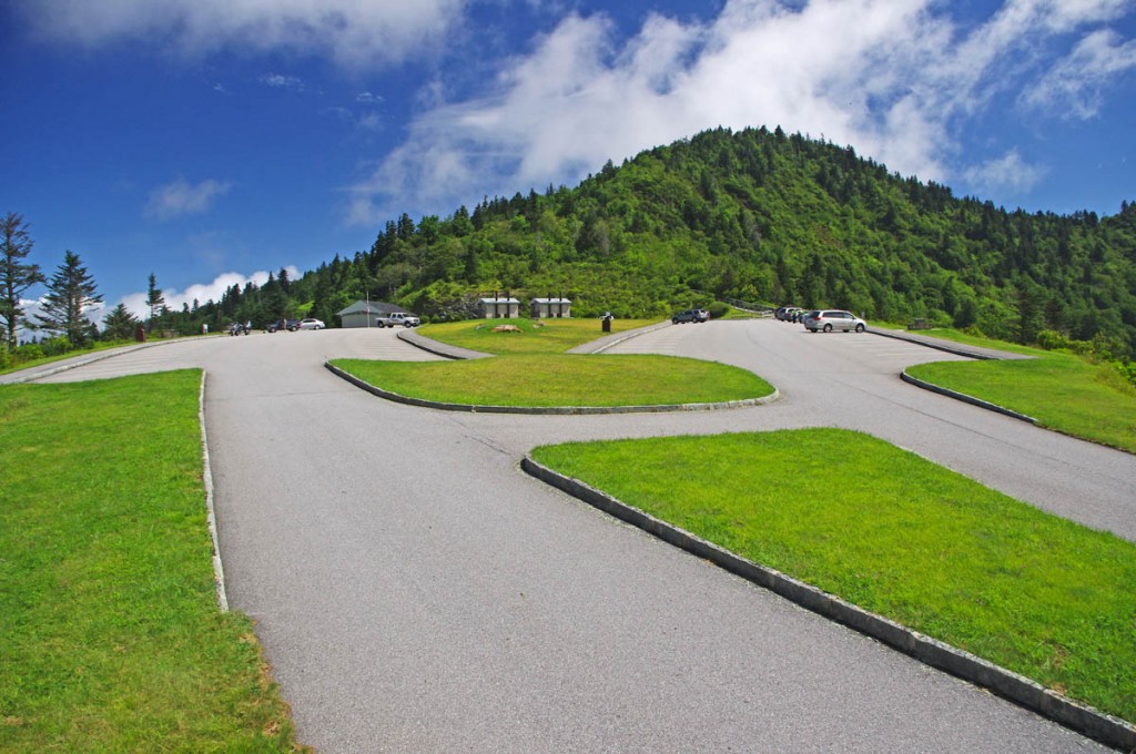
Best Blue Ridge Parkway Overlooks by Motorcycle - Waterrock Knob

Best Blue Ridge Parkway Overlooks by Motorcycle – It’s a great place for a pit stop at Waterrock Knob, plenty of room and places to view from, and a visitor center with info and bling.
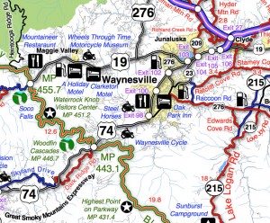
Best Blue Ridge Parkway Overlooks - Waterrock Knob - map

Best Blue Ridge Parkway Overlooks – Waterrock Knob – map – a section of Map #6 shows where to find Waterrock Knob on the Blue Ridge Parkway. There are lots of other things to see nearby.

You’ll find Waterrock Knob on America Rides Motorcycle pocket maps –

#6 The Best Motorcycle Rides Near Smoky Mountains Park – EAST
http://shop.americaridesmaps.com/6-The-Best-Motorcycle-Rides-Near-Smoky-Mountains-Park-EAST-NC017.htm

#7 The Best Motorcycle Rides SOUTH of GSMNP
http://shop.americaridesmaps.com/7-The-Best-Motorcycle-Rides-SOUTH-of-GSMNP-NC021.htm

____________________________________________________________________

wayne busch - Smoky Mountain Motorcycle Rider.com

Wayne Busch

– Wayne Busch lives in Waynesville, NC, where he produces the most detailed and comprehensive and up-to-date motorcycle pocket maps of the Blue Ridge and Smoky Mountains to help you get the most of your vacation experience. See them here – AmericaRidesMaps.com

Total Rider Tech Logo

Learn Total Control

Wayne is an advanced motorcycle instructor for Total Rider Tech teaching Lee Parks Total Control Advanced Rider Courses. Isn’t it time you looked into advanced rider training to ride more confidently and safely? It can transform your mountain riding experience.  Total Rider Tech

____________________________________________________________________

Best Blue Ridge Parkway Overlooks by Motorcycle

Best Blue Ridge Parkway Overlooks by Motorcycle – Highest Point

Richland Balsam Overlook
Elevation – 6053 feet
Milepost – 431.4 

Best Blue Ridge Parkway Overlooks - highest point

Best Blue Ridge Parkway Overlooks – highest point. The long sweeping overlook  provides expansive views of the mountains which comprise ‘The Land of the Waterfalls”

The highest point on the Blue Ridge Parkway is in North Carolina at milepost 431.4. Here, the nations top motorcycle ride reaches an elevation of 6053 feet as it carves it’s way along  the southern exposure of the Balsam mountain range.

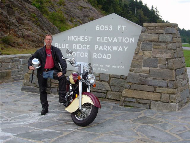
Best Blue Ridge Parkway Overlooks by Motorcycle - highest point

Best Blue Ridge Parkway Overlooks by Motorcycle – Getting your picture with the sign at the highest point on the Blue Ridge Parkway is one of those “must have” photos from your trip to reach the long paved overlook which spans the radius of the curve around the mountain.

There is no dramatic climb to reach the long paved overlook which spans the radius of the broad curve around the mountain. The Blue Ridge Parkway maintains a steady altitude through this long remote and isolated section of the national park rarely dipping below 5000 feet. While the grades are gentle, the curves are full of surprises and the drop-offs along the roadside inspire a real respect for the altitude on this best motorcycle ride in the USA.

Best Blue Ridge Parkway Overlooks by Motorcycle - high point

Best Blue Ridge Parkway Overlooks by Motorcycle – peer into several states from the highest point on clear days, but it not place to be in bad weather

Only 37.7 miles from the southern end of the Blue Ridge Parkway at Great Smoky Mountains National Park near Cherokee, NC, a ride to the high point is an easy one to squeeze in even if you’re not on an end-to-end parkway ride on your motorcycle. From Asheville, Waynesville and Maggie Valley, it’s a wonderful way to spend a few hours riding a motorcycle on one of the the best scenic motorcycle rides you’ll find anywhere.

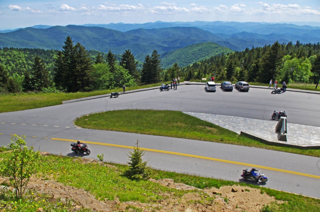
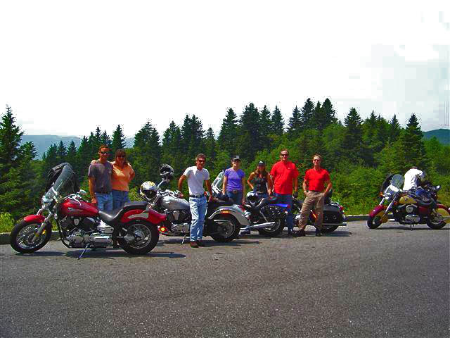
Best Blue Ridge Parkway Overlooks by Motorcycle - high point

Best Blue Ridge Parkway Overlooks by Motorcycle – Few can resist a stop at the high point. The large parking area is able to handle the crowds, and it’s a great lace to get shots of large groups of riders.

As you might suspect, this spot is one of the most remote and isolated on your Blue Ridge Parkway motorcycle ride. It’s a long ride for gas, tank up before you go. The high parts get the wet weather first – if it looks cloudy from the valley, you may not see much when you get up high. It will be a lot cooler than down in the valley and more windy, be prepared.

Best Blue Ridge Parkway Overlooks by Motorcycle - high point

Best Blue Ridge Parkway Overlooks by Motorcycle – A fall view from the high point overlook. Clear days are just spectacular!

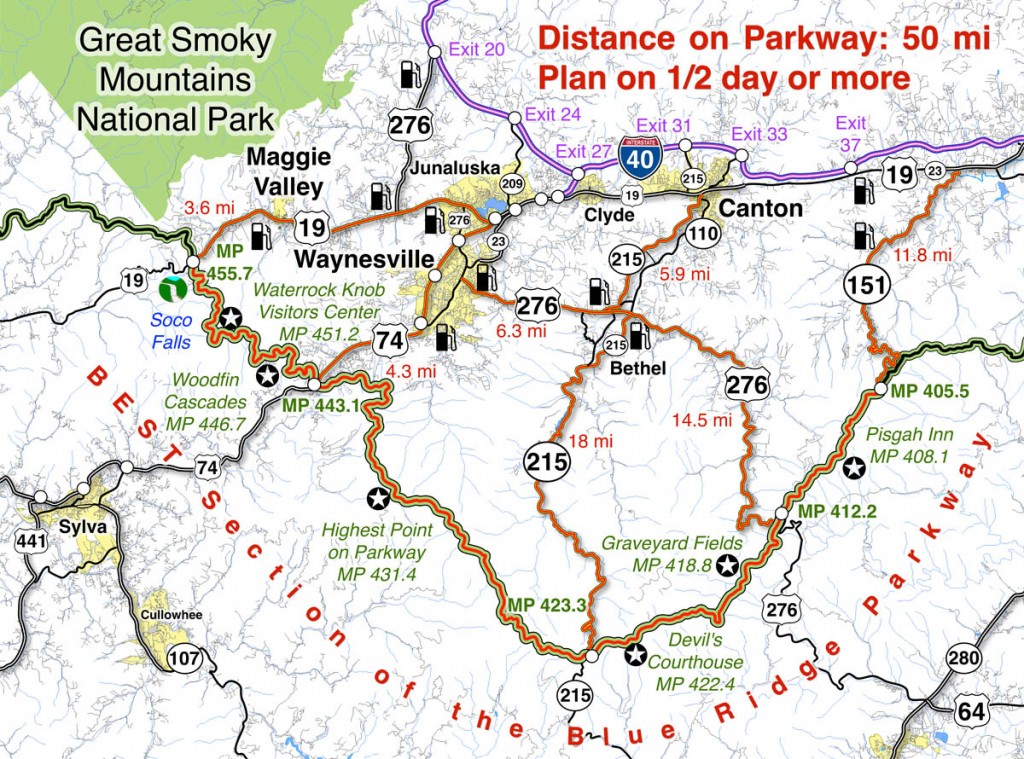
Map of the best section of the Blue Ridge Parkway

Blue Ridge Parkway Map best

Map of the best 50 mile section of the Blue Ridge Parkway shows the location of the high point and the ways to reach it from nearby towns. Click for larger image –

See a 360 degree panoramic view at Virtual Blue Ridge – http://www.virtualblueridge.com/parkway_tour/overlooks/00431b.asp

image-motorcycle-ride-map-cover

You’ll find the highest point on the Blue Ridge Parkway on America Rides Maps motorcycle pocket map

#6 The Best Motorcycle Rides Near Smoky Mountains National Park – EAST http://shop.americaridesmaps.com/6-The-Best-Motorcycle-Rides-Near-Smoky-Mountains-Park-EAST-NC017.htm

____________________________________________________________________

wayne busch - Smoky Mountain Motorcycle Rider.com

Wayne Busch

– Wayne Busch lives in Waynesville, NC, where he produces the most detailed and comprehensive and up-to-date motorcycle pocket maps of the Blue Ridge and Smoky Mountains to help you get the most of your vacation experience. See them here – AmericaRidesMaps.com

Total Rider Tech Logo

Learn Total Control

Wayne is an advanced motorcycle instructor for Total Rider Tech teaching Lee Parks Total Control Advanced Rider Courses. Isn’t it time you looked into advanced rider training to ride more confidently and safely? It can transform your mountain riding experience.  Total Rider Tech

____________________________________________________________________

Best Motorcycle Rides in North Carolina – Secrets

Best Motorcycle Rides in North Carolina – Secrets

Here’s another bunch of the best motorcycle rides in North Carolina that few ever discover – it’s a nice loop ride that includes a section riding the Blue Ridge Parkway

Best Motorcycle Rides in North Carolina - Sandy Mush

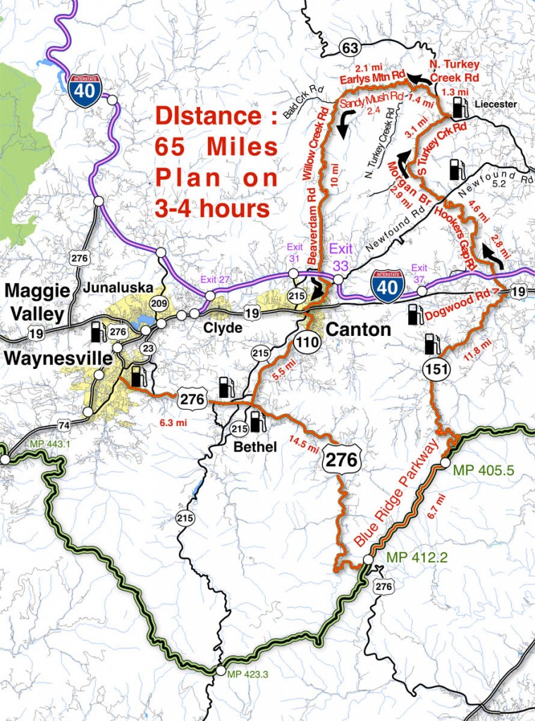
Best Motorcycle Rides in North Carolina - This loop ride will surprise you with some very challenging roads, nice scenery, and places you'd never see otherwise.

The roads shown south of I-40 are pretty well known biker roads. US 276 runs from Waynesville to the Blue Ridge Parkway, always a popular North Carolina motorcycle ride. The section of the Blue Ridge Parkway shown includes Mt. Pisgah and The Pisgah Inn. NC 151 is legendary for it’s treacherous curves as it plunges towards  the valley that leads into Candler.

Best Motorcycle Rides in North Carolina - Pisgah View

Best Motorcycle Rides in North Carolina - the view from the Pisgah Inn on the Blue Ridge Parkway represents others on this section of the road - outstanding!

Most riders then point their wheels to I-40 or US 19 and miss out on the roads that lie north of I-40. This area gets little attention from motorcycle touring visitors who are lured to the more publicized roads elsewhere. To the east lie the suburbs of Asheville, the west is mostly rural valley farms.

Best Motorcycle Rides in North Carolina - NC 151

Best Motorcycle Rides in North Carolina - The section of NC 151 which descends from the Blue Ridge Parkway is full of tricky curves.

The two primary roads north of I-40 are Newfound Road which runs from Canton to Leicester, and Leicester Rd (NC 63) which runs into Asheville. Both are decent rides, particularly the west end of NC 63 as it climbs out of the valleys to intersect NC 209 – The Rattler (Click for ride guide). Still, they are the most heavily used roads so this route avoids them in favor of the empty two lanes which provide a much more relaxing and fun scenic motorcycle ride.

Best Motorcycle Rides in North Carolina - Hookers Gap Rd

Best Motorcycle Rides in North Carolina - Hookers Gap Rd has little traffic and wonderful curves as it climbs over a mountain.

You’ll want to pay attention to the map and watch for the turns as it’s easy to wander off on the maze of small surrounding roads. The turn onto Hookers Gap Rd is not well marked and the road can be hard to spot, but the ride is worth the effort. You’ll also find a short unpaved section of road where Morgan Branch Rd runs into S. Turkey Creek Rd. Be sure to veer right and take the high road where N. Turkey Creek meets Earlys Mountain Rd. NC 215 makes a nice alternative to NC 110 leading out of Canton.

Best Motorcycle Rides in North Carolina - Earlys Mtn Rd

Best Motorcycle Rides in North Carolina - Earlys Mountain Road is one I often ride in winter. The valleys will be clear while snow covers the higher elevations. A nice ride any time of year!

You’ll enjoy a variety of motorcycle riding experiences on this nice loop ride. The valley roads often follow along rushing streams or wind through twisty mountain passes. You’ll enjoy farms and pastures, the park atmosphere of the Blue Ridge Parkway, and the contrast of the massive paper mill when passing through Canton. There are historic buildings and timeless views.

Best Motorcycle Rides in North Carolina - Beaverdam Rd

Best Motorcycle Rides in North Carolina - If you ride Beaverdam Road north from Canton when you crest the mountain the Sandy Mush Valley view explodes as you plunge down the steep hillside.

Step-by-step Route: (uses NC 215 instead of NC 110, either does the job)

  • Start in Canton. Follow NC 215 to Bethel.
  • 5.4 mi Turn left  @ stop sign onto Sonoma Road. Junction NC 215 and Sonoma Road.
  • 6 mi Turn right @ stop sign onto NC 110. Junction Sonoma Road and NC 110.
  • 6.4 mi Turn left @ traffic light onto US 276. Junction NC 110 / US 276 / NC 215. Follow to Blue Ridge Parkway.
  • 20.9 mi Left turn onto ramp to Blue Ridge Parkway.
  • 21 mi Turn right  onto Blue Ridge Parkway (towards Asheville). Follow to next exit.
  • 27.3 mi Turn left onto NC 151. Junction Blue Ridge Parkway and NC 151. Steep descent with tight switchbacks.
  • 39.1 mi Continue through traffic light @ US 19 onto Dogwood Road. Traffic light. Junction NC 151 and US 19.
  • 41.4 mi Turn right onto Hookers Gap Road. Junction Dogwood Road and Hookers Gap Road. Poorly marked, be alert for this turn.
  • 46.5 mi Cross Newfound Road @ stop sign to continue on Morgan Branch Road. Junction Hookers Gap Road and Newfound Road.
  • 49 mi Unpaved section of road for short distance. Cross single lane bridge.
  • 49.4 mi Turn right @ stop sign onto S. Turkey Creek Road.
  • 52.4 mi Turn left  @ stop sign onto NC 63 (New Leicester Highway). Junction S. Turkey Creek Road and NC 63.
  • 53.7 mi Turn left onto N. Turkey Creek Road. Junction NC 63 and N. Turkey Creek Road.
  • 55.1 mi Keep right on Earlys Mountain Road. Junction N. Turkey Creek Road and Earlys Mountain Road.
  • Earlys Mountain Road becomes Big Sandy Mush Road.
  • 59.6 mi Turn left onto Willow Creek Road. Junction Big Sandy Mush Road / Willow Creek Road / Bald Creek Road.
  • Willow Creek Road becomes Beaverdam Road
  • 69.6 mi Turn right @ stop sign onto Newfound Road and follow into Canton. Junction Beaverdam Road and Newfound Road.
  • 71 mi Stop sign. Junction Beaverdam Road and Main Street in Canton.
Best Motorcycle Rides in North Carolina - Willow Creek Rd

Best Motorcycle Rides in North Carolina - Willow Creek Rd has some pretty views and pretty challenging curves.

You can do this North Carolina motorcycle ride in half a day or less. It’s a good one to know about if you’re staying in Waynesville or Maggie Valley or at the Pisgah Inn on the Blue Ridge Parkway. It’s a nice one to fill the rest of the day if you visit Wheels Through Time Motorcycle Museum. If you get caught here during a rainy spell, it’s a quick one you can dart out and do between showers with easy options to run back for shelter if you get caught in a downpour.
Best Motorcycle Rides in North Carolina - old store

Best Motorcycle Rides in North Carolina - riding through historic farms and tiny towns that date back a hundred years or more.


Don’t underestimate these roads, they are plenty challenging and worth the time to investigate. You’ll see sights others miss, and experience a part of the mountains rarely visited. You’ll pass by homes and farms that have been there for hundreds of years and many generations. It’s a ride through the history and heritage of the Smokies. Enjoy!

______________________________________

Map #6These roads are just a few of the more than 50 great motorcycle rides found on America Rides Maps pocket map  #6 – The Best Motorcycle Rides EAST of Great Smoky Mountains National Park.

____________________________________________________________________
wayne busch - Smoky Mountain Motorcycle Rider.com

Wayne Busch

– Wayne Busch lives in Waynesville, NC, where he produces the most detailed and comprehensive and up-to-date motorcycle pocket maps of the Blue Ridge and Smoky Mountains to help you get the most of your vacation experience. See them here – AmericaRidesMaps.com

Total Rider Tech Logo

Learn Total Control

Wayne is an advanced motorcycle instructor for Total Rider Tech teaching Lee Parks Total Control Advanced Rider Courses. Isn’t it time you looked into advanced rider training to ride more confidently and safely? It can transform your mountain riding experience.  Total Rider Tech

____________________________________________________________________
Motorcycle Safety – Respect and Skin in the Game

I don’t remember much, it was almost 40 years ago. My first thought when I regained my senses was to find the piece of the bike which had the key in it – didn’t want somebody stealing it. Obviously, I was still rattled a bit. That was the last ride for that Honda CB 450.

I remember the dog that shot out of nowhere as I rode home, I may have been coming from high school. It came running out of a cow field and right into the bike. Almost went down, but found myself riding along the sandy shoulder of the road. Hardly suited to off-road riding, I was rolling on the throttle to keep the front wheel of that heavy Honda from washing out in the soft sand, picking up speed.

I remember thinking I was doing pretty good on this bike in those conditions, heck, I’d saved it, but making the coming curve meant I needed to be back on the pavement.  I picked my spot only to find there was a deep gully where so many cars had run wide and a mound of patch built up in a futile attempt to fill it.

I remember the loud bang as the front wheel hit the asphalt.

I remember looking straight down at the pavement as the now vertical bike landed on the front wheel and for an instant it seemed to balance and roll along in control. Then the bars were jerked violently from my hands as the front end buckled, and it was slow motion silence as I floated through the air doing a somersault.

I remember thinking “This is going to be a bad one”.

* * * * *

How to Avoid Skinning Yourself Alive – Brittany Morrow from Brittany Morrow on Vimeo.
Direct link – http://vimeo.com/22897515

Looking at my helmet my head probably contacted first. Considering my injuries, I then laid out on my back and slid down the road and into the pasture. The bike probably took out the barbed-wire fence just before I went through it, no deep cuts or lacerations.

I remember walking along the road thumbing for a ride. I knew there was a fire station nearby, if I could get there they could help me.

I remember the cars slowing down, I looked fine from the front, then taking off when they saw the bloody mess where all the skin had been taken off my back. The light cotton shirt and blue jeans I was wearing in the summer heat of Florida might as well have been paper. No protection at all. Last time I would ever ride without at least a jacket.

I spent the next few weeks lying face down on the fold-out couch as my wounds healed. Most of that was in a codeine stupor. Seems every joint in my body had donated some flesh. A few scars remain, but the years have faded most of them. There would be more to come before I learned the value of leather and then textile gear.

______________________________________________________________________


Direct link – http://youtu.be/Uz748Q4tkGo

I don’t often tell this tale. There are others. So why bring it up?

I spent a few hours this weekend at a rally. Don’t really like doing events, it can be pretty boring. You end up doing a lot of people watching.

Many of the riders were from out-of-state, groups from Georgia, Florida. Standard biker attire, blue jeans and a t-shirt. Some wore shorts. Slip on shoes. Many of the passengers wore only jeans and a tank top. Some pretty ladies. Not even wearing gloves. The smallest skid lids that would keep you from getting pulled over.

I went through my recent photos. All too common attire. Photos of riders on some of the most challenging roads they will ever see, for the first time. You can often see the look on their faces that tell the ride is demanding something from them.

I watched Daryl’s (Killboy.com) recent 12 minute video from the Dragon. Easy to spot the bare flesh rolling by, particularly the passengers, on one of the most challenging and dangerous motorcycle rides in the world.

____________________________________________________________________

WAKE UP PEOPLE. Riding in the mountains is some serious sh*t. RESPECT IT.

Go off the road up here and road rash will probably be the best of outcomes. We’ve got rocks and trees right up to the roadside. You’ll probably be plunging over a steep hillside or worse yet a rocky cliff. It takes hours to get a rope team out to haul your inured body up to the ambulance.  Show some freakin’ respect for it.

Word to you “easy riders”watch the video – You know who you are. Low and slow and always in control. Too hot to wear gear. I like the feel of the wind and the sun, yadda, yadda, gonna work on my tan. Gotta look the part with the right biker attire – blue jeans, your biker t-shirt, the tiniest helmet you are forced to wear – I never planned any of the motorcycle accidents I’ve had. Most happened relatively close to home. Just a short ride, a commute, running to the store, work, school, going to hang out with my buds,  etc. Almost all have been under 30 mph. Just riding along minding my own business, taking it easy, la-la-la. If there was skin exposed, it was skin in the game, skin lost.


Direct link – http://youtu.be/EhJ74f-MGak

PS – I’m not just posting this  for you flatlanders – it’s pretty common up here as well. As if that big fat bike is going to protect you. Gotta look the part, dress like everyone else, feel the freedom! WAKE UP. Think about all those times you’re rounding a curve and there’s a car half in your lane coming at you. All those times some old geezer pulls out at 10 mph in front of you. It’s always the worst of curves where the cars slip off the inside edge and kick gravel and rocks onto the road. You KNOW it happens. You KNOW what I’m talking about.

Forget the blue jeans. Useless. Repeated personal experience. You’ve got 2 choices – textile or leather. If you can get some armor in there it will help keep bones from breaking. Respect the ride. If you don’t need it, at least respect your rider and get her the right gear. She’s trusting in you, do her right.

If there is skin exposed, it is skin in the game, a game you are forced to play every ride. 

—————————————————————————–

Wayne Busch

Wayne Busch - Cartographer

Total Rider Tech Logo

Learn Total Control


____________________________________________________________________
– Wayne Busch lives in Waynesville, NC, where he produces the most detailed and comprehensive and up-to-date motorcycle pocket maps of the Blue Ridge and Smoky Mountains to help you get the most of your vacation experience. See them here – AmericaRidesMaps.com

Wayne is an advanced motorcycle instructor for Total Rider Tech teaching Lee Parks Total Control Advanced Rider Courses. Isn’t it time you looked into advanced rider training to ride more confidently and safely? It can transform your mountain riding experience.  Total Rider Tech

____________________________________________________________________
Motorcycle Riding on the Blue Ridge Parkway – Safety Tips

Motorcycle Riding on the Blue Ridge Parkway – Safety Tips
Courteous Passing  and Signal your intentions

I’m opening myself up for some criticism by posting this, but when motorcycle riding on the Blue Ridge Parkway and you need to pass, one safety tip I’ve found helpful is using better communication and courteous passing. While passing may be illegal, it’s a frequent occurrence. Here’s how I deal with it.

Why take the criticism? Because I see it so often – it’s a rare stretch of the 469 mile long Blue Ridge motorcycle ride that isn’t painted with a double yellow line. Passing zones are few and far between. Crossing the double yellow line is breaking the law, so consider that before you do it. If something goes wrong, you’re at fault, and any ticket you get is deserved.

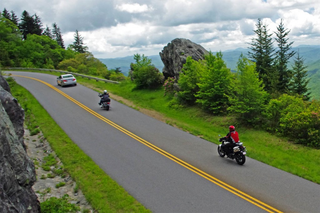
Motorcycle Riding on the Blue Ridge Parkway - Safety Tips Courteous Passing  and Signal your intentions - Crossing the double yellow line is illegal. Legal passes are safe passes.

Motorcycle Riding on the Blue Ridge Parkway – Safety Tips – Courteous Passing and Signal your intentions – Crossing the double yellow line is illegal. Legal passes are safe passes.

Still, I can’t recall a recent motorcycle ride on the Blue Ridge Parkway where it didn’t happen. It’s a common situation as the comfortable travel speed for many car drivers is around 35 mph on this mostly 45 mph road. While most bikers are content to adapt to the lower speed and relax and enjoy the scenery, the situation can get frustrating when the curves get tighter.

Motorcycles and cars approach curves differently. Cars tend to get off the throttle and slow down when going through a turn. Motorcycles want to be on the gas to gain traction, ground clearance, and stabilize the bike in a turn. Applying the brakes when behind a car in a turn makes the motorcycle want to stand up when it should be leaning and it’s harder to steer and more unstable.

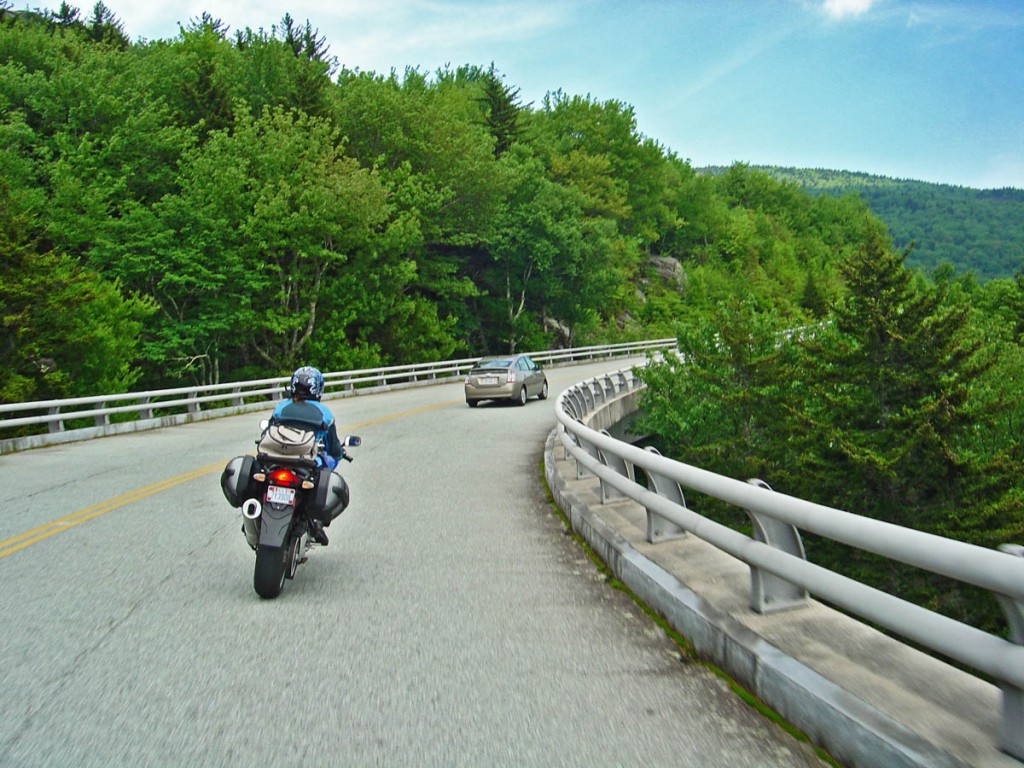
Motorcycle Riding on the Blue Ridge Parkway - Safety Tips - Courteous Passing and Signal your intentions - There are lots of overlooks through the most scenic sections. Use your signal lights to communicate to the driver ahead.

Motorcycle Riding on the Blue Ridge Parkway – Safety Tips – Courteous Passing and Signal your intentions – There are lots of overlooks through the most scenic sections. Use your signal lights to communicate to the driver ahead.

In a perfect world, you follow along to the next pull-out, the car slips in and lets you by. Give the driver that opportunity, it’s the best, safest, and legal option. A lot of times that happens. Sometimes it takes a couple overlooks before the driver recognizes the easy solution.

Just as often though, you’ll come up on a car which slows and starts waving you by to make an illegal pass. Here’s how I approach it –

  • If you don’t want to pass, drop back and give the car some space.
  • If you do want to pass, but it’s not safe here due to an approaching curve, limited visibility, or other traffic, be courteous and work with the driver. Drop back a little and signal your intent that you do want an opportunity to pass by using your turn signal.

Communicating to the driver by using your turn signal lets him know your intent and you can work together to make the pass as safe as possible.

The driver may wait for the next pull off, give him the opportunity to use it, as it’s safest for everyone and the legal way to do it.

Motorcycle Riding on the Blue Ridge Parkway - Safety Tips - Courteous Passing and Signal your intentions - Choose your passing spots carefully and wisely.

Motorcycle Riding on the Blue Ridge Parkway – Safety Tips – Courteous Passing and Signal your intentions – Choose your passing spots carefully and wisely. This is hardly the place to even consider it. Wait patiently for those sections where you have a long view ahead and plenty of road before the next curve.

If you do choose to pass, do it politely and with some respect. Don’t blast by at warp speed with the pipes screaming. Stay in as high a gear as you can and make it a smooth and controlled quiet pass. Wait for a long enough section of road with clear visibility and enough margin for safety so you don’t convince the driver all bikers are dangerous and out of control or end up proving it as well. I usually give a wave of thanks to those who let me slip by, I appreciate their courtesy and respond in kind.

In summary;

  • Use passing zones when available
  • Crossing the double yellow line is illegal
  • Give the car a chance or two to exit into an overlook and let you by
  • Communicate with the driver by using your turn signals
  • Wait for a safe opportunity
  • Pass quietly and with respect
Motorcycle Riding on the Blue Ridge Parkway - Safety Tips - illegal passing is not without risks and potential consequences!

Motorcycle Riding on the Blue Ridge Parkway – Safety Tips – Illegal passing is not without risks and potential consequences!

At some point on your Blue Ridge Parkway motorcycle ride you’re going to be presented with this dilemma – to pass or not to pass. There’s a darned good reason crossing the double yellow line is illegal, it’s dangerous! In a dangerous situation one of your best tools is good communication. Use those signal lights and show some thanks if you decide to take a ride on the wild side of the line. A lot of times, seeing your signal lights alerts the driver and results in a safe and legal passing event and a better Blue Ridge Parkway ride for everyone.

These tips work with bicycles as well, be kind and let’s all enjoy our ride!

See the Blue Ridge Parkway Park Service Safety Page

See the Blue Ridge Motorcycling Parkway Safety Tips Page

—————————————————————————–

Wayne Busch

Wayne Busch – Cartographer

Total Rider Tech Logo

Learn Total Control

____________________________________________________________________
– Wayne Busch lives in Waynesville, NC, where he produces the most detailed and comprehensive and up-to-date motorcycle pocket maps of the Blue Ridge and Smoky Mountains to help you get the most of your vacation experience. See them here – AmericaRidesMaps.com

Wayne is an advanced motorcycle instructor for Total Rider Tech teaching Lee Parks Total Control Advanced Rider Courses. Isn’t it time you looked into advanced rider training to ride more confidently and safely? It can transform your mountain riding experience.  Total Rider Tech

____________________________________________________________________
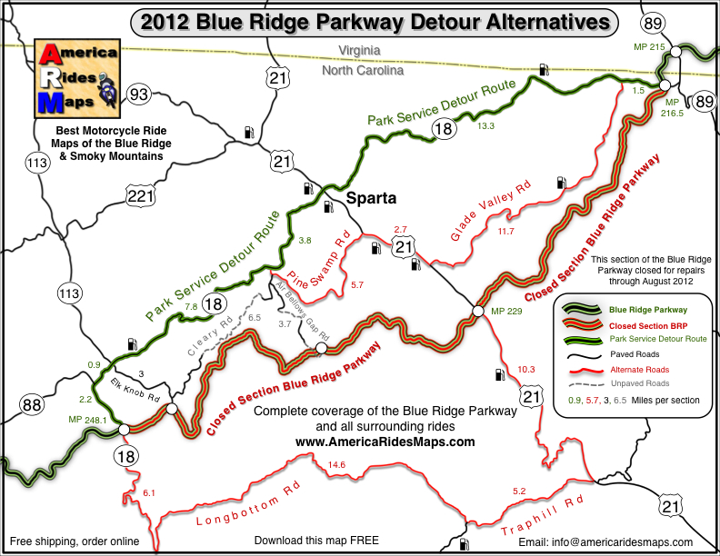
Wayne’s 2012 Blue Ridge Parkway Alternative Detours for Motorcycles

map-brp-detour-2012

Don’t get caught up in the traffic on the Park Service Detour Route 

These roads allow you to take the shortcuts (or the long way round) that will keep you riding!

Get your free copy! Instructions at bottom of page.

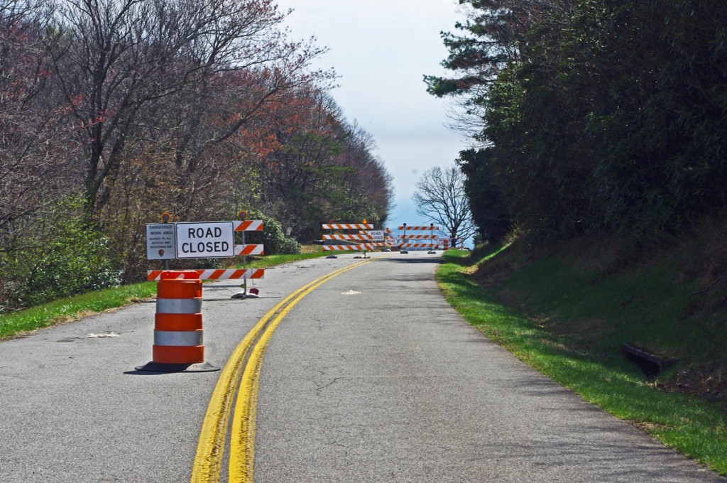
photo-parkway-closed-signs-nc18

30+ miles of the Blue Ridge Parkway is closed for most of 2012 near the NC / VA border. Detour via NC 18.


There is one significant detour on the Blue Ridge Parkway for 2012. To my surprise, it’s an extension of the detour that closed this middle section of the road near the North Carolina / Virginia border last year. While I found a much better detour route for motorcycle touring in 2011, 2012 is a real challenge in this very rural area where a paved road is a rarity.

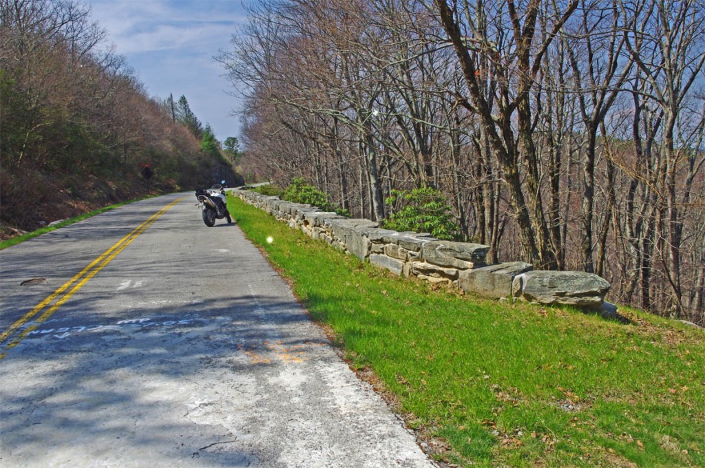
photo-stone-walls-on-brp

The Blue Ridge Parkway is closed for maintenance, repair, and rebuilding of the historic stone walls found in this 30+ mile section.

The Blue Ridge Parkway will be closed to traffic (including bicycles) in 2012 from Milepost 216.5 near Cumberland Knob to Milepost 248.1 for repair of historic stone walls (see photo). While the wall shown may not seem impressive, this is where the Blue Ridge Parkway was born back in 1930-40. The early masonry work you see on the overpasses, bridges, and walls was done by master masons brought over from Europe. A few third generation descendants continue this restoration work today.

photo-brp-barricade

4 Road Closed signs, barrels, barricades, flashing lights, locked gate, - seriously closed!

Last year’s detour was north of the Blue Ridge Parkway through Sparta. I knew of a longer though much better route on the south side and produced a free downloadable map of it. It was fun. That route is included on the map. This years extension of the closure means there is no good way to bypass it completely on the south side of the Blue Ridge Parkway.

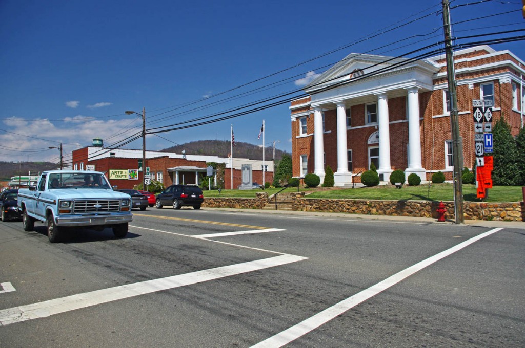
photo-sparta

The Allegheny County Courthouse is the cornerstone of downtown Sparta. It's a small crossroads town, little of interest to me.

The 2012 Park Service detour route is simple, just one road – NC 18 which intersects the Blue Ridge Parkway at two points. It’s the easy, elegant solution passing through Sparta. While NC 18 could be a decent motorcycle ride, it’s curvy and rolling, the lack of paved roads in the area means it also carries all the traffic. Few cars and trucks are able to maintain the 55 mph speed limit and there’s always that one or two that can’t seem to get much above 40 mph and the lines back up behind them. It can be frustrating to ride when you can’t enjoy the curves at a proper motorcycle pace.

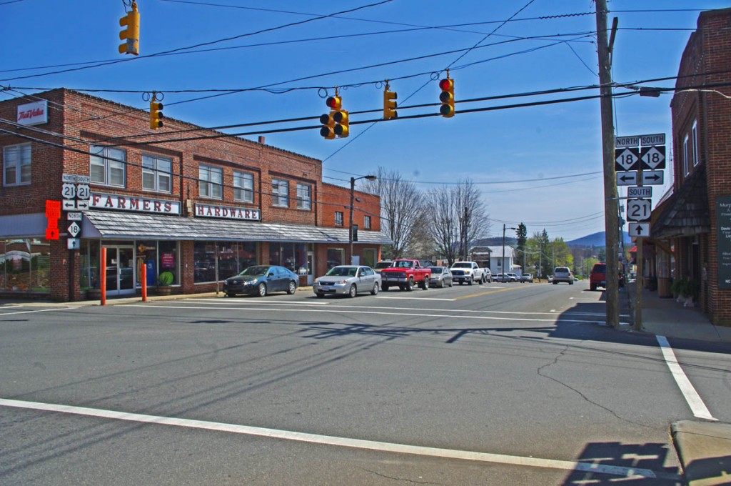
photo-sparta

There - now you've seen Sparta. Don't feel like you've missed much if you bypass it.

Nor is there a compelling reason to go into Sparta. It’s a historic town at the crossroads of NC 18 / US 21, but I saw no places which looked enticing to eat at (one coffee shop), and the 2 gas stations require you to leave NC 18 and go a short distance on US 21. There’s a little museum, but miss Sparta and you won’t miss much.

map-brp-detour-2012

Download this map and print your copy or save it in your phone!

The roads show on the map offer alternatives to avoid most of the standard route and should save you some time. They will at least help you avoid getting caught up in any traffic that could get backed up on the official detour. For those on adventure bikes I’ve included a couple non-paved options that will let you get your wheels dirty on gravel roads.

Downloads:
Use http://americaridesmaps.com/downloads/BRP-detour-2012.pdf for a map you can print on a standard sheet of paper.

Use http://americaridesmaps.com/downloads/BRP-detour-2012.jpg for an image file you can store in your cell phone, iPad, or GPS.

__________________________________________________________________

Wayne Busch

Wayne Busch - Cartographer

Total Rider Tech Logo

Learn Total Control

– Wayne Busch lives in Waynesville, NC, where he produces the most detailed and comprehensive and up-to-date motorcycle pocket maps of the Blue Ridge and Smoky Mountains to help you get the most of your vacation experience. See them here – AmericaRidesMaps.com

Wayne is an advanced motorcycle instructor for Total Rider Tech teaching Lee Parks Total Control Advanced Rider Courses. Isn’t it time you looked into advanced rider training to ride more confidently and safely? It can transform your mountain riding experience.  Total Rider Tech

____________________________________________________________________
The Blue Ridge Parkway’s Best Kept Secret Waterfall

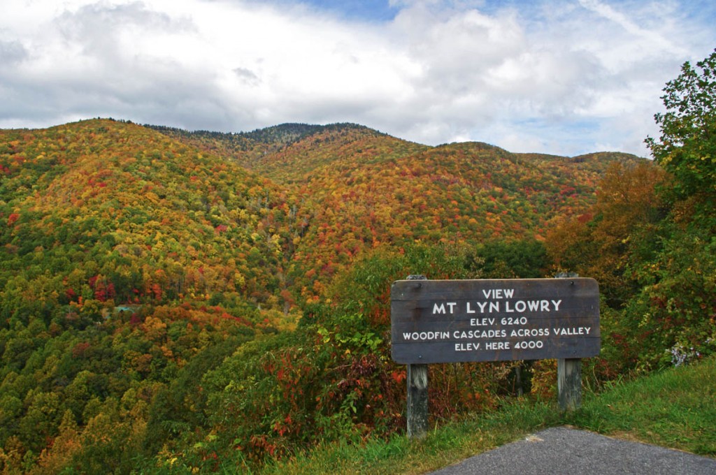
The Mount Lyn Lowry overlook is  a large and welcoming pull-off on the Blue Ridge Parkway that holds more than appears on a drive-by.

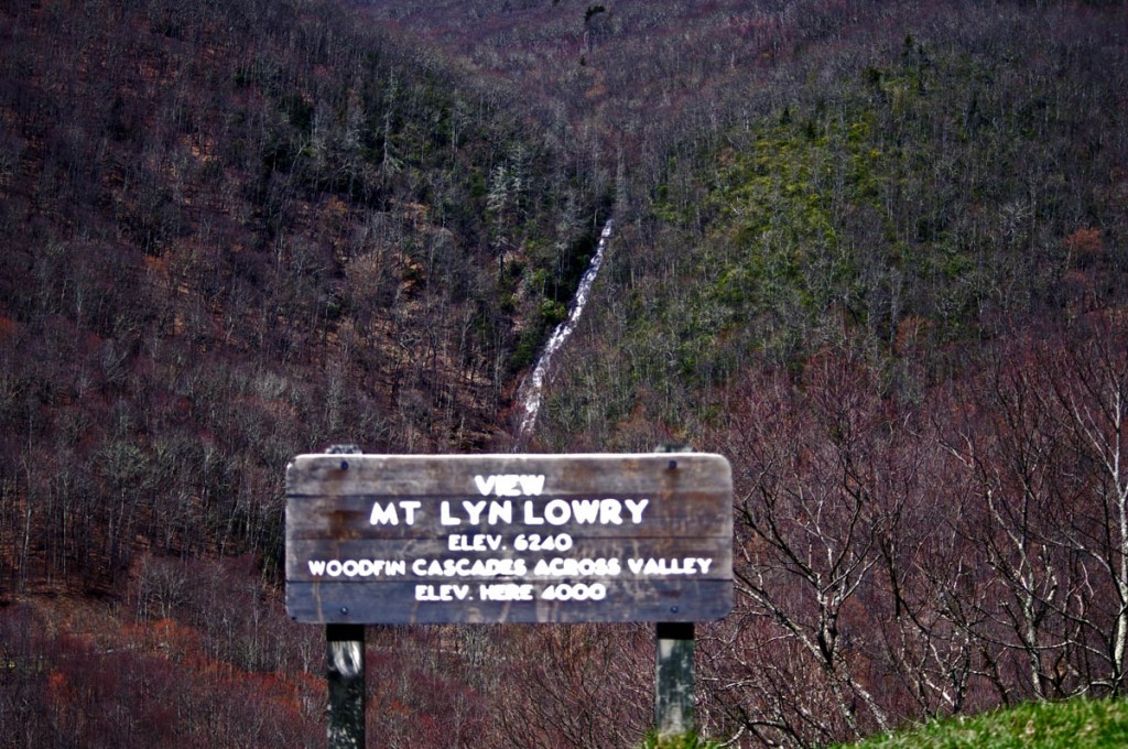
Motorcycle the Blue Ridge Parkway in the early spring and you’ll be rewarded with sights unseen by those who visit later in the year. One of them is Woodfin Cascades at the Mt Lyn Lowry overlook (MP 446.7). Once leaves cover the trees when summer arrives, most of this waterfall disappears from view.

Photo-woodfin-cascades-on-the-blue-ridge-parkway

Woodfin Cascades are viewed from the Mt. Lyn Lowry overlook on the Blue Ridge Parkway

Another secret revealed to those who spend a little time observing at this Blue Ridge Parkway overlook is the 60 foot high illuminated cross atop Mt. Lyn Lowry. You can use the cross as a reference to fid the falls, they are located beneath it on the mountainside.

Photo-mt-lyn-lowry-fall

The cross is located atop the mountain. Even though it's 60 ft tall, on a 6240 mountain it's just a speck! The falls are hiding behind the leaves.

Mt Lyn Lowry overlook is located on the section of the Blue Ridge Parkway between Waynesville at US 74 and Maggie Valley at US 19. This is one of the most scenic stretches of the national park as it climbs to the heights of Waterrock Knob, then descends to Soco Gap and Maggie Valley. There are numerous long range overlooks.  Be sure to bring your camera for some of the best views you’ll find.

photo-woodfin-cascades

In spring, the entire 235 foot run of Woodfin Cascades can be admired. It dissapears when things green up.

Here’s a 2 min video closeup of Woodfin Cascades –

__________________________________________________________________

Wayne Busch

Wayne Busch - Cartographer

Total Rider Tech Logo

Learn Total Control

– Wayne Busch lives in Waynesville, NC, where he produces the most detailed and comprehensive and up-to-date motorcycle pocket maps of the Blue Ridge and Smoky Mountains to help you get the most of your vacation experience. See them here – AmericaRidesMaps.com

Wayne is an advanced motorcycle instructor for Total Rider Tech teaching Lee Parks Total Control Advanced Rider Courses. Isn’t it time you looked into advanced rider training to ride more confidently and safely? It can transform your mountain riding experience.  Total Rider Tech

____________________________________________________________________
Motorcycles use caution – Rocks and Ice on the Blue Ridge Parkway

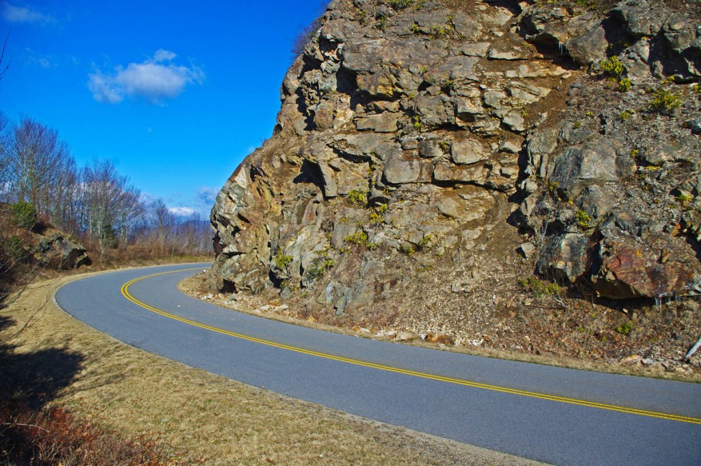
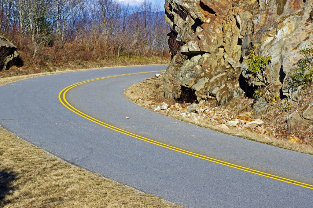
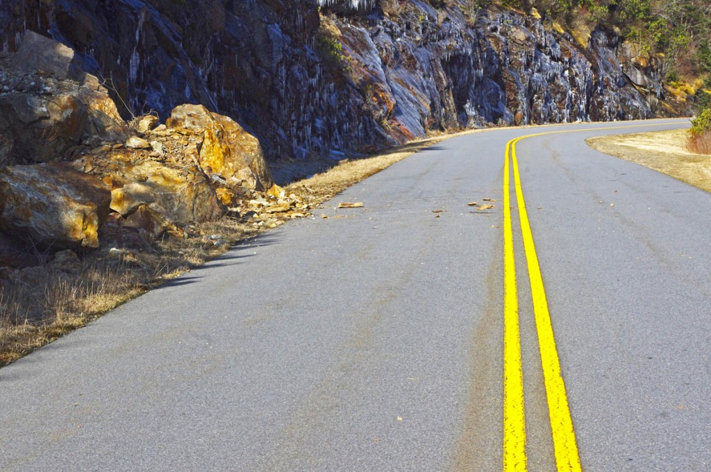
Early spring means early season motorcycle riding on the Blue Ridge Parkway, but nightly freezes cause lots of small rock slides.

photo-rocky-section-along-blue-ridge-parkway

Rocky sections along the parkway are prone to slides

The National Park Service has done an outstanding job keeping the Blue Ridge Parkway open through the winter season as much as possible. I can’t remember spending as much time up there on my motorcycle, usually I’m on skis this time of year.

photo-rocky-section-along-blue-ridge-parkway

Rocks in the road are a common hazard

Warm and sunny days through this mild winter often find me pointing my wheels to the high country to take advantage of the nearly empty scenic road as it carves along the high ridge tops more than 5000 ft in elevation. Clear winter skies mean you can see into the surrounding states on the horizon, and the naked trees reveal what is hidden in the forested valleys spread out below.

photo-rocky-section-along-blue-ridge-parkway

If you see evidence of a large slide, be alert for the smaller ones which often follow.

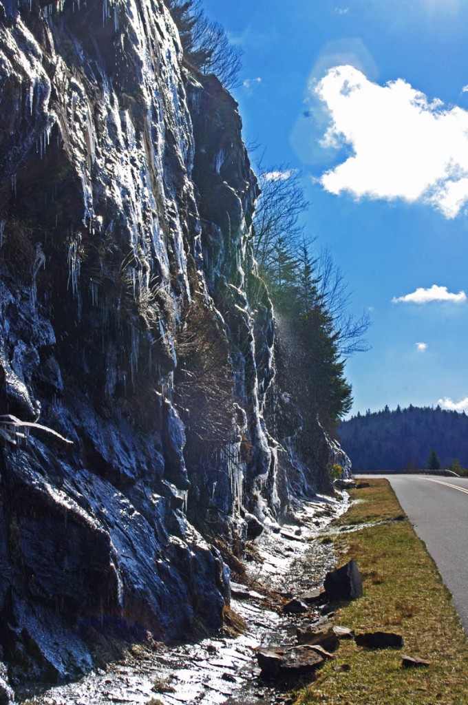
Once darkness comes, the temperatures dive below freezing and sheets of ice build on the wet rock faces that line the roadway. As the sun warms them the next day, the ice melts and rains down along the roadside, and the repetitive freezing and melting cracks and loosens the rocks above causing small slides.

photo-rocky-section-along-blue-ridge-parkway

When the sun hits the rocks, the ice quickly melts and falls.

The park service is quick to remove the bigger slides as they occur and you’ll see the piles of rock pushed to the roadside. Throughout the day the process continues and it’s not uncommon to find rocks in the road when the road carves along the rocky cliffs.

photo-rocky-section-along-blue-ridge-parkway

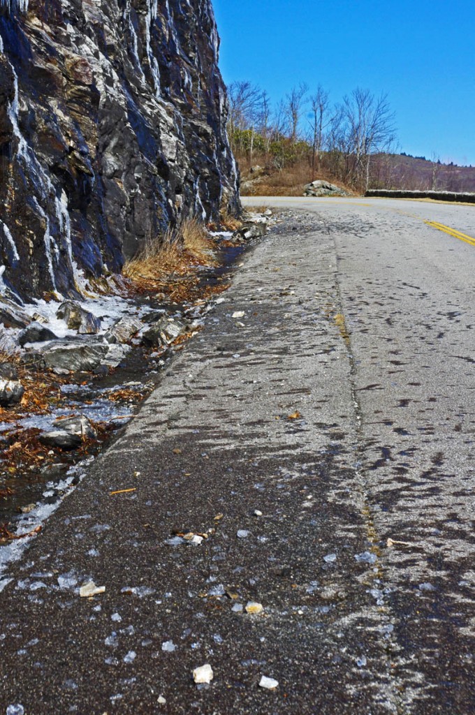
Rocks, ice, and water litter this section of the road

Be alert whenever you see exposed rock along the roadside, particularly when rounding shady curves. The road may be clear where the sun rarely reaches, but as you come into the sunny side there may be surprises in the road.

1 minute video shows how noisy and active the melting and falling ice can be. It’s worth a stop to watch the spectacle.

__________________________________________________________________

Wayne Busch

Wayne Busch - Cartographer

Total Rider Tech Logo

Learn Total Control

– Wayne Busch lives in Waynesville, NC, where he produces the most detailed and comprehensive and up-to-date motorcycle pocket maps of the Blue Ridge and Smoky Mountains to help you get the most of your vacation experience. See them here – AmericaRidesMaps.com

Wayne is an advanced motorcycle instructor for Total Rider Tech teaching Lee Parks Total Control Advanced Rider Courses. Isn’t it time you looked into advanced rider training to ride more confidently and safely? It can transform your mountain riding experience.  Total Rider Tech

____________________________________________________________________
Good Motorcycle Rides near Waynesville and Maggie Valley, NC

The last place I want to be riding a motorcycle is the 4-lane highway when there are so many good 2 lane back roads in North Carolina.

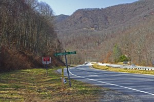
photo-turn-onto-candlestick-lane

Turn off the highway onto Candlestick Lane

For most motorcycle riders, covering the distance between Waynesville and Sylva means a relatively pleasant ride on four lane divided NC Highway 74 (The Great Smoky Mountains Expressway). As far as highways go, it is a nice ride winding down from Balsam Mountain and it rarely gets enough traffic to be annoying.

Lately though, I’ve been covering the relatively short distance on a few nice little back roads which I’ve grown very fond of. Since so many motorcycle touring riders pass through and stay in this area, I think they should know about them. If you’re riding near Cherokee, Maggie Valley, Waynesville, or Sylva, these roads may come in handy.

photo-turn-onto-cabin-flats

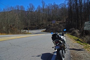
Next turn onto Cabin Flats Road.

Both ends meet the Highway (US 74). The Waynesville end starts near the Blue Ridge Parkway Exit for Waynesville (MP 443.1) where it intersects US 74. Pass under the parkway then exit left onto Candlestick Lane. It’s an obvious intersection, well marked, look for the signs to Balsam, Balsam Mountain Inn, Moonshine Creek Campground.

Candlestick Circle is just a short loop off the highway, turn right onto Cabin Flats Rd. Cabin Flats Road winds along the railroad tracks a short distance, then makes a hairpin turn across them.  Balsam Mountain Inn sits on the hill above.

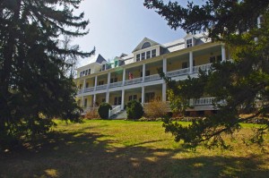
photo-balsam-mountain-inn

The Balsam Mountain Inn – historic, good food

It’s been a long while side I last visited, but the historic inn (1905) is both scenic and the food used to be very, very, good. You can imagine it’s heyday when it was a stop on the tracks in the middle of nowhere.

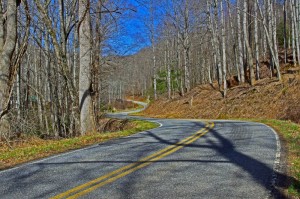
Cabin Flats Road will morph into Dark Ridge Road and start a twisting course alongside a stream through the mountain passes. The railroad also follows this narrow valley and you’ll often see it off in the woods crossing the stream on bridges and trestles.

photo-Dark-Ridge-Rd

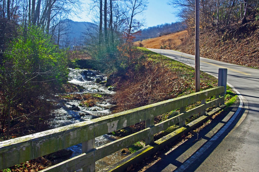
Dark Ridge Road – more fun than the 4 lane

Dark Ridge Road, the railroad, the highway, and the stream cross each other several times on the way to Sylva in a twisted mountain mess. You go under the highway, under the railroad, over the stream several times on the ride.

Dark Ridge Road meets Skyland Road at a stop sign just after you cross the railroad tracks. Turn left (the road quickly peters out if you go right).

photo-trestle-on-skyland-rd

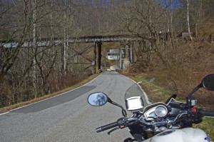
Under the tracks on Skyland Rd

The first part of Skyland Road is nice and there are several good spots to stop and get a look at the now rushing whitewater stream.

The second half looses it’s appeal as it draws near Sylva and the suburbs of the town. You can follow the road all the way into Sylva. You may note the prominent fork right onto Chipper Curve Rd – it will bring you closer to downtown.

photo-creek

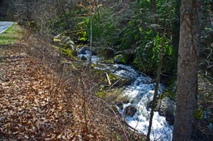
Whitewater Creek along Skyland Rd

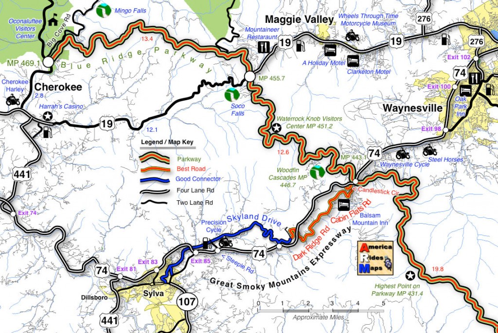
You can hop on-off this ride at 2 points and get back on the highway. One of them is obvious, a mile or so after you get on Skyland Rd. The other, Steeple Road, is closer to Sylva and is the best way to get back on the highway without going into town. Precision Cycles and a BP station mark it at the highway.

map

Click on photos and map for larger views

__________________________________________________________________

Wayne Busch

Wayne Busch – Cartographer

Total Rider Tech Logo

Learn Total Control

– Wayne Busch lives in Waynesville, NC, where he produces the most detailed and comprehensive and up-to-date motorcycle pocket maps of the Blue Ridge and Smoky Mountains to help you get the most of your vacation experience. See them here – AmericaRidesMaps.com

Wayne is an advanced motorcycle instructor for Total Rider Tech teaching Lee Parks Total Control Advanced Rider Courses. Isn’t it time you looked into advanced rider training to ride more confidently and safely? It can transform your mountain riding experience.  Total Rider Tech

____________________________________________________________________
Misleading Blue Ridge Parkway Sign should come down

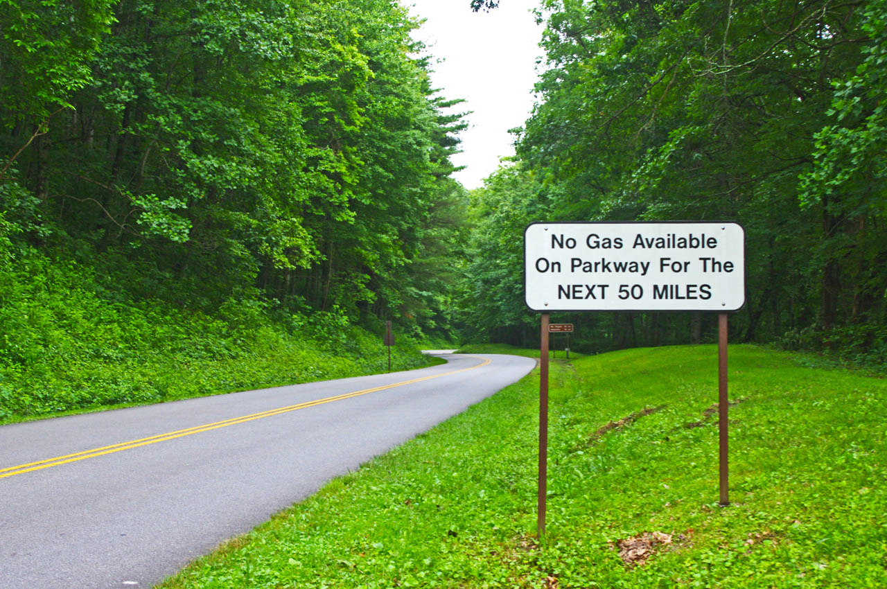
There was a time when the “No Gas for Next 50 Miles” sign at the US 74 exit on the Blue Ridge Parkway (MP 443.1) was an accurate warning, but it no longer serves the purpose.

photo-no-gas-sign-on-blue-ridge-parkway

This sign is a legacy to when gas was available on the Blue Ridge Parkway. It should now read "No gas next 400 miles". There is no gas on the Blue Ridge Parkway.

Years ago, there were gas stations on the Blue Ridge Parkway. This sign warns next gas was once available at the Pisgah Inn after a long lonely stretch with no convenient access to fuel. That’s no longer the case.

You’ll also see the remnants of a gas station at the Crabtree Meadows Visitor Center (MP 339.5).

Country-Store-at-Pisgah-Inn

The Country Store at the Pisgah Inn was once a gas station. Now it's just a break spot and service for the campground.

The Park Service removed the gas stations yeas ago. There is no longer gas available on the Blue Ridge Parkway nor are there any signs directing you to the location of the nearest gas at an exit.

The only place you’ll find a gas station visible from the Blue Ridge Parkway is at Raps’ Deli at Orchard Gap (MP 193.8) in southern Virginia.

With the limited range of motorcycles and long stretches of isolated road, knowing where the gas stations are is one of those things that takes a lot of the worry out of a Blue Ridge Parkway trip.

image-section-of-map

You'll find the closest gas to each Parkway exit listed on each of my Blue Ridge Parkway maps and descriptions of the best roads nearby.

It’s one of the most useful features I’ve included on my maps – closest gas to each exit along the 469 mile ride. Sometimes it’s just a few miles, other times it can be quite a distance. Knowing which way to go can keep you from getting stranded and help you make the best use of your time.

In keeping with the park service’s ethic of minimal signage, this legacy warning sign should be removed.

__________________________________________________________________
Wayne Busch

Wayne Busch - Cartographer

Total Rider Tech Logo

Learn Total Control

– Wayne Busch lives in Waynesville, NC, where he produces the most detailed and comprehensive and up-to-date motorcycle pocket maps of the Blue Ridge and Smoky Mountains to help you get the most of your vacation experience. See them here – AmericaRidesMaps.com

Wayne is an advanced motorcycle instructor for Total Rider Tech teaching Lee Parks Total Control Advanced Rider Courses. Isn’t it time you looked into advanced rider training to ride more confidently and safely? It can transform your mountain riding experience.  Total Rider Tech

____________________________________________________________________