Best Motorcycle Rides – A Mt. Mitchell Loop Ride

Photo-mt-mitchell-highest-in-east

The observation tower atop Mt. Mitchell. Pick a sunny clear day. Clouds will hang on the peak.

Best Motorcycle Rides – A Mt. Mitchell Loop Ride

A lot of bikers ask about riding to the highest mountain east of the Mississippi. This loop will spice up the ride with a fun run by Chimney Rock.

Who wouldn’t want to ride their motorcycle to the peak of the highest mountain in the eastern United States? At 6,684 feet, the views from the top are worth the trip, as is the enjoyable ride to get there. Located on NC 128, a spur road off a remote section of the Blue Ridge Parkway, it’s just a short walk to reach the observation tower the crowns the crest.
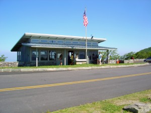
blue-ridge-parkway-craggy-gardens-visitor-center

Blue Ridge Parkway – Craggy Gardens Visitor Center is a popular rest stop north of Asheville with nice views.

While a ride up this section of the Blue Ridge Parkway is a satisfying experience, why not kill two birds with one stone and come back on a different route? For those looking for a more challenging ride than the park road, this loop will give you some classic curves and outstanding scenery. You’ll pass through dramatic Hickory Nut Gorge, home to beautiful Lake Lure and Chimney Rock, and wind your way home through some of the nicest curves  in the Pisgah Forest.

While there are some challenging sections, this is a great route for cruisers as most of it is pretty laid back and you can take your time.

_____________________________________________________________________
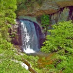
Great Motorcycle Rides in North Carolina - Pisgah Triangles

Great Motorcycle Rides in North Carolina – Pisgah Triangles – Looking Glass Falls on US 276 is one of the most visited roadside waterfalls in North Carolina

Distance: 205+ miles with side trips

Duration: All day ride

Difficulty: Easy to moderate ride

Before you go:

  • Fill up first – Long stretches with no gas stations.
  • Watch the weather – High elevations will have the most extremes. Bring extra clothing. Pick a nice day to visit Mt. Mitchell, the clouds will come in here first.

______________________________________________________________________

Turn-by-turn route:

Start in Waynesville. Follow US 276 to the Blue Ridge Parkway.

6.3 mi Traffic light in Bethel. Last chance to fill up before the long ride.

20.8 mi Turn left @ junction US 276 and ramp to Blue Ridge Parkway.

21 mi Turn right @ stop sign onto Blue Ridge Parkway (towards Asheville).

77.1 mi Turn left @ junction Blue Ridge Parkway and NC 128. Follow to top of Mt. Mitchell – 4.8 mi one way.

88.3 mi Exit and follow ramp to NC 80. Blue Ridge Parkway exit at NC 80.

blue-ridge-parkway-motorcycles

The Blue Ridge Parkway section north of Asheville

88.4 mi Turn right @ stop sign. Junction ramp and NC 80.

100 mi Turn right @ traffic light. Junction NC 80 and NC 70.  Follow NC 70 into Old Fort.

109 mi Turn left @ traffic light. Junction US 70 and Catawba Avenue in Old Fort. Pass through town. Follow Bat Cave Road south.

121 mi Turn left  @ stop sign. Junction Bat Cave Road and NC 9.

128 mi Turn left @ stop sign. Junction NC 9 and US 74A (Gerton Highway). 

128.3 mi Traffic Light. Junction US 74A and US 64. Go through traffic light to see Chimney Rock in 2 miles. Explore Lake lure. Turn right to leave the area on US 64 (left turn when leaving).

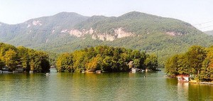
Photo - Lake Lure

Scenic Lake Lure, south of Asheville, in the Hickory Nut Gorge is worth the side trip

140 mi Cross over I-26 on US 64. Continue into Hendersonville.

143 mi Turn left, then right @ traffic lights downtown to continue west on US 64.

160 mi Pass straight through traffic light @ Junction US 64 / US 276 / NC 280. onto US 276. Good place add some gas to your tank. 

175 mi Pass under Blue Ridge Parkway and continue on US 276.

195 mi Return to start in Waynesville via US 276.

 ______________________________________________________________________

There is a restaurant at Mt. Mitchell. You’ll also find food in Chimney Rock / Lake Lure, as well as Hendersonville and Brevard.

Hendersonville is a bit congested with some traffic.

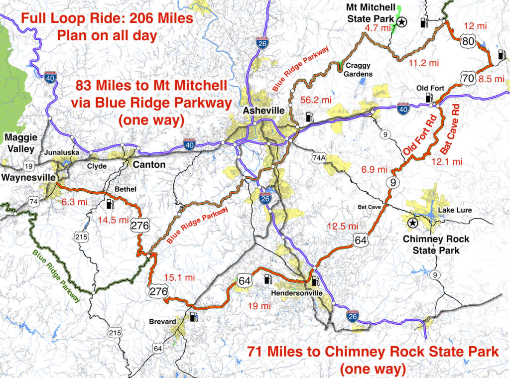
Map of Mt. Mitchell / Chimney Rock loop ride

Click to enlarge

This ride and all the surrounding roads are detailed on –

Map #5 – The Best Roads North & South of Asheville, NC

Map #6 – The Best Motorcycle Rides Near Smoky Park – EAST

____________________________________________________________________

wayne busch - Smoky Mountain Motorcycle Rider.com

Wayne Busch

– Wayne Busch lives in Waynesville, NC, where he produces the most detailed and comprehensive and up-to-date motorcycle pocket maps of the Blue Ridge and Smoky Mountains to help you get the most of your vacation experience. See them here – AmericaRidesMaps.com

Total Rider Tech Logo

Learn Total Control

Wayne is an advanced motorcycle instructor for Total Rider Tech teaching Lee Parks Total Control Advanced Rider Courses. Isn’t it time you looked into advanced rider training to ride more confidently and safely? It can transform your mountain riding experience.  Total Rider Tech

____________________________________________________________________

Best Motorcycle Rides in North Carolina – A sport bike loop

Best Motorcycle Rides in North Carolina – A sport bike loop ride

When I’m looking for a “dragon like” challenge close to home, this 90 mile loop satisfies every time!

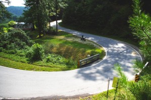
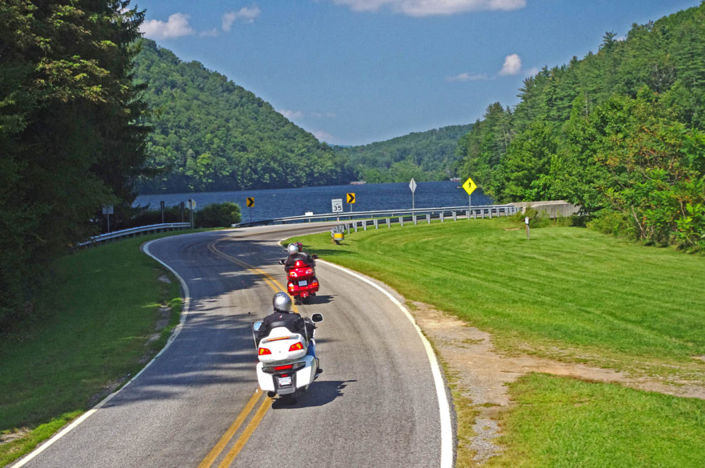
Section of NC 215 near Lake Logan.

Section of NC 215 near Lake Logan. You’ll find some nice scenery on the popular road. The curves so far are just a warm up for what lies ahead.

As much as I enjoy a ride on the infamous Tail of the Dragon at Deals Gap, it’s a bit of a ride to get out to it from the Waynesville / Maggie Valley area where I live. Fortunately, there are ample challenging roads nearby, and when I really want a peg-scraping ride, this is one of my favorite local loops. For those on sport bikes, it’s a must-do when you are in the area.

The higher you go the better it gets on NC 215.

The higher you go the better it gets on NC 215. The road crests where it meets the Blue Ridge Parkway, then plunges down the other side of the gap.

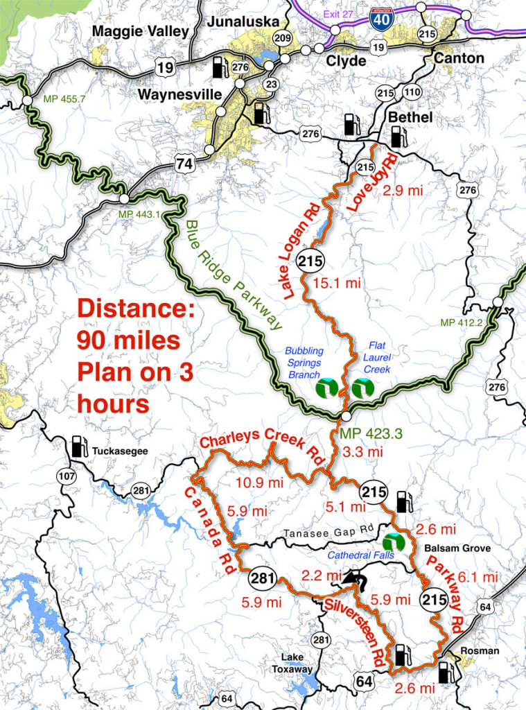
The map originates in the small crossroads town of Bethel, NC south of Waynesville, Canton, Maggie Valley, and Junaluska. It can also be done as a side loop off the Blue Ridge Parkway (exit at Beech Gap, MP 423.3, NC 215 – cuts 36 miles off the route).

Descending from the Blue Ridge Parkway on NC 215

The curves continue as you descend from the Blue Ridge Parkway with a brief break when you enter a valley. The curves that follow really kick it up!

______________________________________________________________________

Length: 90 miles plus your ride to the start in Bethel, NC.
Ride time: 3-4 hours
Difficulty: Very challenging, tight curves, climbs and descents, sustained, varied road surfaces, all paved

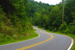
Photo-curve-on-Silversteen-Rd

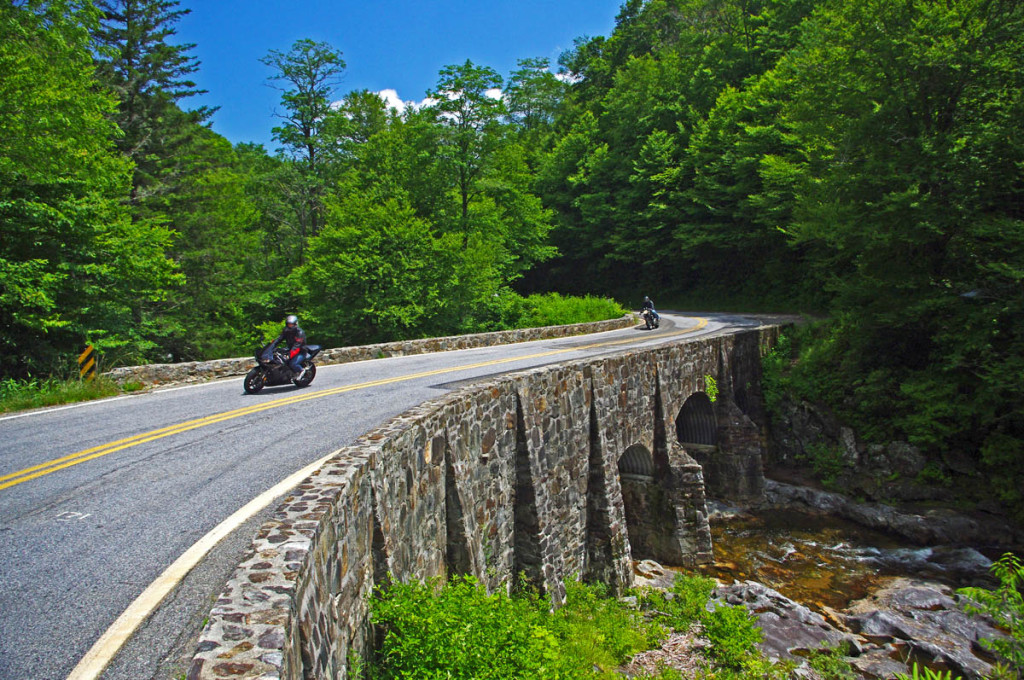
Imagine miles and miles of curves like this one – a.k.a. Silversteen Road

Turn-by-turn route description

Start at traffic light in Bethel (junction US 276, NC 215, NC 110).

Follow NC 215  – starts as Love Joy Road. Easy section through farmland along river with a few sharp turns.

2.9 mi – Turn left @ stop sign to continue on NC 215. Junction Love Joy Road and Lake Logan Rd (NC 215).  Moderately difficult. Rolls through houses, some nice curves, section along Lake Logan very nice.

16.8 mi – Pass Sunburst Campground. Enter Pisgah National Forest. Start climb to Blue Ridge Parkway. Road gets more twisty here. Nice stop at a roadside waterfall. Beware loose gravel on road, especially in turns, most likely to be found in the highest sections. Difficult.

17.9 mi – Pass Blue Ridge Parkway ramp. Popular break spot, if not at the junction, go up to the parkway and turn right to reach a nearby overlook with lots of parking. Continue under the parkway on NC 215. Good views from the highest section. Road surface improves south of parkway. Difficult.

35 mi – Turn right @ stop sign onto US 64. Junction NC 215 (Parkway Road) and US 64. Just a short section on this sometimes busy road. Easy.

Photo-Charlies-Creek-Rd

Charlie’s Creek Rd – typical of the wonderfully empty and inviting rides that abound in the Smokies

37.7 mi  – Turn right onto Silversteen Road. Junction US 64 and Sliversteeen Rd. Sign warns of tight turns ahead, believe it! Difficult.

38.3 mi – Keep right on Silversteen Rd. Junction Silversteen Rd and Golden Road. Difficult.

43.6 mi – Sharp left turn to stay on Silversteen Road. Junction Silversteen Rd and Macedonia Church Road. If you don’t make this turn, you will end up back on NC 215. Difficult.

45.7 mi – Turn right @ stop sign onto NC 281. Junction Silversteen Road and NC 281 (Canada Road). Nice section, a little loose gravel in places. Difficult.

57.6 mi – Turn right onto Charlies Creek Road. Junction NC 281 (Canada Road) and Charlies Creek Road. Be on your guard, surprising turns on this road. Difficult.

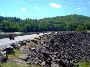
Photo - wolf Creek Dam

Wolf Creek Dam near the midpoint of NC 281, one of the scenic points on this great motorcycle ride.

68.4 mi – Turn left onto NC 215. Junction Charlies Creek Road and NC 215. Start back on a road you’ve been on previously.

89.7 mi – Follow NC 215 back to Bethel.

You’ll find gas stations in Bethel, on NC 215 on the south side of the Blue Ridge Parkway, and at the turn off US 64 onto Silversteen Road.

Jukebox Junction is a popular diner in Bethel. It’s mostly gas station food for the remainder of the ride.

Map of the ride

You’ll find these roads and many others in the surroundings on America Rides Maps motorcycle pocket map #6 – The Best Motorcycle Rides Near Great Smoky Mountains National Park – EAST.

____________________________________________________________________

wayne busch - Smoky Mountain Motorcycle Rider.com

Wayne Busch

– Wayne Busch lives in Waynesville, NC, where he produces the most detailed and comprehensive and up-to-date motorcycle pocket maps of the Blue Ridge and Smoky Mountains to help you get the most of your vacation experience. See them here – AmericaRidesMaps.com

Total Rider Tech Logo

Learn Total Control

Wayne is an advanced motorcycle instructor for Total Rider Tech teaching Lee Parks Total Control Advanced Rider Courses. Isn’t it time you looked into advanced rider training to ride more confidently and safely? It can transform your mountain riding experience.  Total Rider Tech

____________________________________________________________________

Blue Ridge Parkway Motorcycle – Fall Leaf Color

Blue Ridge Parkway Motorcycle – Fall Leaf Color, October 12, 2012
South section, Asheville to Cherokee

Blue Ridge Parkway Motorcycle - Fall leaf color

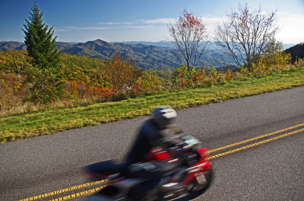
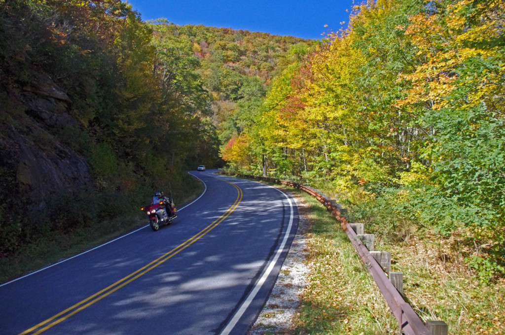
Blue Ridge Parkway Motorcycle – Fall leaf color; While the leaves have dropped some at the highest points, plenty remains just a little lower.

For bikers riding the Blue Ridge Parkway by motorcycle this year, it’s been another good fall showing of fall leaf color. The weather has been a bit “iffy” at times, but that’s not uncommon during this transitional period of the year.

Blue Ridge Parkway Motorcycle - Fall leaf color;

Blue Ridge Parkway Motorcycle – Fall leaf color; Even where some leaf loss has occurred, the views are still outstanding. Late in the day the golden sunlight really sets them off!

Friday, the colors were just getting near their peak at the highest elevations. A cold front over the weekend brought some wind and rain lingered into the week. Unfortunately the leaves were stripped in many exposed areas. Still, there is plenty remaining to make a motorcycle tour worth the time and effort.

Blue Ridge Parkway Motorcycle - Fall leaf color;

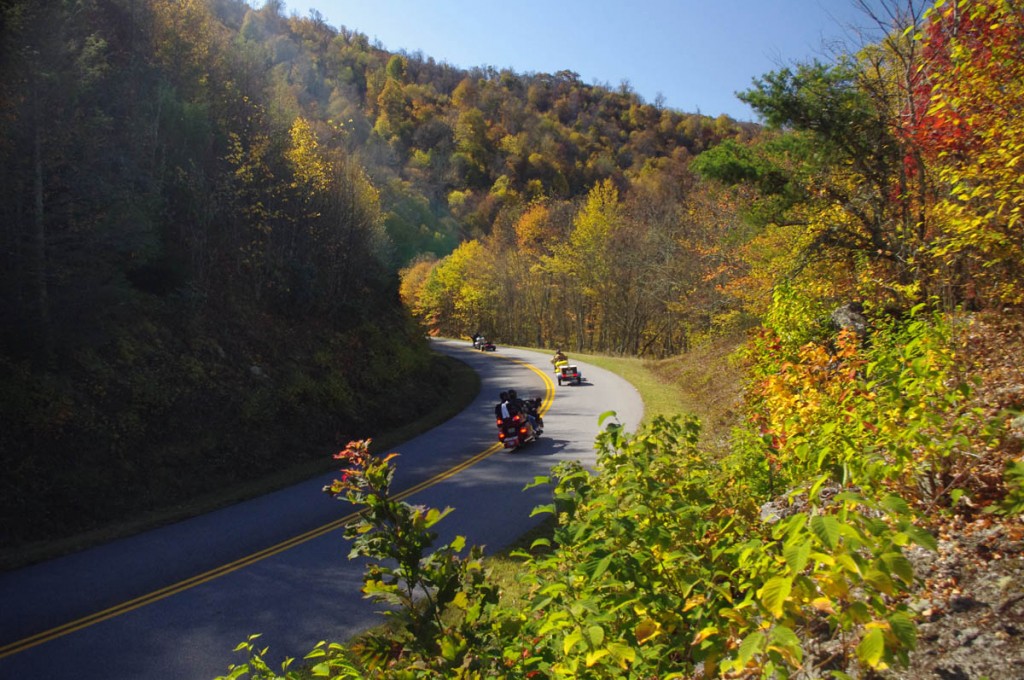
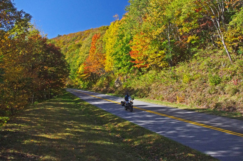
Blue Ridge Parkway Motorcycle – Fall leaf color; plenty of color yet to come at the lower elevations throughout the mountains. It usually lasts well into November.

Above 5000 ft. some color remains, but the real show now is a little further down. You’ll find excursions off the Blue Ridge Parkway onto the many great connecting motorcycle rides still yielding a spectacular view of natures glory.

Blue Ridge Parkway Motorcycle - Fall leaf color;

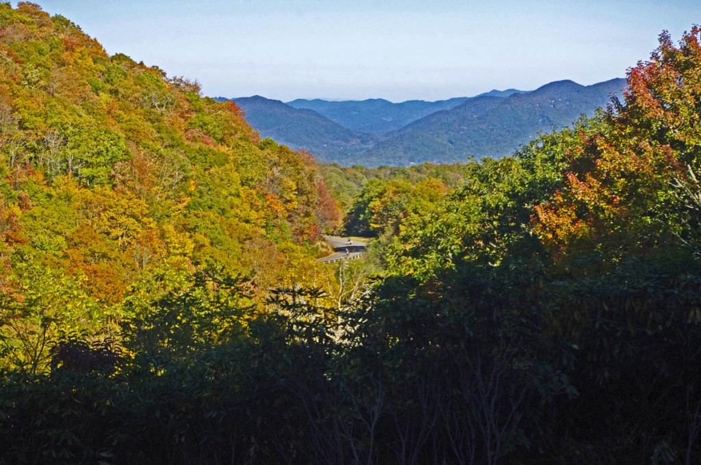
Blue Ridge Parkway Motorcycle – Fall leaf color; The lower elevations are just beginning to show the full spectrum of all the hues of the leafy rainbow.

Don’t miss opportunities to get off onto the back roads where there are some outstanding displays of not only great leaf color, but beautiful mountain scenes that reward the wanderer year-round.  AmericaRidesMaps.com will help you find them!

NC 215 fall leaf color - motorcycle rides nc

NC 215 fall leaf color – motorcycle rides nc – NC 215 has currently got some great shows of color as well as the scores of roads shown on America Rides Maps in the surrounding area. Be sure to check them out!

____________________________________________________________________

wayne busch - Smoky Mountain Motorcycle Rider.com

Wayne Busch

– Wayne Busch lives in Waynesville, NC, where he produces the most detailed and comprehensive and up-to-date motorcycle pocket maps of the Blue Ridge and Smoky Mountains to help you get the most of your vacation experience. See them here – AmericaRidesMaps.com

Total Rider Tech Logo

Learn Total Control

Wayne is an advanced motorcycle instructor for Total Rider Tech teaching Lee Parks Total Control Advanced Rider Courses. Isn’t it time you looked into advanced rider training to ride more confidently and safely? It can transform your mountain riding experience.  Total Rider Tech

____________________________________________________________________
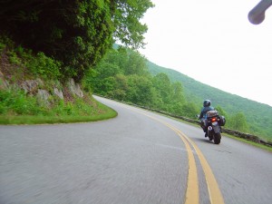
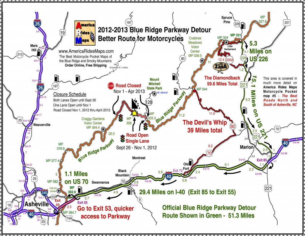
Blue Ridge Parkway 2013 Detour Map for Motorcycles

Blue Ridge Parkway 2013 Detour Map for Motorcycles

Location: North Carolina, Milepost 358, 2.6 miles south of NC 128 / Mt. Mitchell State Park.

Blue Ridge Parkway Detour 2012 - 2013 - View from Craggy Gardens Overlook

Blue Ridge Parkway Detour 2012 – 2013 – Amazingly clear skies from the Craggy Gardens Overlook on the Blue Ridge Parkway. It can still be accessed from the south. That brown stripe in the distance in I-26 more than 22 miles distant. Visibility must have been nearly 50 miles this day.

Schedule:

  • Road open both lanes until 9/26/12
  • 9/26/12 – 10/01/12One lane closed. Temporary traffic lights for one way traffic
  • 10/01/12 – April, 2013 6.5 miles of road closed, use detour

> Access Mt. Mitchell State Park from north (NC 80 crossover)

> Access Craggy Gardens from south (Asheville /  Weaverville exits)

A short stretch of the Blue Ridge Parkway will be closed November 1, 2012 through April 2013 to stabilize a failing slope. I’ve been watching this spot in the road as it has subsided over the past couple years. It involves all of the north bound lane and a portion of the southbound lane, and it’s very noticeable dip when riding through.

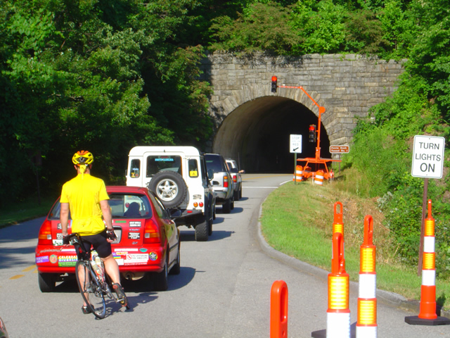
On or about September 26, Temporary traffic lights will stagger one way traffic through the work area, expect short to moderate delays. Gates above the Craggy Gardens Picnic Area and just south of NC 128 to Mt Mitchell State Park will be closed November 1 to isolate it for the construction.

Blue Ridge Parkway Road Closure 2012 - 2013

Blue Ridge Parkway Road Closure 2012 – 2013 – Temporary trffic lights like this one will regulate the flow when one lane is closed this week.

The Official Blue Ridge Parkway Detour exits at NC 226 at Spruce Pine, following it south to NC 221 then west on I-40 to reconnect in Asheville at the US 70 intersection.

I suggest those motorcycle riding on the Blue Ridge Parkway continue south and exit the Blue Ridge Parkway at NC 80. NC 80 a.k.a the “Devils Whip plunges down from the heights through a series of switchbacks, then a nice long curvy section takes you to the junction with US 70 at a traffic light. Follow US 70 east through Old Fort and connect to I-40 West.

Blue Ridge Parkway closure 2013 map

Blue Ridge Parkway closure 2013 map – Click on map for full sized version. Prints on a standard sheet of paper.

Print a copy free from a .pdf file here: http://smokymountainrider.com/Downloads/parkway-closure-2013.pdf

The Official Blue Ridge Parkway detour will have you connecting to the south end via US 70 east of Asheville via Exit 55 on I-40.  I recommend you go to the next I-40 Exit #53 at the junction with US 74A. The connection here is much shorter, no traffic lights, and you won’t miss anything scenic on the Parkway.

You’ll find these roads on America Rides Maps motorcycle pocket map #5 – The Best  Roads North and South of Asheville, NC along with another 40 or so outstanding rides in the surrounding area.

____________________________________________________________________

wayne busch - Smoky Mountain Motorcycle Rider.com

Wayne Busch

– Wayne Busch lives in Waynesville, NC, where he produces the most detailed and comprehensive and up-to-date motorcycle pocket maps of the Blue Ridge and Smoky Mountains to help you get the most of your vacation experience. See them here – AmericaRidesMaps.com

Total Rider Tech Logo

Learn Total Control

Wayne is an advanced motorcycle instructor for Total Rider Tech teaching Lee Parks Total Control Advanced Rider Courses. Isn’t it time you looked into advanced rider training to ride more confidently and safely? It can transform your mountain riding experience.  Total Rider Tech

____________________________________________________________________
Georgia Motorcycle Rides Map Updated

Georgia Motorcycle Rides Map Updated

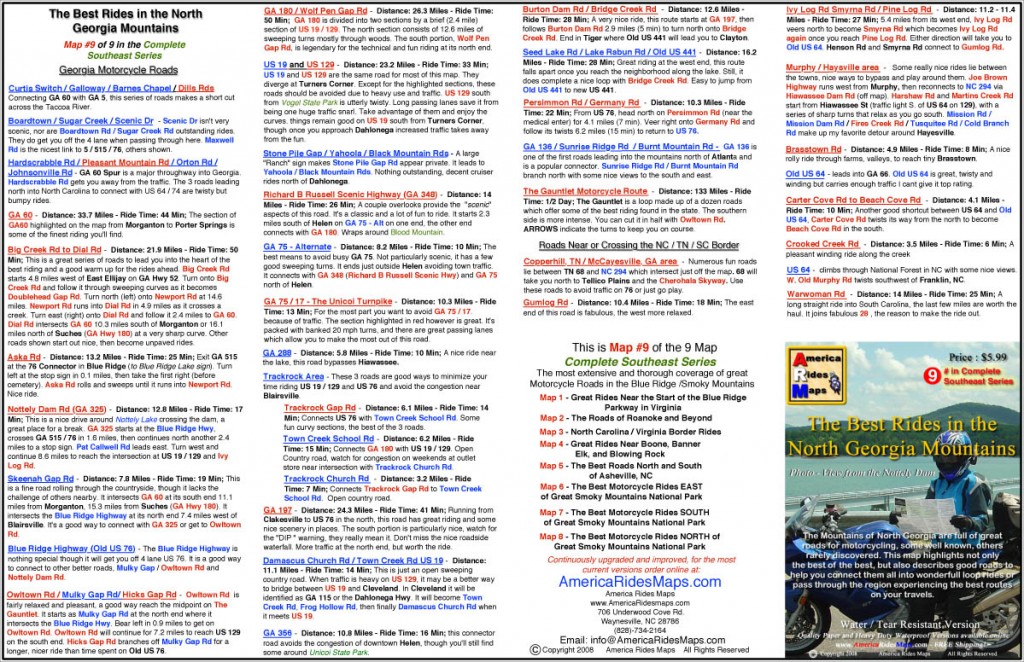
Georgia Motorcycle Rides MapAmerica Rides Maps#9 – The Best Rides in the North Georgia Mountains” motorcycle ride map has just been revised and updated for 2012. This pocket map identifies the best biker roads in the Blue Ridge Mountains of North Georgia and good secondary roads to connect them all together.

Other Motorcycle Ride Maps –

Blue Ridge Parkway Motorcycle Maps

Blue Ridge Parkway

This Georgia motorcycle ride map is the 9th map in a series that covers the best motorcycle rides in the Blue Ridge Mountains. Maps 1-6 of the series detail the Blue Ridge Parkway end-to-end. Maps 7 & 8 focus on the south and north sides of Great Smoky Mountains National Park and both include The Dragon at Deals Gap (Tail of the Dragon) and the Cherohala Skyway. Maps overlap and connect for easy navigation.

Scope – Area Covered on the Georgia Motorcycle Ride Map – 

The Best Rides in the North Georgia Mountains starts north of Jasper, Dahlonega, and Taccoa and extends across the border into North Carolina as far north as Murphy, NC. On the west edge, it’s bounded by 5 / 515 / 76 and the towns of East Ellijay, GA, McCayesville, GA, and Copperhill, TN. The East side of the map traces US 441 north through Tallulah Falls, Clayton and Dillsboro just clipping a tiny piece of South Carolina.

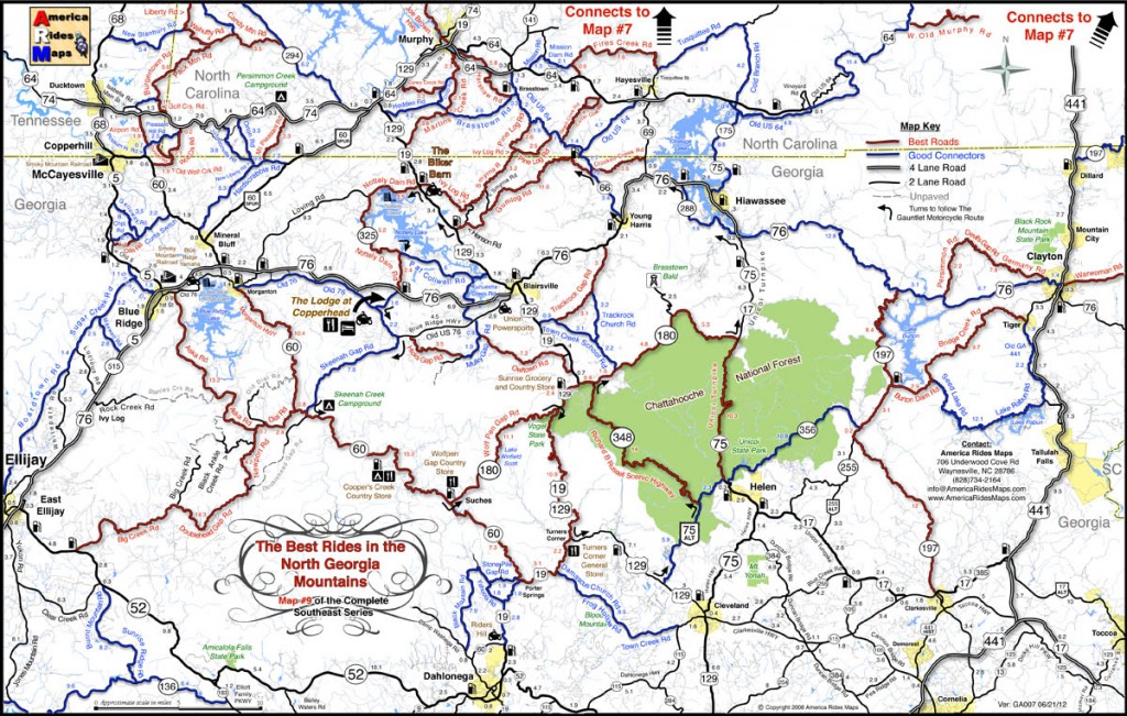
Georgia motorcycle rides map

Georgia motorcycle rides map – Best roads are shown in red, good ways to connect them and other suggested roads shown in blue.

More than 60 roads are highlighted for Georgia motorcycle touring riders. Best Motorcycle Rides are shown in Red. Good Connecting Roads are shown in Blue. Roads are selected based on the challenge of the ride, low traffic flow, scenic views and attractions, and have to stand out from surrounding roads to be considered. Emphasis is on finding the ways to stay off the 4-lane and major roads and connect the best rides together with the best ways to reach them.

So Whats NEW?

  • The original map had about 25 roads, this one has expanded to more than 60 nice motorcycle rides.
  • Road segment mileage is now shown to help you find the turns onto these hidden gems.
  • More out-of-the-way gas stations have been added, additional motorcycle friendly places and service providers have been added.
  • The Gauntlet Motorcycle Route is now indicated with arrows which show the turns from one road to the next.
Georgia Motorcycle Rides Map

Georgia Motorcycle Rides Map – The reverse side of the map gives descriptions of the highlighted roads to help you find which ones you want to ride most

Why are these maps IDEAL for MOTORCYCLE TOURING?

  • They focus on the best Georgia Motorcycle Rides and make them easy to find
  • These maps are done from the seat of a motorcycle – every road is ridden and experienced on 2 wheels.
  • Designed for function – 11 inches x 17 inches means they fit in your pocket so they are always right there for you to use, not stowed in a pack or saddlebag. Easy to fold, even with gloves on. High contrast, easy to read.
  • At $5.99 for the water and tear-resistant version, it’s THE BEST VALUE out there. No other maps are this comprehensive, this detailed, and this cheap.

How do I get one?

Order Online and get free shipping through the America Rides Maps Secure Online Store – Just click this link to start shopping:

http://shop.americaridesmaps.com/main.sc

– Maps are sent via 1st Class or Priority Mail, typical delivery in 2-3 days.

Maps are also available at:

The Biker Barn – http://www.thebikerbarn.com/

The Lodge at Copperhead – http://www.thelodgeatcopperhead.com/

Click here now to get this map —> http://shop.americaridesmaps.com/9-The-Best-Rides-in-the-North-Georgia-Mountains-GA007.htm  

____________________________________________________________________

wayne busch - Smoky Mountain Motorcycle Rider.com

Wayne Busch

– Wayne Busch lives in Waynesville, NC, where he produces the most detailed and comprehensive and up-to-date motorcycle pocket maps of the Blue Ridge and Smoky Mountains to help you get the most of your vacation experience. See them here – AmericaRidesMaps.com

Total Rider Tech Logo

Learn Total Control

Wayne is an advanced motorcycle instructor for Total Rider Tech teaching Lee Parks Total Control Advanced Rider Courses. Isn’t it time you looked into advanced rider training to ride more confidently and safely? It can transform your mountain riding experience.  Total Rider Tech

____________________________________________________________________
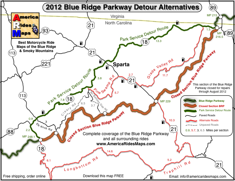
Wayne’s 2012 Blue Ridge Parkway Alternative Detours for Motorcycles

map-brp-detour-2012

Don’t get caught up in the traffic on the Park Service Detour Route 

These roads allow you to take the shortcuts (or the long way round) that will keep you riding!

Get your free copy! Instructions at bottom of page.

photo-parkway-closed-signs-nc18

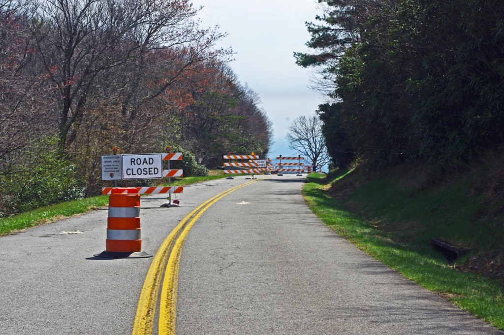
30+ miles of the Blue Ridge Parkway is closed for most of 2012 near the NC / VA border. Detour via NC 18.


There is one significant detour on the Blue Ridge Parkway for 2012. To my surprise, it’s an extension of the detour that closed this middle section of the road near the North Carolina / Virginia border last year. While I found a much better detour route for motorcycle touring in 2011, 2012 is a real challenge in this very rural area where a paved road is a rarity.

photo-stone-walls-on-brp

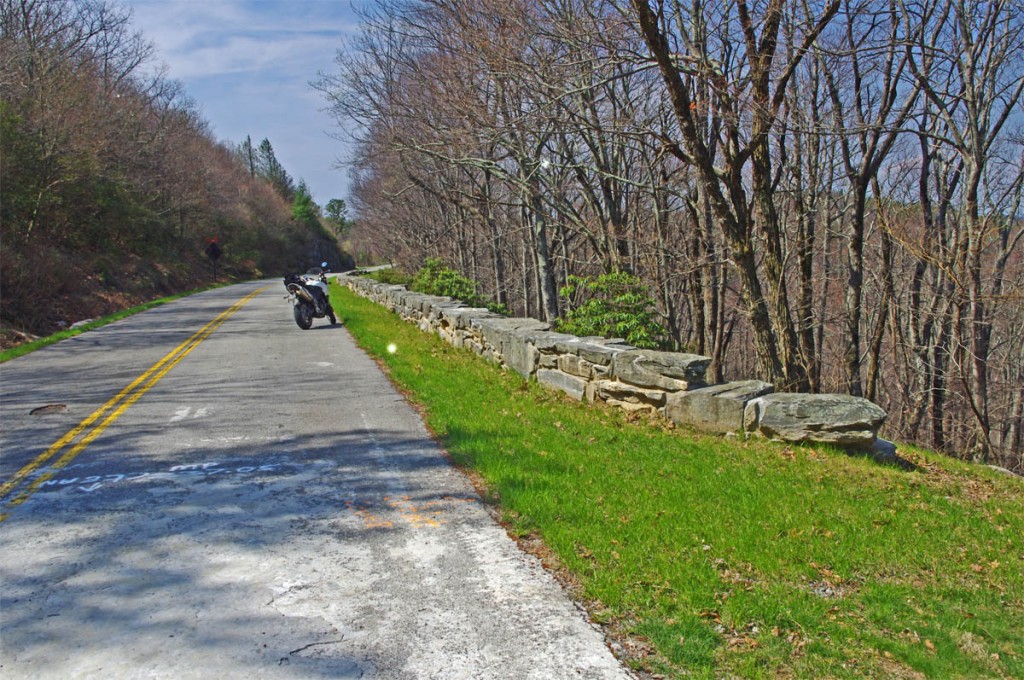
The Blue Ridge Parkway is closed for maintenance, repair, and rebuilding of the historic stone walls found in this 30+ mile section.

The Blue Ridge Parkway will be closed to traffic (including bicycles) in 2012 from Milepost 216.5 near Cumberland Knob to Milepost 248.1 for repair of historic stone walls (see photo). While the wall shown may not seem impressive, this is where the Blue Ridge Parkway was born back in 1930-40. The early masonry work you see on the overpasses, bridges, and walls was done by master masons brought over from Europe. A few third generation descendants continue this restoration work today.

photo-brp-barricade

4 Road Closed signs, barrels, barricades, flashing lights, locked gate, - seriously closed!

Last year’s detour was north of the Blue Ridge Parkway through Sparta. I knew of a longer though much better route on the south side and produced a free downloadable map of it. It was fun. That route is included on the map. This years extension of the closure means there is no good way to bypass it completely on the south side of the Blue Ridge Parkway.

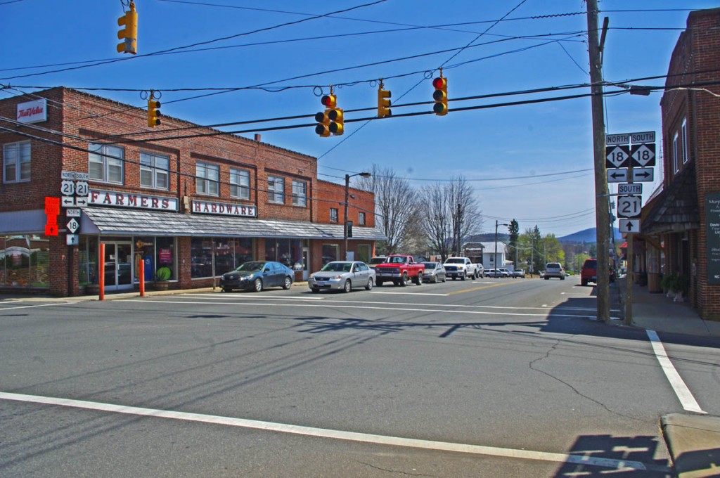
photo-sparta

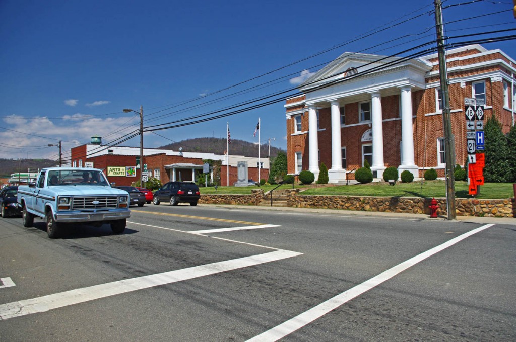
The Allegheny County Courthouse is the cornerstone of downtown Sparta. It's a small crossroads town, little of interest to me.

The 2012 Park Service detour route is simple, just one road – NC 18 which intersects the Blue Ridge Parkway at two points. It’s the easy, elegant solution passing through Sparta. While NC 18 could be a decent motorcycle ride, it’s curvy and rolling, the lack of paved roads in the area means it also carries all the traffic. Few cars and trucks are able to maintain the 55 mph speed limit and there’s always that one or two that can’t seem to get much above 40 mph and the lines back up behind them. It can be frustrating to ride when you can’t enjoy the curves at a proper motorcycle pace.

photo-sparta

There - now you've seen Sparta. Don't feel like you've missed much if you bypass it.

Nor is there a compelling reason to go into Sparta. It’s a historic town at the crossroads of NC 18 / US 21, but I saw no places which looked enticing to eat at (one coffee shop), and the 2 gas stations require you to leave NC 18 and go a short distance on US 21. There’s a little museum, but miss Sparta and you won’t miss much.

map-brp-detour-2012

Download this map and print your copy or save it in your phone!

The roads show on the map offer alternatives to avoid most of the standard route and should save you some time. They will at least help you avoid getting caught up in any traffic that could get backed up on the official detour. For those on adventure bikes I’ve included a couple non-paved options that will let you get your wheels dirty on gravel roads.

Downloads:
Use http://americaridesmaps.com/downloads/BRP-detour-2012.pdf for a map you can print on a standard sheet of paper.

Use http://americaridesmaps.com/downloads/BRP-detour-2012.jpg for an image file you can store in your cell phone, iPad, or GPS.

__________________________________________________________________

Wayne Busch

Wayne Busch - Cartographer

Total Rider Tech Logo

Learn Total Control

– Wayne Busch lives in Waynesville, NC, where he produces the most detailed and comprehensive and up-to-date motorcycle pocket maps of the Blue Ridge and Smoky Mountains to help you get the most of your vacation experience. See them here – AmericaRidesMaps.com

Wayne is an advanced motorcycle instructor for Total Rider Tech teaching Lee Parks Total Control Advanced Rider Courses. Isn’t it time you looked into advanced rider training to ride more confidently and safely? It can transform your mountain riding experience.  Total Rider Tech

____________________________________________________________________

Good Biker Roads – US 76 in Georgia – Motorcycle Map change

US 76 in Georgia between Clayton and Hiawasse is a good biker road.

It’s not one of “the best motorcycle roads” in north Georgia,

– but it’s a good motorcycle ride that rates high enough that I’ve decided to upgrade it on America Rides Maps #9 The Best Rides in the North Georgia Mountains to the “good connector” category.

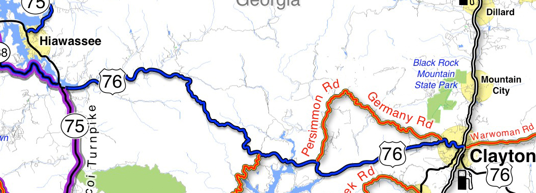
map-image-US-76-Georgia

US 76 is now shown as a "good connector" on America Rides Maps (blue highlight). You can see there are other great rides which link to it along this section. I show you which roads are worth riding!

How I show the roads: I list “good connector” roads on my America Rides Maps highlighted blue to help you find the best ways to link together the best motorcycle rides which I show in red.  There’s no way I’ll ever rate this section of US 76 in Georgia as a great biker road (shown highlighted red on America Rides Maps) as it carries too much traffic. That’s what usually disqualifies or downgrades what would otherwise be great motorcycle rides – too much traffic.

Description of this section of US 76: The blue highlighted section of US 76 shown on the map is flatter and more open to the west, dotted with houses which thin out as you head east. It then enters a section of National Forest and makes a gentle climb over a mountain with a nice section of curves – nothing extreme, but a lot of them and they can be fun if you’re not caught behind slow traffic. Houses, then businesses start appearing as you near Clayton, the road is more twisty at this end.

Where can I get this map? #9 The Best Rides in the North Georgia Mountains

PS – current map owners may have noted something else – the purple highlighted roads. They are part of “The Gauntlet” motorcycle ride in georgia’s blue ridge mountains. (Trying something new, if it works out you’l see more of it – you know I’m constantly changing and improving America Rides Maps.

Comments? Did I make the right choice?

_______________________________________________________________________________
Wayne Busch

Wayne Busch - Cartographer

Total Rider Tech Logo

Learn Total Control

– Wayne Busch lives in Waynesville, NC, where he produces the most detailed and comprehensive and up-to-date motorcycle pocket maps of the Blue Ridge and Smoky Mountains to help you get the most of your vacation experience. See them here – AmericaRidesMaps.com

Wayne is an advanced motorcycle instructor for Total Rider Tech teaching Lee Parks Total Control Advanced Rider Courses. It’s time you looked into advanced rider training to ride more confidently and safely, it will change your mountain riding experience. It worked so well for me I became an instructor! Total Rider Tech

_______________________________________________________________________________
 You’ll find US 76 and all the other good biker roads on America Rides Maps #9 The Best Rides in the North Georgia Mountains 

Updates to Blue Ridge Motorcycle Ride Maps

America-Rides-Maps-Logo

www.AmericaRidesMaps.com

First of all, none of the recent updates are significant enough for you to order fresh versions of your America Rides Maps Blue Ridge and Smoky Mountain motorcycle maps if you’ve recently purchased them. The major updates were completed over the last 18 months, and only if your maps are more than a year old will you see the benefit of looking to the newer expanded versions.

However, there have been some more recent changes I’d like to share with you so you don’t miss out on the best motorcycle rides in the Blue Ridge and Smoky Mountians.


image-Georgia-motorcycle-map-cover

#9 - The Best Rides in the North Georgia Mountains

Map #9 – The Best Rides in the North Georgia Mountains was the last completed so it’s most up to date. I’ve just added the new Wolfpen Gap Country Store which will open Saturday in Suches, Georgia (the offical opening is Oct. 1). This is a significant development in Georgia as the convenience store and gas station has long been a popular gathering and rest stop at the intersection of some of the best motorcycle rides in Georgia.


image-motorcycle-ride-map-cover

#6 - The Best Motorcycle Rides EAST of Great Smoky Mountains National Park

Map #6 – The Best Motorcycle Rides EAST of Great Smoky Mountains National Park – This is one of the best of all the maps and were I forced to choose it would be probably be my favorite. It includes the best section of the Blue Ridge Parkway. The gas station and convenience store closest to the Blue Ridge Motorcycle Campground has closed and has been removed from the map. Just a few miles further down the road there are 3 gas stations in Bethel, 2 popular restaurants, so it’s no big deal. I’ve added Max Thompson Rd as a good connector as it’s a way to divert around tiny Bethel and a nice connecting road, and it also intersects the short section of NC 215 (Sonoma Rd) at NC 110. Rather than wait at the traffic light, you can just pass by it on Max Thompson Rd and enjoy this short but twisty ride to reach US 276.


Image-motorcycle-ride-map-cover

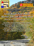
#4 Great Roads Near Boone, Banner Elk, and Blowing Rock

Map #4 – Great Roads Near Boone, Banner Elk, and Blowing Rock – I’ve added Shulls Farm / Shull’s Mill Rd which connect NC 105 to the Blue Ridge Parkway in Julian Prince State Park near the Moses Cone House. While I’ve known about this wonderfully twisty ride previously, it somehow got left off the last update. That’s been corrected. I also added the BP station near 7 Devils on NC 105. Again, don’t know why it got missed, I stop there all the time.


image-virigina-motorcycle-ride-map

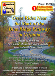
#1 The Best Rides near the Start of the Blue Ridge Parkway in Virginia

Map #1 – Great Rides Near the Start of the Blue Ridge Parkway in Virginia – I’ve added Red Hill Rd, Plank Rd, and Padgett Hill Rd as good connectors. These make the ride from Natural Bridge to Lexington much more enjoyable then the alternative – Interstate 81. They are not lined with outstanding scenery, and a little remote, but they do the job and throw in a few nice curves along the way.


People have often told me my maps are more up-to-date than their GPS, and I can concur as I use GPS while out mapping – the little lady often gets confused when it comes to the twisty two lane back roads we love so much. I’m constantly updating the maps to keep them as accurate and useful as possible and unlike other maps, I produce them in small batches as they change so often. I want to insure you always get the most recent and up-to-date versions. I hope these changes help you have the best motorcycle rides and get the most out of your precious motorcycle vacation adventures.


Map #1 – Great Rides Near the Start of the Blue Ridge Parkway in Virginia
Map #4 – Great Roads Near Boone, Banner Elk, and Blowing Rock
Map #6 – The Best Motorcycle Rides EAST of Great Smoky Mountains National Park
Map #9 – The Best Rides in the North Georgia Mountains

Wayne Busch

Wayne Busch - Cartographer

Thanks,

Wayne

www.AmericaRidesMaps.com

Blue Ridge Motorcycle Touring – Natural Bridge, Virginia

In general, I avoid the touristy sights on my motorcycle travels as I get my kicks from the road. It’s the hundreds of great motorcycle rides in the Blue Ridge and Smoky Mountains I most enjoy, and that is best done with the kickstand up and the throttle open. I need a pretty good reason to park the motorcycle and go for a walk, and Natural Bridge, Virginia, is worth time the time to stop and see.

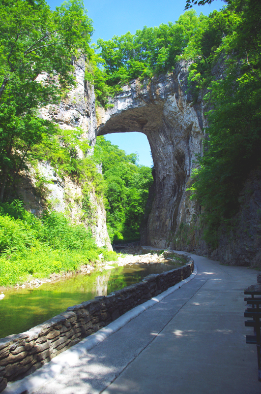
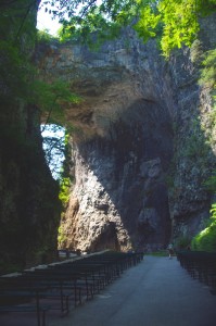
Photo-Natural-Bridge-view

The Natural Bridge, a Viriginia landmark worth seeing.

Photo-Natural-Bridge-Hotel

The Natural Bridge Hotel, a historic landmark

Natural Bridge has been around for a long time. It was already a tourist destination when Thomas Jefferson visited. This 200 foot high natural arch started as a cavern millennia ago. Over the eons erosion collapsed the majority of it leaving only the dramatic and inspiring rock formation that has drawn thousands of spectators over the last few centuries.

Photo-Natural-Bridge-Entrance-and-Gift-Shop

Natural Bridge Entrance and Gift Shop

This long history was part of the attraction for me. There are many early sketches and historic reports of the landmark displayed in the museum, it is part of our national heritage. This legacy though has come at the cost of commercialization of the natural attraction with manufactured ones added to woo the crowds and entice them to part with their dollars.

Photo-Cowboy-on-a-dinosaur

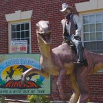
I managed to escape the Dinosaur Kingdom

We passed on the wax museum, the butterfly room, and most all the other man-made enhancements designed to lure the tourist. I was particularly amused by the hook for the “Escape from the Dinosaur Kingdom” with a statue of a cowboy riding a dinosaur. Easy to pass on that one, I’m quite satisfied with the Flintsone’s version of pre-history. Yabba-dabba dumb, but I’ll bet the kids like it as well as the Haunted Monster Museum.

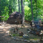
Photo-Indian-village

The Indian Village re-creation.

We did walk the trail to view the re-created native indian village, but it pales in comparison to the main attraction.

We paid $18 a piece for a ticket that gave us partial access to all the attractions. All we really wanted to see was the Natural Bridge. It’s a short walk and worth the time, and while I we could have seen all the other kitschy stuff, I felt my money well spent avoiding it.

A side trip to Natural Bridge, Virginia is an easy and pleasant ride from the Blue Ridge Parkway. Exit near the James River Visitor Center on US 501 (milepost 63.7) or VA 130  a couple miles north (milepost 61.6, and the better ride). Follow Us 501 / VA 130 to Glasgow, turning right on VA 130 to pass through the small town for another 4 miles or so. Don’t worry, you can’t miss it when you arrive.

Photo-Natural-Bridge-view

View of the other side of the Natural Bridge

Natural Bridge, Virginia

The Natural Bridge and other scenic attractions nearby are found on Map #1 of the 6 map Blue Ridge Parkway series of motorcycle pocket maps by America Rides Maps. Don’t miss all the great motorcycle rides in this area.

Image-map-cover

Great rides Near the Start of the Blue Ridge Parkway in Virginia

_______________________________________________________________________________
Wayne Busch
Wayne Busch – Cartographer
– Wayne Busch lives in Waynesville, NC, where he produces the most detailed and comprehensive and up-to-date motorcycle pocket maps of the Blue Ridge and Smoky Mountains to help you get the most of your vacation experience. See them here – AmericaRidesMaps.com