Smoky Mountains Adventurous Spring Motorcycle Ride Photos

Photo - Soco view

Morning view on Soco Rd - Click on pics for LG view

15 minutes from home and already I was fighting the urge to jump off the motorcycle and start snapping pictures. It was a beautiful Smoky Mountain spring morning. Rounding every curve the canvas repainted another fabulous scene as I droned down from the Blue Ridge Parkway at Soco Gap towards Cherokee.

Photo - view from Clingman's Dome

Clingman's Dome view

Not a car on the road ahead of me, I let the bike stretch it’s legs through the curves effortlessly riding every last inch of rubber as my Triumph Tiger charged down the incline in pursuit of it’s prey.

Photo - view from Roaring Fork Rd

Roaring Fork Road - must be Roaring Fork!

It felt so good, all is right with the world when you’re on your motorcycle in the mountains. Wrapping around a rock face with the mellow grace of a cat arching it’s back, I flicked left to begin my plunge to the valley floor on the first of the new roads I’d see today.

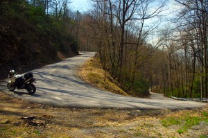
Photo - hairpin curve on Alpine Rd

Alpine Rd - one of my newest favorites

How had I missed this road? I’ve bypassed it many times on my passages to Cherokee. It’s not like I haven’t studied the area and it’s so close to home. Yet when we came through on a motorcycle ride Saturday, a road I was vaguely familiar with suddenly jumped out at me and said, “Come back and take a closer look”.

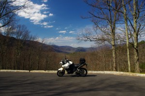
Photo - Cherokee Orchard Rd

Cherokee Orchard Road Overlook

The clue  that tipped me off  was the name – “Old Soco Road”. It suggested I was riding the “new” Soco Rd (US 19). “Old” Soco Rd was the way things used to be. Sometimes these “old” roads are gems.

It was like riding off a cliff and I had to quickly adapt to the more primitive road surface. Gliding through turn after turn I delicately parachuted through the  loose gravel and the windblown debris that had rained down on the switchbacks on this third day of roaring mountain wind. April was coming in with a bang.

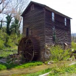
Photo - Old mill

I passed this old mill again today

So began a day that took me across Great Smoky Mountains National Park and out into the wilds to the north as I clicked off road after road on my search for the best motorcycle rides. The afternoon would bring me into a violent storm navigated on what were now familiar byways through seemingly remote and isolated hidden valleys where angry streams threatened to crest their banks and wash across the pavement.

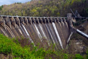
Photo - Tapoco Dam

The Dam at Tapoco

Looping around the west side of Great Smoky Mountains National Park near the end of the day, I’d arrive at Deals Gap to find the motorcycle resort closed due to the lack of electricity as a wind blown forest fire raged up a flank of the park consuming the lines and felling trees in it’s path. I’d squeeze through a gap between the fire trucks parked on a back road to ride through the smoke and smolder where crews fought the flames and mended the wires.

As the day drew to an end the lightening and rains caught up to me again, followed me home bringing the fury of the storm with them, and toppled trees that would have me without power for the next few days.

I’ve lost a couple days of work and will now double-down to make it up. With each new day the grays and browns of winter give way to the soft pastel greens of emerging leaves as spring wrestles the cold grip from the old season to bring the warm blooms of the new.  The fuse is lit for the explosion of color. It’s time to point your wheels towards the high country, its ready for you.

_______________________________________________________________________________

Wayne Busch
Wayne Busch – Cartographer
– Wayne Busch lives in Waynesville, NC, where he produces the most detailed and comprehensive and up-to-date motorcycle pocket maps of the Blue Ridge and Smoky Mountains to help you get the most of your vacation experience. See them here – AmericaRidesMaps.com 
Blue Ridge Parkway Construction – Plan on Letting the Motorcycle Cool for a While

With the new paving done, I’ve been using the Blue Ridge Parkway more often for my motorcycle touring rides north. It’s actually about as quick as taking any other route if you’re heading for areas between Asheville and Boone, NC, and even if it takes a tad longer, it’s usually so much nicer to go that way. Today though, I hit it at the wrong time.

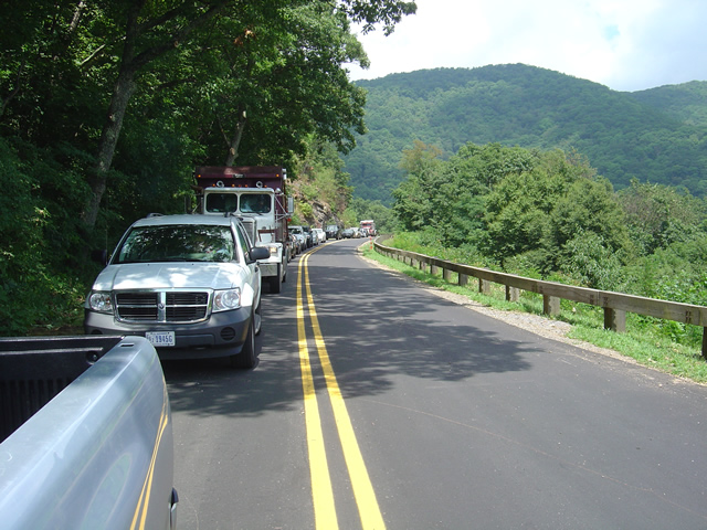
Photo - line of cars on the Blue Ridge Parkway

This line of cars much have stretched for a mile waiting on the tree clearing crews to let us pass.

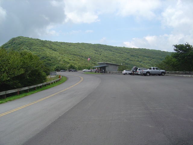
I needed to make a run up to Craggy Gardens for a photo. If you’ve been to Craggy Gardens on your motorcycle vacation you know why it makes a good photo spot, if not, I can be confident you’ll stop there if you pass that way and take your own. It’s the first Visitor Center location north of Asheville, though it’s the views people come for, not the facilities.

I had expected the traffic from the work crews would be tapering off. I was proven wrong today and I’ll need to explore a bit further to find out why.  I just plain didn’t have the time this morning.  As soon as I got on the Blue Ridge Parkway in Asheville I found myself behind a dump truck. I was shortly joined by a string of motorcycle riders as we putted along behind said truck for creeping uphill mile after mile. Just as the truck managed to pick up speed it caught up to another.

Photo - the Craggy Gardens Visitor Center on the Blue Ridge Parkway. Lots of parking, it's a popular stop.

The Craggy Gardens Visitor Center on the Blue Ridge Parkway

I don’t know where the trucks were headed, the last work I saw was near Mt. Mitchell State Park. If they are working on the stretch of road north of there, more power to them and I have no complaints. It needs some attention, though not as severely as that south of Craggy Gardens. The hold up today was the tree clearing crews. I waited for 1/2 and hour to pass. Must be the same slow crews which worked through Asheville last week.

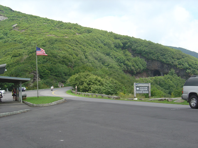
Photo - The Craggy Pinnacle Tunnel

I was looking for and got a nice photo at the Craggy Pinnacle Tunnel for a new "The Best Rides North and South of Asheville, NC" map cover.

Anyway, be aware there are still delays through this section and take it in stride on your motorcycle vacation plans. Spend a little more time at the overlooks, appreciate the improvements to the road, and remember there are  few places better to have to pause and wait. I’ll be at the north end of the Parkway in Virginia next week to update what’s going on there.

_______________________________________________________________________________

Wayne Busch

Wayne Busch - Cartographer


– Wayne Busch lives in Waynesville, NC, where he produces the most detailed and comprehensive and up-to-date motorcycle pocket maps of the Blue Ridge and Smoky Mountains to help you get the most of your vacation experience. See them here – AmericaRidesMaps.com
 

Blue Ridge Parkway Motorcycle Road Construction Report / photos 7-14-10

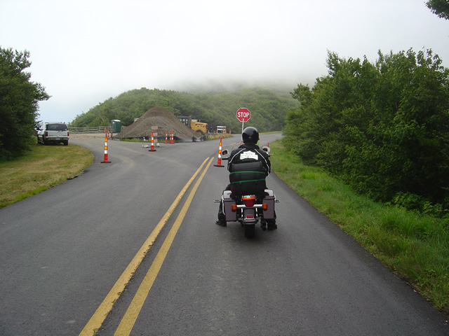
Photo - stopped on the Blue Ridge Parkway

A short delay between Mt. Mitchell and Craggy Gardens near the roadwork.

I took a motorcycle ride through the North Carolina section of the Blue Ridge Parkway to confirm my suspicions this morning. Even with the heavy fog up high it was clear that the bulk of the Blue Ridge Parkway paving work in North Carolina has been completed. While work continues, the major roadwork between Asheville and Mt. Mitchell is done and you may expect smooth new pavement on your next motorcycle ride.

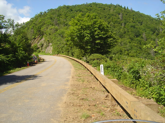
Photo - section of new Blue Ridge Parkway guardrail

The new wooden guardrails are much heavier and a little higher than the ones they replace

The focus has now shifted to the margins of the road as the drainage is being cleaned and groomed, trees are being trimmed, and most significantly, new wooded guardrails are being installed. You will hit short delays when you come upon this work. North of Mt. Mitchell State Park you’ll still hit some bumpy areas of road. The worst of the pot holes are being filled and patched.

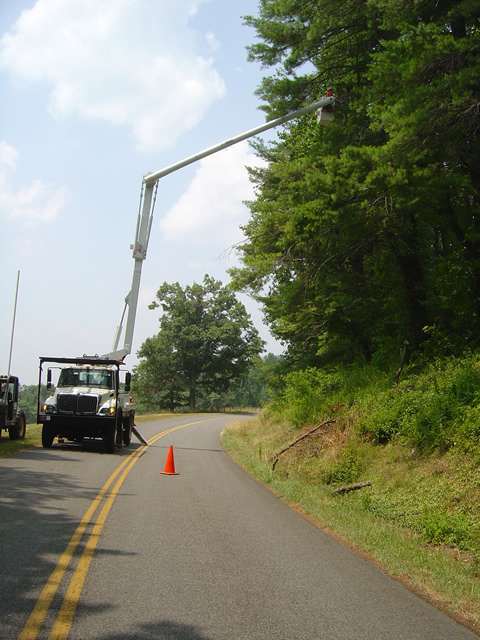
Photo - tree trimming on the Blue Ridge Parkway

The most extensive tree work is on the Virginia side of the border where much of the winter damage is yet to be removed.

Further north on the sections of the Blue Ridge Parkway near the North Carolina and Virginia border, you’ll still run into sections being paved, though nothing as extensive as what was done to the south.  On the Virginia side of the border, the paving is in short sections and along the edges of the road. I’m hoping this is just laying down a base for a fresh coat of pavement over the top as some of the patched areas dip lower than the untouched sections of road and you’ll notice the drop. I’m impressed with the stone work being done to construct the drains.

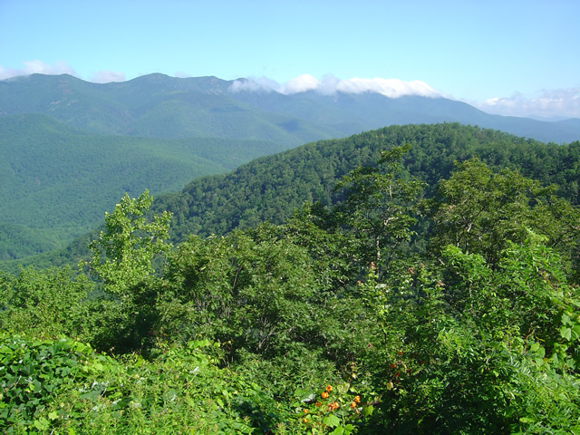
Photo - Clouds hug the tops of the black Mountains this morning

Take time to pause and look at the Black Mountains, some of the most rugged and beautiful peaks in the south. Clouds hugged the tops this morning.

Overall, delays are brief, you’ll hit more in Virginia right now, but the work that has been done was needed and welcome. No major changes at the rock slide area south of Asheville – one lane remains open controlled by a traffic signal.

Wayne from America Rides Maps

Blue Ridge Parkway Rockslide – Photos / Info – July 4, 2010

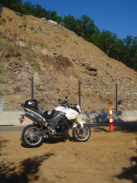
Photo - view of the rock slide

Once a steep hillside giving way, the rock slide is now being reshaped into a more gradual slope near milepost 400 on the Blue Ridge Parkway.

My July 4th holiday was one of those exquisite weekends with ideal weather, clear skies, and lots of time on the motorcycles. I managed to hit four states, rode several of the most notable routes, discovered some new rides, and treated my riding partners to at least one America Rides Maps road they’d never seen before that they will surely remember. While I touched the Blue Ridge Parkway several times, the holiday traffic took much of the fun out of it for me and I stuck mostly the little known hidden two lane mountain back roads I know so well. Finally, Monday evening, I rode up to view the newly opened section at the rock slide south of Asheville.

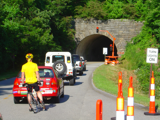
Photo - traffic waits on the parkway

Waiting to go at Ferrin Knob Tunnel #1 south of the work area - A set of temporary traffic lights control passage through the single lane open at the site of the rock slide cleanup.

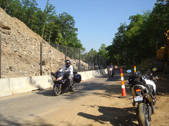
One lane is open at the Blue Ridge Parkway section near milepost 400 between Asheville and Mt. Pisgah. Passage is controlled by a set of temporary traffic lights on either side of the work area. They are programed to change about every 5 minutes so delays are tolerable though I’m sure the lines got pretty long during the peak of the weekend. Concrete barriers and a chain fence separate the tourists from the workers and prevent too many boulders from tumbling down onto the road.

Photo - the single open lane on the parkway

A concrete barrier and high fence help protect from boulders and debris which might come down from above. It's a short ride past.

They’ve removed one heck of a lot of rock from up high on what was previously a pretty vertical section of hillside. It now slopes more gradually, though there’s enough loose rock and soil above to make one hesitant to linger below. There’s still quite a bit to haul out and stabilize before the second lane is opened in September, but it will come.

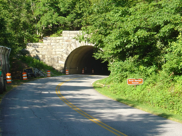
photo- work zone near Buck Spring Tunnel

Another set of traffic lights is being used near work on the Buck Springs Tunnel just north of the Pisgah Inn.

There is a second work area at the Spring Gap Tunnel near milepost 408 just north of the Pisgah Inn. A set of temporary traffic lights also does duty here as the tunnel work progresses. It doesn’t appear to be too extensive and I wouldn’t think it will last long, but count on another delay.

This is great news, and I’m glad to see it finally come to pass. For the first time in more than 18 months the Parkway is open from end to 469 mile long end. Enjoy!

wayne@americaridesmaps.com

Blue Ridge Parkway On Ice – Photos / Video

With all the snow and cold weather we’ve had this winter, riding the motorcycle has been only a dream. This afternoon, we headed up to the Blue Ridge Parkway to enjoy it in full winter glory.

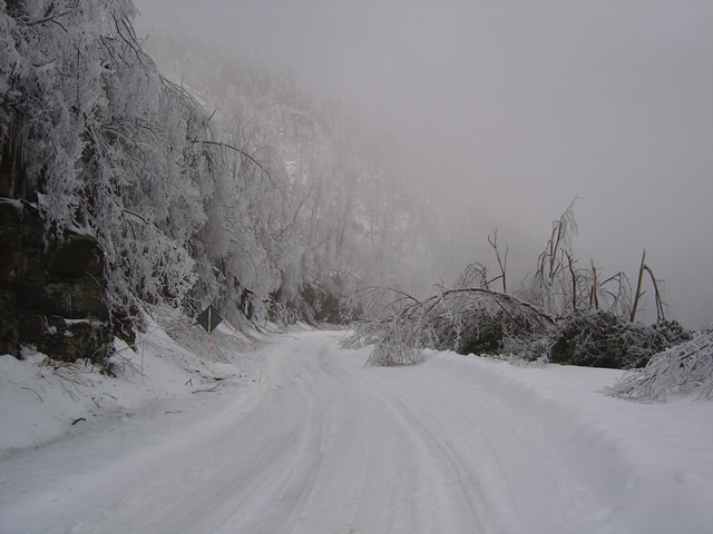
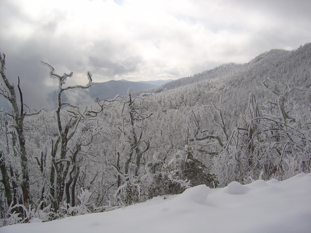
An ice storm hit last night. Damage was extensive.

While “Snowmageddon” hit Washington we were largely spared it’s fury in the high mountains of western North Carolina. We picked up a few more inches here and there to what was already a significant accumulation. What we did get with this storm was ice. You can see the trees bent over from the weight of it.

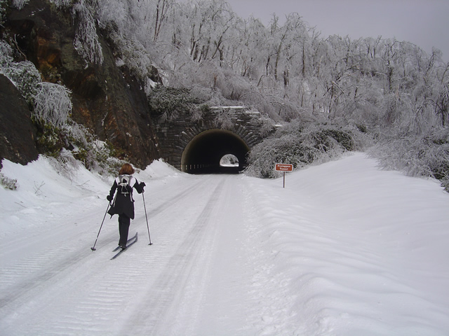
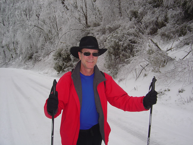
Photo - skiing the parkway

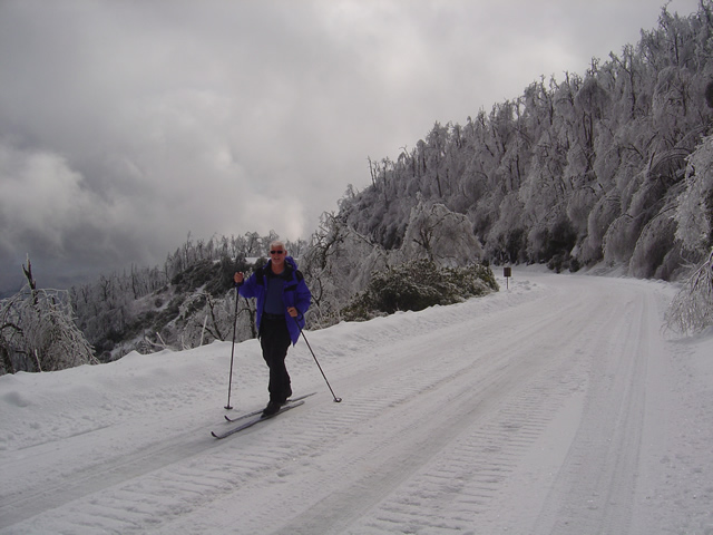
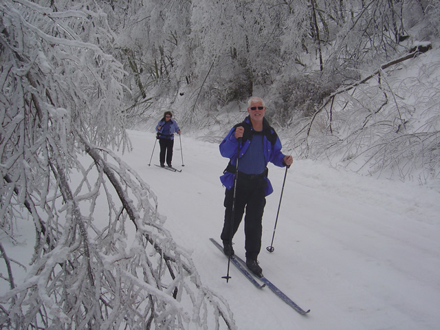
Cross country skiing on the highest sections of the Blue Ridge Parkway

For those of us who live here, the Blue Ridge Parkway becomes our winter playground when it closes for the colder season. This section has seen park service traffic to maintain a communications tower. It made for nice skiing.

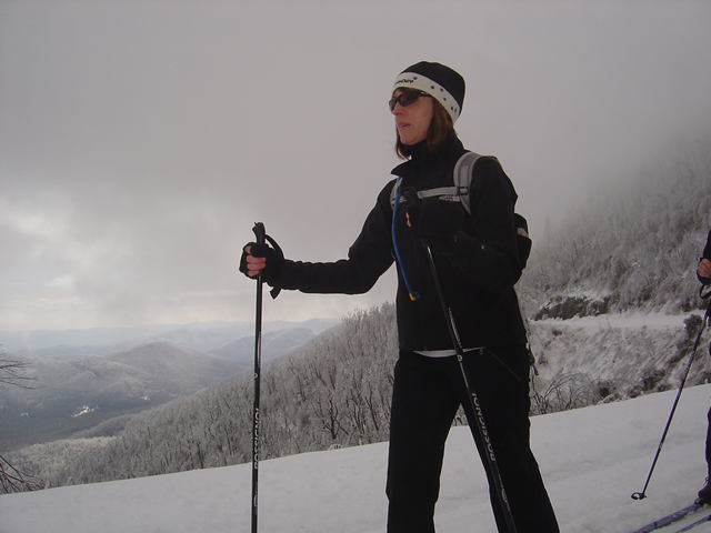
Jackie Skiing

When the snow is good, the skiing here is great

We started at Wagon Road Gap where US 276 and the Parkway meet at on of the highest crossings. From there, we headed east towards Asheville.

Ice was bringing down trees the whole time we were out.

The coating of rhyme ice, while beautiful, was causing extensive damage. The surroundings were filled with the almost constant sound of limbs and even entire trees breaking from the weight of the ice. Large branches lay everywhere. In places, every tree had been snapped and I saw none higher than about 12 feet, their tops broken off. A hike in the woods would be deadly.

Heavy ice coats and brings down surrounding trees.

We skied as far as the Pisgah Inn near Mount Pisgah passing through the Frying Pan Tunnel. Along the way we ran into a convoy of rangers hauling in equipment to repair the communications tower which must have been damaged by the storm or its aftermath.

Jackie approaches the Frying Pan Tunnel.

Being one of the highest and most rugged sections of the Blue Ridge Parkway, there are more tunnels in this area than any other. Most are not very long, like this one, though the majority are curved. This is a spectacular scenic area in summer. What a contrast and compliment in winter.

The group pauses to take off skis to walk through the tunnel.

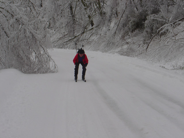
The nice thing about this route is it’s a very gentle climb from Wagon Road Gap to Mount Pisgah. Up hill on the way out, but downhill on the way back. Skiing takes on a whole new aspect when you change from uphill to downhill.

Wayne makes up some time on the downhill sections.

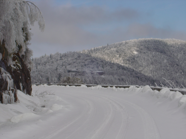
By the time we reached the Pisgah Inn it was shrouded in thick cloud and I couldn’t get any close up photos of it or Mt.Pisgah. The inn is closed of course, though the joke of the day was getting a beer and a meal once we reached it.

The Pisgah Inn seen from distance.

Few people ever see the Blue Ridge Parkway like this. It is admittedly a rare occurrence in recent times, at least until this year. Now it’s to the point we look at this a realize just how much snow has already melted and remember how deep it once was. We’ve not had ice like this though, and it will be spring before we realize just how much impact it had.

Wayne, the author,makes the most of a snowy winter

My wife shot some video of our excursion and posted it on You Tube. It really captures the scenery and the experience, and shows just how bad a skier I really am. Enjoy.