2019 brings big changes to America Rides Maps motorcycle maps of the southern Appalachians – more area, more detail, and new maps!
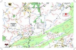 The desire to expand the areas covered by America Rides Maps into the Allegheny Mountains of West Virginia required a lot more work than expected. Since the maps connect and overlap, existing maps needed to be updated. I took this opportunity to include the most current data available and employ new skills learned since the last updates improving the detail and readability of what we currently had.
 When I began there were 13 pocket maps available. Now there are 16 motorcycle ride maps which cover the great motorcycle roads found in the southeast mountains. 5 existing maps were reworked and three new ones introduced. In addition, one of the two large format maps was completely overhauled in the process.
The first step was updating the 3 maps which cover Virginia – Map #1, Map #2, and Map #3.
For each of these maps we spent weeks on the road riding the old routes and scouting new ones, updating the information from direct experience and observation, visiting the sights, staying in the hotels and lodges, exploring and recording the new roads.
Map #1 – Great Rides Near the Start of the Blue Ridge Parkway 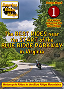
This map was expanded to cover a larger area including more of the border with West Virginia. The previous map cut off before it reached Marlinton, WV, it now extends further west. It also extends further south clipping more of Lynchburg. The old map did a good job covering the main roads, the new map focuses on including more of the smaller side roads which stem from them, we found a lot worth adding.
Map #2 The Roads Of Roanoke and Beyond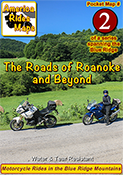
Map #2 got a significant shift to the west. The previous version covered more area east of Roanoke but there were few good roads there. The good riding is west of Roanoke so the focus shifted. Map #2 now extends well across the Virginia border into West Virginia adding a lot of new roads in a really beautiful riding area. We have some new favorite rides and places to visit and stay thanks to these explorations.
Map #3 North Carolina / Virginia Border Rides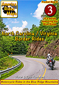
Map #3 was quite a challenge. It was expanded to cover more area both in Virginia and North Carolina. It was enlarged to include Pilot Mountain State Park & Hanging Rock State Park, a large section of the Blue Ridge Parkway, and get in the full run of VA 16 – “The Back of the Dragon”. This is one of our favorite areas to ride in and it is better represented and easier to understand than it was on the previous two overlapping maps.
Once the Virginia maps were ready we moved on to the new West Virginia maps which overlap and connect to them on the border.
Exploring West Virginia was a lot of work with a lot of rewards. I’ve not found such a variety of roads anywhere in the US. This first taste of it has us yearning to expand our coverage.
Map #10 West Virginia Border Rides – New River Area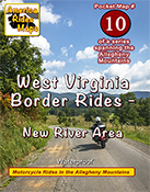
This new map covers the New River Gorge area and extends east to Snowshoe, West Virginia. The city of Beckley anchors the bottom left corner of the area shown. While compared to other maps there are not a lot of paved roads in large sections, more than 50 roads are featured and described and they are great rides. There are some outstanding scenic areas, lots of historic sights, and a handful of great little backroads for the adventurous rider to explore.
Map #11 West Virginia Border Rides – Coal Country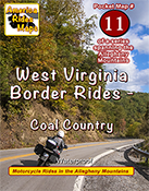
The highlight of this map is the region southwest of Beckley, West Virginia, where you find yourself riding in historic coal country. Numerous roads extend back through the mountains to reach the mines, a few of which are right on the roadway. It also covers the New River area south of Beckley and the scenic roads which wind along broad rivers through historic towns. It picks up VA 16 at the Tazwell end of The Back of the Dragon which continues as a great curvy ride into the city. More than 100 roads are highlighted and described.
Next, it was time to update one of the big maps.
Too much has changed over the last few years, the update was needed. The new maps looked so good I wanted to apply the new techniques so I rebuilt 100 Great Motorcycle Rides in the Smokies from scratch.
 Premium Map 100 Great Motorcycle Rides in the Smoky Mountains is my best work and best selling map. It was last updated in 2017. Nothing is as comprehensive or as detailed as this motorcycle ride map of the areas surrounding Great Smoky Mountains National Park but I knew I could do it better and I did. I had to add the new “missing link” section fo the Tennessee Foothills Scenic Parkway which was still in limbo at the last printing. Several motorcycle friendly locations on the previous version had gone out of business and there were new ones to be added. I wanted to push the limits and expand the map to include some really great roads not covered on any other map. Mission accomplished.
With the big map done, I used the data to expand another one of the pocket maps –
Map #8 – The Best Motorcycle Rides Near Smoky Park – NORTH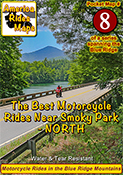
Once again I pushed to expand the map and add more roads. I also updated the points of interest and added a lot of new ones, several more waterfalls, motorcycle friendly stops, it’s a significant upgrade to this map of the area north of the park.
Finally, my attentions turn to the mountains of Northeast Georgia –
Map OR4 – The Best UNPAVED Roads in Northeast Georgia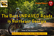
With 3 maps of the unpaved roads in the Smoky Mountains already completed, I set my sights on Northeast Georgia more than a year ago. Frustrated with the limitations of Forest Service maps of this rich off pavement riding area I knew I could do better. It took way too long to poke my wheels down every back road and trail I could find then sort them out, many adventures ensued. You won’t find a better dual sport map of this wonderful area.
Map #9 – The Best Rides in the North Georgia Mountains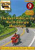
As I’d already built the base maps for the unpaved roads in NE Georgia, and discovered new stuff while exploring, it made sense to update the paved roads map as well. Expanded, more points of interest, more motorcycle friendly locations, etc. It really turned out nice.
I finished it all up as the winter weather arrived here in the Blue Ridge Mountains. With short days and freezing weather upon us I will now return to working on the digital versions of the maps and laying out the new explorations for the spring. It was a busy year. I hope the next one brings more road time. Don’t we all.
You can see the maps and order them online at AmericaRidesMaps.com
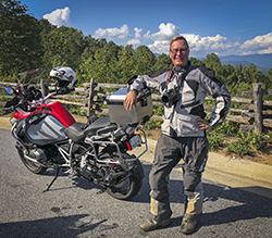
Printed in the USA on the highest quality waterproof and durable materials, these maps are specifically designed for the motorcycle traveler.
Pocket maps are easy to fold, fit in your pocket so they are always handy.
Order Online at
AmericaRidesMaps.com
