Big Updates to Motorcycle Ride Maps 2019

2019 brings big changes to America Rides Maps motorcycle maps of the southern Appalachians – more area, more detail, and new maps!
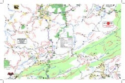
View of Map 11The desire to expand the areas covered by America Rides Maps into the Allegheny Mountains of West Virginia required a lot more work than expected. Since the maps connect and overlap, existing maps needed to be updated. I took this opportunity to include the most current data available and employ new skills learned since the last updates improving the detail and readability of what we currently had.
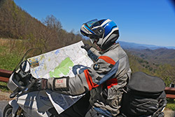
Wayne-with-mapWhen I began there were 13 pocket maps available. Now there are 16 motorcycle ride maps which cover the great motorcycle roads found in the southeast mountains. 5 existing maps were reworked and three new ones introduced. In addition, one of the two large format maps was completely overhauled in the process.

The first step was updating the 3 maps which cover Virginia – Map #1, Map #2, and Map #3.
For each of these maps we spent weeks on the road riding the old routes and scouting new ones, updating the information from direct experience and observation, visiting the sights, staying in the hotels and lodges, exploring and recording the new roads.

Map #1 – Great Rides Near the Start of the Blue Ridge Parkway Map 1 - Great Rides Near the Start of the Blue Ridge Parkway
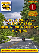
This map was expanded to cover a larger area including more of the border with West Virginia. The previous map cut off before it reached Marlinton, WV, it now extends further west. It also extends further south clipping more of Lynchburg. The old map did a good job covering the main roads, the new map focuses on including more of the smaller side roads which stem from them, we found a lot worth adding.

Map #2 The Roads Of Roanoke and BeyondThe Roads Of Roanoke and Beyond
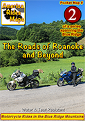
Map #2 got a significant shift to the west. The previous version covered more area east of Roanoke but there were few good roads there. The good riding is west of Roanoke so the focus shifted. Map #2 now extends well across the Virginia border into West Virginia adding a lot of new roads in a really beautiful riding area. We have some new favorite rides and places to visit and stay thanks to these explorations.

Map #3 North Carolina / Virginia Border RidesNorth Carolina / Virginia Border Rides
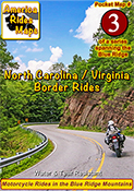
Map #3 was quite a challenge. It was expanded to cover more area both in Virginia and North Carolina. It was enlarged to include Pilot Mountain State Park & Hanging Rock State Park, a large section of the Blue Ridge Parkway, and get in the full run of VA 16 – “The Back of the Dragon”. This is one of our favorite areas to ride in and it is better represented and easier to understand than it was on the previous two overlapping maps.

Once the Virginia maps were ready we moved on to the new West Virginia maps which overlap and connect to them on the border.
Exploring West Virginia was a lot of work with a lot of rewards. I’ve not found such a variety of roads anywhere in the US. This first taste of it has us yearning to expand our coverage.

Map #10 West Virginia Border Rides – New River AreaWest Virginia Border Rides - New River Area
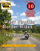
This new map covers the New River Gorge area and extends east to Snowshoe, West Virginia. The city of Beckley anchors the bottom left corner of the area shown. While compared to other maps there are not a lot of paved roads in large sections, more than 50 roads are featured and described and they are great rides. There are some outstanding scenic areas, lots of historic sights, and a handful of great little backroads for the adventurous rider to explore.

Map #11 West Virginia Border Rides – Coal CountryWest Virginia Border Rides - Coal Country
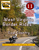
The highlight of this map is the region southwest of Beckley, West Virginia, where you find yourself riding in historic coal country. Numerous roads extend back through the mountains to reach the mines, a few of which are right on the roadway. It also covers the New River area south of Beckley and the scenic roads which wind along broad rivers through historic towns. It picks up VA 16 at the Tazwell end of The Back of the Dragon which continues as a great curvy ride into the city. More than 100 roads are highlighted and described.

Next, it was time to update one of the big maps.
Too much has changed over the last few years, the update was needed. The new maps looked so good I wanted to apply the new techniques so I rebuilt 100 Great Motorcycle Rides in the Smokies from scratch.

100 Great Motorcycle Rides in the Smoky MountainsPremium Map 100 Great Motorcycle Rides in the Smoky Mountains is my best work and best selling map. It was last updated in 2017. Nothing is as comprehensive or as detailed as this motorcycle ride map of the areas surrounding Great Smoky Mountains National Park but I knew I could do it better and I did. I had to add the new “missing link” section fo the Tennessee Foothills Scenic Parkway which was still in limbo at the last printing. Several motorcycle friendly locations on the previous version had gone out of business and there were new ones to be added. I wanted to push the limits and expand the map to include some really great roads not covered on any other map. Mission accomplished.

With the big map done, I used the data to expand another one of the pocket maps –

Map #8 – The Best Motorcycle Rides Near Smoky Park – NORTHBest Rides NORTH of Smoky Park
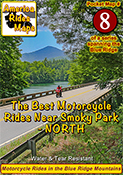
Once again I pushed to expand the map and add more roads. I also updated the points of interest and added a lot of new ones, several more waterfalls, motorcycle friendly stops, it’s a significant upgrade to this map of the area north of the park.

Finally, my attentions turn to the mountains of Northeast Georgia –

Map OR4 – The Best UNPAVED Roads in Northeast GeorgiaThe Best UNPAVED Roads in Northeast Georgia
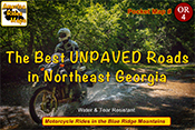
With 3 maps of the unpaved roads in the Smoky Mountains already completed, I set my sights on Northeast Georgia more than a year ago. Frustrated with the limitations of Forest Service maps of this rich off pavement riding area I knew I could do better. It took way too long to poke my wheels down every back road and trail I could find then sort them out, many adventures ensued. You won’t find a better dual sport map of this wonderful area.

Map #9 – The Best Rides in the North Georgia MountainsThe Best Rides in the North Georgia Mountains
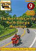
As I’d already built the base maps for the unpaved roads in NE Georgia, and discovered new stuff while exploring, it made sense to update the paved roads map as well. Expanded, more points of interest, more motorcycle friendly locations, etc. It really turned out nice.

I finished it all up as the winter weather arrived here in the Blue Ridge Mountains. With short days and freezing weather upon us I will now return to working on the digital versions of the maps and laying out the new explorations for the spring. It was a busy year. I hope the next one brings more road time. Don’t we all.

You can see the maps and order them online at AmericaRidesMaps.com
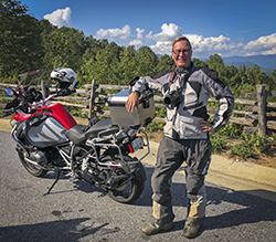
Wayne Busch - AMERICA RIDES MAPS
Wayne Busch – AMERICA RIDES MAPS

Printed in the USA on the highest quality waterproof and durable materials, these maps are specifically designed for the motorcycle traveler.

Pocket maps are easy to fold, fit in your pocket so they are always handy.

Order Online at
AmericaRidesMaps.com

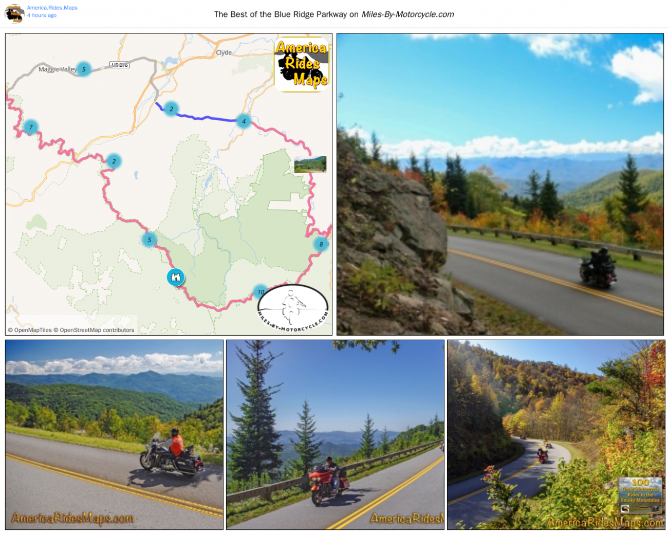
The Best Section of the Blue Ridge Parkway

This 43 mile section is the best of the 491 mile long world famous motorcycle ride. It’s the highest, the twistiest, and has the most scenic overlooks to stop and enjoy. 

Click to go to interactive map

Enjoy views from the Highest Point, see the Devil’s Courthouse, Looking Glass Rock, Graveyard Fields, and more. Some of the best overlooks are listed on each parkway section by milepost in this guide.

Soco Gap (Milepost 455.7) to Wagon Road Gap (Milepost 412.2) 

Distance: 78 miles to make the loop

Ride Time: 3 hours or more 


Wayne BuschAmerica Rides Maps

Wayne Busch searches out the most entertaining roads in the Blue Ridge Mountains then records them on a series of maps which span the Blue Ridge Mountains.

There are more great motorcycle roads in the Blue Ridge and Smoky Mountains than anywhere else. I highlight the best roads then show you the best ways to connect them together into rides. More than a decade of searching has discovered more than 1000 good roads to enjoy. We continue to search so you may enjoy.

Review the maps, order online hereAmericaRidesMaps.com

The Best Section of the Blue Ridge Parkway is found on America Rides Maps – 

Map #6  – The Best Motorcycle Rides Near Smoky Mountains Park – EAST

Map – 12 Classic Deals Gap Motorcycle Rides

Map – 100 Great Motorcycle Rides in the Smoky Mountains

Map OR2 – The Best Unpaved Roads SOUTH of Smoky Park

Source: America Rides Maps Blog @ Miles-by-Motorcycle.com
https://miles-by-motorcycle.com/51999/blog/53348/the-best-section-of-the-blue-ridge-parkway

Motorcycle Loop Ride near Hot Springs, NC

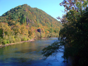
French Broad River in Hot Springs, NC

French Broad River

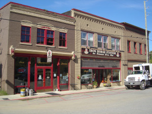
The small historic town of Hot Springs, NC, has long been a familiar pit stop for mountain area motorcycle riders. It is situated north and west of Asheville near the border with Tennessee on the banks of the French Broad River. The town is popular with rafters and hikers, has couple biker friendly places to eat, and there are natural hot springs to soak in at the spa.

Hot Springs, NC

Hot Springs, NC

Motorcycle riders are attracted to this area for the wonderful and tricky two lane back roads which thread through the surrounding mountains. The newfound popularity of NC 209 a.k.a. “The Rattler” as one of the top 10 motorcycle rides in the Blue Ridge Mountains is bringing more motorcycle touring enthusiasts to discover this playground of nice biker roads.

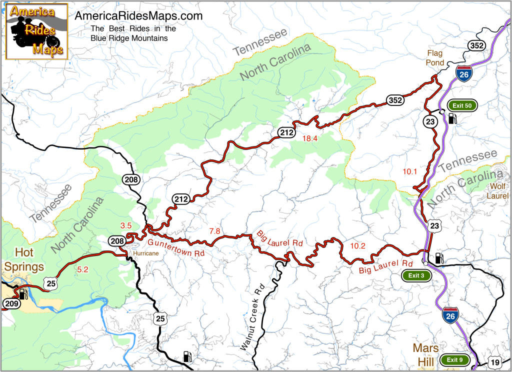
Hot Springs to Flag Pond Motorcycle Ride Map

The map shows a motorcycle loop ride that takes you across the border to Flag Pond, TN., then loops you back to Hot Springs.

  • Leaving Hot Springs, go east on US 25 / 70 making the gentle climb then descent to the junction with NC 208 at Hurricane.
  • Turn north (left) and follow NC 208 along the winding river. As you come to the junction of NC 208 and NC 212 note the small bridge over the creek. Guntertown Road is on the right just before the bridge, NC 212 is at the stop sign once you cross the bridge.
  • The north leg ( NC 212 / TN 352 ) of the triangle shaped motorcycle ride is a pretty nice cruise following along creeks and streams for the most part with a few tricky curves thrown in to keep you on your toes.
  • The east leg ( TN 23 / US 23 ) is pretty relaxed riding, there are a couple passing zones on the long inclines. You’ll want to keep an eye out for the turn onto Big Laurel Road, then hold on for the wild ride back.
  • Big Laurel Road is the south leg of the loop and full of tricky curves. Be alert for scattered debris in a couple of the hairpins around bluff faces. Walnut Creek Road spurs off to the south, be sure you veer in the correct direction when you reach this junction to remain on Big Laurel Road.
  • Guntertown Road leads you east to the small bridge on NC 208. Retrace your path to return to Hot Springs.

Motorcycles on Big Laurel Road

Big Laurel Road

The roads in this area can be extremely challenging and tight. If you prefer an easier course, the ride to Flag Pond on NC 212 / TN 352 can be done out-and-back. There is a large pull off riders use for a break at the junction of TN 352 & TN 23.

————————————————————————————

wayne busch - Smoky Mountain Motorcycle Rider.com

Wayne Busch

– Wayne Busch lives in Waynesville, NC, where he produces the most detailed, comprehensive, up-to-date motorcycle pocket maps of the Blue Ridge and Smoky Mountains to help you get the most of your vacation experience. See them here – AmericaRidesMaps.com

Best 1000 Mile Motorcycle Ride You’ll Ever Do

If you’re looking for that epic ride this is one of the best ever!

Motorcycles at overlook in Smoky Park

Enjoy an overlook in Great Smoky Mountains National Park

When you link these mountain roads together you’ll spend almost all your time on 2 lane roads, most of it National Parks or on scenic parkways, and you’ll experience some of the best motorcycle rides in the USA.

Skyline Drive – 105 Miles
The Skyline Drive runs the crest of Shenandoah National Park in Virginia. It starts at Front Royal and runs seamlessly into the Blue Ridge Parkway

Blue Ridge Parkway – 469 Miles

Blue Ridge Parkway View

Blue Ridge Parkway in NC

The Blue Ridge Parkway follows the highest ridge lines of the Blue Ridge Mountains through Virginia and North Carolina. It ends at Great Smoky Mountains National Park.

Great Smoky Mountains National Park – 47 Miles
The most visited National Park in the nation, ride across on US 441 passing from North Carolina into Tennessee at the crest, then turn west on Little River Road. Follow through to the Foothills Parkway.

Foothills Parkway – 17 Miles
Continue west on the scenic Foothills Parkway to reach US 129

The Dragon – 15 Miles

Springtime motorcycle ride on the Cherohala Skyway

The Cherohala Skyway in TN

Turn south on US 129 to enter the Dragon. Pass through and back into North Carolina. Continue south to Robbinsville, NC to head west again on the Cherohala Skyway.

The Cherohala Skyway – 52 Miles
Climb back up into the mountains and return to Tennessee near the mid-point of the ride. Turn south on 68 when you reach Tellico Palins, TN and follow this wonderful road into Georgia.

GA 60 – 23 Miles
Work your way east on GA 60 to Blue Ridge, GA, then continue on one of Georgia’s best motorcycle roads.

The Gauntlet – 133 Miles

Georgia

The Gauntlet ride in GA

Wrap it all up with a loop around the Gauntlet. You may continue on GA 60 or veer north on Skeenah Gap Road to start the loop.

Of course, this is just an overview. It’s a great introduction to riding in the Blue Ridge Mountains, still it only scratches the surface. It’s pretty straightforward to navigate, but you’ll want to do some planning. There are many variations and additions to make it even better.

9 map setYou’ll find this region covered in detail with America Rides Maps. In addition to these well known roads, almost 500 more are highlighted on a series of easy-to-read durable maps that will fit in your pocket with the info you depend on like out-of-the-way gas stations, mileage, and how to best link them all together.

The are more great motorcycle rides in the Blue Ridge Mountains than anywhere else. Any one of America Rides Motorcycle pocket ride maps is a vacation adventure in itself. With the full set you’ll have the freedom to point your wheels in any direction and know you’re on the best rides. Take a look here and see how easy it is – http://shop.americaridesmaps.com/Full-Southeast-Package-All-9-Maps-SE9.htm

————————————————————————————

wayne busch - Smoky Mountain Motorcycle Rider.com

Wayne Busch

– Wayne Busch lives in Waynesville, NC, where he produces the most detailed and comprehensive and up-to-date motorcycle pocket maps of the Blue Ridge and Smoky Mountains to help you get the most of your vacation experience. See them here – AmericaRidesMaps.com
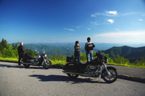
Great Blue Ridge Mountain Motorcycle Rides I found this Year

Great Blue Ridge Mountain Motorcycle Rides I found this Year

– Saluda, Columbus, and the edge of South Carolina

Blue Ridge Motorcycle Rides - Whiteoak Mountain Road

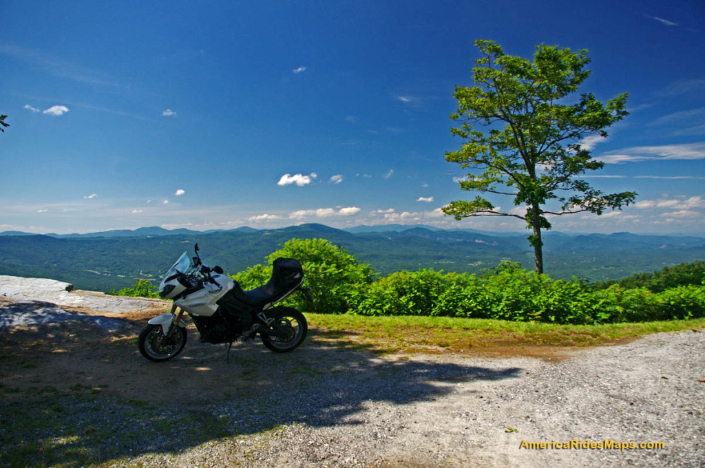
Nearing the top of Whiteoak Mountain Road near Columbus, NC. View into South Carolina and the flat lands. I-26 cuts through the Green River Gorge here.

In my constant search for the best motorcycle rides in the Blue Ridge mountains, this year I expanded one of my motorcycle ride maps further south and discovered some of the nicest biker roads at the North-South Carolina border.

It’s an easy area to reach as I-26 south of Asheville cuts through the heart of it. For those approaching the Blue Ridge Mountains from Charlotte, NC or Spartanburg and Greenville, SC, both I-26 and US 25 funnel through this gap in the mountains converging near the small mountain town of Saluda, NC.

Good motorcycle rides Saluda, NC

Saluda is a small rail side town that sits atop one of the steepest railroad grades in the east, the Saluda Grade.

Saluda is a historic little trackside mountain town. There are few nice nice victorian-era homes, old churches, ice cream, a couple spots to get a bite, touristy small town stuff on Main Street.  I’ve eaten at the Purple Onion Cafe a couple times in Saluda, it’s very good but can be crowded on those sweet summer Saturdays. Good place for a coffee break, some ice cream, or a lunch stop.

Saluda motorcycle rides map

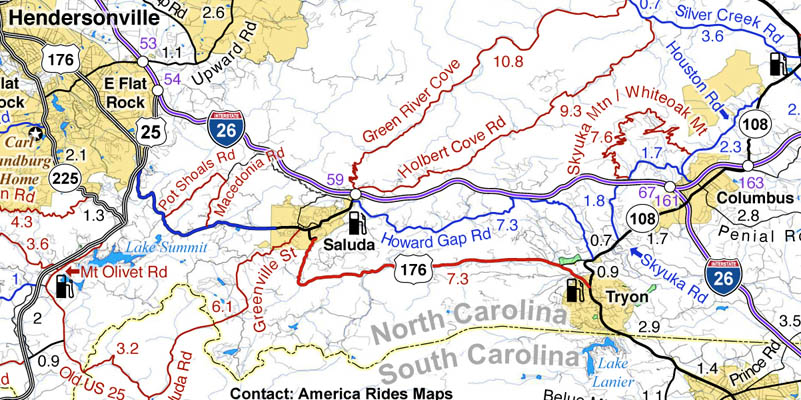
Section of America Rides Maps #5 “Best Roads North & South of Asheville” shows a lot of nice rides around Saluda, NC.

Section of motorcycle ride map #5, “The Best Roads North & South of Asheville, NC”. Best roads shown in red, good connecting roads in blue.

You can’t take a bad road out of Saluda. US 176 runs through town as Main Street. It’s a good road to ride north, a gentle and curvy climb to Flat Rock. The ride is even nicer going south to Tryon, but not below it.  Leaving the middle of downtown Saluda as Greenville Street, it crosses the railroad tracks in the heart of town to take you west as Saluda Road through the forest to intersect Old US 25, another pleasant ride. If you head east from town, Holbert Cove Road winds through the gorge to reach Silver Creek Road or loop back through the tight switchbacks on Green River Cove Road.

Looking north from the top of Whiteoak Mountan near Columbus, NC towards Lake Lure and Asheville.

Looking north from the top of Whiteoak Mountan near Columbus, NC towards Lake Lure and Asheville.

Once you get north of Saluda and through the Green River Gorge you hit the congestion of Hendersonville which continues north into Asheville. Get on the good back roads sooner and leave the highway near Saluda. You can work northeast to Lake Lure or skirt southwest of Hendersonville on some excellent back roads both scenic and challenging away from the traffic.

Caution – The loop ride north of Columbus on Whiteoak Mountain Road  / Skyuka Mountain roads is steep and has some of the tightest switchback turns you’ll find. No place for the inexperienced rider, hesitation or doubt will get you in trouble.

_______________________________________________________________________

Santa - great gift ideaMaps make great holiday gifts! Riding in the Blue Ridge Mountains is made so easy with these detailed ride maps. Give the gift that pays back with the thrills of riding some of the most beautiful and challenging roads in the nation!

See the maps here -> America Rides Maps

Facebook

If you enjoy photos of motorcycle riding in the Blue Ridge and Smoky Mountains, like MY BLUE RIDGE MOTORCYCLING FACEBOOK PAGE.
____________________________________________________________________

wayne busch - Smoky Mountain Motorcycle Rider.com

Wayne Busch

– Wayne Busch lives in Waynesville, NC, where he produces the most detailed and comprehensive and up-to-date motorcycle pocket maps of the Blue Ridge and Smoky Mountains to help you get the most of your vacation experience. See them here – AmericaRidesMaps.com
____________________________________________________________________

Impact of Government Shutdown on Smoky Mountain Bikers

Government Shutdown Predictions for Smoky Mountain Motorcycle Touring

Oct 2, 2013 – so you’ve got your Smoky Mountain motorcycle trip scheduled and you’re wondering “How does all this government shutdown nonsense affect me?” Here’s my best guesses for now –

The main impact will be around Great Smoky Mountains National Park. All the park facilities are now closed at the start of peak camping season. This includes River Road (TN 73). That’s going to displace a lot of people who will seek other accommodations and things to do on the north side of the park. Tourist traffic has already been building in Gatlinburg / Pigeon Forge, this will likely make it worse. It will also disperse those park tourists onto surrounding roads in the area. If you don’t have Map #8,  I’d avoid the area for a while, especially on the weekends. On the south side of the park, I’d expect increased congestion in Cherokee.

Foothills Parkway in Tennessee is Closed – The Tennessee Foothills Parkway is the most common route to approach The Dragon on the north side of Great Smoky Mountains National Park.  Most of the traffic will continue on US 321 to Maryville, then come west on 411, and south on US 129. If you have Map #8 look to using Walden’s Creek Road, then work over to Butterfly Gap Road, Flats Road, and Happy Valley Road. You just might find you like this route a lot better than the traditional tourist slog.

The Blue Ridge Parkway remains open for travel, but all facilities are closed including campsites. Some facilities and side roads had already been closed due to the sequester. I’d expect heavier traffic at the south end of the parkway between Cherokee and Asheville. Rangers will still be out, but routine maintenance may be postponed. Things are generally in great shape, so it shouldn’t be much of an impact. Be alert for rocks and limbs in the road with potential  decreased attention to maintenance. The Pisgah Inn south of Asheville is open.

The Dragon will likely see minor impact. I predict a small increase in car traffic as locals take the long way around rather than deal with the traffic on US 441 through the park, and some decrease in bike traffic as riders from the north go to other places rather than deal with the increased traffic on the surrounding roads. Adventurous tourists will look for other places to see.

Suggestions – Focus on the areas south and east of Great Smoky Mountains National Park. The Dragon and Cherohala Skyway will still be good options. Cherokee will probably be congested. Expect heavy traffic on US 64 from Franklin to Lake Lure.  It’s a great time to stray into north Georgia.

I have all these roads mapped out for you – http://americaridesmaps.com
____________________________________________________________________

wayne busch - Smoky Mountain Motorcycle Rider.com

Wayne Busch

– Wayne Busch lives in Waynesville, NC, where he produces the most detailed and comprehensive and up-to-date motorcycle pocket maps of the Blue Ridge and Smoky Mountains to help you get the most of your vacation experience. See them here – AmericaRidesMaps.com
Total Rider Tech Logo

Learn Total Control

Wayne is an advanced motorcycle instructor for Total Rider Tech teaching Lee Parks Total Control Advanced Rider Courses. Isn’t it time you looked into advanced rider training to ride more confidently and safely? It can transform your mountain riding experience.  Total Rider Tech

____________________________________________________________________

Don’t Let This Happen to Your Motorcycle Trip Next Year

Don’t Let This Happen to Your Motorcycle Trip Next Year. A single word can make the difference.

Enjoy a Blue Ridge Parkway view on a motorcycle trip

Blue Ridge Parkway view – Give yourself permission to let this happen to you

The end of the year approaches. The holy days are behind us, and I look with dread at the incessant barrage of recaps, summations, and “the year in review” coming in the media as we approach 2013. It can drive me crazy; let’s face it, you and I were there. I’m not a “look back” kinda guy. Been there, done that, memories made, lessons learned.

Nor am I one to embrace the “New Year’s Resolution” mantra as we all know how rarely they endure beyond the morning after hangover. Reality has a painful way of drawing us back to our old habits and familiarity breeds contempt for change.

Blue Ridge Parkway-motorcycle-view

Don’t deny yourself the experience. Open the door. It’s already there and waiting. You just need to beleive it will happen.

Still, we all dream, desire the adventures in life, the glorious experiences and challenges of our “bucket lists”. If only there were something that could trigger these events, some trick, some key that unlocks that fantasy future of riding our motorcycles on that empty road through a paradise of wonder and beauty, sun on the shoulders, wind in the face.

Roadside waterfalls abound for the motorcycle rider

Discover the hidden secrets on your motorcycle travels in the Blue Ridge and Smoky Mountains

I know the key, I know what makes things happen, and I want to share it with you. It’s one simple word that can change your motorcycle riding future if you embrace it;

– Just say YES.

Give yourself permission. Unlock the doors of possibility. As soon as you say YES, you have created the possibility which was not there before for that great motorcycle trip to happen.

photo-motorcycles-on-nc-63

Yes or no? Will this be you on your motorcycle in 2013?

Before the planning, before the goal, before the first step of that 1000 mile journey, you must create the potential for it to happen at all.

Motorcycles at Cullasaja Falls in North Carolina's "Land of the Waterfalls"

With permission granted, I stand ready to help you have the ride of your life! Just say YES!

Sounds kinda kooky and spiritual doesn’t it? But consider the contrast. How likely is it to happen if you instead say NO?   

You’ve got nothing to lose, and everything to gain by trying this one simple thing;  if you want that bucket list motorcycle ride, that vacation motorcycle trip of a lifetime, that discovery and adventure we two-wheeled souls need to feel alive, give your self permission. Say YES and believe. The rest will follow. I’m here to help.

America Rides Maps


Making your motorcycle dreams come true in the Blue Ridge an Smoky Mountains.

____________________________________________________________________

wayne busch - Smoky Mountain Motorcycle Rider.com

Wayne Busch

– Wayne Busch lives in Waynesville, NC, where he produces the most detailed and comprehensive and up-to-date motorcycle pocket maps of the Blue Ridge and Smoky Mountains to help you get the most of your vacation experience. See them here – AmericaRidesMaps.com
Total Rider Tech Logo

Learn Total Control

Wayne is an advanced motorcycle instructor for Total Rider Tech teaching Lee Parks Total Control Advanced Rider Courses. Isn’t it time you looked into advanced rider training to ride more confidently and safely? It can transform your mountain riding experience.  Total Rider Tech

____________________________________________________________________

Best Motorcycle Rides North Carolina – Pisgah Triangles Repaved!

Fresh paving bumps this NC motorcycle ride to the top of list!

Freshly paved  –

  • US 276 from Fish Hatchery Road to the Blue Ridge Parkway (done)
  • US 276 from the Blue Ridge Parkway to Big East Fork (done)
  • NC 215 from Blue Ridge Parkway to Sunburst (in progress)

Unbelievable! Fantastic! Outstanding motorcycle ride!

US 276 – the Newly Paved Section

Note – while paving is done (it was a quality job) there is still fill work along the shoulders and pavement markings / lines need to be added so expect work crews in the area. It will take a bit for the gravel at the edges of the road to settle in, so you need to be watchful for loose stone in the curves for a while. 

We’ve just come in off a great North Carolina motorcycle ride on the newly paved sections of US 276 which connect Waynesville to Brevard just south of Great Smoky Mountains National Park in North Carolina. US 276 crosses the best and most scenic area of the Blue Ridge Parkway at the mid-point on this 30 mile ride.

Best North Carolina motorcycle rides - US 276

Best North Carolina motorcycle rides – Jackie gives a big “thumbs up” to the fresh paving on US 276 near the Blue Ridge Parkway

South of the Blue Ridge Parkway, the fresh paving invites motorcycle riders to snake all the way down from the parkway’s heights to popular Looking Glass Falls, one of the most visited roadside waterfalls in the southeast. Along the way you’ll find scenic areas like Pink Beds, informative and historic places like The Cradle of Forestry, and you might even want to plunge 60 feet down a waterfall for a chilly wake-up at Sliding Rock. The entire ride carves and switchbacks through the steep and wooded mountains of the Pisgah National Forest with whitewater streams, dark tree lined passages, and numerous pull-outs to stop ad savor the surroundings.

Best motorcycle rides North Carolina - US 276

Best motorcycle rides North Carolina – the south side of US 276 winds through thick forest

North of the Blue Ridge Parkway, US 276 drops more than 1000 feet in a 3 mile plunge from Wagon Road Gap (MP 412.2) to the trailhead at Big East Fork, then it flanks along the slopes of Cold Mountain following the Pigeon River to the Bethel Valley. This section of tight curves is one of the most sustained series of back-to-back turns you’ll come across anywhere AND it’s a steep grade to boot. For the motorcycle rider looking for a challenging stretch of road, this one has all you need!

Why is this important?

US 276 is one leg of a triangle which form a number of the best motorcycle rides in North Carolina I call The Pisgah Triangles. The other long leg of the triangle is NC 215. Several roads form third legs of a series of triangles crossing between NC 215 and US 276  within the upside down “V” formed. The roads which hold the most challenging, steep, curvy, and scenic sections of the rides are found near the top of the triangle and have been in poor repair making a challenging ride even more difficult. Once these sections of road are repaved, the quality of the motorcycle rides on The Pisgah Triangles will beat most, if not all of the best motorcycle rides in North Carolina.

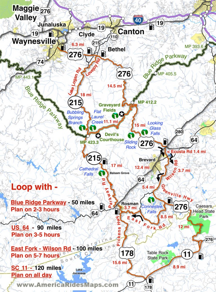
Great Motorcycle Rides in North Carolina - Pisgah Triangles motorcycle map

Great Motorcycle Rides in North Carolina – Pisgah Triangles motorcycle map – At least 4 variations, the 3rd is my favorite.

See photos, map, and ride guide here – The Pisgah Triangles

The Final Piece is in the Works! – 

We were delighted to see the upper portions of NC 215 are also receiving a sweet smooth coating of fresh asphalt. There is still a good bit to be done as it’s a much longer run down to the Sunburst Campground at the edge of the national forest. Like US 276, NC 215 traces the course of the Little East Fork of the Pigeon River as it rushes down from the heights.

Best Motorcycle Rides North Carolina - NC 215

Best Motorcycle Rides North Carolina – Paving on NC 215 has started from the top down. You can see one lane done here, still a way to go.

Easy to find, convenient to ride, lots of options!

Both US 276 and NC 215 intersect the Blue Ridge Parkway on the highest and most scenic portion of the road. If you are riding the Blue Ridge Parkway it’s easy to hop off and play with these roads or if you are riding through, it’s a short cruise to loop back from the south end at Cherokee and enjoy. I believe most riders are going to enjoy these roads more than The Dragon at Deals Gap as they are not only curvy, but wonderfully scenic and carry very light traffic.

image-motorcycle-ride-map-cover

You’ll find these roads on America Rides Maps motorcycle pocket map #6 – The Best Motorcycle Rides EAST of Great Smoky Mountains National Park along with another 50 or so outstanding rides in the surrounding area and a guide to the numerous roadside waterfalls.

____________________________________________________________________

wayne busch - Smoky Mountain Motorcycle Rider.com

Wayne Busch

– Wayne Busch lives in Waynesville, NC, where he produces the most detailed and comprehensive and up-to-date motorcycle pocket maps of the Blue Ridge and Smoky Mountains to help you get the most of your vacation experience. See them here – AmericaRidesMaps.com
Total Rider Tech Logo

Learn Total Control

Wayne is an advanced motorcycle instructor for Total Rider Tech teaching Lee Parks Total Control Advanced Rider Courses. Isn’t it time you looked into advanced rider training to ride more confidently and safely? It can transform your mountain riding experience.  Total Rider Tech

____________________________________________________________________

Great Motorcycle Rides Easy to Find Online

Great Blue Ridge & Smoky Mountain Motorcycle Rides discussed live online @ Map Chat

I’ve kicked off a new series of live online interactive webinars discussing the best motorcycle rides in the Blue Ridge & Smoky Mountains called Map Chat.

First Tuesday of each month at 8 PM eastern time, join me as I review one of my America Rides Motorcycle ride maps in detail.

Get the schedule and links to the webinars at http://americaridesmaps.com/map chat.html

Here’s a 5 min edited version of the first of the Map Chat series where we discussed Map #1 – Great Rides Near the Start of the Blue Ridge Parkway in Virginia.

The full (40 minute) version of the webinar is posted online at: http://youtu.be/8g4GatVrUNc

_______________________________________________________________________________

Wayne Busch

Wayne Busch - Cartographer

Total Rider Tech Logo

Learn Total Control

– Wayne Busch lives in Waynesville, NC, where he produces the most detailed and comprehensive and up-to-date motorcycle pocket maps of the Blue Ridge and Smoky Mountains to help you get the most of your vacation experience. See them here – AmericaRidesMaps.com
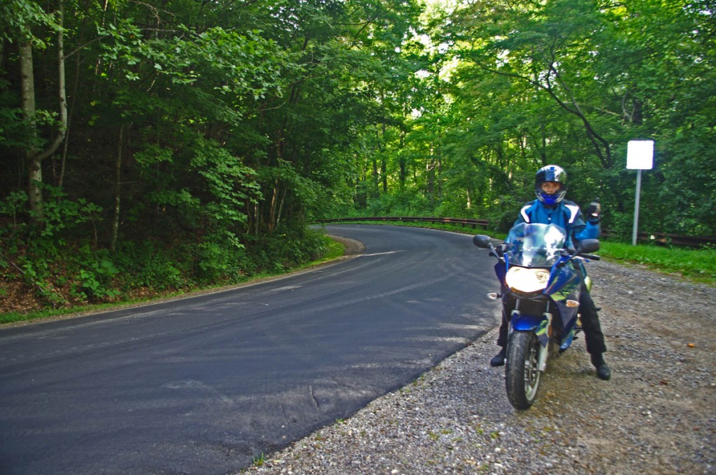
Wayne is an advanced motorcycle instructor for Total Rider Tech teaching Lee Parks Total Control Advanced Rider Courses. It’s time you looked into advanced rider training to ride more confidently and safely, it will change your mountain riding experience. It worked so well for me I became an instructor! Total Rider Tech

_______________________________________________________________________________

image-virigina-motorcycle-ride-map

#1 Great Rides near the Start of the Blue Ridge Parkway in Virginia

See  / purchase the map discussed – Map #1 Great Rides Near the Start of the Blue Ridge Parkway in Virginia 

Another Great Smoky Mountain Motorcycle Ride

photo-silversteen-rd-meets US-64

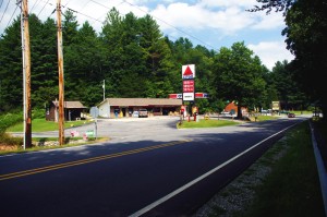
The junction with US 64 is marked by a Citgo Station

Silversteen Road is one of those roads  you want to keep in your pocket – it’s almost so good I’ve been tempted to keep it to myself. But after riding it again this week, I’ve just got to share it so you can enjoy it too.

Silversteen Road intersects US 64 between Rosman and Sapphire, NC. The junction is well marked by a convenient landmark gas station. About half way through Silversteen Road, it makes a turn so sharp it doubles back on itself where it meets Macendonia Church Road. If you don’t make the turn to stay on Silversteen Road, Macendonia Church Road will lead you out to NC 215, another outsanding ride which crosses the Blue Ridge Parkway.

Photo-curve-on-Silversteen-Rd

Imagine miles and miles of curves like this one - a.k.a. Silversteen Road

If you stay on Silversteen Road it runs into NC 281, another fabulous Smoky Mountain Motorcycle Ride and another of my favorites. I typically follow NC 281 north to Tuckaseegee or use it to connect to Charlies Creek Road to reach NC 215 (so many good choices in the area).

I’m attracted to Silversteen Road for it’s challenge – it’s every bit as twisty as the infamous Dragon at Deals Gap. In fact, it’s more difficult as the road seems a bit narrower and the pavement is not up to the quality you find at the Dragon. It sees very little traffic, but the trade off is you’ll find a few potholes and some gravel in the road where unpaved side roads and driveways connect to it. It also has some very sneaky descending radius turns you’ll want to be prepared for so you don’t get in over your head.

Photo-motorcycle-curves-on Sliversteen-Rd-NC

The curves on Silversteen Road never let up.

The ride holds a few scenic areas, particularly where it runs along the bank of what could be the Horsepasture River, but your eyes had better be on the road, not the scenery. It will give you all the challenge you want, maybe more.

You’ll find Silversteen Road on America Rides Maps Map #6 – The Best Motorcycle Rides EAST of Great Smoky Mountains National Park along with all the other great rides in the area, more than 50 great motorcycle rides in this small but beautiful area of the “Land of the Waterfalls”.

_______________________________________________________________________________

Wayne Busch

Wayne Busch - Cartographer

Total Rider Tech Logo

Learn Total Control

– Wayne Busch lives in Waynesville, NC, where he produces the most detailed and comprehensive and up-to-date motorcycle pocket maps of the Blue Ridge and Smoky Mountains to help you get the most of your vacation experience. See them here – AmericaRidesMaps.com
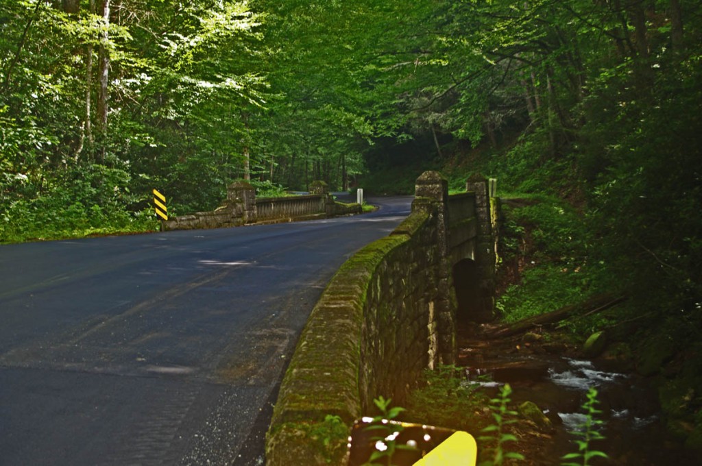
Wayne is an advanced motorcycle instructor for Total Rider Tech teaching Lee Parks Total Control Advanced Rider Courses. It’s time you looked into advanced rider training to ride more confidently and safely, it will change your mountain riding experience. It worked so well for me I became an instructor! Total Rider Tech

_______________________________________________________________________________