The Birthplace of Tennessee – Best Seen on a Motorcycle

Photo - marble campfire

Who knows where this is?

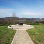
It was the middle of nowhere yet it was the center of everything. I’d stumbled upon the birthplace of Tennessee.

I had low expectations. My research told me most of the roads I’d be riding today would hold little interest to the typical motorcycle rider who had come to ride The Dragon at Deals Gap and the Cherohala Skyway. None of the roads I’d ride on my 450+ mile travels would come anywhere close to those legends. Still, the morning held a surprise I never expected and made the efforts worthwhile.
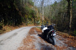
Photo - Cherokee National Forest Road

Parked along Pleasant Mountain Road. It's typical of other roads nearby - of little interest to most. Still I check them all.

Arriving in Tellico Plains, Tennessee, after an early morning motorcycle ride where I’d had the whole of the Cherohala Skyway to myself, I pointed my wheel north onto TN 360 and my workday began. Within a few miles I’d reach the point where I’d previously abandoned my search for great motorcycle rides and the explorations would resume. Rounding a curve a green street sign flashed past with a name I recognized and I clamped on the brakes to swing around.

I could rule this road out as soon as I saw it, it was doubtful it would be of any interest. Consulting my map, I saw it connected to another I wanted to investigate, so I snicked into first gear determined to make quick work of White Plains Road and move on.

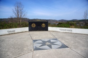
Photo - Tanasi Monument

The Tansi Monument - Tennessee gets it's name from here

It met Smoky Branch Road in a few miles where they both intersected Citico Road. I’d eventually loop back through Smoky Branch Road, also of little interest. Obviously Citico Road was the daddy in this area, the main thoroughfare of better quality, decent pavement, and sporting a faded double yellow line, a proper road.

I expected it would quickly peter out, but after several miles it continued to wind and snake through the mostly bland countryside and I started to wonder if it actually went somewhere in the big empty white space on the map. Curiosity aroused, I couldn’t resist investigating the Tanasi Memorial Site when the sign appeared.

Photo - Tanasi Monument

The empty and isolated setting quickly fills with visions of what must have been

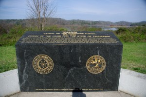
Never heard of it. Turning the motorcycle onto Bacon Ferry Road I ventured out into the nothingness on the barely paved bumpy and potholed  single lane that led out onto a low finger of land surrounded by Tellico Lake. I rode past the pull-off, but a quick glance towards the lake had me circling back when I saw the shoreside monument.

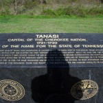
Photo - Tanasi inscription

Inscription transcribed below

Tanasi

Capital of the Cherokee Nation

1721-1730

Origin of the Name for the State of Tennessee

The site of the former town of Tanasi, now underwater, is located about 300 yards west of this marker. Tanasi attained political prominence in 1721 when its civil chief was elected the first “Emperor of the Cherokee Nation”. About the same time, the town name was also applied to the river on which it was located. During the mid 18th century, Tansi became overshadowed and eventually absorbed by the adjacent town of Chota, which was to the immediate north. The first recorded spelling of Tennessee as it is today occured on Henry Timberlakes map of 1762. In 1796, the name Tennessee was selected from among several as most appropriate for the nation’s 16th state. Therfore, symbolized by this monument, those who reside in this beautiful state are forever linked to its Cherokee heritage.

Pho

Cherokee Tanasi to Tennessee - State. A heritage preserved and honored.

I don’t much adhere to theories of “vortexes” or spirituality, but there’s something about this site that is powerful enough to make it worth a visit, it will be on the new map. It’s worth the ride out to it. See it if you have the chance.

_______________________________________________________________________________

Wayne Busch
Wayne Busch – Cartographer
– Wayne Busch lives in Waynesville, NC, where he produces the most detailed and comprehensive and up-to-date motorcycle pocket maps of the Blue Ridge and Smoky Mountains to help you get the most of your vacation experience. See them here – AmericaRidesMaps.com 
It’s Verified – This Motorcycle Ride is HOT

Scanning the blogs and forums I often stumble across the discussion Motorcyclist vs. Biker. I rarely get into it as it’s never resolved. I believe I fall into a separate category – Rider. For me, it’s all about the ride. I don’t care what I’m riding. I don’t care what my image is. I don’t care what you ride or how you look. For me it’s getting as much out of the ride as I can. It’s all about the ride.

<insert gratuitous Blue Ridge Parkway picture here>

Photo - View from Craggy Gardens Overlook

Gratuitous Photo 1 - Amazingly clear skies from the Blue Ridge Parkway. That brown stripe in the distance is I-26 more than 22 miles distant. Visibility must have been nearly 50 miles this day.

Thats why I do what I do. I constantly seek out the best rides. It’s the best job in the world. When I find them, I share them with you, mostly through my motorcycle pocket  maps. A couple weeks ago I literally stumbled across a ride while exploring near Banner Elk, North Carolina. It’s 13.8 miles long which puts it in the same range as the Dragon at Deals Gap and the Diamondback at Little Switzerland. I had just been up at the Snake in Shady Valley. On my way home I used the rest of the afternoon (which turned into a night ride home) exploring.

<insert another gratuitous Blue Ridge Parkway photo here – making you work for it>

Photo - Blue Ridge Parkway View

Gratuitous Photo 2 - View from the Blue Ridge Parkway - The Smoky Mountains got their name from the blue haze which is primarily caused by moisture in the air. Clear and warm days are so rare you should treasure them.

It wasn’t the best of conditions. That recent big hurricane was passing off the coast. Winds were gusting bringing down limbs and debris. Spits of rain had dampened the roads. The skies were dark. I didn’t care. When seeking out roads I’m on a mission.

<Why doesn’t he just tell us about this this road?>

On the first pass through I paused to takes notes. The ride had been a handful. It was certainly challenging. Looking at my notes I actually wrote, “But was it fun?”

<Wait for it>

The return ride was confirming and answered the question with a resounding “Yes!” As the storm broke I continued on and added another superb ride to my list. Then another good side road. I realized I’d overlooked an area that could be a gold mine.

<Get to it man, or I’m outta here>

The ride haunted me. I kept thinking about it. Was it really that good? Two passes was not enough. I needed to ride it again. So I did. It was better than I recalled.

<Ok.> You’ve been overly patient.  Here’s the scoop:

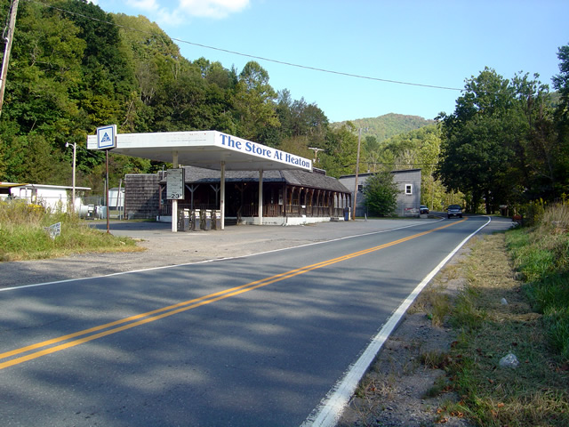
The road has two names over its length. On the south end it starts as Beech Mountain Road. Midway it changes to Flat Springs Road. It connects Banner Elk Highway (NC 194) to US 321. Here are photos to help you find it. I’ll describe it from south to north, from Banner Elk Highway to US 321.

Photo - Start of ride

This abandoned gas station/store on Banner Elk Highway (SR 194) alerts you to the start of the ride. The road is just beyond it.

It starts off easily enough. Gentle straights with a few decent turns. A couple miles in it gets downright squirrely. You enter a series of tight curves, some of them first gear, with the occasional more or less straight section. Be wary of catching too much speed on these  easier portions as they are punctuated with screaming tight curves. Carrying any speed through this road has you flicking and throwing the bike around. It rarely lets up at all.

I was going to get more photos of the road, but I;

1) realized one curvy road pretty much looks like another in a photo, and

2) I was having too much fun to stop

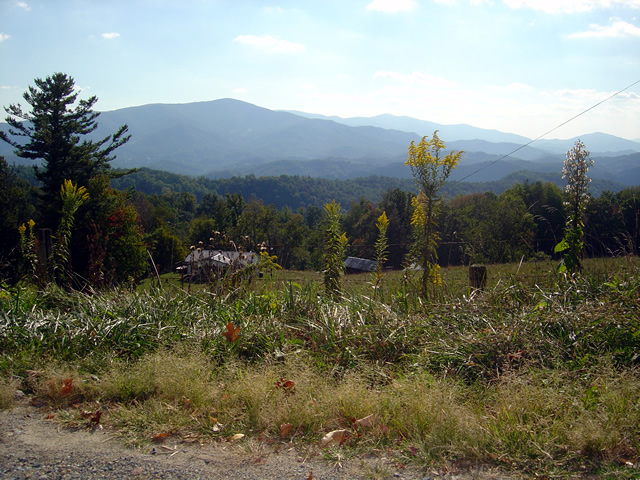
Photo - view from road

One of the views from Beech Mountain Road.

While it’s not particularly scenic, I did pause at one point to get some photos when a good view presented.  You’ll just have to trust me. It’s curvy. It’s fun. I wouldn’t be writing about it if it wasn’t.

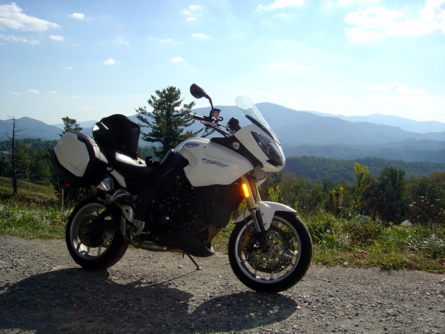
Photo - My bike on Beech Mountain Road

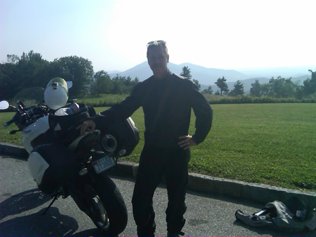
Another view from Beech Mountain Road - I think that's Roan Mountain behind my Triumph Tiger.

It’s a good road to know about as it lets you pass to the north without going through the traffic and congestion of Boone. It saves you time. It gets you somewhere and it’s useful.

Photo _ view of start of road from US 321

This is what to look for from US 321. Flat Springs Road makes a sharp climb with sharper curves. There's a dilapidated building to the left.

It does get some local traffic, and if you time it wrong you might run into school buses who know this shortcut. Opportunities to pass are rare and may have your spinchter puckering. Watch out for gravel in some turns.

Photo - view from nearby road

This photo is from another road in the area. Though challenging, it had way too much gravel dragged on it from the local traffic. The other roads stay cleaner.

The photos show the landmarks to help you find it at either end. The roads it connects to are good rides. This one’s good enough I have to give it away, but only because I’ve found more great roads nearby.

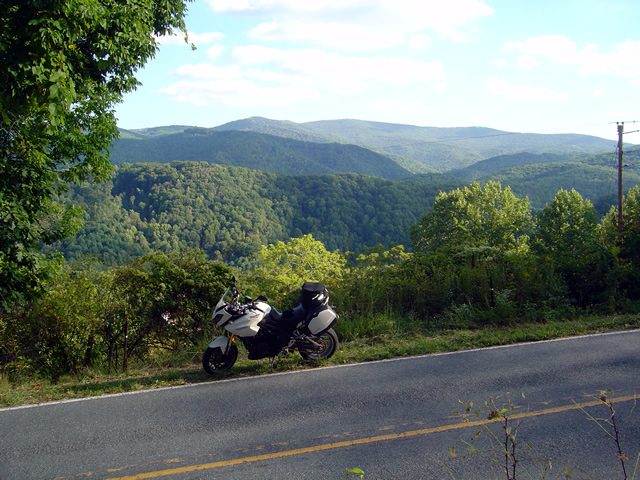
Photo - view from road

One last view of what I think is Roan Mountain. It's not the rare views that make Beech Mountain / Flat Springs Roads good, it's the ride.

I’m still discovering more roads in this area. I’ve got more sleepers in my quiver, more roads I need to ride again before I decide if I really like them and want to add them to my maps. I’m mighty picky. But this is one you deserve to know about. It’s that good.  It’s all about the ride.

Let me know what you think of it and don’t be surprised to see a white bike flashing by. I’ll be using this road whenever I can.

_______________________________________________________________________________

Wayne Busch

Wayne Busch - Cartographer


– Wayne Busch lives in Waynesville, NC, where he produces the most detailed and comprehensive and up-to-date motorcycle pocket maps of the Blue Ridge and Smoky Mountains to help you get the most of your vacation experience. See them here – AmericaRidesMaps.com


Motorcyclists – Help Support the Blue Ridge Parkway with Bling

Image from Blue Ridge Parkway Foundation - http://brpfoundation.org

End-to-Ender decal - get yours online when you've made your ride. I'll be shipping them as a bonus with BRP orders as long as they last

I enjoyed lunch yesterday with Houck Medford from the Blue Ridge Parkway Foundation. He’s a great guy with ties to Waynesville – where I live. We talked about the Blue Ridge Parkway of course, as well as local hiking and motorcycle related subjects. Houck had seen my post about my “Blue Ridge Parkway in a Day” motorcycle ride, and sent me my End-to-End Rider packet. It contained a nice certificate, a pin, a decal for my bike, info and stories. I was impressed and glad to have it.

If you’ve made an end-to-end ride of the Blue Ridge Parkway you too can get your package by filling out the form here – http://brpfoundation.org/end-to-end/ . Leave your story, read of others travels, the Blue Ridge Parkway Foundation web site has a lot of good info.

Ok, so the pin is not what you’d call “hefty bling”, though North Carolina motorcycle riders and Blue Ridge Parkway enthusiasts can get a Blue Ridge Parkway Foundation license plate for your ride and/or car and help support the good work of the foundation.  It’s so easy, you do it online right from this link –http://brpfoundation.org/tag-program/

Houck wants you to help support the Parkway, share your stories and enthusiasm, and has given me a supply of end-to-end Blue Ridge Parkway rider decals which I’ll be shipping with every Blue Ridge Parkway Series map order as a bonus for as long as they last.

Image from Blue Ridge Parkway Foundation - http://brpfoundation.org

Blue Ridge Parkway License Plates available for your car or bike and easy to order online.

Hmm, Jackie’s bike is due, this might just make a very nice gift!

Show you appreciation at http://brpfoundation.org/

PS – don’t leave home without your America Rides Maps – ride the Blue Ridge Parkway and much, much more. Free decals with orders.

_______________________________________________________________________________

Wayne Busch

Wayne Busch - Cartographer


– Wayne Busch lives in Waynesville, NC, where he produces the most detailed and comprehensive and up-to-date motorcycle pocket maps of the Blue Ridge and Smoky Mountains to help you get the most of your vacation experience. See them here – AmericaRidesMaps.com
 

Motorcycle Touring the Blue Ridge Parkway in One Day – What was it Like?

On Thursday I rode the Blue Ridge Parkway on my motorcycle from the start at Waynesboro, Virginia, 469 miles to the southern end at Great Smoky Mountains National Park in North Carolina. As I progressed I paused to snap photos and posted them on Facebook and Twitter. Here’s a recap of the experience;

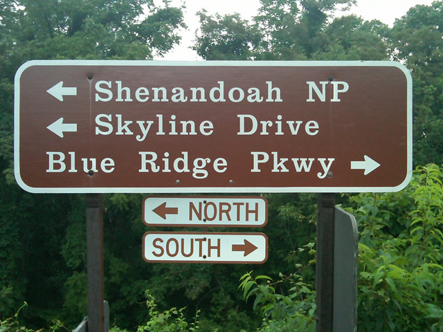
Photo - sign at start of Blue Ridge Parkway

The Blue Ridge Parkway starts where the Skyline Drive ends near Waynesboro, Virginia.

I chose to start at the north end as I knew I’d need to leave at daybreak. The morning fog has been so heavy at the southern end I didn’t want to chance it slowing me down or making for pictures of nothing but white mist. I spent the previous night in Richmond and left before 5 AM to make the 1 1/2 hour ride to Waynesboro in the darkness.

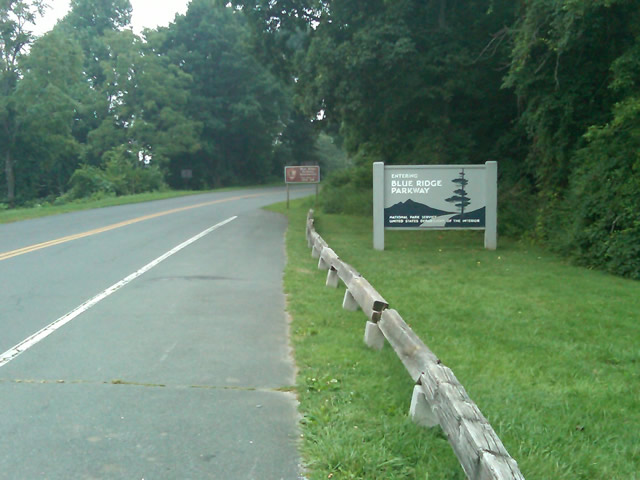
Photo - sign at the start of the Blue Ridge Parkway in Virginia

I took these photos the previous day as I expected it would be too dark to take them on the actual trip. I was right.

I fueled up in Waynesboro, grabbed a cup of coffee and a pack of doughnuts to sustain me, and headed on my way. It would be the last time I stopped to eat or drink. 469 miles is a long way at the 45 mph speed limit. I had no time to waste. At least that was my attitude early on.

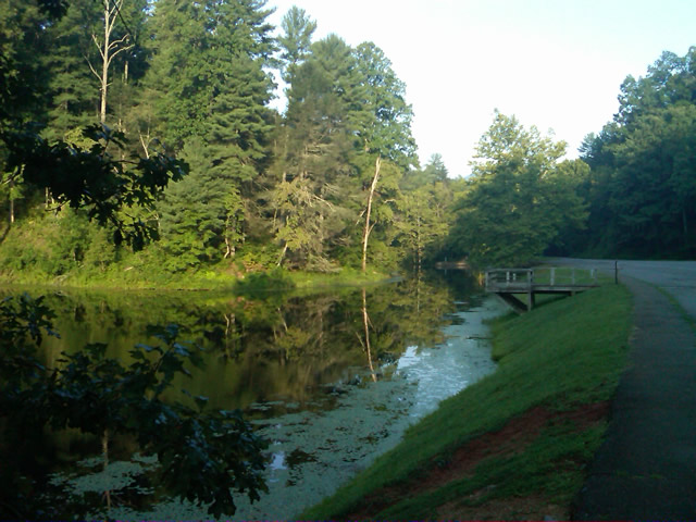
Photo - morning at the lake on Otter Creek

The sun comes up at the lake on Otter Creek. Easy ride so far.

I had the road to myself in the early morning twilight. Within a few minutes I’d seen both deer and turkey. The road starts a gradual climb to elevation here though nothing like the heights reached further south. With no other traffic on the road, my speed crept up a bit, something I’d fight the remainder of the trip. As you get comfortable and into the rhythm of the road, the temptation to take things at your more comfortable pace is always there taunting you. Knowing how far I had left to go didn’t help.

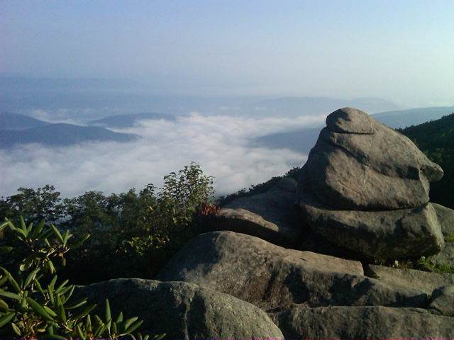
Photo - Above the clouds approaching Roanoke

I paused at this overlook to top up on oil, lube what was left of the chain, and take a few moments to savor the views I was rushing by.

I was also facing the challenge of not knowing if my chain would last the trip. It was already shot before I left, adjusted to the end of the swingarm, far beyond the normal limit. It now sagged precariously and was making noises that had me wondering when it would snap. I’d never seen a chain smoke when lubed before, and I took advantage of opportunities to slather it with lubricant whenever my concerns peaked. I prayed it would not jump the sprockets when carving through a turn and catapult me into a rock face or over a precipice.

Photo - me and my bike along the Blue Ridge Parkway

A fellow biker snapped this photo of me at a rest stop. Riding from Florida to Maine and back, he and his wife were enjoying the parkway on their return.

Traffic remained surprisingly light through the morning with few holdups to pass slower vehicles. I watched the parkway wake up, the rangers and maintenance crews come to work and start their labors. Finding cell phone coverage to post my photos was always a challenge. You never know when it will be available, sometimes there in what looks like the most unlikely spots, other times absent where you think it should be a strong signal.

Photo - near Doughton Park

By mid morning there were plenty of other motorcycles on the road. This photo was taken somewhere near Doughton Park.

My first stop for gas necessitated a detour into Floyd, VA. Knowing where the nearest gas stations are is one reason I map the area so throughly. You can waste a lot of time looking for them if you don’t know which way to go. While in Floyd I popped in for a minute to see Derek at the Hotel Floyd, one of my favorite places to stay.

Photo - Historic cabin on the Blue Ridge Parkway

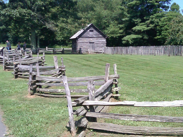
There are a few historic cabins along the road in southern Virginia.

As I crossed into North Carolina and entered the high mountains I knew cell phone coverage would be much more limited. The curves tightened up bit and the road was often wet from spotty showers. It would be another day with temps approaching near 100 in the valleys, but at elevation things remained tolerable so long as I was moving. I somehow avoided all but a slight peppering of rain which felt wonderful at the time.

Photo - Grandfather Mountain

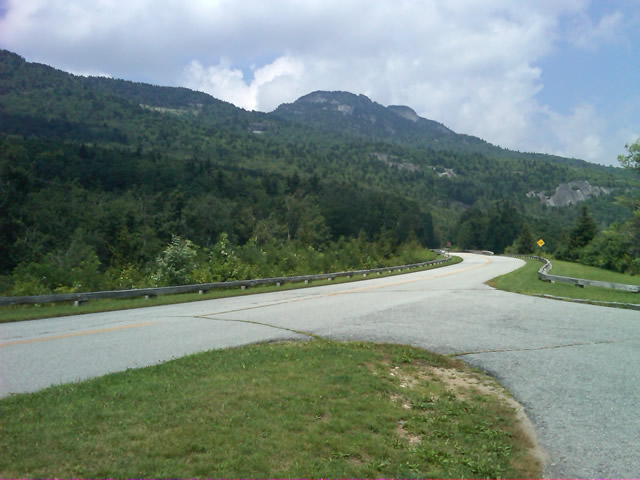
Passing Grandfather Mountain I felt I was back on home turf though still a long, long way to go.

Delays had been brief so far, and I planned my next fuel stop to coincide with a quick stop to say hello at the Switzerland Inn in Little Switzerland, one of my favorite places to eat or overnight. I fueled up in Spruce Pine. It was tempting to get a good meal, but I forced myself to press on. The real hold ups came as I approached Asheville. Tree crews and road construction caused significant delays and I hit the “commuter section” during evening rush hour.

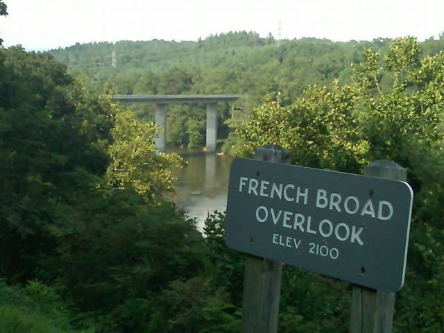
Photo - French Broad River Overlook

It was a great relief to finally cross the French Broad River southwest of Asheville and begin the climb to the highest and most scenic section of the Blue Ridge Parkway.

The sun was drawing near the horizon as I carved my way along the high ridge tops of the section of the Blue Ridge Parkway I consider my back yard. Thunderheads lurked and the road was wet in places, but my luck continued.

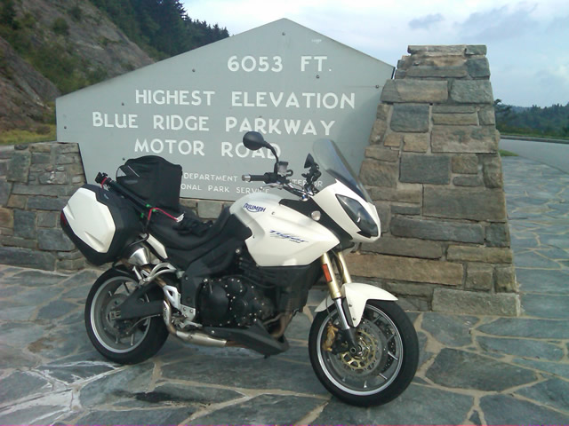
Photo - at the highest point on the Blue Ridge Parkway

Reaching the highest point on the Blue Ridge Parkway, I knew there was less than 40 miles to go to reach my goal.

I reached the southern end of the 469 mile ride with daylight to spare and took a pause at the Oconoluftee Visitor Center in Great Smoky Mountains National Park. I grabbed a few photos but found the battery was now dead on my cell phone. Here they are now –

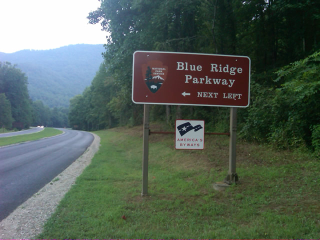
Photo - start of the Blue Ridge Parkway in North Carolina

The Southern end of the Blue Ridge Parkway near the Oconoluftee Visitor Center.

While my Blue Ridge Parkway in a day adventure was completed, I still needed to get home. Noting the evening traffic, I chose to avoid going into Cherokee and got back on the Blue Ridge Parkway now headed in the opposite direction. I rode through to Soco Gap, then passed through Maggie Valley to finally get to my home in Waynesville.

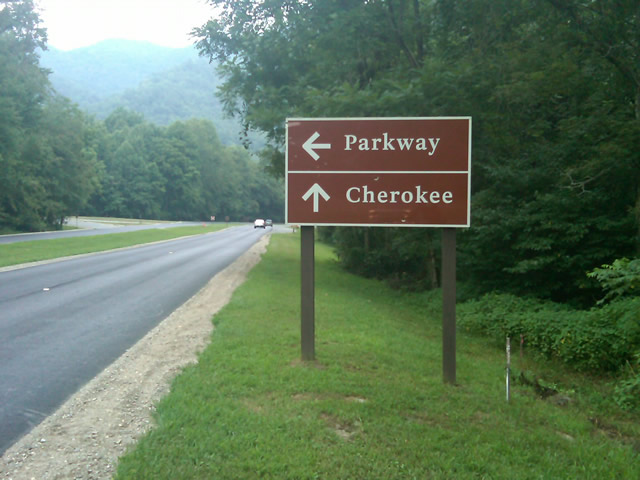
Photo - sign at the southern end of the Blue Ridge Parkway

Go through Cherokee or back the way I'd come? I chose to return home via the Blue Ridge Parkway of course.

My chain lasted the trip. My rear tire is bald. It’s time for some service on the engine. New parts are on order and it will take this week to get the bike roadworthy again. Next week? I might just poke into east Tennessee. I’ve too long ignored the area between Great Smoky Mountains National Park and Knoxville. If I can locate at least a dozen good rides there it will warrant a new motorcycle pocket map. I discovered some great roads along the Virginia / West Virginia border on this trip, several of which will be added to existing America Rides Maps. It will take a few more trips north to determine how the map of that region will lay out but it will come. For now, it’s catch up on the work I left, update the existing maps with the new rides I discovered, and make preparations for the roads ahead.

America Rides Maps on Facebook

America Rides Maps on Twitter

America Rides Maps – the best motorcycle pocket maps money can buy

_______________________________________________________________________________

Wayne Busch

Wayne Busch - Cartographer


– Wayne Busch lives in Waynesville, NC, where he produces the most detailed and comprehensive and up-to-date motorcycle pocket maps of the Blue Ridge and Smoky Mountains to help you get the most of your vacation experience. See them here – AmericaRidesMaps.com
 

New Deals Gap Motorcycle Map Nears Completion – Your Chance For Input

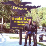
Photo - Smoky Mountain Rider and BMW Girl at the Tail of the Dragon

Smoky Mountain Rider and BMW Girl at the Dragon

Having completed a series of motorcycle ride maps covering the full scope of the Blue Ridge Parkway from end to end describing more than 3000 miles of the most outstanding motorcycle rides along its entire length, I’ve now been commissioned to produce the ultimate and best map available for the motorcycle rider planning a motorcycle vacation trip to Deals Gap, home of the infamous “Dragon” motorcycle ride.

Due to the success of the Blue Ridge Parkway motorcycle ride maps as well as others which expand the areas covered into Georgia and South Carolina, I invested in new hardware and software to take America Rides Maps to the next level. This new Deals Gap map will be the first to take full advantage of the improvements and I am impressed with the output to date.

Maintaining the handy pocket map size which makes the maps easy to use and conveniently accessible, as well as the most affordable motorcycle ride maps available at the ridiculously low price of $5 each, this latest America Rides map will guide the Dragon rider to a dozen or more additional great motorcycle rides in the surrounding area including the best section of the Blue Ridge Parkway, as well as the most notable rides in the Smoky Mountains of Tennessee and North Carolina and touching on north Georgia and South Carolina.

The scope of the map covers the largest area yet tackled to include approach routes to Deals Gap from all points of the compass making navigation to reach the Dragon easy. Once there, it leads you to enough additional good motorcycle rides to fill a week of vacation time or more. The back side of the map will describe the various routes as well as give details about riding them.

image-raw-map

The Ultimate Deals Gap Map Nears Completion

As I wrap this project up, now is the time for your input as to which features are most important to you. I typically include out of the way reliable gas stations, notable attractions, and a handful of selected eateries, campgrounds, and motorcycle dealers and repair shops. Unlike my other maps which are only available online, this Deals Gap map will be provided by vendors in the area. As such, the frequent updates I normally provide to the maps will not be as easy to accomplish and I want to get this first edition as complete as possible as once maps are distributed they will not be updated as frequently.

Send your suggestions to info@americaridesmaps.com . If your suggestion is incorporated into this new map, I’ll send you a copy in appreciation. It should be wrapped up in about a week, so if you’ve got a great idea shoot it to me immediately. I’ve got to get this done, the open road beckons and I’m itching to get away from my office and ride.

Notes from the Road – Eateries, The Hardware Co., Hillsville, VA

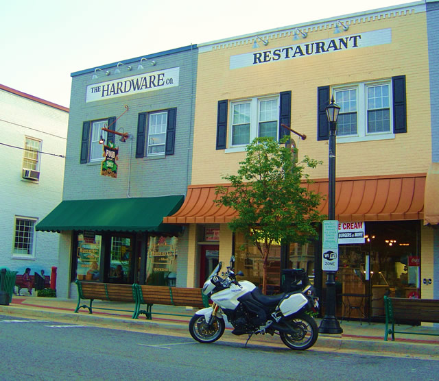
Photo - The Hardware Co. Restaurant, Hillsville, Virginia

Photo - The Hardware Co. Restaurant, Hillsville, Virginia

As I’m out on the road doing the explorations for America Rides motorcycle maps, I try to find good places I can recommend. I visited this one several times and think it’s one you’ll like to visit on your motorcycle vacation. It’s 10 minutes more or less from the Blue Ridge Parkway on VA 52 from the Fancy Gap exit in the southern Virginia town of Hillsville.

While there is a historic section in Hillsville where this restaurant serves as a centerpiece, the town spreads along the main roads which all come together in the small town, including Interstate 77 and US 221. I found myself staying here on several occasions as there are a large number of motels near the Interstate. It makes for a good place to not only lay over on a Blue Ridge Parkway vacation trip, but also to tour the surprising number of great motorcycle rides which course through the surrounding countryside. It became the hub for one of my most extensive maps.

The restaurant resides in a building which was originally a hardware company, hence the name.The food is good, sometimes great. I’ve always enjoyed my meal, a fine compliment to the great rides that lead you here. There’s a nice pub to get a cool one and live music on some evenings. If you’re passing through on a warm day or just looking for a treat, right next door is an old time soda fountain where you can get some pretty darned good ice cream and sodas.

You can check them out online at http://www.hardwarecompany.net/ . The street address is:

The Hardware Co. of Hillsville
508 North Main Street
Hillsville, VA
Telephone: 276-728-265
Email: info@hardwarecompany.net

While Mapping Motorcycle Roads I Found the Andrews Geyser

I was passing through Old Fort, North Carolina the other day hoping to find a road I might have missed on one of my motorcycle mapping trips, when I came across the man-made Andrews Geyser. The wading pond was frozen, the spout encased in heavy ice, and the grass surrounding the pool was a huge sheet of bumpy rhyme.

Photo - Andrews Geyser encased in ice near Old Fort, NC

Andrews Geyser encased in ice near Old Fort, NC

The Geyser was built in 1880 as a tourist attraction and to commemorate those whole lost their lives building the railroad that climbed from Old fort to Swannanoa, then on to Asheville. Until that time, Old Fort was as far west as the railroad went. The 3 mile climb through the mountains required more than 12 miles of serpentine track and seven tunnels. More details at  (http://www.romanticasheville.com/old_fort.htm)

My explorations take me to the most unusual and scenic locations as I search out the best roads for my motorcycle maps. I’d passed the sign that directs you to the Geyser on the west end of town many times, but never ventured out to see it as the paved road does not make it all the way through the mountains. It’s a nice ride, but it doesn’t lead you anywhere else so it’s not on my motorcycle map of the area. Still, you won’t miss the signs.

If you’re passing through Old Fort on your way to reach those great two lane mountain roads nearby and have a little extra time, you might want to ride out and see the 80 ft. high plume. I got there late on the day when the temperatures never went much above freezing. Next time I visit, I hope it will be a little warmer.


Wayne Busch - AMERICA RIDES MAPS

Wayne Busch – AMERICA RIDES MAPS

Scenic Motorcycle Rides – Backbone Rock, TN

photo - motorcycle cruises through Backbone RockI went back to Virginia this weekend to revisit and explore some of the sights I’d passed while mapping the area

I’m pretty much all business when mapping – I only stop for three things; gas, to take notes, and when “nature” forces me to do so. Eating is a luxury typically left for the evening to make the most of the time on the road. This trip was to go back and savor some of the gems I’d just blown by previously.

One of my favorite loop rides is found near the point where North Carolina, Virginia, and Tennessee meet, a 103 mile jaunt that takes you on some of the twistiest and most scenic roads. It’s listed on America Rides Map #4 – “Great Roads Near Boone, Banner Elk, and Blowing Rock.

Heading south from Damascus, Virginia, on SR 133, you soon enter the National Forest in Tennessee and signs for Backbone Rock Park start appearing along the road. Round a curve and you find yourself zipping through the quick yet dramatic tunnel through Backbone Rock.

I stopped in to investigate.

The Empire Mining Company blasted through Backbone Rock in 1901 to lay train tracks for the Tennessee Lumber Company. Long gone, the rail bed became the roadbed which continues on towards Mountain City.

The ridge is about 75 feet high and 20 feet thick, though it narrows near the top. There is a steep trail from the parking area on the right just after you pass through the rock, though if you have any aversion to heights and walking near the edge of a cliff, you’ll never make it to the section of rock which straddles the road.

There are several hiking trails, picnic tables and campsites, a waterfall is about 0.4 miles on a foot trail. The area is popular for fishing and kayaking.

_______________________________________________________________________________

Wayne Busch

Wayne Busch - Cartographer

Total Rider Tech Logo

Learn Total Control

– Wayne Busch lives in Waynesville, NC, where he produces the most detailed and comprehensive and up-to-date motorcycle pocket maps of the Blue Ridge and Smoky Mountains to help you get the most of your vacation experience. See them here – AmericaRidesMaps.com
Wayne is an advanced motorcycle instructor for Total Rider Tech teaching Lee Parks Total Control Advanced Rider Courses. It’s time you looked into advanced rider training to ride more confidently and safely, it will change your mountain riding experience. It worked so well for me I became an instructor! Total Rider Tech

America Rides Map #4 – “Great Roads Near Boone, Banner Elk, and Blowing Rock

_______________________________________________________________________________