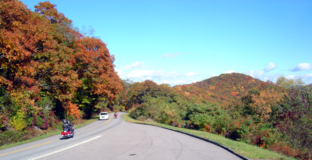
Making Gatlinburg Tolerable for Motorcycles (1 photo)

Gatlinburg. I cringe just thinking about the traffic, congestion, and development.  It’s one of the last places I consider when thinking of good motorcycle riding. Today, my outlook may be changing.

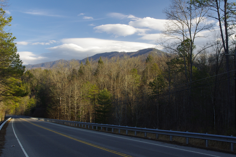
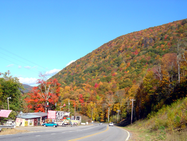
Photo-US-321-north-of-great-smoky-mountains-national-park

US 321 north of Great Smoky Mountains National Park. 90% of the east-west traffic between I-40 and Gatlinburg will be on this road.

I’m closing in on the GatlinburgPigeon ForgeSevierville area, mapping west from I-40 in search of the best motorcycle rides. I’ve already found my best route to reach the city limits avoiding the traffic on US 321 along the north edge of Great Smoky Mountains National Park. A few back roads linked together turn the chore of crossing the foothills downright enjoyable but now I’m getting into the towns.

Even so, I found a couple nice shortcuts today to skirt around the tourists, and there are number of promising roads waiting. The short winter days and roads strewn with road salt, grit, and lingering icy patches limit the miles I can cover efficiently before I turn tail and head home.

I shouldn’t complain about the traffic as it’s the dead of winter. Dollywood is closed. Much of Great Smoky Mountains National Park is closed. The memories of what happens once things warm up give me chills. I won’t quit until I find the best ways to go.

_______________________________________________________________________________

Wayne Busch
Wayne Busch – Cartographer
– Wayne Busch lives in Waynesville, NC, where he produces the most detailed and comprehensive and up-to-date motorcycle pocket maps of the Blue Ridge and Smoky Mountains to help you get the most of your vacation experience. See them here – AmericaRidesMaps.com 

I Just Keep Finding More Great Motorcycle Rides

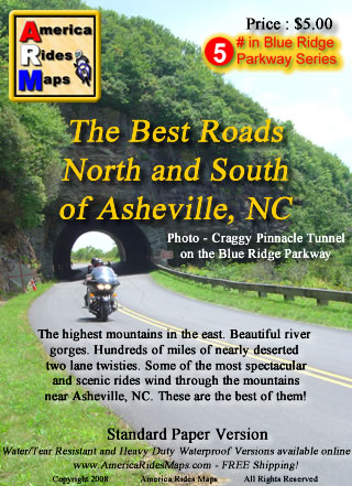
Image - Map CoverAsheville

Map - The Best Roads North and South of Asheville, NC - the revision is so close to being done.

I’ve resigned myself to the fact it’s going to take at least one more day on the road to investigate some roads for the revision of America Rides MapsThe Best Roads North and South of Asheville, NC“. I’ve already added more than a dozen new roads to the hundreds of miles of great motorcycle rides I’d already charted, roads which link the existing great rides together and expand the options to stay out on the two lane back roads enjoying the twisty bliss of carving through the tallest mountains in the east. I’ve got at least a dozen more yet to be evaluated and judged.

I systematically go through each of the dozen maps I now produce, re-evaluating each of the roads by riding them again, noting any changes along the way to insure you get the most up to date and best ride info I can produce. I’ve been reworking this Asheville map for well over a month now and thought I was closing in on wrapping it up. I sat down to knock off the last chunk of it today, and as the clock now approaches midnight my efforts have only yielded yet more possibilities that must be explored. The devil is in the details, and I too often find as I get down to the final detail work I start to ask questions. Has this road been paved? Is there a way to find a link between these two great rides? If this road was so good, what about this one nearby? The questions just keep coming and I research them as best I can then pencil in the ones I can’t rule out. There are enough unanswered to warrant another long day in the saddle, maybe two.

I’ll spend tomorrow getting things as close to finished as I can. Then, I’ll go out on the road and spend the day or two that’s needed to ride each and every one of them to see if they measure up. Though my last trip was very rewarding, this time I suspect it will be mostly disappointment – that’s the norm. Still, if one or two of them pan out, I’ll come home happy. These are the last of the last, kind of like sifting through the tailings at a gold mine to see if any small nuggets were missed. A real bonus is finding another reliable out of the way gas station. Maybe, just maybe, I’ll stumble across a real jewel. You never know until you ride it.


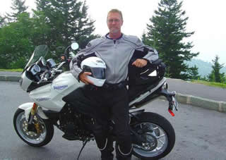
Photo - Wayne and his motorcycle

A couple more days on the road should do it. I'm really excited to get to the next map, I have some big plans for expansion.

Addendum: This region north of Asheville is one of the most undiscovered areas of great mountain motorcycle rides. Few venture into this area though there are a wealth of fabulous motorcycle rides through the tallest mountains in the east virtually devoid of any traffic. This time of year, when leaf peepers clog most of the backroads, you can ride all day through this area and count the cars on one hand. This map will give you a vacations worth of great rides and you’ll still come back for the ones you didn’t get to.

America Rides Maps – nobody covers the Smoky Mountains as comprehensively so you can make the most of your precious riding time.

_______________________________________________________________________________

Wayne Busch
Wayne Busch – Cartographer
– Wayne Busch lives in Waynesville, NC, where he produces the most detailed and comprehensive and up-to-date motorcycle pocket maps of the Blue Ridge and Smoky Mountains to help you get the most of your vacation experience. See them here – AmericaRidesMaps.com

Fall leaves – Photos from The Snake Motorcycle Ride

With such a beautiful day I was itching for an excuse to get out of the office, onto my motorcycle, and enjoy it when an email came in from David at the Shady Valley Country Store at The Snake Motorcycle Ride in Tennessee. He needed to be restocked on maps, and I was curious about a recommended road in the area – Denton Valley Road. Thats all it took.

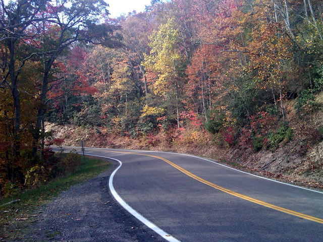
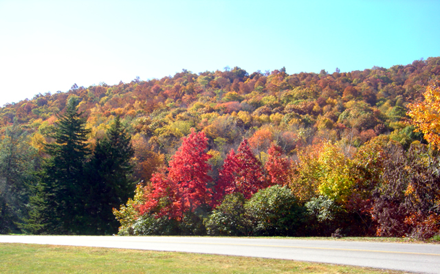
Photo - Fall leaves on the Snake - US 421

The were some nice spots of fall color on US 421 a.k.a. "The Snake" yesterday. I was delivering a load of maps to the Shady Valley Country Store.

The big question was “How to get there?” Normally I’d take the Blue Ridge Parkway north to Linville, then jump on the back roads to skirt around the traffic in Boone. Knowing the Blue Ridge Parkway would be heavy with leaf peeping traffic, I considered going east to take the most common routes, but I also knew US 321 would be clogged with traffic and I’d get held up going through Boone. That left a western approach, so I went to Asheville, then up I-26 to US 19E from which I could jump on the back roads once I neared Elk Park. Looking back, I should have just followed the back roads all the way. I got held up in the construction on US 19E and could probably have made the trip in the same amount of time and had a lot more fun. Time was an issue as it was after noon before I left the house.

Photo - Fall leaves on The Snake - US 421

I snapped this photo just before I started down Denton Valley Road from US 421. The sun hit just right, the colors are real, not enhanced. I tried to tone them down, but decided to go with what the camera captured.

It was nearing 4 PM when I concluded my business at the Shady Valley Country Store and continued west on US 421 enjoying the twists and curves of The Snake to reach Denton Valley Road. It was a decent ride, though I hadn’t researched it well enough and ended up spending the next hour and a half exploring it and the roads which connect to it to determine the best and most natural routes. I rolled into Bristol, Virginia, around 6 to refuel and resigned to taking the Interstates back home as it was the most efficient course. It’s not the first time I’ve made that trip in the dark, and unprepared to be out so late I once again suffered the chills of going through the high pass on I-26 at Buckner Gap at night – it ‘s always cold there.

I pulled into the driveway at 8PM, shivering but happy after a decent 350 miles and a collection of new roads to add to America Rides Maps collection.

_______________________________________________________________________________

Wayne Busch
Wayne Busch – Cartographer
– Wayne Busch lives in Waynesville, NC, where he produces the most detailed and comprehensive and up-to-date motorcycle pocket maps of the Blue Ridge and Smoky Mountains to help you get the most of your vacation experience. See them here – AmericaRidesMaps.com

Photos – Blue Ridge Parkway Leaves and Motorcycles – 10/14/10

Photo - fall colors at Soco Gap

View heading down from the Blue Ridge Parkway at Soco Gap on US 19 towards Maggie Valley. The hills are really lighting up now.

The weatherman paid me back for that prior post by starting this “sunny day” with fog, clouds, and rain. I stand by what I said – never believe what’s forecasted. It’s OK, the day was shot anyway as I waited for a mid-day phone call that never came. I used the office time to get caught up.

Photo - leaves changing at Soco Gap on the Blue Ridge Parkway

I snapped this photo at the exit ramp at Soco Gap on the Blue Ridge Parkway. I only spent a few minutes driving around admiring the leaves. Great colors are almost everywhere.

The rain gave way to bright sunshine and cool breezy weather after lunch. I finally grew weary of working on the updates to the Best Rides North and South of Asheville map and had to get out of the office. Joanne at the Mountaineer Restaurant on US 19 just down from the Soco Gap exit on the Blue Ridge Parkway needed a restock of maps, and I knew there was always great color at the Mountaineer Restaurant, so I grabbed the camera and headed over there this afternoon.

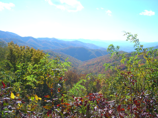
Photo from Thunderstruck Ridge on the Blue Ridge Parkway

A view from the Thunderstruck Ridge overlook on the Blue Ridge Parkway. This is where the photos of me in the Road Bike Magazine article were taken.

The photos I took at the Mountaineer Restaurant didn’t come out. Ever since I submerged my bike and camera in a river while exploring for the Best Motorcycle Rides in the Mountains of North Georgia, the camera has been temperamental and unreliable. I’m shopping for a new one.

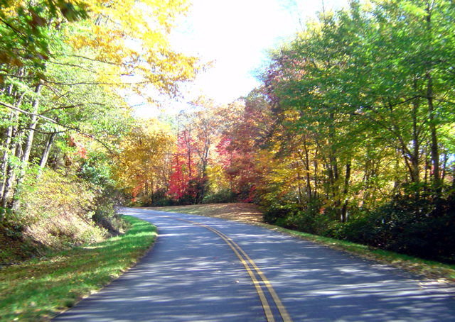
Photo - leaves changing on the Blue Ridge Parkway

I brought the video camera along, but it was a little hazy for the long range shots I wanted. If the force is with me, tomorrow I'll get out with the bike mounted camera and get some of these great views to share. There are tunnels of color.

I don’t know what’s going on with the leaves in other places, I haven’t really been out for a few days. I hope to do some riding tomorrow to give you a more accurate report, at least of the local area. I suspect most of the leaves and color are gone from the highest elevations, above 5500 feet. We should get a cold snap tonight, maybe a little frost in the morning. That will really make the leaves pop – right on schedule.

View of leaves changing at the Plott-Balsam overlook on the Blue Ridge Parkway

There were a lot of motorcycles on the Blue Ridge Parkway. My quirky camera only gave me this one shot near the Plott-Balsam Mountains overlook. I'm almost desperate enough to go out a buy a new camera in the morning.

I only spent a few minutes out of my day to take these photos. We’ll see what tomorrow brings, I’d like to get out and ride. Virtual Blue Ridge , the best resource for Blue Ridge Parkway info, has a new leaf report posted here.

http://www.virtualblueridge.com/color-reports/ 

_______________________________________________________________________________

Wayne Busch
Wayne Busch – Cartographer
– Wayne Busch lives in Waynesville, NC, where he produces the most detailed and comprehensive and up-to-date motorcycle pocket maps of the Blue Ridge and Smoky Mountains to help you get the most of your vacation experience. See them here – AmericaRidesMaps.com


A Bad Leaf Photo & How to Read a Wooly Worm

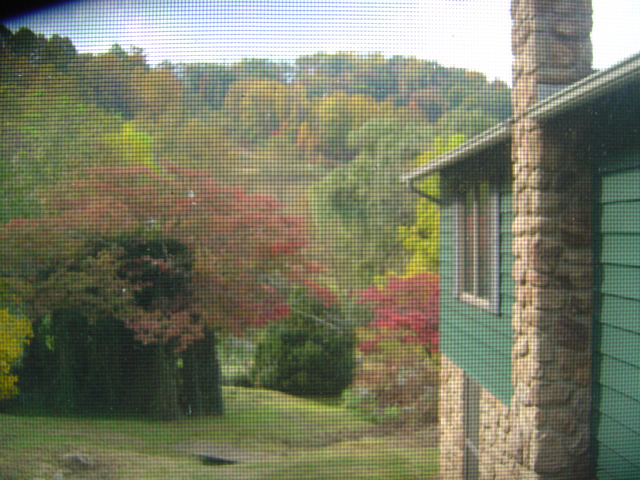
I SHOULD be out on my motorcycle exploring! It’s all prepped and ready to go. The fall leaves are doing their best to entice me, the sun is shining, the sky is blue, it’s unusually warm. Duty calls and I’m confined to the office. At least I have a nice view from my window;

Photo - view out my office window

Shot through the window (and the screen), the view from my desk is calling me to get outside. The hillsides are more colorful every day.

I’ve got work to do. I’ve yet to get all the new motorcycle rides I’ve discovered on the appropriate maps. The good / bad news is rain is coming so I won’t feel so bad about spending tomorrow working at the computer. It’s here for a day, then things should cool off a bit (get back to normal), and the days which follow are projected to be clear and sunny.  Can’t wait to get back out on the road again.

Of course I’m putting too much faith in the weather forecast. It is so rarely correct you never really know what to expect even over the short term. Long term? You’re better off making your own guess. I’ve heard all sorts of predications about the winter. Most, after a really harsh winter last year, are predicting an even colder one this year. I’d prefer to get out and ride more and am going to trust in the most reliable of mountain forecasters – the wooly worm.

Photo - A wooly worm

A fuzzy picture of one fuzzy worm. Black means cold, brown mild winter weather.

How to Read a Wooly Worm – Dark colors, black, mean very cold weather. Light colors, brown mean mild weather. To know what the winter weather will be read the worm from head to tail. According to this one, there will be an early cold snap, then a generally mild winter followed by some harsh weather late in the spring. We’ve already had a good cold snap so maybe things will be great for a while according to this little critter.

PS – if you don’t like what your worm says, just find another.

wayne@americaridesmaps.com

It’s Verified – This Motorcycle Ride is HOT

Scanning the blogs and forums I often stumble across the discussion Motorcyclist vs. Biker. I rarely get into it as it’s never resolved. I believe I fall into a separate category – Rider. For me, it’s all about the ride. I don’t care what I’m riding. I don’t care what my image is. I don’t care what you ride or how you look. For me it’s getting as much out of the ride as I can. It’s all about the ride.

<insert gratuitous Blue Ridge Parkway picture here>

Photo - View from Craggy Gardens Overlook

Gratuitous Photo 1 - Amazingly clear skies from the Blue Ridge Parkway. That brown stripe in the distance is I-26 more than 22 miles distant. Visibility must have been nearly 50 miles this day.

Thats why I do what I do. I constantly seek out the best rides. It’s the best job in the world. When I find them, I share them with you, mostly through my motorcycle pocket  maps. A couple weeks ago I literally stumbled across a ride while exploring near Banner Elk, North Carolina. It’s 13.8 miles long which puts it in the same range as the Dragon at Deals Gap and the Diamondback at Little Switzerland. I had just been up at the Snake in Shady Valley. On my way home I used the rest of the afternoon (which turned into a night ride home) exploring.

<insert another gratuitous Blue Ridge Parkway photo here – making you work for it>

Photo - Blue Ridge Parkway View

Gratuitous Photo 2 - View from the Blue Ridge Parkway - The Smoky Mountains got their name from the blue haze which is primarily caused by moisture in the air. Clear and warm days are so rare you should treasure them.

It wasn’t the best of conditions. That recent big hurricane was passing off the coast. Winds were gusting bringing down limbs and debris. Spits of rain had dampened the roads. The skies were dark. I didn’t care. When seeking out roads I’m on a mission.

<Why doesn’t he just tell us about this this road?>

On the first pass through I paused to takes notes. The ride had been a handful. It was certainly challenging. Looking at my notes I actually wrote, “But was it fun?”

<Wait for it>

The return ride was confirming and answered the question with a resounding “Yes!” As the storm broke I continued on and added another superb ride to my list. Then another good side road. I realized I’d overlooked an area that could be a gold mine.

<Get to it man, or I’m outta here>

The ride haunted me. I kept thinking about it. Was it really that good? Two passes was not enough. I needed to ride it again. So I did. It was better than I recalled.

<Ok.> You’ve been overly patient.  Here’s the scoop:

The road has two names over its length. On the south end it starts as Beech Mountain Road. Midway it changes to Flat Springs Road. It connects Banner Elk Highway (NC 194) to US 321. Here are photos to help you find it. I’ll describe it from south to north, from Banner Elk Highway to US 321.
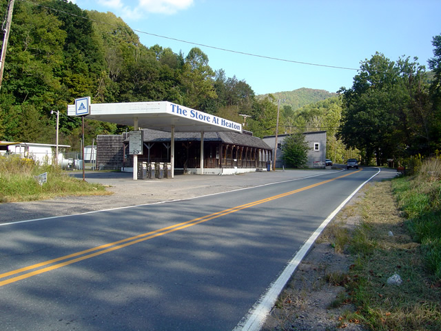
Photo - Start of ride

This abandoned gas station/store on Banner Elk Highway (SR 194) alerts you to the start of the ride. The road is just beyond it.

It starts off easily enough. Gentle straights with a few decent turns. A couple miles in it gets downright squirrely. You enter a series of tight curves, some of them first gear, with the occasional more or less straight section. Be wary of catching too much speed on these  easier portions as they are punctuated with screaming tight curves. Carrying any speed through this road has you flicking and throwing the bike around. It rarely lets up at all.

I was going to get more photos of the road, but I;

1) realized one curvy road pretty much looks like another in a photo, and

2) I was having too much fun to stop
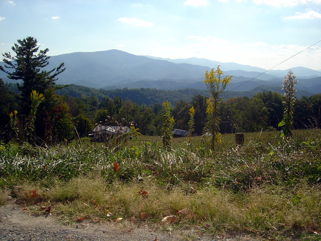
Photo - view from road

One of the views from Beech Mountain Road.

While it’s not particularly scenic, I did pause at one point to get some photos when a good view presented.  You’ll just have to trust me. It’s curvy. It’s fun. I wouldn’t be writing about it if it wasn’t.
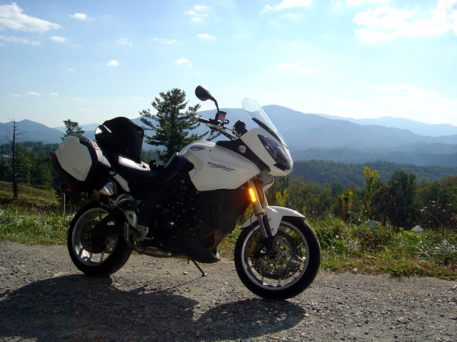
Photo - My bike on Beech Mountain Road

Another view from Beech Mountain Road - I think that's Roan Mountain behind my Triumph Tiger.

It’s a good road to know about as it lets you pass to the north without going through the traffic and congestion of Boone. It saves you time. It gets you somewhere and it’s useful.

Photo _ view of start of road from US 321

This is what to look for from US 321. Flat Springs Road makes a sharp climb with sharper curves. There's a dilapidated building to the left.

It does get some local traffic, and if you time it wrong you might run into school buses who know this shortcut. Opportunities to pass are rare and may have your spinchter puckering. Watch out for gravel in some turns.
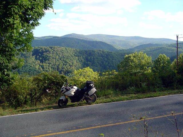
Photo - view from nearby road

This photo is from another road in the area. Though challenging, it had way too much gravel dragged on it from the local traffic. The other roads stay cleaner.

The photos show the landmarks to help you find it at either end. The roads it connects to are good rides. This one’s good enough I have to give it away, but only because I’ve found more great roads nearby.

Photo - view from road

One last view of what I think is Roan Mountain. It's not the rare views that make Beech Mountain / Flat Springs Roads good, it's the ride.

I’m still discovering more roads in this area. I’ve got more sleepers in my quiver, more roads I need to ride again before I decide if I really like them and want to add them to my maps. I’m mighty picky. But this is one you deserve to know about. It’s that good.  It’s all about the ride.

Let me know what you think of it and don’t be surprised to see a white bike flashing by. I’ll be using this road whenever I can.

_______________________________________________________________________________

Wayne Busch

Wayne Busch - Cartographer


– Wayne Busch lives in Waynesville, NC, where he produces the most detailed and comprehensive and up-to-date motorcycle pocket maps of the Blue Ridge and Smoky Mountains to help you get the most of your vacation experience. See them here – AmericaRidesMaps.com