Scanning the blogs and forums I often stumble across the discussion Motorcyclist vs. Biker. I rarely get into it as it’s never resolved. I believe I fall into a separate category – Rider. For me, it’s all about the ride. I don’t care what I’m riding. I don’t care what my image is. I don’t care what you ride or how you look. For me it’s getting as much out of the ride as I can. It’s all about the ride.
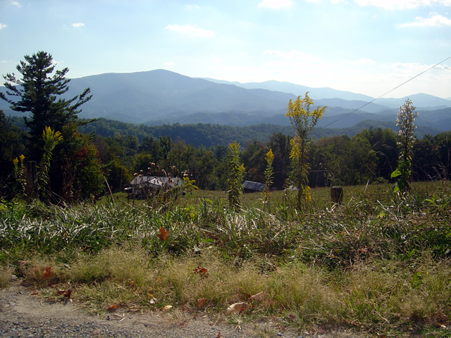
<insert gratuitous Blue Ridge Parkway picture here>

Gratuitous Photo 1 - Amazingly clear skies from the Blue Ridge Parkway. That brown stripe in the distance is I-26 more than 22 miles distant. Visibility must have been nearly 50 miles this day.
Thats why I do what I do. I constantly seek out the best rides. It’s the best job in the world. When I find them, I share them with you, mostly through my motorcycle pocket maps. A couple weeks ago I literally stumbled across a ride while exploring near Banner Elk, North Carolina. It’s 13.8 miles long which puts it in the same range as the Dragon at Deals Gap and the Diamondback at Little Switzerland. I had just been up at the Snake in Shady Valley. On my way home I used the rest of the afternoon (which turned into a night ride home) exploring.
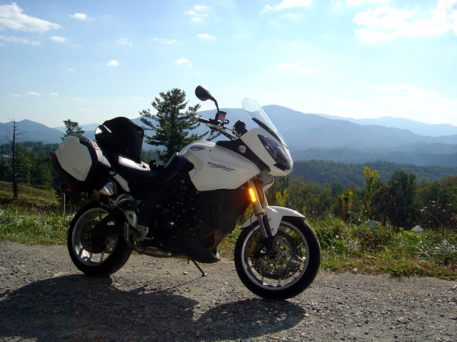
<insert another gratuitous Blue Ridge Parkway photo here – making you work for it>

Gratuitous Photo 2 - View from the Blue Ridge Parkway - The Smoky Mountains got their name from the blue haze which is primarily caused by moisture in the air. Clear and warm days are so rare you should treasure them.
It wasn’t the best of conditions. That recent big hurricane was passing off the coast. Winds were gusting bringing down limbs and debris. Spits of rain had dampened the roads. The skies were dark. I didn’t care. When seeking out roads I’m on a mission.
<Why doesn’t he just tell us about this this road?>
On the first pass through I paused to takes notes. The ride had been a handful. It was certainly challenging. Looking at my notes I actually wrote, “But was it fun?”
<Wait for it>
The return ride was confirming and answered the question with a resounding “Yes!” As the storm broke I continued on and added another superb ride to my list. Then another good side road. I realized I’d overlooked an area that could be a gold mine.
<Get to it man, or I’m outta here>
The ride haunted me. I kept thinking about it. Was it really that good? Two passes was not enough. I needed to ride it again. So I did. It was better than I recalled.
<Ok.> You’ve been overly patient. Here’s the scoop:
The road has two names over its length. On the south end it starts as Beech Mountain Road. Midway it changes to Flat Springs Road. It connects Banner Elk Highway (NC 194) to US 321. Here are photos to help you find it. I’ll describe it from south to north, from Banner Elk Highway to US 321.
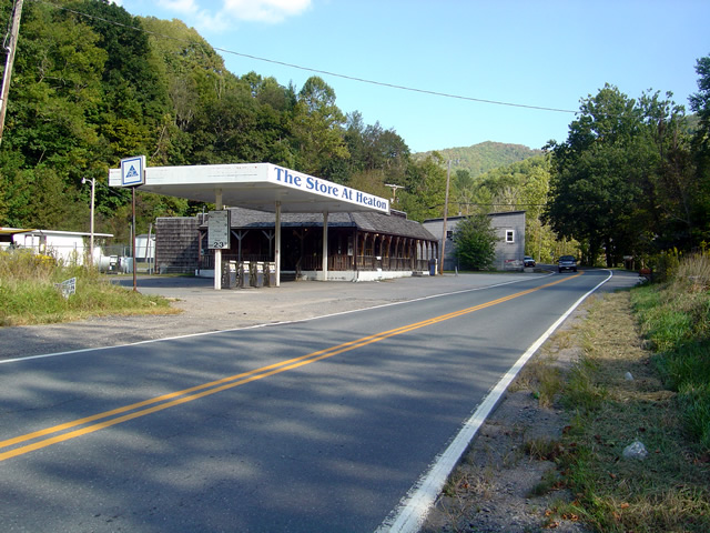
This abandoned gas station/store on Banner Elk Highway (SR 194) alerts you to the start of the ride. The road is just beyond it.
It starts off easily enough. Gentle straights with a few decent turns. A couple miles in it gets downright squirrely. You enter a series of tight curves, some of them first gear, with the occasional more or less straight section. Be wary of catching too much speed on these easier portions as they are punctuated with screaming tight curves. Carrying any speed through this road has you flicking and throwing the bike around. It rarely lets up at all.
I was going to get more photos of the road, but I;
1) realized one curvy road pretty much looks like another in a photo, and
2) I was having too much fun to stop
While it’s not particularly scenic, I did pause at one point to get some photos when a good view presented. You’ll just have to trust me. It’s curvy. It’s fun. I wouldn’t be writing about it if it wasn’t.
It’s a good road to know about as it lets you pass to the north without going through the traffic and congestion of Boone. It saves you time. It gets you somewhere and it’s useful.

This is what to look for from US 321. Flat Springs Road makes a sharp climb with sharper curves. There's a dilapidated building to the left.
It does get some local traffic, and if you time it wrong you might run into school buses who know this shortcut. Opportunities to pass are rare and may have your spinchter puckering. Watch out for gravel in some turns.
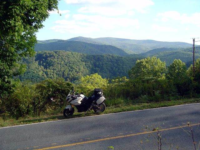
This photo is from another road in the area. Though challenging, it had way too much gravel dragged on it from the local traffic. The other roads stay cleaner.
The photos show the landmarks to help you find it at either end. The roads it connects to are good rides. This one’s good enough I have to give it away, but only because I’ve found more great roads nearby.

One last view of what I think is Roan Mountain. It's not the rare views that make Beech Mountain / Flat Springs Roads good, it's the ride.
I’m still discovering more roads in this area. I’ve got more sleepers in my quiver, more roads I need to ride again before I decide if I really like them and want to add them to my maps. I’m mighty picky. But this is one you deserve to know about. It’s that good. It’s all about the ride.
Let me know what you think of it and don’t be surprised to see a white bike flashing by. I’ll be using this road whenever I can.
_______________________________________________________________________________
– Wayne Busch lives in Waynesville, NC, where he produces the most detailed and comprehensive and up-to-date motorcycle pocket maps of the Blue Ridge and Smoky Mountains to help you get the most of your vacation experience. See them here – AmericaRidesMaps.com

