Riding the Blue Ridge Parkway – Fall leaves can be deadly!

Motorcycle riding tips – Wet leaves in the road can be slick as ice! Watch out for them.

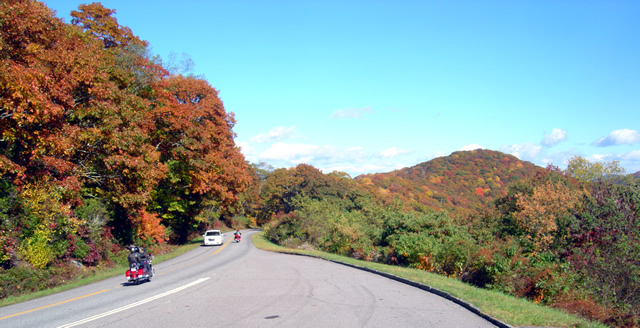
The fall leaf color show is nearing it’s end. With every good breeze a shower of tree trash rains down to blanket the ground for winter’s slumber. Usually those winds blow it clear from the road and it’s no big deal for the motorcycle rider flying along with trails of floating color swirling romantically in your wake.
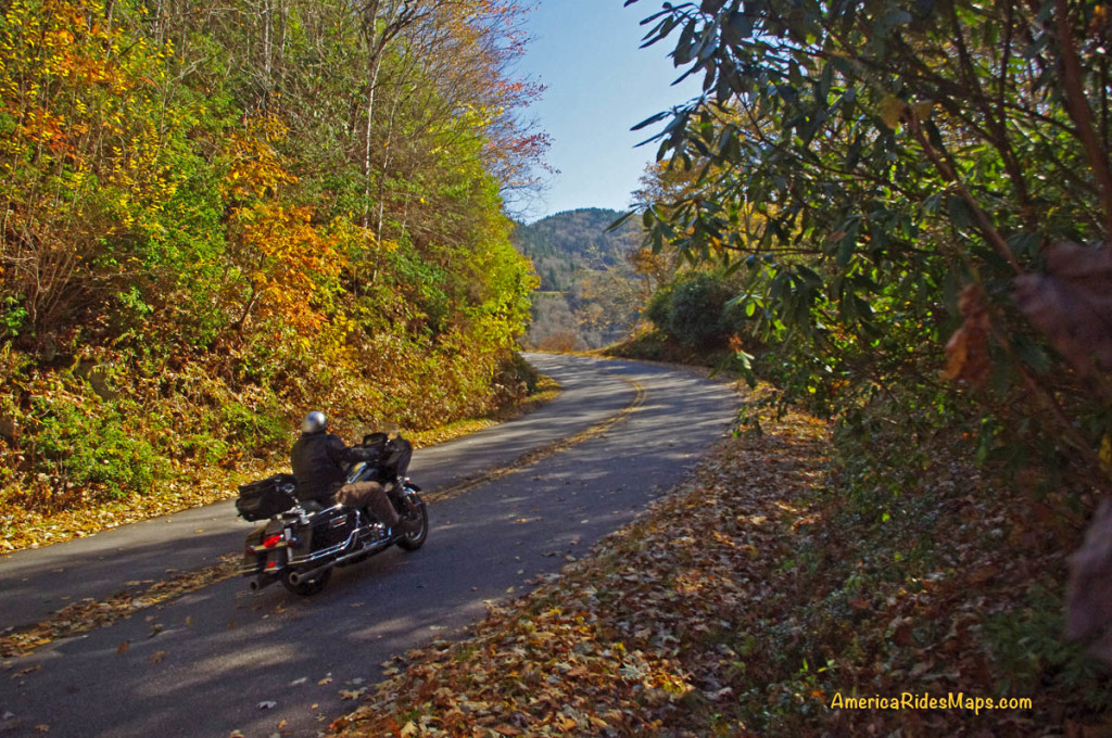
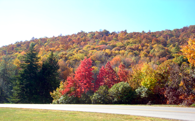
There is still plenty of fall color to enjoy in the Blue Ridge, but those leaves can become a hazard!

There is still plenty of fall color to enjoy in the Blue Ridge, but those leaves can become a hazard!

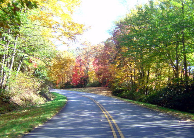
But add water to the mix and those leaves get heavy and stick to the road piling up between the two tire tracks cleared by passing autos. The water acts as a lubricant. Stray out of those tire tracks cleared by the cars, especially in a curve, and you’ll find your traction goes from hero to zero in an instant.
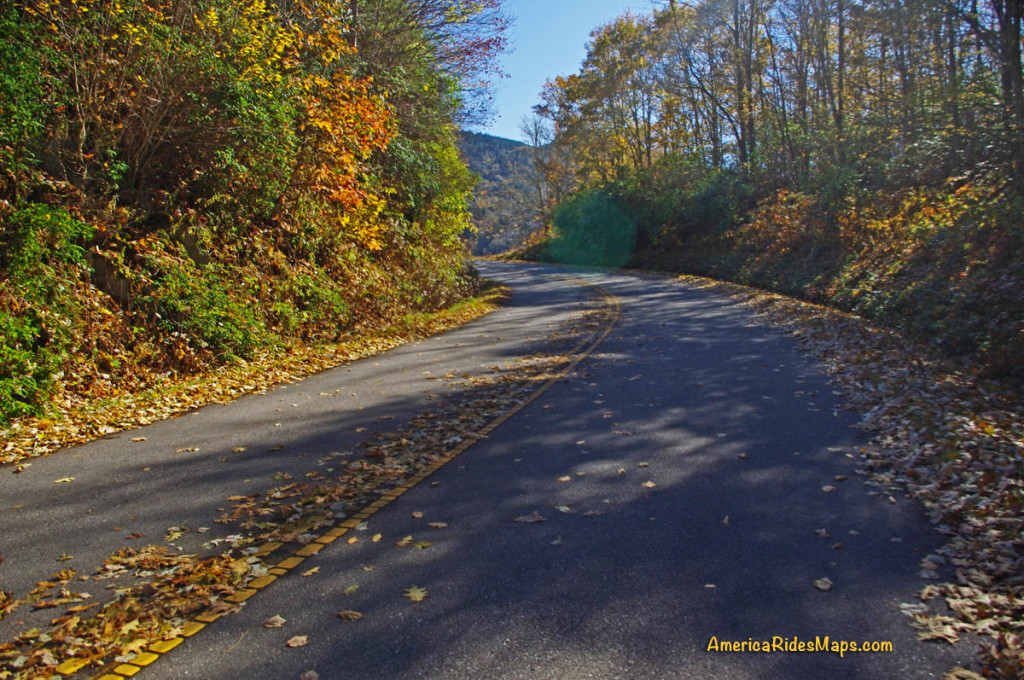
We all know the painted lines are slick when wet -

We all know the painted lines are slick when wet – it can be deadly when you add wet leaves on top of them. Watch out and hold your line in the curves!

Be especially alert and cautious when riding now after it rains. The problem goes away pretty quickly with sunshine, but don’t be fooled. Many areas of our mountain roads are perpetually shady and those leaves remain wet and slippery even on the brightest of days.

If you enjoy photos of motorcycle riding in the Blue Ridge and Smoky Mountains, like MY BLUE RIDGE MOTORCYCLING FACEBOOK PAGE.
____________________________________________________________________

wayne busch - Smoky Mountain Motorcycle Rider.com

Wayne Busch

– Wayne Busch lives in Waynesville, NC, where he produces the most detailed and comprehensive and up-to-date motorcycle pocket maps of the Blue Ridge and Smoky Mountains to help you get the most of your vacation experience. See them here – AmericaRidesMaps.com

____________________________________________________________________

Motorcycle Riders Enjoying Blue Ridge Parkway Fall Color

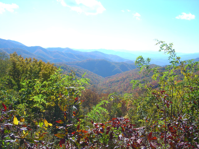
This year, I spent the peak of the leaf season riding my motorcycle on the Blue Ridge Parkway. I photographed the scenery and captured other riders on their motorcycle vacation as they roared past. I selected some of the better ones and a few video clips to share memories with those of you who made it this year and to show those of you who are coming next what they’ve missed out on.

Watch on YouTube http://youtu.be/fQEqdbrt1fI

_______________________________________________________________________________

Wayne Busch

Wayne Busch - Cartographer

Total Rider Tech Logo

Learn Total Control

– Wayne Busch lives in Waynesville, NC, where he produces the most detailed and comprehensive and up-to-date motorcycle pocket maps of the Blue Ridge and Smoky Mountains to help you get the most of your vacation experience. See them here – AmericaRidesMaps.com

Wayne is an advanced motorcycle instructor for Total Rider Tech teaching Lee Parks Total Control Advanced Rider Courses. It’s time you looked into advanced rider training to ride more confidently and safely, it will change your mountain riding experience. It worked so well for me I became an instructor! Total Rider Tech

_______________________________________________________________________________

Fall leaves – Photos from The Snake Motorcycle Ride

With such a beautiful day I was itching for an excuse to get out of the office, onto my motorcycle, and enjoy it when an email came in from David at the Shady Valley Country Store at The Snake Motorcycle Ride in Tennessee. He needed to be restocked on maps, and I was curious about a recommended road in the area – Denton Valley Road. Thats all it took.

Photo - Fall leaves on the Snake - US 421

The were some nice spots of fall color on US 421 a.k.a. "The Snake" yesterday. I was delivering a load of maps to the Shady Valley Country Store.

The big question was “How to get there?” Normally I’d take the Blue Ridge Parkway north to Linville, then jump on the back roads to skirt around the traffic in Boone. Knowing the Blue Ridge Parkway would be heavy with leaf peeping traffic, I considered going east to take the most common routes, but I also knew US 321 would be clogged with traffic and I’d get held up going through Boone. That left a western approach, so I went to Asheville, then up I-26 to US 19E from which I could jump on the back roads once I neared Elk Park. Looking back, I should have just followed the back roads all the way. I got held up in the construction on US 19E and could probably have made the trip in the same amount of time and had a lot more fun. Time was an issue as it was after noon before I left the house.

Photo - Fall leaves on The Snake - US 421

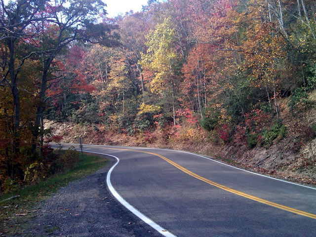
I snapped this photo just before I started down Denton Valley Road from US 421. The sun hit just right, the colors are real, not enhanced. I tried to tone them down, but decided to go with what the camera captured.

It was nearing 4 PM when I concluded my business at the Shady Valley Country Store and continued west on US 421 enjoying the twists and curves of The Snake to reach Denton Valley Road. It was a decent ride, though I hadn’t researched it well enough and ended up spending the next hour and a half exploring it and the roads which connect to it to determine the best and most natural routes. I rolled into Bristol, Virginia, around 6 to refuel and resigned to taking the Interstates back home as it was the most efficient course. It’s not the first time I’ve made that trip in the dark, and unprepared to be out so late I once again suffered the chills of going through the high pass on I-26 at Buckner Gap at night – it ‘s always cold there.

I pulled into the driveway at 8PM, shivering but happy after a decent 350 miles and a collection of new roads to add to America Rides Maps collection.

_______________________________________________________________________________
Wayne Busch
Wayne Busch – Cartographer
– Wayne Busch lives in Waynesville, NC, where he produces the most detailed and comprehensive and up-to-date motorcycle pocket maps of the Blue Ridge and Smoky Mountains to help you get the most of your vacation experience. See them here – AmericaRidesMaps.com

Photos – Blue Ridge Parkway Leaves and Motorcycles – 10/14/10

Photo - fall colors at Soco Gap

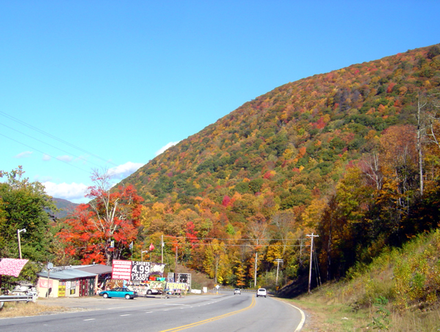
View heading down from the Blue Ridge Parkway at Soco Gap on US 19 towards Maggie Valley. The hills are really lighting up now.

The weatherman paid me back for that prior post by starting this “sunny day” with fog, clouds, and rain. I stand by what I said – never believe what’s forecasted. It’s OK, the day was shot anyway as I waited for a mid-day phone call that never came. I used the office time to get caught up.

Photo - leaves changing at Soco Gap on the Blue Ridge Parkway

I snapped this photo at the exit ramp at Soco Gap on the Blue Ridge Parkway. I only spent a few minutes driving around admiring the leaves. Great colors are almost everywhere.

The rain gave way to bright sunshine and cool breezy weather after lunch. I finally grew weary of working on the updates to the Best Rides North and South of Asheville map and had to get out of the office. Joanne at the Mountaineer Restaurant on US 19 just down from the Soco Gap exit on the Blue Ridge Parkway needed a restock of maps, and I knew there was always great color at the Mountaineer Restaurant, so I grabbed the camera and headed over there this afternoon.

Photo from Thunderstruck Ridge on the Blue Ridge Parkway

A view from the Thunderstruck Ridge overlook on the Blue Ridge Parkway. This is where the photos of me in the Road Bike Magazine article were taken.

The photos I took at the Mountaineer Restaurant didn’t come out. Ever since I submerged my bike and camera in a river while exploring for the Best Motorcycle Rides in the Mountains of North Georgia, the camera has been temperamental and unreliable. I’m shopping for a new one.

Photo - leaves changing on the Blue Ridge Parkway

I brought the video camera along, but it was a little hazy for the long range shots I wanted. If the force is with me, tomorrow I'll get out with the bike mounted camera and get some of these great views to share. There are tunnels of color.

I don’t know what’s going on with the leaves in other places, I haven’t really been out for a few days. I hope to do some riding tomorrow to give you a more accurate report, at least of the local area. I suspect most of the leaves and color are gone from the highest elevations, above 5500 feet. We should get a cold snap tonight, maybe a little frost in the morning. That will really make the leaves pop – right on schedule.

View of leaves changing at the Plott-Balsam overlook on the Blue Ridge Parkway

There were a lot of motorcycles on the Blue Ridge Parkway. My quirky camera only gave me this one shot near the Plott-Balsam Mountains overlook. I'm almost desperate enough to go out a buy a new camera in the morning.

I only spent a few minutes out of my day to take these photos. We’ll see what tomorrow brings, I’d like to get out and ride. Virtual Blue Ridge , the best resource for Blue Ridge Parkway info, has a new leaf report posted here.

http://www.virtualblueridge.com/color-reports/ 

_______________________________________________________________________________

Wayne Busch
Wayne Busch – Cartographer
– Wayne Busch lives in Waynesville, NC, where he produces the most detailed and comprehensive and up-to-date motorcycle pocket maps of the Blue Ridge and Smoky Mountains to help you get the most of your vacation experience. See them here – AmericaRidesMaps.com


Great Motorcycle Rides North of Asheville Discovered

It’s not often I have such a successful day when out exploring for new motorcycle rides to add to my maps but Friday was one of the best. Most of the roads I evaluate don’t measure up against my strict standards – low traffic, engaging scenery, and a challenging and fun motorcycle ride. Nearly every road I explored turned out to be good enough to add to my map of “The Best Motorcycle Rides North and South of Asheville, NC”.

Photo - river north of asheville

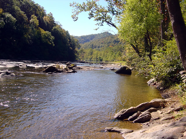
Most of todays rides were through the valleys near rivers. The twisty roads hug the banks.

The weather was ideal – atypically warm, sunny, and clear. The first hints of fall color were starting to emerge in places. Most of that is concentrated in the highest elevations right now, see the post to follow for some photos of the best color. The bulk of todays riding was searching out roads to link and connect to the already outstanding rides previously discovered.

Photo - river north of Asheville

I stopped here for a break along NC 197. It's a great ride as are the roads which connect to it.

I had been avoiding the area around US 19W due to the construction to widen the road to 4 lanes. Part of the mission was to discover the side roads which skirt around it. That construction will be going on for quite some time. I found a bunch of them.

Photo - The lake at roaring Creek, TN

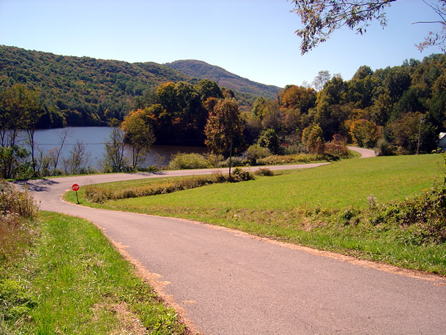
You can see a hint of fall color near this lake along Roaring Creek Road in Tennessee.

I also located a nice loop ride south of Johnson City, Tennessee, a good road to make loops near Roan Mountain, and quite surprising, still more great rides near Little Switzerland and the Diamondback. Much of the riding this trip was down low, through the valleys and along the rivers which are rides you can do pretty much all year round, places to go  after the Blue Ridge Parkway has closed for the winter season.

Photo - Stopped near Roan Mountain

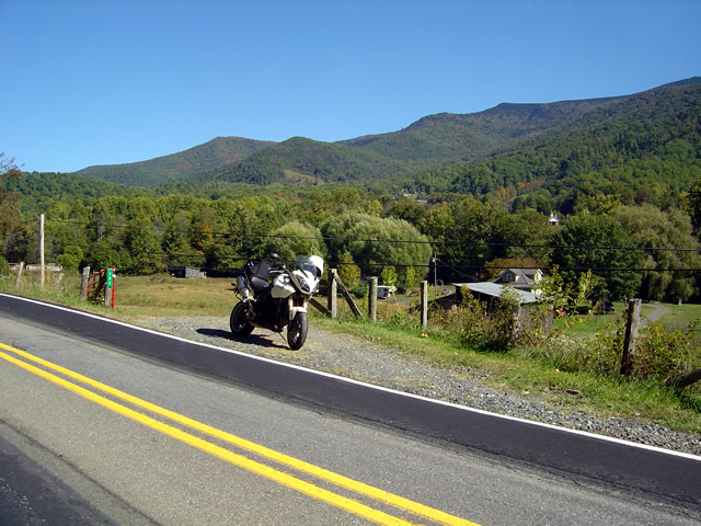
This road turned out to be a great way to make a loop ride when doing the popular ride over Roan Mountain. There is one very short but well maintained unpaved section.

I’ll be adding these new motorcycle rides to the map  The Best Motorcycle Rides North and South of Asheville, NC” this week. It’s almost done with the upgrade to the new and improved format slow but sure.

Photo - mountain view

The skies have been unusually clear lately and the long range views are outstanding.

I got some great photos of the start of the fall color in the higher elevations on the Blue Ridge Parkway. You’ll find some nice stuff starting near Boone and Banner Elk, in the area around Mt. Mitchell and the Black Mountains, not so much near Craggy Gardens, and then some north and south of Asheville. It’s still a little early, the peak will come next weekend, though it will continue through the lower elevations for a while. Next post will show you some color.

America Rides Mapshttp://americaridesmaps.com 

_______________________________________________________________________________
Wayne Busch

Wayne Busch - Cartographer


– Wayne Busch lives in Waynesville, NC, where he produces the most detailed and comprehensive and up-to-date motorcycle pocket maps of the Blue Ridge and Smoky Mountains to help you get the most of your vacation experience. See them here – AmericaRidesMaps.com