Riding the Blue Ridge Parkway – Fall leaves can be deadly!

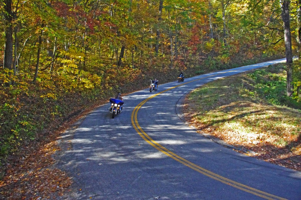
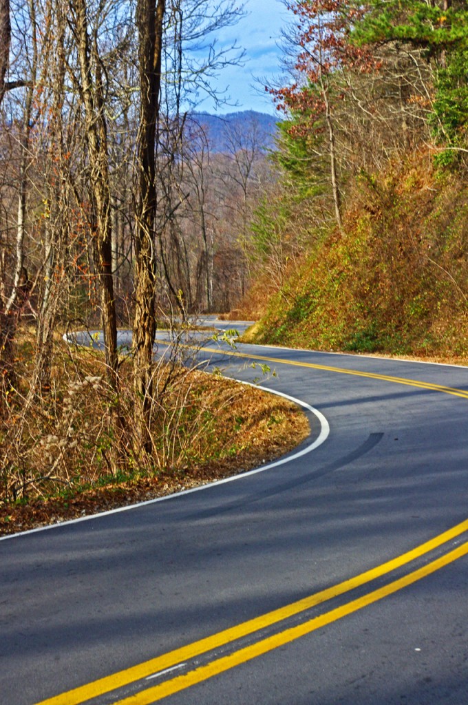
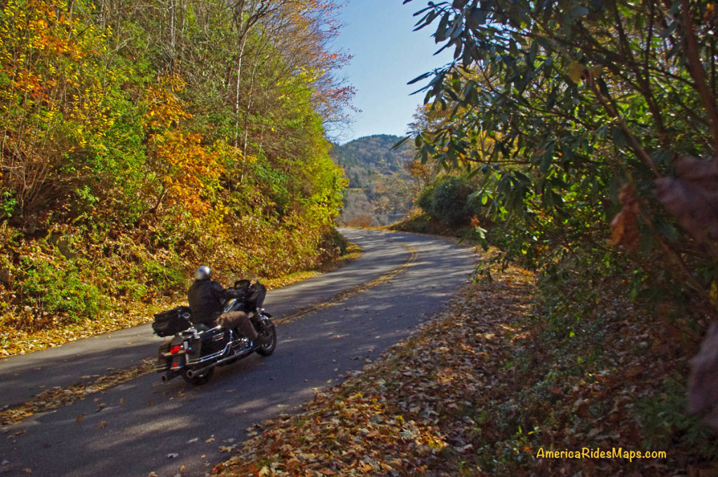
Motorcycle riding tips – Wet leaves in the road can be slick as ice! Watch out for them.

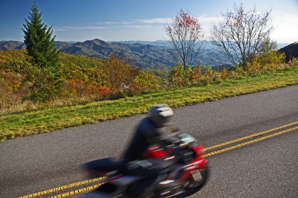
The fall leaf color show is nearing it’s end. With every good breeze a shower of tree trash rains down to blanket the ground for winter’s slumber. Usually those winds blow it clear from the road and it’s no big deal for the motorcycle rider flying along with trails of floating color swirling romantically in your wake.

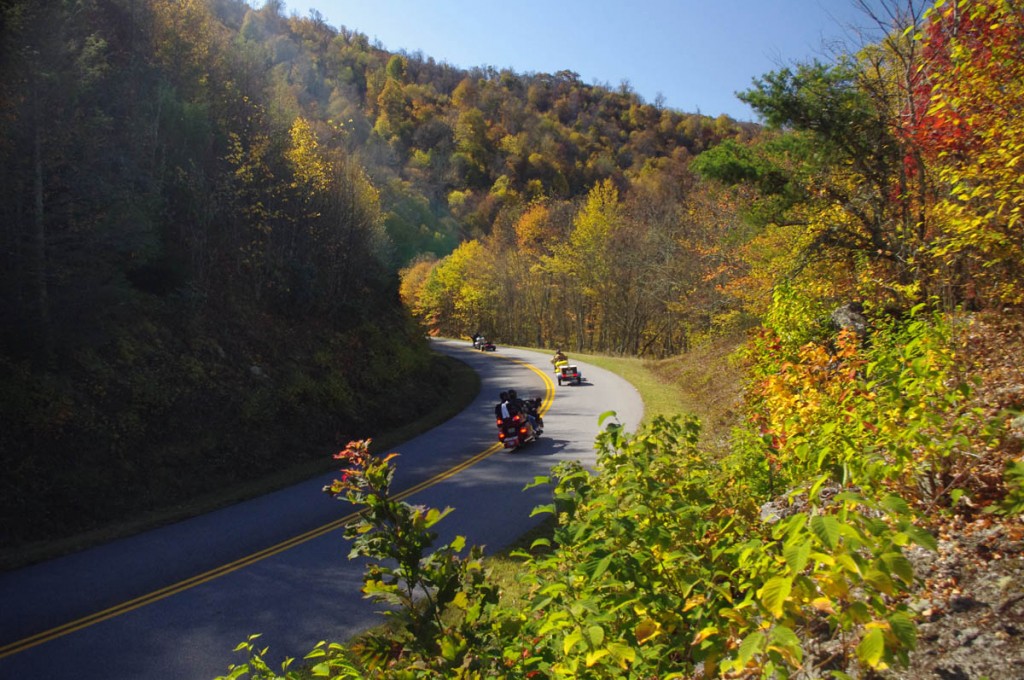
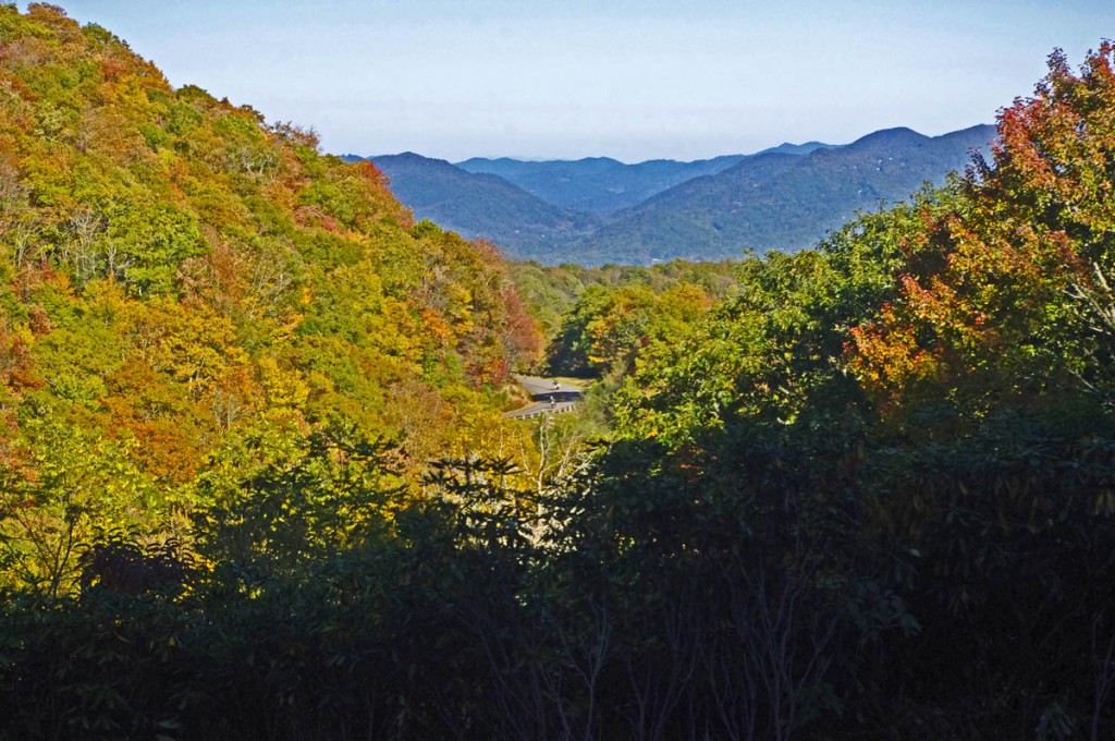
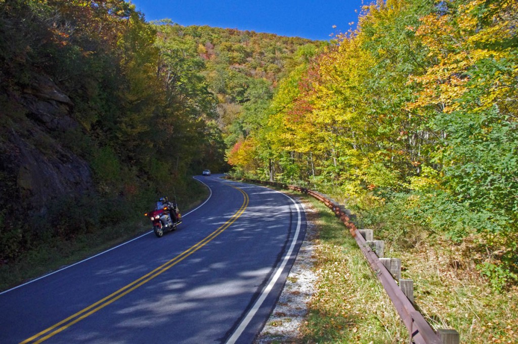
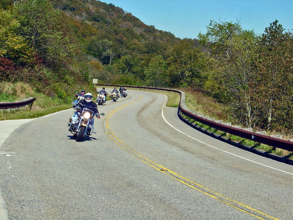
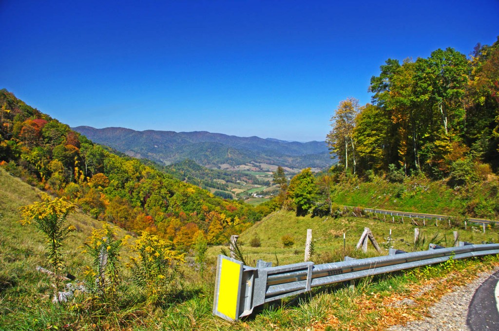
There is still plenty of fall color to enjoy in the Blue Ridge, but those leaves can become a hazard!

There is still plenty of fall color to enjoy in the Blue Ridge, but those leaves can become a hazard!

But add water to the mix and those leaves get heavy and stick to the road piling up between the two tire tracks cleared by passing autos. The water acts as a lubricant. Stray out of those tire tracks cleared by the cars, especially in a curve, and you’ll find your traction goes from hero to zero in an instant.

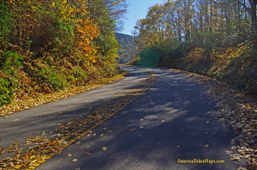
We all know the painted lines are slick when wet -

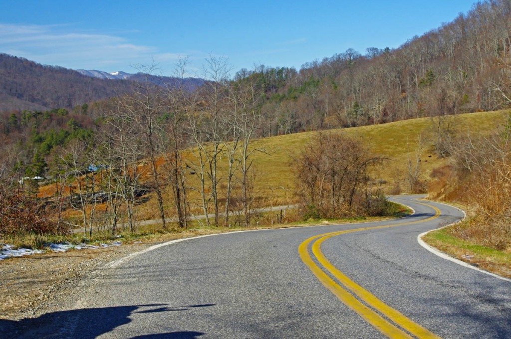
We all know the painted lines are slick when wet – it can be deadly when you add wet leaves on top of them. Watch out and hold your line in the curves!

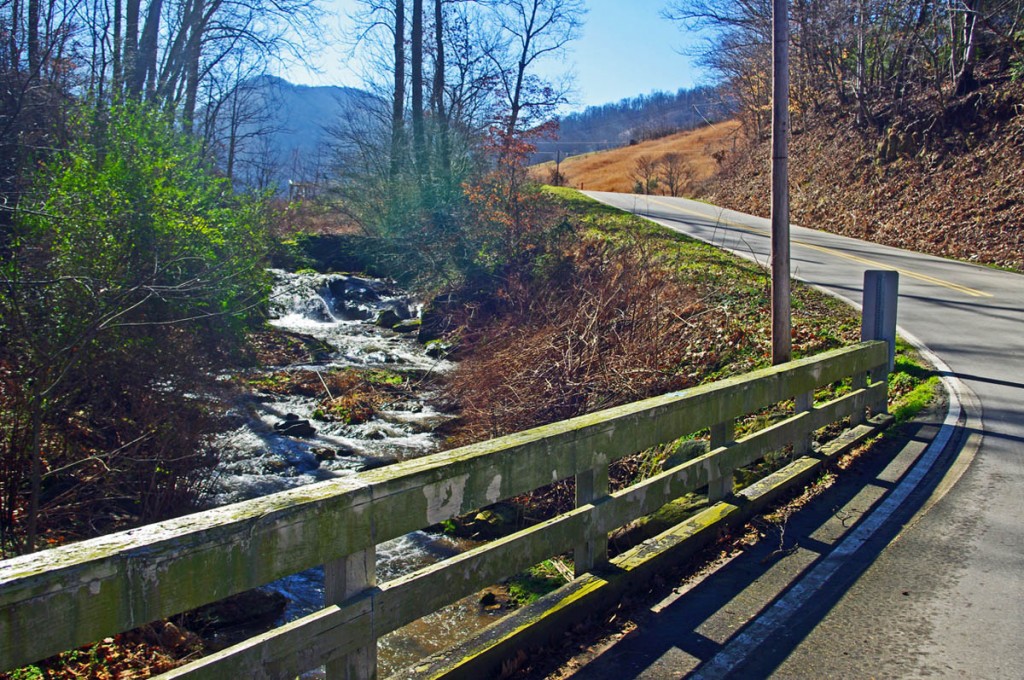
Be especially alert and cautious when riding now after it rains. The problem goes away pretty quickly with sunshine, but don’t be fooled. Many areas of our mountain roads are perpetually shady and those leaves remain wet and slippery even on the brightest of days.

If you enjoy photos of motorcycle riding in the Blue Ridge and Smoky Mountains, like MY BLUE RIDGE MOTORCYCLING FACEBOOK PAGE.
____________________________________________________________________

wayne busch - Smoky Mountain Motorcycle Rider.com

Wayne Busch

– Wayne Busch lives in Waynesville, NC, where he produces the most detailed and comprehensive and up-to-date motorcycle pocket maps of the Blue Ridge and Smoky Mountains to help you get the most of your vacation experience. See them here – AmericaRidesMaps.com

____________________________________________________________________

Blue Ridge Parkway Detour Route for Motorcycles – July, 2013

Blue Ridge Parkway Detour Route for Motorcycles – July, 2013

A section of the Blue Ridge Parkway north of Asheville, NC has closed due to a recent slope failure. Unprecedented rainfall in the region has triggered numerous slides, washed out roads and bridges, and caused some flooding in areas. The National Park Service detour routes traffic south and east of this long closed section of the parkway using US 221 through Marion, NC.

Photo courtesy National Park Service - Blue Ridge Parkway crack in road

Photo courtesy National Park Service – Blue Ridge Parkway crack in road at site of slope failure.

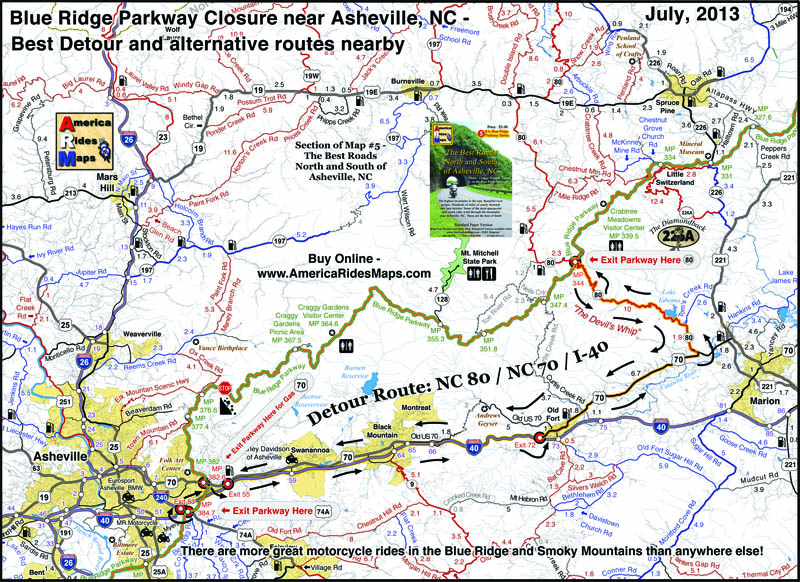
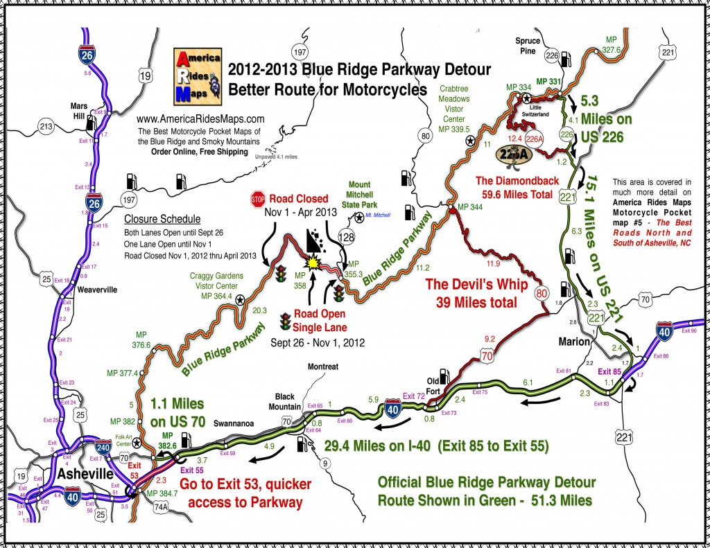
Usually, there is a better route than the “official Park Service Route”, as the park needs to factor in for the large RV’s which cannot easily negotiate steep climbs and sharp turns. Here is a map which highlights the most pleasant way for the motorcycle traveler to bypass the closed section of the Blue Ridge Parkway. It is also the most direct route so you miss as little as possible.

Blue Ridge Parkway detour map 2013

Blue Ridge Parkway detour map 2013

Use this link to a .pdf file of the map here to download or print it for free;

http://smokymountainrider.com/Downloads/Parkway-detour-map-2013.pdf

Map #5 - The Best Roads North and South of Asheville, NC

Map #5 – The Best Roads North and South of Asheville, NC

This road closure occurs on America Rides Maps Motorcycle Pocket Map #5 – “The Best Roads North and South of Asheville, NC”.  A section of Map #5 with the better detour route is highlighted. You’ll also see there are several other ways to go –  the red roads are best if you have the time.

America Rides Motorcycle Pocket Maps catalogue several hundred of the best motorcycle roads in the Blue Ridge Mountains from north Georgia to north Virginia so you get the most out of your visits. Great rides are linked together with the best connecting roads to keep you rolling on the most enjoyable 2 lane back roads you’ll find anywhere.

Get your maps here
____________________________________________________________________

wayne busch - Smoky Mountain Motorcycle Rider.com

Wayne Busch

– Wayne Busch lives in Waynesville, NC, where he produces the most detailed and comprehensive and up-to-date motorcycle pocket maps of the Blue Ridge and Smoky Mountains to help you get the most of your vacation experience. See them here – AmericaRidesMaps.com

Total Rider Tech Logo

Learn Total Control

Wayne is an advanced motorcycle instructor for Total Rider Tech teaching Lee Parks Total Control Advanced Rider Courses. Isn’t it time you looked into advanced rider training to ride more confidently and safely? It can transform your mountain riding experience.  Total Rider Tech

____________________________________________________________________

Riding the Blue Ridge Parkway – Tips; Tame the Tunnels

Riding the Blue Ridge Parkway – Tips; Tame the Tunnels

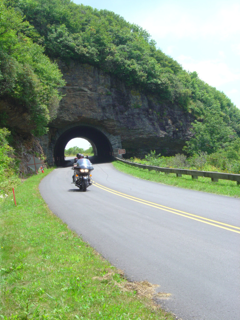
Danger or delight? With 26 tunnels on the Blue Ridge Parkway the experience of rolling under a mountain is common. Most are short, and in many  you can see the light at the other side. Still, every one is dark and if you’re riding along in the bright sunlight with your sunglasses on, the sudden plunge into darkness can momentarily blind you. Here are some observations and tips –

Riding the Blue Ridge Parkway  Tips - Taming the Tunnels

Riding the Blue Ridge Parkway Tips – Taming the Tunnels – the contrast can momentarily blind you

Know where they are – there’s only one in Virginia at MP 53.1 approaching the James River area. The remaining 25 are in North Carolina. A few are near Little Switzerland, but there are two areas to really plan for them – climbing from the French Broad River in Asheville to Mt. Pisgah, and descending from Soco Gap at Maggie Valley to Cherokee. You’ll hit 9 or so in sequence as you climb or descend from the highest section of the Parkway which lies between these points. If you are coming into one of these sections and the tunnels are a problem for you, it may be time to go without the sunglasses through here.

Riding the Blue Ridge Parkway  Tips - Taming the Tunnels

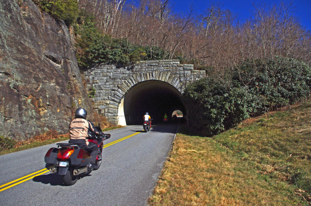
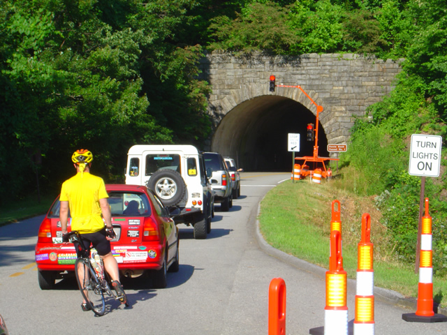
Riding the Blue Ridge Parkway Tips – Taming the Tunnels – It’s pretty easy to just follow the lights, but give plenty of room. The first guy is doing all the work. Be ready for the unexpected.

Use your lights , all of them – motorcycles are required to burn headlights at all times in North Carolina, but even so, they may not do the job in these dark tunnels. Flip on the brights. That will help light up the reflectors along the wall.

Riding the Blue Ridge Parkway  Tips - Taming the Tunnels

Riding the Blue Ridge Parkway Tips – Taming the Tunnels – Tunnels need a lot of maintenance. Slow down when the workers are there.

Watch for hazards – Keep alert for bicycles. They too are required to have lights on the Blue Ridge Parkway, but they won’t be as bold as on a vehicle. Watch for those dim flashing red strobes at the side of the road. Also keep an eye out for wet spots which are common in the tunnels. Cars often slow a bit when in the tunnels, expect it.

Riding the Blue Ridge Parkway  Tips - Taming the Tunnels

Riding the Blue Ridge Parkway Tips – Taming the Tunnels – Be alert for bicycles in the tunnels.

Don’t look down – The tunnels are not only dark, but they curve. You need to keep your eyes ahead. Pay attention to the wall of the tunnel where your brights will illuminate a piece of it ahead of you. It will guide you through.

Riding the Blue Ridge Parkway  Tips - Taming the Tunnels

Riding the Blue Ridge Parkway Tips – Taming the Tunnels – even the short ones often have wet spots, debris, and other things to watch for. In cold weather be wary of ice.

____________________________________________________________________

wayne busch - Smoky Mountain Motorcycle Rider.com

Wayne Busch

– Wayne Busch lives in Waynesville, NC, where he produces the most detailed and comprehensive and up-to-date motorcycle pocket maps of the Blue Ridge and Smoky Mountains to help you get the most of your vacation experience. See them here – AmericaRidesMaps.com

Total Rider Tech Logo

Learn Total Control

Wayne is an advanced motorcycle instructor for Total Rider Tech teaching Lee Parks Total Control Advanced Rider Courses. Isn’t it time you looked into advanced rider training to ride more confidently and safely? It can transform your mountain riding experience.  Total Rider Tech

____________________________________________________________________

Blue Ridge Parkway Motorcycle – Fall Leaf Color

Blue Ridge Parkway Motorcycle – Fall Leaf Color, October 12, 2012
South section, Asheville to Cherokee

Blue Ridge Parkway Motorcycle - Fall leaf color

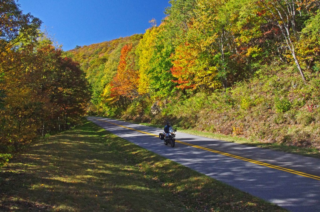
Blue Ridge Parkway Motorcycle – Fall leaf color; While the leaves have dropped some at the highest points, plenty remains just a little lower.

For bikers riding the Blue Ridge Parkway by motorcycle this year, it’s been another good fall showing of fall leaf color. The weather has been a bit “iffy” at times, but that’s not uncommon during this transitional period of the year.

Blue Ridge Parkway Motorcycle - Fall leaf color;

Blue Ridge Parkway Motorcycle – Fall leaf color; Even where some leaf loss has occurred, the views are still outstanding. Late in the day the golden sunlight really sets them off!

Friday, the colors were just getting near their peak at the highest elevations. A cold front over the weekend brought some wind and rain lingered into the week. Unfortunately the leaves were stripped in many exposed areas. Still, there is plenty remaining to make a motorcycle tour worth the time and effort.

Blue Ridge Parkway Motorcycle - Fall leaf color;

Blue Ridge Parkway Motorcycle – Fall leaf color; plenty of color yet to come at the lower elevations throughout the mountains. It usually lasts well into November.

Above 5000 ft. some color remains, but the real show now is a little further down. You’ll find excursions off the Blue Ridge Parkway onto the many great connecting motorcycle rides still yielding a spectacular view of natures glory.

Blue Ridge Parkway Motorcycle - Fall leaf color;

Blue Ridge Parkway Motorcycle – Fall leaf color; The lower elevations are just beginning to show the full spectrum of all the hues of the leafy rainbow.

Don’t miss opportunities to get off onto the back roads where there are some outstanding displays of not only great leaf color, but beautiful mountain scenes that reward the wanderer year-round.  AmericaRidesMaps.com will help you find them!

NC 215 fall leaf color - motorcycle rides nc

NC 215 fall leaf color – motorcycle rides nc – NC 215 has currently got some great shows of color as well as the scores of roads shown on America Rides Maps in the surrounding area. Be sure to check them out!

____________________________________________________________________

wayne busch - Smoky Mountain Motorcycle Rider.com

Wayne Busch

– Wayne Busch lives in Waynesville, NC, where he produces the most detailed and comprehensive and up-to-date motorcycle pocket maps of the Blue Ridge and Smoky Mountains to help you get the most of your vacation experience. See them here – AmericaRidesMaps.com

Total Rider Tech Logo

Learn Total Control

Wayne is an advanced motorcycle instructor for Total Rider Tech teaching Lee Parks Total Control Advanced Rider Courses. Isn’t it time you looked into advanced rider training to ride more confidently and safely? It can transform your mountain riding experience.  Total Rider Tech

____________________________________________________________________

Blue Ridge Parkway 2013 Detour Map for Motorcycles

Blue Ridge Parkway 2013 Detour Map for Motorcycles

Location: North Carolina, Milepost 358, 2.6 miles south of NC 128 / Mt. Mitchell State Park.

Blue Ridge Parkway Detour 2012 - 2013 - View from Craggy Gardens Overlook

Blue Ridge Parkway Detour 2012 – 2013 – Amazingly clear skies from the Craggy Gardens Overlook on the Blue Ridge Parkway. It can still be accessed from the south. That brown stripe in the distance in I-26 more than 22 miles distant. Visibility must have been nearly 50 miles this day.

Schedule:

  • Road open both lanes until 9/26/12
  • 9/26/12 – 10/01/12One lane closed. Temporary traffic lights for one way traffic
  • 10/01/12 – April, 2013 6.5 miles of road closed, use detour

> Access Mt. Mitchell State Park from north (NC 80 crossover)

> Access Craggy Gardens from south (Asheville /  Weaverville exits)

A short stretch of the Blue Ridge Parkway will be closed November 1, 2012 through April 2013 to stabilize a failing slope. I’ve been watching this spot in the road as it has subsided over the past couple years. It involves all of the north bound lane and a portion of the southbound lane, and it’s very noticeable dip when riding through.

On or about September 26, Temporary traffic lights will stagger one way traffic through the work area, expect short to moderate delays. Gates above the Craggy Gardens Picnic Area and just south of NC 128 to Mt Mitchell State Park will be closed November 1 to isolate it for the construction.

Blue Ridge Parkway Road Closure 2012 - 2013

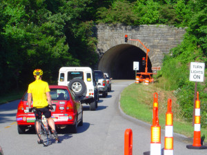
Blue Ridge Parkway Road Closure 2012 – 2013 – Temporary trffic lights like this one will regulate the flow when one lane is closed this week.

The Official Blue Ridge Parkway Detour exits at NC 226 at Spruce Pine, following it south to NC 221 then west on I-40 to reconnect in Asheville at the US 70 intersection.

I suggest those motorcycle riding on the Blue Ridge Parkway continue south and exit the Blue Ridge Parkway at NC 80. NC 80 a.k.a the “Devils Whip plunges down from the heights through a series of switchbacks, then a nice long curvy section takes you to the junction with US 70 at a traffic light. Follow US 70 east through Old Fort and connect to I-40 West.

Blue Ridge Parkway closure 2013 map

Blue Ridge Parkway closure 2013 map – Click on map for full sized version. Prints on a standard sheet of paper.

Print a copy free from a .pdf file here: http://smokymountainrider.com/Downloads/parkway-closure-2013.pdf

The Official Blue Ridge Parkway detour will have you connecting to the south end via US 70 east of Asheville via Exit 55 on I-40.  I recommend you go to the next I-40 Exit #53 at the junction with US 74A. The connection here is much shorter, no traffic lights, and you won’t miss anything scenic on the Parkway.

You’ll find these roads on America Rides Maps motorcycle pocket map #5 – The Best  Roads North and South of Asheville, NC along with another 40 or so outstanding rides in the surrounding area.

____________________________________________________________________

wayne busch - Smoky Mountain Motorcycle Rider.com

Wayne Busch

– Wayne Busch lives in Waynesville, NC, where he produces the most detailed and comprehensive and up-to-date motorcycle pocket maps of the Blue Ridge and Smoky Mountains to help you get the most of your vacation experience. See them here – AmericaRidesMaps.com

Total Rider Tech Logo

Learn Total Control

Wayne is an advanced motorcycle instructor for Total Rider Tech teaching Lee Parks Total Control Advanced Rider Courses. Isn’t it time you looked into advanced rider training to ride more confidently and safely? It can transform your mountain riding experience.  Total Rider Tech

____________________________________________________________________

Blue Ridge Parkway to Tail of the Dragon Map

Blue Ridge Parkway to Tail of the Dragon Map

Three roads are consistently on the top 10 motorcycle rides list – The Blue Ridge Parkway, the Dragon at Deals Gap, and the Cherohala Skyway. This map shows how connect them.

Blue Ridge Parkway to Tail of the Dragon Map

Blue Ridge Parkway to Tail of the Dragon Map – how to connect 3 of the best motorcycle rides – click for larger view

Many who ride motorcycles on the The Blue Ridge Parkway when motorcycle touring then go on to ride The Dragon at Deals Gap. If you can afford the time, you can make a nice loop ride which connects The Dragon and the Cherohala Skyway using TN 72 / 360.

Best Blue Ridge Parkway Overlooks - highest point

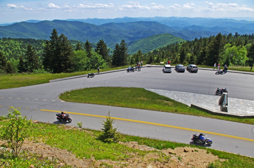
Best Blue Ridge Parkway Overlooks – highest point. The long sweeping overlook compliments the great sweeping views

The southern end of the The Blue Ridge Parkway is near Cherokee, NC. The map includes Maggie Valley / Waynesville as it’s one of the best locations to stay to enjoy the wealth of great motorcycle rides in the surrounding area.

Blue Ridge Parkway to Tail of the Dragon Map - riders come from around the world to experience the Dragon at Deals Gap.

Blue Ridge Parkway to Tail of the Dragon Map – riders come from around the world to experience the Dragon at Deals Gap.

Time / distances are from the eastern junction of the roads for riders starting from Maggie Valley / Waynesville. US 74 is the principal 4 lane road – scenic for a highway, the most direct route east / west. US 19 leads west from Maggie Valley, passes through Cherokee and Bryson City. It’s more curvy, passes through the Cherokee Indian Reservation, and takes a bit longer due to traffic.

Blue Ridge Parkway to Tail of the Dragon map - Cherohala skyway

Blue Ridge Parkway to Tail of the Dragon map – The Cherohala Skyway offers sweeping curves and views to match with scenic overlooks at 5000+ ft.

Approaching Deals Gap and The Dragon, NC 28 is also one of the top rated roads in the area a.k.a the Hellbender or Moonshiner 28 and leads you to the start of the best section of The Dragon near the NC / TN state line.

Blue Ridge Parkway to Tail of the Dragon map - NC 28

Blue Ridge Parkway to Tail of the Dragon map – NC 28 leads you to The Dragon. It traces the shoreline of Fontana Lake and is both beautiful and challenging.

So long as you are in the area, don’t forget about another well known motorcycle ride in Georgia – The Gauntlet. It’s only a short ride to reach it, and you’ll have experienced the best of the southern Blue Ridge motorcycle rides.

The Gauntlet Motorcycle Ride in Georgia

The Gauntlet Motorcycle Ride in Georgia – rounding a curve on GA 348

Several America Rides motorcycle pocket maps cover the Dragon / Cherohala area – see them here;

#7 The Best Motorcycle Rides SOUTH of GSMNP –http://shop.americaridesmaps.com/7-The-Best-Motorcycle-Rides-SOUTH-of-GSMNP-NC021.htm

#8 Best Rides NORTH of Smoky Park – http://shop.americaridesmaps.com/8-Best-Rides-NORTH-of-Smoky-Park-NC020.htm

12 Classic Deals Gap Motorcycle Rides – http://shop.americaridesmaps.com/12-Classic-Deals-Gap-Motorcycle-Rides-NC007.htm

____________________________________________________________________

wayne busch - Smoky Mountain Motorcycle Rider.com

Wayne Busch

– Wayne Busch lives in Waynesville, NC, where he produces the most detailed and comprehensive and up-to-date motorcycle pocket maps of the Blue Ridge and Smoky Mountains to help you get the most of your vacation experience. See them here – AmericaRidesMaps.com

Total Rider Tech Logo

Learn Total Control

Wayne is an advanced motorcycle instructor for Total Rider Tech teaching Lee Parks Total Control Advanced Rider Courses. Isn’t it time you looked into advanced rider training to ride more confidently and safely? It can transform your mountain riding experience.  Total Rider Tech

____________________________________________________________________

Best Motorcycle Rides in North Carolina – Secrets

Best Motorcycle Rides in North Carolina – Secrets

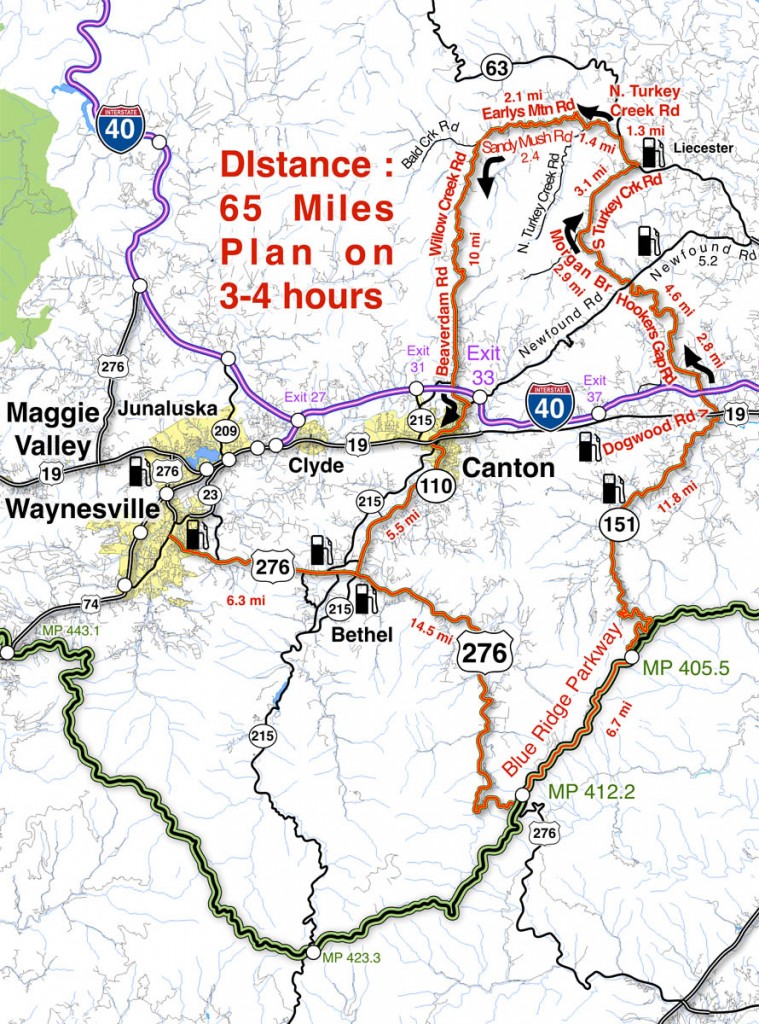
Here’s another bunch of the best motorcycle rides in North Carolina that few ever discover – it’s a nice loop ride that includes a section riding the Blue Ridge Parkway

Best Motorcycle Rides in North Carolina - Sandy Mush

Best Motorcycle Rides in North Carolina - This loop ride will surprise you with some very challenging roads, nice scenery, and places you'd never see otherwise.

The roads shown south of I-40 are pretty well known biker roads. US 276 runs from Waynesville to the Blue Ridge Parkway, always a popular North Carolina motorcycle ride. The section of the Blue Ridge Parkway shown includes Mt. Pisgah and The Pisgah Inn. NC 151 is legendary for it’s treacherous curves as it plunges towards  the valley that leads into Candler.

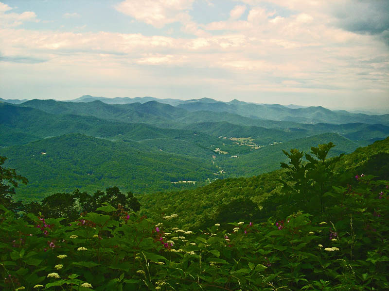
Best Motorcycle Rides in North Carolina - Pisgah View

Best Motorcycle Rides in North Carolina - the view from the Pisgah Inn on the Blue Ridge Parkway represents others on this section of the road - outstanding!

Most riders then point their wheels to I-40 or US 19 and miss out on the roads that lie north of I-40. This area gets little attention from motorcycle touring visitors who are lured to the more publicized roads elsewhere. To the east lie the suburbs of Asheville, the west is mostly rural valley farms.

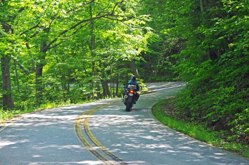
Best Motorcycle Rides in North Carolina - NC 151

Best Motorcycle Rides in North Carolina - The section of NC 151 which descends from the Blue Ridge Parkway is full of tricky curves.

The two primary roads north of I-40 are Newfound Road which runs from Canton to Leicester, and Leicester Rd (NC 63) which runs into Asheville. Both are decent rides, particularly the west end of NC 63 as it climbs out of the valleys to intersect NC 209 – The Rattler (Click for ride guide). Still, they are the most heavily used roads so this route avoids them in favor of the empty two lanes which provide a much more relaxing and fun scenic motorcycle ride.

Best Motorcycle Rides in North Carolina - Hookers Gap Rd

Best Motorcycle Rides in North Carolina - Hookers Gap Rd has little traffic and wonderful curves as it climbs over a mountain.

You’ll want to pay attention to the map and watch for the turns as it’s easy to wander off on the maze of small surrounding roads. The turn onto Hookers Gap Rd is not well marked and the road can be hard to spot, but the ride is worth the effort. You’ll also find a short unpaved section of road where Morgan Branch Rd runs into S. Turkey Creek Rd. Be sure to veer right and take the high road where N. Turkey Creek meets Earlys Mountain Rd. NC 215 makes a nice alternative to NC 110 leading out of Canton.

Best Motorcycle Rides in North Carolina - Earlys Mtn Rd

Best Motorcycle Rides in North Carolina - Earlys Mountain Road is one I often ride in winter. The valleys will be clear while snow covers the higher elevations. A nice ride any time of year!

You’ll enjoy a variety of motorcycle riding experiences on this nice loop ride. The valley roads often follow along rushing streams or wind through twisty mountain passes. You’ll enjoy farms and pastures, the park atmosphere of the Blue Ridge Parkway, and the contrast of the massive paper mill when passing through Canton. There are historic buildings and timeless views.

Best Motorcycle Rides in North Carolina - Beaverdam Rd

Best Motorcycle Rides in North Carolina - If you ride Beaverdam Road north from Canton when you crest the mountain the Sandy Mush Valley view explodes as you plunge down the steep hillside.

Step-by-step Route: (uses NC 215 instead of NC 110, either does the job)

  • Start in Canton. Follow NC 215 to Bethel.
  • 5.4 mi Turn left  @ stop sign onto Sonoma Road. Junction NC 215 and Sonoma Road.
  • 6 mi Turn right @ stop sign onto NC 110. Junction Sonoma Road and NC 110.
  • 6.4 mi Turn left @ traffic light onto US 276. Junction NC 110 / US 276 / NC 215. Follow to Blue Ridge Parkway.
  • 20.9 mi Left turn onto ramp to Blue Ridge Parkway.
  • 21 mi Turn right  onto Blue Ridge Parkway (towards Asheville). Follow to next exit.
  • 27.3 mi Turn left onto NC 151. Junction Blue Ridge Parkway and NC 151. Steep descent with tight switchbacks.
  • 39.1 mi Continue through traffic light @ US 19 onto Dogwood Road. Traffic light. Junction NC 151 and US 19.
  • 41.4 mi Turn right onto Hookers Gap Road. Junction Dogwood Road and Hookers Gap Road. Poorly marked, be alert for this turn.
  • 46.5 mi Cross Newfound Road @ stop sign to continue on Morgan Branch Road. Junction Hookers Gap Road and Newfound Road.
  • 49 mi Unpaved section of road for short distance. Cross single lane bridge.
  • 49.4 mi Turn right @ stop sign onto S. Turkey Creek Road.
  • 52.4 mi Turn left  @ stop sign onto NC 63 (New Leicester Highway). Junction S. Turkey Creek Road and NC 63.
  • 53.7 mi Turn left onto N. Turkey Creek Road. Junction NC 63 and N. Turkey Creek Road.
  • 55.1 mi Keep right on Earlys Mountain Road. Junction N. Turkey Creek Road and Earlys Mountain Road.
  • Earlys Mountain Road becomes Big Sandy Mush Road.
  • 59.6 mi Turn left onto Willow Creek Road. Junction Big Sandy Mush Road / Willow Creek Road / Bald Creek Road.
  • Willow Creek Road becomes Beaverdam Road
  • 69.6 mi Turn right @ stop sign onto Newfound Road and follow into Canton. Junction Beaverdam Road and Newfound Road.
  • 71 mi Stop sign. Junction Beaverdam Road and Main Street in Canton.
Best Motorcycle Rides in North Carolina - Willow Creek Rd

Best Motorcycle Rides in North Carolina - Willow Creek Rd has some pretty views and pretty challenging curves.

You can do this North Carolina motorcycle ride in half a day or less. It’s a good one to know about if you’re staying in Waynesville or Maggie Valley or at the Pisgah Inn on the Blue Ridge Parkway. It’s a nice one to fill the rest of the day if you visit Wheels Through Time Motorcycle Museum. If you get caught here during a rainy spell, it’s a quick one you can dart out and do between showers with easy options to run back for shelter if you get caught in a downpour.
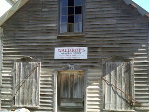
Best Motorcycle Rides in North Carolina - old store

Best Motorcycle Rides in North Carolina - riding through historic farms and tiny towns that date back a hundred years or more.


Don’t underestimate these roads, they are plenty challenging and worth the time to investigate. You’ll see sights others miss, and experience a part of the mountains rarely visited. You’ll pass by homes and farms that have been there for hundreds of years and many generations. It’s a ride through the history and heritage of the Smokies. Enjoy!

______________________________________

Map #6These roads are just a few of the more than 50 great motorcycle rides found on America Rides Maps pocket map  #6 – The Best Motorcycle Rides EAST of Great Smoky Mountains National Park.

____________________________________________________________________
wayne busch - Smoky Mountain Motorcycle Rider.com

Wayne Busch

– Wayne Busch lives in Waynesville, NC, where he produces the most detailed and comprehensive and up-to-date motorcycle pocket maps of the Blue Ridge and Smoky Mountains to help you get the most of your vacation experience. See them here – AmericaRidesMaps.com

Total Rider Tech Logo

Learn Total Control

Wayne is an advanced motorcycle instructor for Total Rider Tech teaching Lee Parks Total Control Advanced Rider Courses. Isn’t it time you looked into advanced rider training to ride more confidently and safely? It can transform your mountain riding experience.  Total Rider Tech

____________________________________________________________________

Wayne’s 2012 Blue Ridge Parkway Alternative Detours for Motorcycles

map-brp-detour-2012

Don’t get caught up in the traffic on the Park Service Detour Route 

These roads allow you to take the shortcuts (or the long way round) that will keep you riding!

Get your free copy! Instructions at bottom of page.

photo-parkway-closed-signs-nc18

30+ miles of the Blue Ridge Parkway is closed for most of 2012 near the NC / VA border. Detour via NC 18.


There is one significant detour on the Blue Ridge Parkway for 2012. To my surprise, it’s an extension of the detour that closed this middle section of the road near the North Carolina / Virginia border last year. While I found a much better detour route for motorcycle touring in 2011, 2012 is a real challenge in this very rural area where a paved road is a rarity.
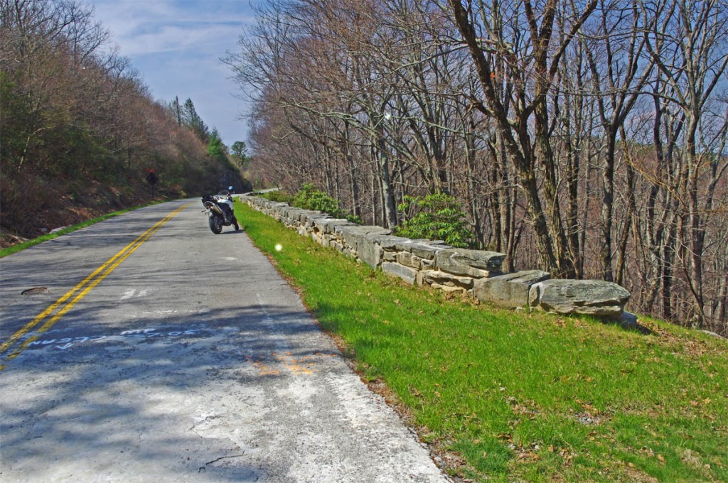
photo-stone-walls-on-brp

The Blue Ridge Parkway is closed for maintenance, repair, and rebuilding of the historic stone walls found in this 30+ mile section.

The Blue Ridge Parkway will be closed to traffic (including bicycles) in 2012 from Milepost 216.5 near Cumberland Knob to Milepost 248.1 for repair of historic stone walls (see photo). While the wall shown may not seem impressive, this is where the Blue Ridge Parkway was born back in 1930-40. The early masonry work you see on the overpasses, bridges, and walls was done by master masons brought over from Europe. A few third generation descendants continue this restoration work today.
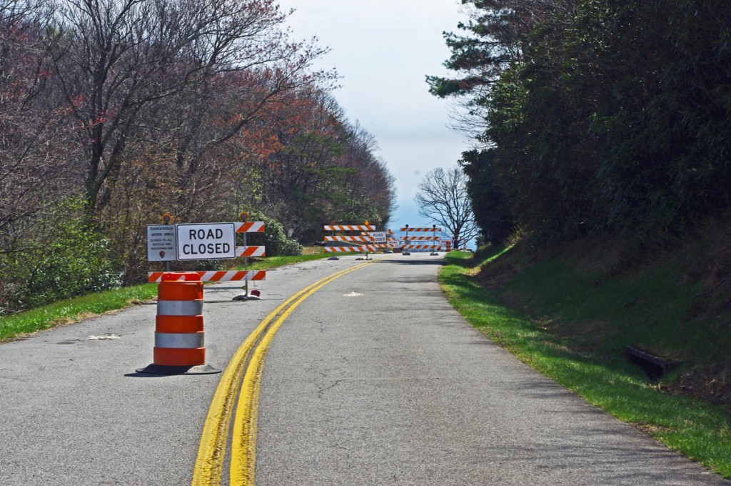
photo-brp-barricade

4 Road Closed signs, barrels, barricades, flashing lights, locked gate, - seriously closed!

Last year’s detour was north of the Blue Ridge Parkway through Sparta. I knew of a longer though much better route on the south side and produced a free downloadable map of it. It was fun. That route is included on the map. This years extension of the closure means there is no good way to bypass it completely on the south side of the Blue Ridge Parkway.
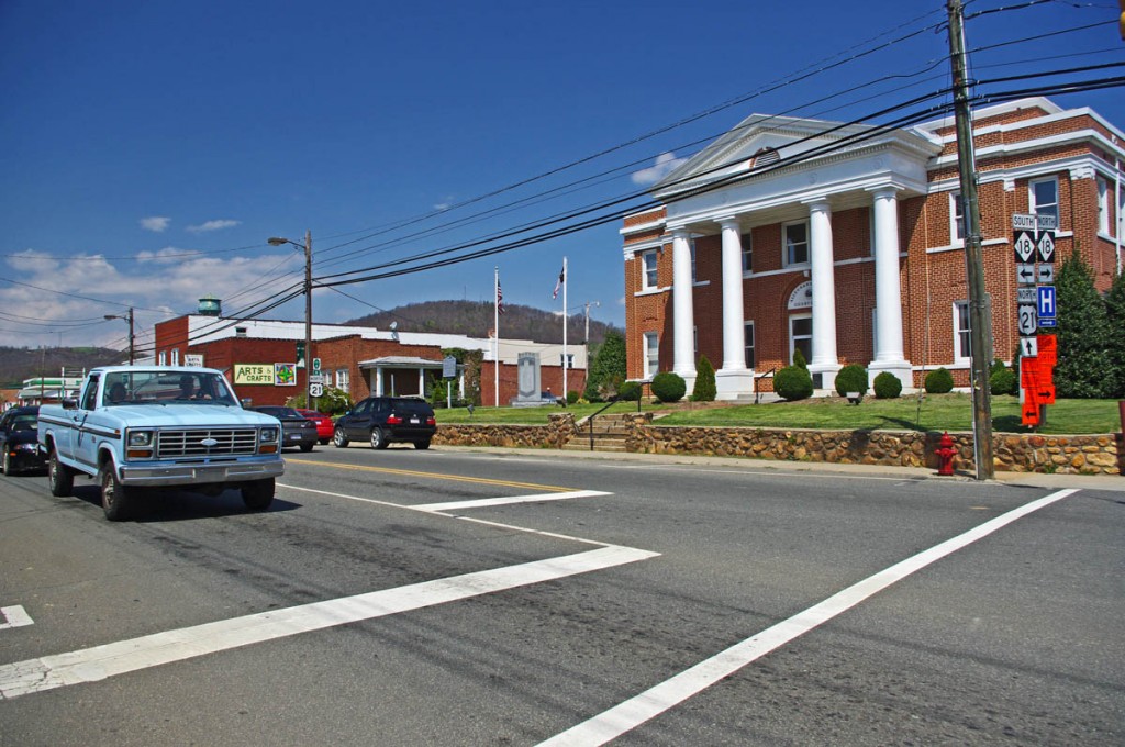
photo-sparta

The Allegheny County Courthouse is the cornerstone of downtown Sparta. It's a small crossroads town, little of interest to me.

The 2012 Park Service detour route is simple, just one road – NC 18 which intersects the Blue Ridge Parkway at two points. It’s the easy, elegant solution passing through Sparta. While NC 18 could be a decent motorcycle ride, it’s curvy and rolling, the lack of paved roads in the area means it also carries all the traffic. Few cars and trucks are able to maintain the 55 mph speed limit and there’s always that one or two that can’t seem to get much above 40 mph and the lines back up behind them. It can be frustrating to ride when you can’t enjoy the curves at a proper motorcycle pace.
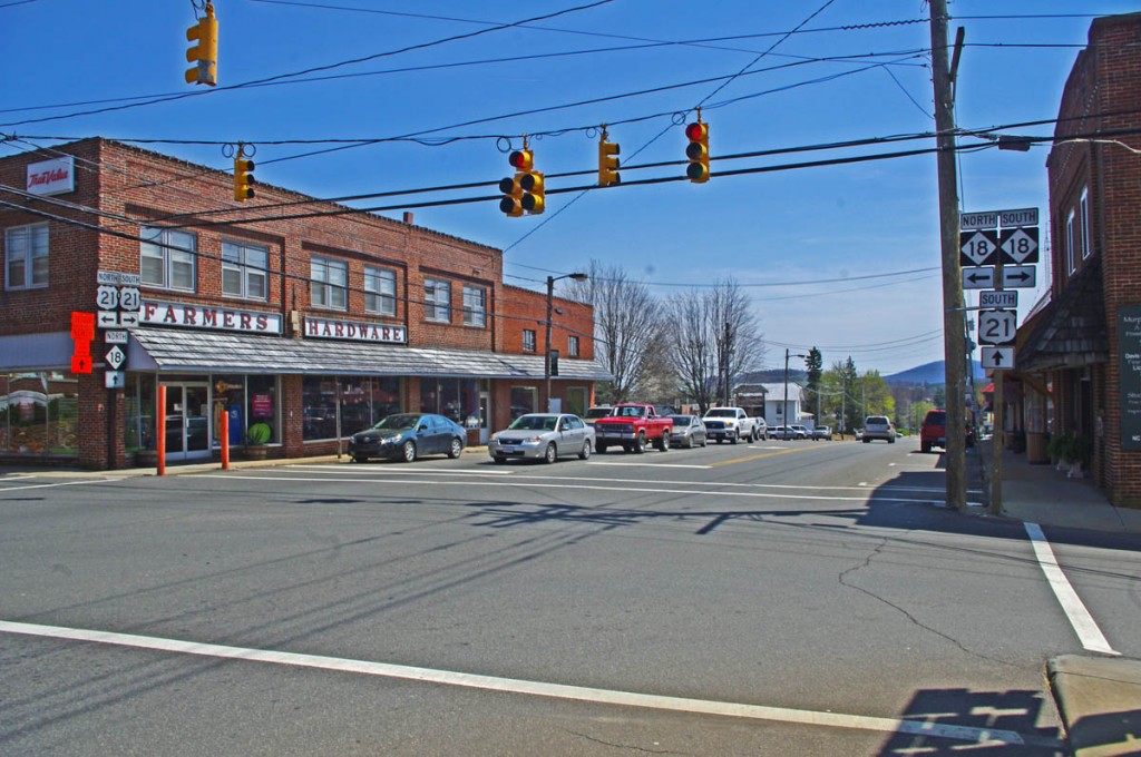
photo-sparta

There - now you've seen Sparta. Don't feel like you've missed much if you bypass it.

Nor is there a compelling reason to go into Sparta. It’s a historic town at the crossroads of NC 18 / US 21, but I saw no places which looked enticing to eat at (one coffee shop), and the 2 gas stations require you to leave NC 18 and go a short distance on US 21. There’s a little museum, but miss Sparta and you won’t miss much.
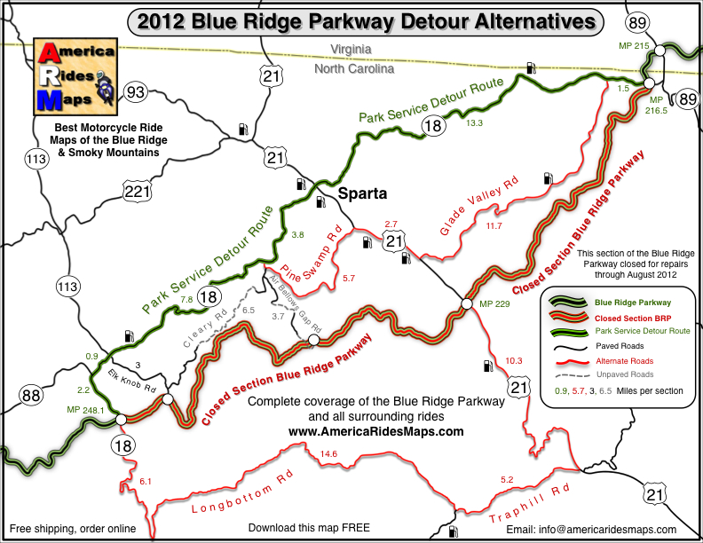
map-brp-detour-2012

Download this map and print your copy or save it in your phone!

The roads show on the map offer alternatives to avoid most of the standard route and should save you some time. They will at least help you avoid getting caught up in any traffic that could get backed up on the official detour. For those on adventure bikes I’ve included a couple non-paved options that will let you get your wheels dirty on gravel roads.

Downloads:
Use http://americaridesmaps.com/downloads/BRP-detour-2012.pdf for a map you can print on a standard sheet of paper.

Use http://americaridesmaps.com/downloads/BRP-detour-2012.jpg for an image file you can store in your cell phone, iPad, or GPS.

__________________________________________________________________

Wayne Busch

Wayne Busch - Cartographer

Total Rider Tech Logo

Learn Total Control

– Wayne Busch lives in Waynesville, NC, where he produces the most detailed and comprehensive and up-to-date motorcycle pocket maps of the Blue Ridge and Smoky Mountains to help you get the most of your vacation experience. See them here – AmericaRidesMaps.com

Wayne is an advanced motorcycle instructor for Total Rider Tech teaching Lee Parks Total Control Advanced Rider Courses. Isn’t it time you looked into advanced rider training to ride more confidently and safely? It can transform your mountain riding experience.  Total Rider Tech

____________________________________________________________________
Misleading Blue Ridge Parkway Sign should come down

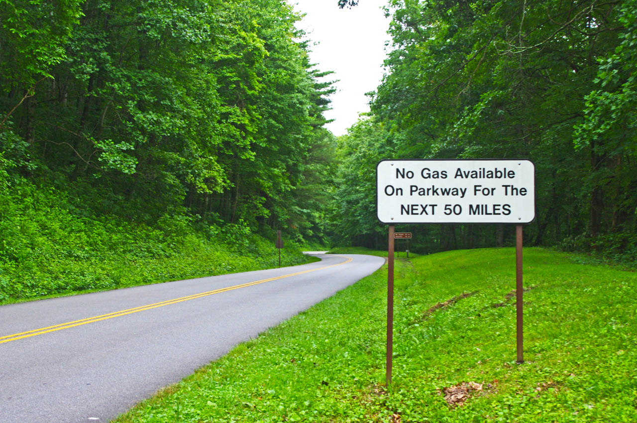
There was a time when the “No Gas for Next 50 Miles” sign at the US 74 exit on the Blue Ridge Parkway (MP 443.1) was an accurate warning, but it no longer serves the purpose.

photo-no-gas-sign-on-blue-ridge-parkway

This sign is a legacy to when gas was available on the Blue Ridge Parkway. It should now read "No gas next 400 miles". There is no gas on the Blue Ridge Parkway.

Years ago, there were gas stations on the Blue Ridge Parkway. This sign warns next gas was once available at the Pisgah Inn after a long lonely stretch with no convenient access to fuel. That’s no longer the case.

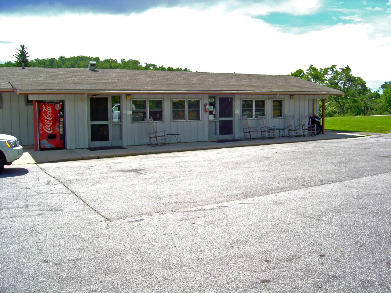
You’ll also see the remnants of a gas station at the Crabtree Meadows Visitor Center (MP 339.5).

Country-Store-at-Pisgah-Inn

The Country Store at the Pisgah Inn was once a gas station. Now it's just a break spot and service for the campground.

The Park Service removed the gas stations yeas ago. There is no longer gas available on the Blue Ridge Parkway nor are there any signs directing you to the location of the nearest gas at an exit.

The only place you’ll find a gas station visible from the Blue Ridge Parkway is at Raps’ Deli at Orchard Gap (MP 193.8) in southern Virginia.

With the limited range of motorcycles and long stretches of isolated road, knowing where the gas stations are is one of those things that takes a lot of the worry out of a Blue Ridge Parkway trip.

image-section-of-map

You'll find the closest gas to each Parkway exit listed on each of my Blue Ridge Parkway maps and descriptions of the best roads nearby.

It’s one of the most useful features I’ve included on my maps – closest gas to each exit along the 469 mile ride. Sometimes it’s just a few miles, other times it can be quite a distance. Knowing which way to go can keep you from getting stranded and help you make the best use of your time.

In keeping with the park service’s ethic of minimal signage, this legacy warning sign should be removed.

__________________________________________________________________
Wayne Busch

Wayne Busch - Cartographer

Total Rider Tech Logo

Learn Total Control

– Wayne Busch lives in Waynesville, NC, where he produces the most detailed and comprehensive and up-to-date motorcycle pocket maps of the Blue Ridge and Smoky Mountains to help you get the most of your vacation experience. See them here – AmericaRidesMaps.com

Wayne is an advanced motorcycle instructor for Total Rider Tech teaching Lee Parks Total Control Advanced Rider Courses. Isn’t it time you looked into advanced rider training to ride more confidently and safely? It can transform your mountain riding experience.  Total Rider Tech

____________________________________________________________________