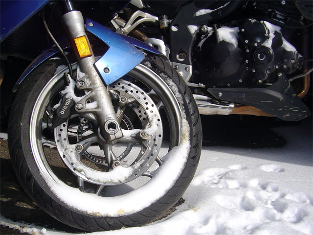
Another Cold Winter Day – Photo – Snow on motorcycles

Photo - Snow on motorcycles

Still too cold to ride. It will be better near the end of the week.

Blue Ridge Mountain skies are blue, but it’s barely in the 20’s. I’m going to wait for the weather to get above freezing before I go back out so it has a chance to melt any ice. The roads are salted, but up in the high parts there  can be spots where it’s too wet and shady to work well.

I’m making good progress on this new map revision, it’s almost done. I’ll still need a few more days to finish re-riding all the roads and catalog the new ones. In the mean time I’m getting it as close to done as possible.

Stay warm!

_______________________________________________________________________________

Wayne Busch
Wayne Busch – Cartographer
– Wayne Busch lives in Waynesville, NC, where he produces the most detailed and comprehensive and up-to-date motorcycle pocket maps of the Blue Ridge and Smoky Mountains to help you get the most of your vacation experience. See them here – AmericaRidesMaps.com 

Blue Ridge Parkway Snow Photos – 12-5-10 Soco Gap, NC

Riding was out of the question today – too icy. Instead, we took a hike on the Blue Ridge Parkway to enjoy the recent snow fall.

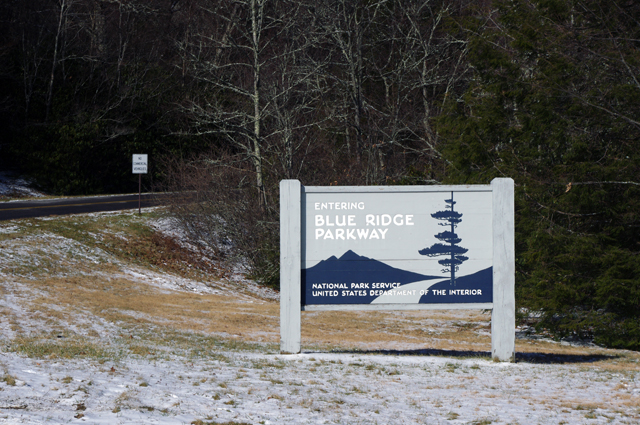
Photo - Parkway entrance at Soco Gap

The Blue Ridge Parkway access at Soco Gap on US 19 just west of Maggie Valley, NC

Soco Gap is the last (paved) Blue Ridge Parkway exit before you reach the south end of the parkway at Great Smoky Mountains National Park just north of Cherokee (13.3 miles).

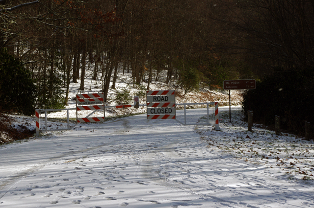
Photo - Parkway gates

Don't think the parkway goes unused when it's closed to traffic for the winter. Look at all those footprints. For the next few months it's a playground for hiking, biking, and skiing.

So far, it’s not much of a snow. There was a bit over an inch accumulated with a layer of ice underneath. If we get a couple more inches tonight, there’s a chance the Blue Ridge Parkway may be decent for cross country skiing tomorrow.  It’s just as likely to melt away.

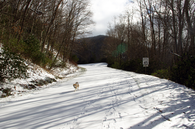
Photo - snow on the Blue Ridge Parkway

That's not a fox, it's one of my dogs - Sophie. I was surprised to see so much snow had stuck at just 4500 feet elevation.

It doesn’t feel cold enough for a significant amount of snow to accumulate. 1000 feet lower in elevation most of it is already gone. I wonder what it’s like up high? If we get more snow tonight, maybe I’ll go up higher tomorrow.

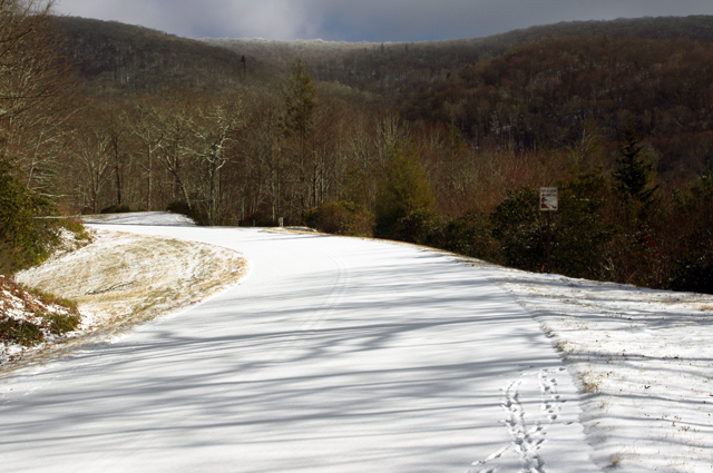
Photo - Snow on Blue Ridge Parkway

This section of the Blue Ridge Parkway makes a steady climb to reach the Waterrock Knob overlook in about 6 miles. That's a bit more than we wanted to walk today. The first overlook hasn't been cleared and there's no view.

We were fortunate to be out of the wind on this side of the mountain. We dressed expecting it, so we were quite comfortable when the extra protection wasn’t needed.

Photo - Blue Ridge Parkway Snow

The snow is like a ghost - you can see the yellow lines on the road. Rumor has it drunken ghosts wander the parkway at times - just look at those footprints!

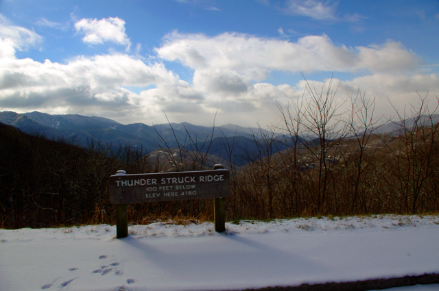
We walked as far as the Thunder Struck Ridge overlook at Milepost 455, about 1 mile.

Photo - Blue Ridge Parkway Snow

Thunder Struck Ridge is a great place for sunset photos.

It’s a faster walk going back – all down hill. The dogs love the Blue Ridge Parkway in the winter and so do Jackie and I.

Photo - dog with snow beard

That's my other dog Ajax wearing a snow beard. The parkway is their playground in the winter too.

_______________________________________________________________________________

Wayne Busch
Wayne Busch – Cartographer
– Wayne Busch lives in Waynesville, NC, where he produces the most detailed and comprehensive and up-to-date motorcycle pocket maps of the Blue Ridge and Smoky Mountains to help you get the most of your vacation experience. See them here – AmericaRidesMaps.com 

My Quick Visit to Paris – A City Full of Motorcycles

Obligatory Eiffel Tower Photo

Obligatory Eiffel Tower Photo

I was gone all last week. To celebrate one of my wife’s milestone birthdays I gave her the gift of a trip to Paris. Her birthday was in August. As she’d recently started new employment, we delayed leaving until she had some time at the job accumulated.

We flew into London, then took the high speed rail Eurostar train beneath the English channel crossing the rolling farmlands of France into the heart of the city of lights.

* This blog is supposed to have at least some relationship to motorcycling, – don’t worry I’m getting there.

We spent 3 days in the heart of the city. We had no set plan or itinerary. Each day we woke up, enjoyed a wonderful european breakfast spread, and walked out the door of our hotel. Afterwards the day just happened.

So what has Paris got to do with motorcycling? Apparently a lot! The city is awash in all sorts of 2 wheeled travel.
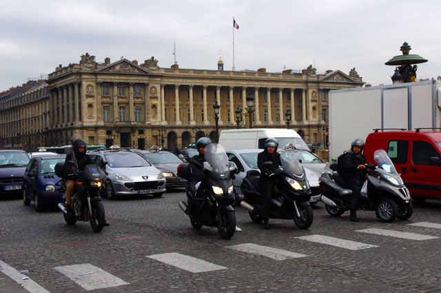
Photo - motorcycles in Paris

Paris is abuzz with motorcycle traffic. It may be one of the best ways to get around.

Photo - Arc de Triomphe

Arc de Triomphe

When you ride a motorcycle, you’re more aware of them. You have a deeper appreciation and your eye is drawn to anything with two wheels. Walking the streets of Paris you can’t help but be impressed with how many motorcycles tangle with the chaotic flow of city traffic.

At first take it appears the vulnerability of being on a motorcycle would make riding in this turmoil more risk than it’s worth. Streets are narrow, lined with cars, I don’t think they even bother with posting speed limit signs – it would be futile in any case.
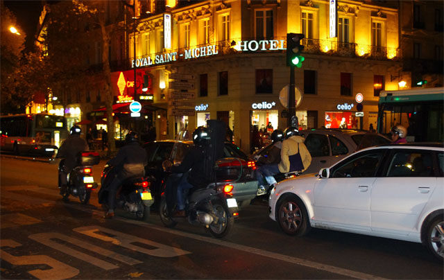
Photos - motorcycles at night in Paris

Night, day, it doesn't make much difference. When a light turns red, the motorcycles filter to the front.

Photo-Wayne-in-Paris

French food deserves its reputation.

The more I watched, the more I became convinced a motorcycle was the ideal means to take advantage of the opportunities the traffic held. Rapid acceleration, quick handling, and the capability to squeeze through most any gap make tackling the Paris traffic on a motorcycle look like a video game. It think it might be fun in some strange way.

Mopeds, Vespas, and scooters, you might expect.  They do make up a decent fraction of the two-wheeled traffic, but are not the bulk of it. There are bikes of all makes and sizes. I was surprised so many dual-sport bikes were present. A good number of big bikes, particularly BMWs, were fairly common. Most of the sport bikes I saw were moving. I even saw several Harley-Davidsons.
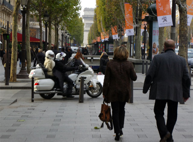
Photo - Motorcycle Champs Elysees

The Setting - the Champs Elyees. Arc de Triomphe in background. Motorcycle passenger on white Goldwing. White helmet. White fur coat. Motorcycling is not done exclusively for economic reasons.

Image-Mona-Lisa

Mona Lisa at Louvre

What a contrast to what I’m familiar with. It’s a whole different environment. Urban vs. rural. It’s almost a combat environment when it comes to driving.  Still, it wasn’t long before I was wishing I had access to a bike. Heck, I’ll give it a try. I’m confident I’ll survive.

It turns out Paris is a pretty easy place to be when you’re off the motorcycle. We walked a lot. We also took the Metro. We managed to do the whirlwind tour hitting many of the tourist spots without even trying. As expected, you can get by without knowing much french. Another day to explore more would have been nice. I think saying that is a sign of a successful vacation.

photo - motorcycle parked along a Paris Street

An assortment of motorcycles crowds any small open street corner. Parking is a treasured commodity.

Photo - Eiffel Tower

The Eiffel Tower viewed from atop the Arc D Triomphe

One day I’m going to make that motorcycle trip across Europe searching for the best rides. I’m convinced the Appalachian Mountains of the US have more to offer the motorcycle adventure tourer than all the Alps of Europe. This trip gives me more confidence about passing through the city of Paris on that future journey, though I’m not sure it will be needed. I may stay further south. It’s good to know I will enjoy revisiting Paris if needed. I may just make a detour.

The short vacation was a nice break from America Rides Maps. With Christmas coming orders pick up, then really start to grow once the new year comes. I’m playing the weather day by day, choosing the best days to get out. I need three good days out on the road to finish up the Hot Springs map revision. With luck, I’ll have the companion map done by the start of the new year.

The break did us both good. Now it’s back to work.

_______________________________________________________________________________

Wayne Busch
Wayne Busch – Cartographer
– Wayne Busch lives in Waynesville, NC, where he produces the most detailed and comprehensive and up-to-date motorcycle pocket maps of the Blue Ridge and Smoky Mountains to help you get the most of your vacation experience. See them here – AmericaRidesMaps.com 

Practicing for Motorcycling in Paris – I’m not ready (videos)

On Sunday I’m flying ‘cross the pond for a much needed vacation in Paris, France. I’m a little disappointed to miss the Paris Motorcycle show, but I’ll try to make up for it as I can. I’ve been looking for info so I can be prepared for the experience, but after reviewing these videos I’m not quite sure I’m ready;

Obviously, I’m going to need to brush up on my traffic skills to fit in. From the looks of this next video, tires must be really expensive – they tend to use just one at a time in the French City.

Maybe its time to rethink this. I only know a couple French words – gendarme and bastille come to mind.  It’s my first visit. Maybe I’ll just stick to the motorcycle taxis for now, but then I’ve still got a couple days to practice up.

PS – you might want to stay off the roads this week or at least pull over if you see a crazy biker approaching with a beret taped his the helmet.

See ME in Road Bike Magazine Sept Issue

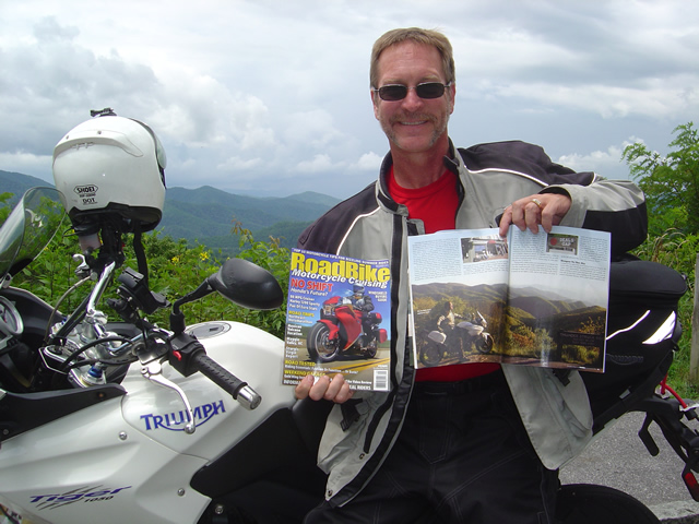
Photo - Wayne from America Rides Maps with copies of Road Bike Magazine

A nice feature article in Road Bike Magazine by Neal Bayley and Jim Miller

September, 2010 issue of Road Bike Magazine just hit the stands and my smiling face graces the pages. Look for the “Maggie Valley Mayhem” article.

wayne@americaridesmaps.com

http://AmericaRidesMaps.com

_______________________________________________________________________________

Wayne Busch

Wayne Busch - Cartographer


– Wayne Busch lives in Waynesville, NC, where he produces the most detailed and comprehensive and up-to-date motorcycle pocket maps of the Blue Ridge and Smoky Mountains to help you get the most of your vacation experience. See them here – AmericaRidesMaps.com
 

12 Classic Deals Gap Motorcycle Rides now at Thunder Mountain

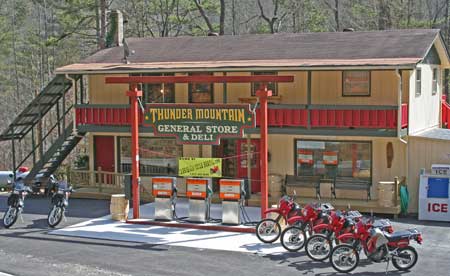
Photo - Thunder Mountain Country Store and Deli

Photo from Thunder Mountain Country Store and Deli - http://thundermountainnc.com/

America Rides Maps newest map, 12 Classic Deals Gap Motorcycle Rides, is now available at the Thunder Mountain Country Store and Deli located at the Robbinsville end of the Cherohala Skyway. You can’t miss it as you carve through the tight curves at the start of the the Cherohala. Say hello to Paul and Tina when you stop in for gas or refreshments on your motorcycle ride.

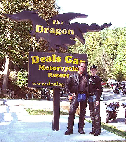
Now that the rock slide has been resolved on the Dragon at Deals Gap, the motorcycle traffic is really picking up again and riding the Cherohala loop is one of the prime attractions for motorcycle touring. Tennessee’s version of the Blue Ridge Parkway, it’s a very similar motorcycle ride with it’s high vantage points and overlooks, paved pull-outs, and quality pavement. After the Dragon, it’s the most popular motorcycle ride in the area and well worth the time.

Be aware enforcement is heavy right now with 8 troopers in the Dragon yesterday. Don’t be silly or you WILL pay the price. With a heavy weekend predicted, I’d suspect they’ll be out in force. Also be careful – I regret to relate there was a motorcycle fatality on the Cherohala yesterday, and the passenger was airlifted to Knoxville. I don’t know the details, it was unfolding while I was there.

Blue Ridge Parkway Motorcycle Road Construction Report / photos 7-14-10

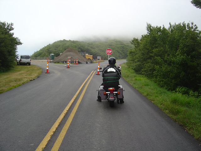
Photo - stopped on the Blue Ridge Parkway

A short delay between Mt. Mitchell and Craggy Gardens near the roadwork.

I took a motorcycle ride through the North Carolina section of the Blue Ridge Parkway to confirm my suspicions this morning. Even with the heavy fog up high it was clear that the bulk of the Blue Ridge Parkway paving work in North Carolina has been completed. While work continues, the major roadwork between Asheville and Mt. Mitchell is done and you may expect smooth new pavement on your next motorcycle ride.

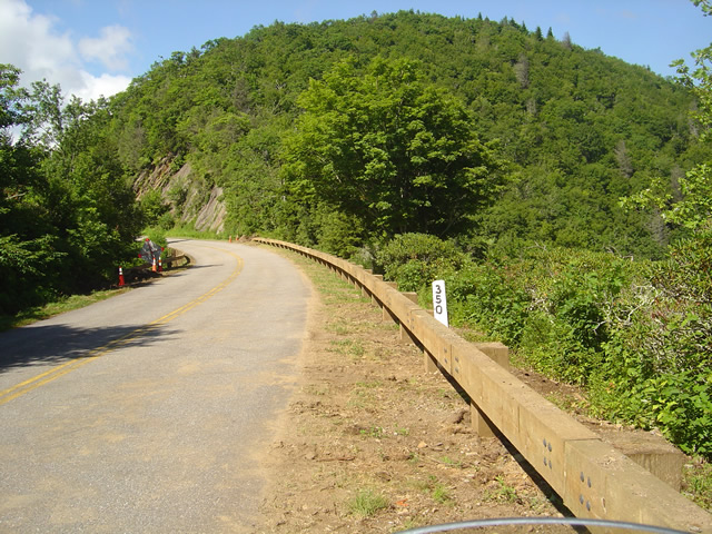
Photo - section of new Blue Ridge Parkway guardrail

The new wooden guardrails are much heavier and a little higher than the ones they replace

The focus has now shifted to the margins of the road as the drainage is being cleaned and groomed, trees are being trimmed, and most significantly, new wooded guardrails are being installed. You will hit short delays when you come upon this work. North of Mt. Mitchell State Park you’ll still hit some bumpy areas of road. The worst of the pot holes are being filled and patched.

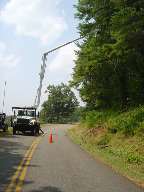
Photo - tree trimming on the Blue Ridge Parkway

The most extensive tree work is on the Virginia side of the border where much of the winter damage is yet to be removed.

Further north on the sections of the Blue Ridge Parkway near the North Carolina and Virginia border, you’ll still run into sections being paved, though nothing as extensive as what was done to the south.  On the Virginia side of the border, the paving is in short sections and along the edges of the road. I’m hoping this is just laying down a base for a fresh coat of pavement over the top as some of the patched areas dip lower than the untouched sections of road and you’ll notice the drop. I’m impressed with the stone work being done to construct the drains.

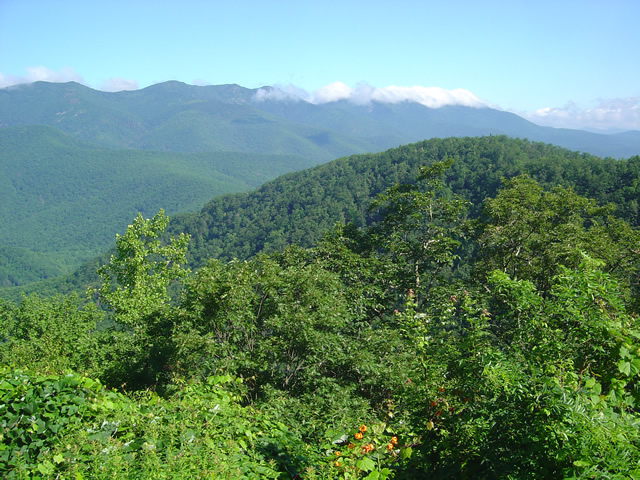
Photo - Clouds hug the tops of the black Mountains this morning

Take time to pause and look at the Black Mountains, some of the most rugged and beautiful peaks in the south. Clouds hugged the tops this morning.

Overall, delays are brief, you’ll hit more in Virginia right now, but the work that has been done was needed and welcome. No major changes at the rock slide area south of Asheville – one lane remains open controlled by a traffic signal.

Wayne from America Rides Maps

Tail of the Dragon Closed for Months? Motorcycles Should Go Elsewhere.

Photo - Smoky Mountain Rider and BMW Girl at the Tail of the Dragon

Smoky Mountain Rider and BMW Girl at the Tail of the Dragon

The rumor mill is churning and I’m trying to sort through it all, but this much seems official. Tennessee has closed the Tail of the Dragon (US 129 at Deals Gap) from the rock slide are to the state line. Even though North Carolina offered to provide traffic enforcement, Tennessee has declined the offer and closed the most popular motorcycle ride in the region until the situation is resolved.

How long will it remain closed, I’ve seen various estimates. Initially one lane was reopened at the site of the slide, but closed the next day. Then there was talk it would be reopened by today. Now the rumors emerging are indicating it will be two months as blasting and bolting are required to stabilize the site. I’ve not seen an official proclamation yet.

I’d like to again urge you re-evalute your motorcycle vacation planning to explore other areas in the surroundings. With all the road closures currently in effect, the traffic loads are shifting onto what few back roads remain and the quality of motorcycle riding in this area will be seriously diminished.

The good news is there are a wealth of fabulous alternatives, hundreds of miles of great two lane uncongested twisty mountain back roads in the immediate area for your motorcycle touring enjoyment that are too often overlooked due to the Dragon’s notoriety. You can get free advice and recommendations on your motorcycle vacation plans by contacting http://americaridesmaps.com. I will be following up with suggested alternatives.

Add Another Great Road to The NC list

Photo – Jackie (my wife) on the newly completed section of NC 281

I’ve been watching this road for a while. When my friend at Gryphon Bikes informed it the he’d ridden it the other day, I had to go check it out for myself. NC 281 from the junction at US 64 near Lake Toxaway northwards is now completed to the point I’m adding it to the list of great rides.

I discovered NC 281 years ago. This portion of NC 281 runs between US 64 near Cashiers, north until it joins with NC 107 at Tuckasegee. The section around the hoity-toity community of Lake Toxaway has been paved and in use for years. The other end of the road, near Tuckasegee, was improved and widened years ago. It makes a climb through a series of high speed sweeping turns that’s a lot of fun. Once you finish the climb, it starts to descend passing though the tiny mountain town of Wolf Mountain.

From there, the road enters a series of very tight corners, one after another that keep you on the edge of your tires for several miles. Round a curve, climb a bit, crest a hill, and suddenly the pavement ends and you are on a graded forest road, rutted and loose, bumpy, steep, and a challenge on road tires. So it used to be.

A couple years ago, the DOT started improving the road. More and more of it got paved, but one last section remained. It required a small bridge be built to cross a stream and that took forever to complete. When I last passed through, it was so close to being paved I predicted and included that on the map “The Best Rides South of Great Smokey Mountains – EAST”. While the road is still getting some work, the paving is done and it’s rideable, just in time for fall. I’ll be updating that map to reflect the change.

The completion of this road is significant in that it opens up a wealth of loop rides with the surrounding roads in the area. In fact, this may now be one section of my new favorite loop ride which I’ll describe in another post. It’s not for the faint hearted, and if you’re a mid-western cruiser guy who’s gonna freak if the floorboards scrape, this may not be the route for you. However, if you’re looking for something challenging, or confident enough to ride within your limits, add this road to your list of fall rides. You’ll be rewarded with pockets of fall leaf color that are truly spectacular in addition to a ride you’ll remember.

Wayne@americaridesmaps.com

>> Go To America Rides Maps.comhttp://americaridesmaps.com

Notes From The Road – Virginia – 7/17/09

Photo – Virginia Road

Surprisingly productive day. I didn’t expect to find so many great roads in this area, but they’re here.

I covered about 332 miles in a 12 hour day. That’s not a lot of miles but it is a testament to the quality of the roads. The majority of the rides were on isolated back roads, many so remote they are devoid of any markings – no center line, just pavement. The area is full of them. It took a lot of riding to identify the best.

Photo – Virginia Road

The rain that moved through last night continued to follow me on and off through the day. I got my first good soaking around 9:30 AM. It came down hard and heavy for a while, then eased off to spit on and off until almost mid-day. As I moved south I moved out of it.

For a while the sun came out and the heat came on. Things were going well until around 4:30. I was headed south from Radford, VA. on a particularly nice stretch of road when all hell broke loose. I saw it coming, but didn’t realize how severe it was until it was on me. The TV is talking about a potential tornado touchdown in the area. It was a least one of those “micro-bursts”.

Photo – Parked along a scenic riverside on one of the routes.

The wind picked up enough to blow me around the road, huge branches were crashing down in the road and I was concerned a tree might fall on me. I ran over several large branches and as soon as I broke free of the tree cover the rain got so heavy I couldn’t see 15 feet in front of me. I caught a glimpse of an abandoned country store at the roadside, circled back, and pulled the front end of the bike up under the porch until things settled down. In 15 minutes the sun was shining again.

A lot the time was spent south of the border – in North Carolina. I found little there as the mountains have veered north and you’re getting out into the Piedmont. There are still a few isolated outcroppings such as Pilot Mountain and the area around Hanging Rock State Park is very good. There are also some interesting areas still further east, but they are off the map so I’ll have to come back and visit them on my own time.

Photo – Dam!

While the mountains which run through this section of Virginia are not as high and impressive as those found further north and south, the entire area is very hilly. It’s the roads which thread through these hilly portions that hold some real gems. Some of them are amazingly tight and technical, when you get up on a hilltop you get views that rival the Blue Ridge Parkway, and there are numerous streams and rivers to add to the scenery.

It’s a lot different from North Carolina, Tennessee, and Georgia and I’ve had to adjust to it. Still, you know a good road when you ride it, and you know a great road from a good road. I think I’ve found several I can recommend.

Wayne@americaridesmaps.com

>> Go To America Rides Maps.com – http://americaridesmaps.com/