True History – How The Blue Ridge Parkway Was Stolen

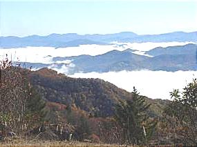
photo - view from Waterrock Knob, one of the highest sections in North Carolina

Morning clouds blanket the valleys in this view from Waterrock Knob in North Carolina

The concept of the Blue Ridge Parkway was to build a scenic connection between Shenandoah National Park in Virginia and Great Smoky Mountains National Park in North Carolina. Even before it was approved by Congress, controversy reigned over the route and clouded the possibility the nations favorite ride would ever be built.

There were strong proponents for building the scenic highway from three states – Virginia, North Carolina, and Tennessee. Originally, they more or less worked together to get the idea launched. Virginia’s route was fairly clear. It would course south from Shenandoah National Park following the highest ridges of the Smoky Mountains. The problem came on which way to go once the border with North Carolina was reached. Great Smoky Mountains National Park is divided right down the middle between Tennessee and North Carolina sharing equal portions in each state. In which state would the parkways southern end of this now classic ride reach Great Smoky Park?
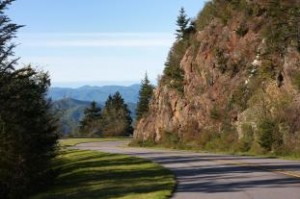
Photo - a view of the Blue Ridge Parkway

Nothing in Tennessee can compare to the views from the North Carolina section of the Blue Ridge Parkway

Tennessee argued the route should be shared between the three states arriving on the north side of Great Smoky Mountains National Park about 40 miles south of Knoxville. North Carolina had different ideas, and a powerful lobby arose from the city of Asheville who wanted the road to pass near it. Reeling from the depression, Asheville felt it’s future relied on tourism and without the parkway, it would would not survive.

Two routes were laid out. North Carolina proposed following the highest passages through the tallest mountains in the east, a route which would not only maximize the views, but come right by Asheville. Tennessee chose a route further north which included both mountains and scenic valleys highlighting various features along the way. It would leave Asheville, the only city of size in the Carolina mountains, in isolation.

Right up to the last minute, it appeared the three state route would prevail. In the end though, it was the powerful and well connected proponents from Asheville who convinced the legislature to favor the route which avoided Tennessee entirely thereby stealing the road from Tennessee.

Riding the parkway it’s easy to see the right choice was made. The highest, most scenic and breathtaking views are found in the North Carolina sections both north and south of Asheville. What a different park we would have now had it been otherwise.

Rock Slide on US 64 near Cleveland, Tennessee

Yet another rock slide has occurred in the southern mountains, this time closing a section of roadway on US 64 in the Ocoee River Gorge of Polk County, Tennessee. A series of slides has blocked both lanes at mile 17.4 near the Ocoee 2 Dam. As of yet, it remains unstable as the remnants of rain from tropical storm Ida play out over the southern mountains.

Photos and more details can be found at this link;
http://www.timesfreepress.com/news/2009/nov/11/rock-slide-shuts-down-us-64-through-polk-county/?local

TDOT’s recommended detour route from Chattanooga and Cleveland toward the Copper Basin or McCaysville, Ga., is:

North on I-75 to Exit 60 at Sweetwater, then south on State Route 68 to Ducktown.

From North Carolina;

Take U.S. 74 to Ducktown and go north on SR 68. Traffic is being rerouted along State Route 68 through Tellico Plains and Sweetwater, Tenn.

The detour more than doubles the trip time between Copperhill and Cleveland.

Wayne@americaridesmaps.com

>> Go To America Rides Maps.comhttp://americaridesmaps.com

Scenic Motorcycle Rides – Backbone Rock, TN

photo - motorcycle cruises through Backbone RockI went back to Virginia this weekend to revisit and explore some of the sights I’d passed while mapping the area

I’m pretty much all business when mapping – I only stop for three things; gas, to take notes, and when “nature” forces me to do so. Eating is a luxury typically left for the evening to make the most of the time on the road. This trip was to go back and savor some of the gems I’d just blown by previously.

One of my favorite loop rides is found near the point where North Carolina, Virginia, and Tennessee meet, a 103 mile jaunt that takes you on some of the twistiest and most scenic roads. It’s listed on America Rides Map #4 – “Great Roads Near Boone, Banner Elk, and Blowing Rock.

Heading south from Damascus, Virginia, on SR 133, you soon enter the National Forest in Tennessee and signs for Backbone Rock Park start appearing along the road. Round a curve and you find yourself zipping through the quick yet dramatic tunnel through Backbone Rock.

I stopped in to investigate.

The Empire Mining Company blasted through Backbone Rock in 1901 to lay train tracks for the Tennessee Lumber Company. Long gone, the rail bed became the roadbed which continues on towards Mountain City.

The ridge is about 75 feet high and 20 feet thick, though it narrows near the top. There is a steep trail from the parking area on the right just after you pass through the rock, though if you have any aversion to heights and walking near the edge of a cliff, you’ll never make it to the section of rock which straddles the road.

There are several hiking trails, picnic tables and campsites, a waterfall is about 0.4 miles on a foot trail. The area is popular for fishing and kayaking.

_______________________________________________________________________________

Wayne Busch

Wayne Busch - Cartographer

Total Rider Tech Logo

Learn Total Control

– Wayne Busch lives in Waynesville, NC, where he produces the most detailed and comprehensive and up-to-date motorcycle pocket maps of the Blue Ridge and Smoky Mountains to help you get the most of your vacation experience. See them here – AmericaRidesMaps.com

Wayne is an advanced motorcycle instructor for Total Rider Tech teaching Lee Parks Total Control Advanced Rider Courses. It’s time you looked into advanced rider training to ride more confidently and safely, it will change your mountain riding experience. It worked so well for me I became an instructor! Total Rider Tech

America Rides Map #4 – “Great Roads Near Boone, Banner Elk, and Blowing Rock

_______________________________________________________________________________