Blue Ridge Parkway Motorcycle Road Construction Report / photos 7-14-10

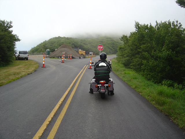
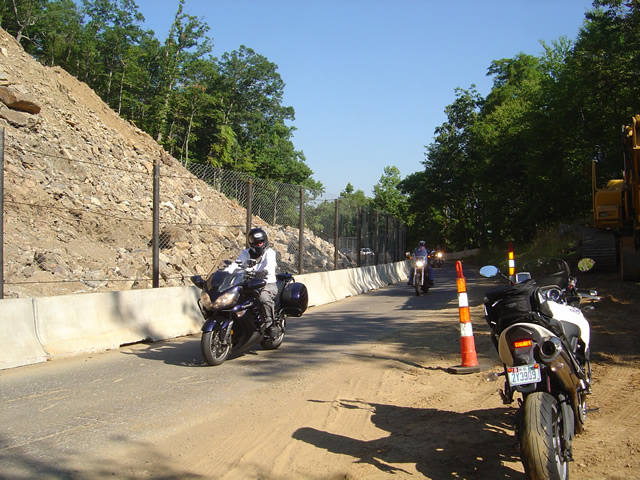
Photo - stopped on the Blue Ridge Parkway

A short delay between Mt. Mitchell and Craggy Gardens near the roadwork.

I took a motorcycle ride through the North Carolina section of the Blue Ridge Parkway to confirm my suspicions this morning. Even with the heavy fog up high it was clear that the bulk of the Blue Ridge Parkway paving work in North Carolina has been completed. While work continues, the major roadwork between Asheville and Mt. Mitchell is done and you may expect smooth new pavement on your next motorcycle ride.

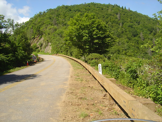
Photo - section of new Blue Ridge Parkway guardrail

The new wooden guardrails are much heavier and a little higher than the ones they replace

The focus has now shifted to the margins of the road as the drainage is being cleaned and groomed, trees are being trimmed, and most significantly, new wooded guardrails are being installed. You will hit short delays when you come upon this work. North of Mt. Mitchell State Park you’ll still hit some bumpy areas of road. The worst of the pot holes are being filled and patched.
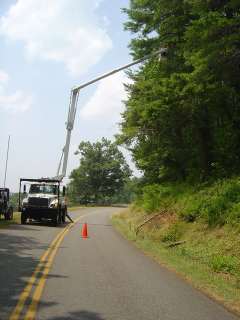
Photo - tree trimming on the Blue Ridge Parkway

The most extensive tree work is on the Virginia side of the border where much of the winter damage is yet to be removed.

Further north on the sections of the Blue Ridge Parkway near the North Carolina and Virginia border, you’ll still run into sections being paved, though nothing as extensive as what was done to the south.  On the Virginia side of the border, the paving is in short sections and along the edges of the road. I’m hoping this is just laying down a base for a fresh coat of pavement over the top as some of the patched areas dip lower than the untouched sections of road and you’ll notice the drop. I’m impressed with the stone work being done to construct the drains.
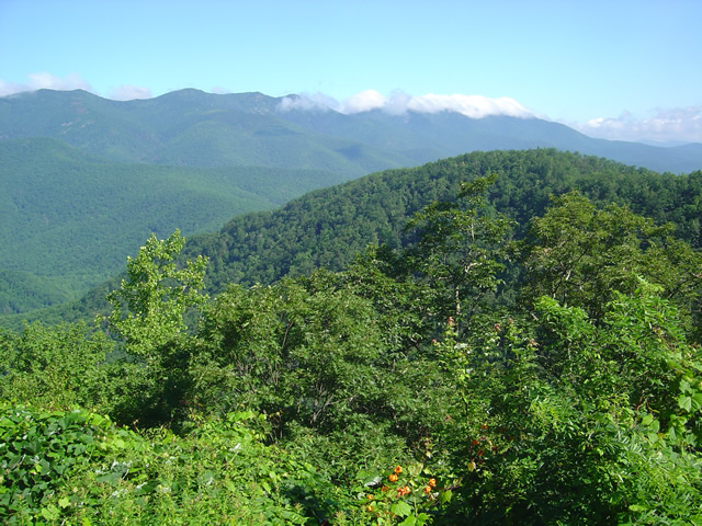
Photo - Clouds hug the tops of the black Mountains this morning

Take time to pause and look at the Black Mountains, some of the most rugged and beautiful peaks in the south. Clouds hugged the tops this morning.

Overall, delays are brief, you’ll hit more in Virginia right now, but the work that has been done was needed and welcome. No major changes at the rock slide area south of Asheville – one lane remains open controlled by a traffic signal.

Wayne from America Rides Maps

Blue Ridge Parkway Rockslide – Photos / Info – July 4, 2010

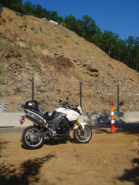
Photo - view of the rock slide

Once a steep hillside giving way, the rock slide is now being reshaped into a more gradual slope near milepost 400 on the Blue Ridge Parkway.

My July 4th holiday was one of those exquisite weekends with ideal weather, clear skies, and lots of time on the motorcycles. I managed to hit four states, rode several of the most notable routes, discovered some new rides, and treated my riding partners to at least one America Rides Maps road they’d never seen before that they will surely remember. While I touched the Blue Ridge Parkway several times, the holiday traffic took much of the fun out of it for me and I stuck mostly the little known hidden two lane mountain back roads I know so well. Finally, Monday evening, I rode up to view the newly opened section at the rock slide south of Asheville.

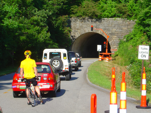
Photo - traffic waits on the parkway

Waiting to go at Ferrin Knob Tunnel #1 south of the work area - A set of temporary traffic lights control passage through the single lane open at the site of the rock slide cleanup.

One lane is open at the Blue Ridge Parkway section near milepost 400 between Asheville and Mt. Pisgah. Passage is controlled by a set of temporary traffic lights on either side of the work area. They are programed to change about every 5 minutes so delays are tolerable though I’m sure the lines got pretty long during the peak of the weekend. Concrete barriers and a chain fence separate the tourists from the workers and prevent too many boulders from tumbling down onto the road.

Photo - the single open lane on the parkway

A concrete barrier and high fence help protect from boulders and debris which might come down from above. It's a short ride past.

They’ve removed one heck of a lot of rock from up high on what was previously a pretty vertical section of hillside. It now slopes more gradually, though there’s enough loose rock and soil above to make one hesitant to linger below. There’s still quite a bit to haul out and stabilize before the second lane is opened in September, but it will come.

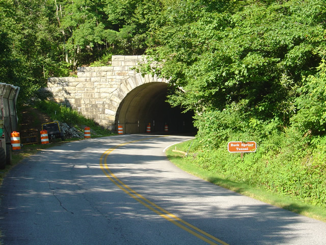
photo- work zone near Buck Spring Tunnel

Another set of traffic lights is being used near work on the Buck Springs Tunnel just north of the Pisgah Inn.

There is a second work area at the Spring Gap Tunnel near milepost 408 just north of the Pisgah Inn. A set of temporary traffic lights also does duty here as the tunnel work progresses. It doesn’t appear to be too extensive and I wouldn’t think it will last long, but count on another delay.

This is great news, and I’m glad to see it finally come to pass. For the first time in more than 18 months the Parkway is open from end to 469 mile long end. Enjoy!

wayne@americaridesmaps.com

Motorcycles in the Fog at Fontana Lake Near Deals Gap

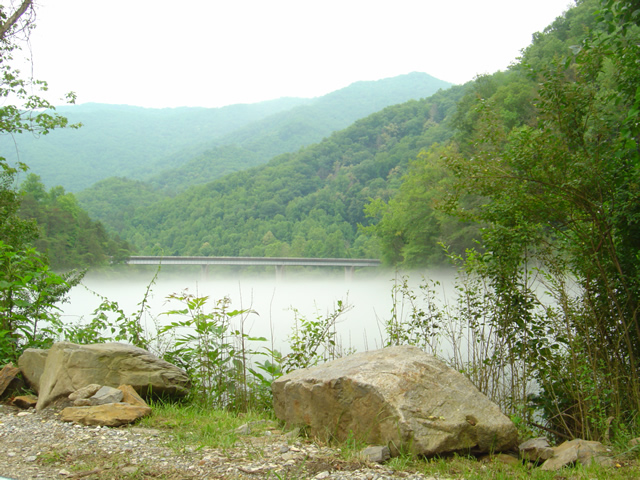
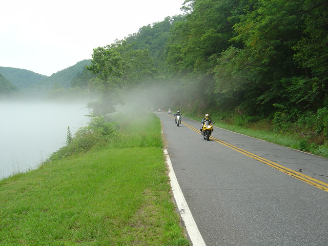
Photo - Fontana Lake draped with fog

The bridge across Fontana Lake on NC 28 floats above a cloud of fog over the chilly water on a hot day.

Hot, overcast, occasional spits of rain, it was still a nice day to hop on the motorcycles and cruise over to Deals Gap at the southwest corner of Great Smoky Mountains National Park. When the summer heat comes on it’s not unusual for a fog to form over the chilly waters of Fontana Lake as you near the Dragon.

Photo - Fog on Lake Fontana

The fog hugs the waters on hot days.

I shot a few photos on NC 28 to capture the phenomenon. Maybe the clouds put off some of the usual weekend crowds, there were relatively few motorcycles out for a Saturday. There were times the Dragon was quiet for a minute or more, a good day to pay a visit.

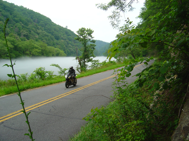
Photo - Motorcycle on NC 28 at Lake Fontana

A motorcycle cruises the lake shore on NC 28

Maybe the sportier riders stayed closer to home today. The Harleys, Gold Wings, Beemers, and other dressers  were out in force on the twisty roads at Deals Gap. It was a good  day for motorcycle touring.

Photo - Motorcycles along foggy Fontana Lake

Rarely does the mist rise high enough to have much effect on the roadway, at least in the middle of the day.

The lake section of NC 28 bordering Great Smoky Mountains National Park is one of the most beautiful, but it’s the curvy and twisty parts that make it one of the best rides in the Smoky Mountains. I hope you get to see sights like these on your next motorcycle vacation.

For the best maps of motorcycle rides the area look no further than America Rides Maps .

http://americaridesmaps.com

Notes from the Road – Eateries, The Hardware Co., Hillsville, VA

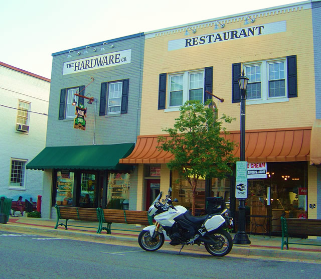
Photo - The Hardware Co. Restaurant, Hillsville, Virginia

Photo - The Hardware Co. Restaurant, Hillsville, Virginia

As I’m out on the road doing the explorations for America Rides motorcycle maps, I try to find good places I can recommend. I visited this one several times and think it’s one you’ll like to visit on your motorcycle vacation. It’s 10 minutes more or less from the Blue Ridge Parkway on VA 52 from the Fancy Gap exit in the southern Virginia town of Hillsville.

While there is a historic section in Hillsville where this restaurant serves as a centerpiece, the town spreads along the main roads which all come together in the small town, including Interstate 77 and US 221. I found myself staying here on several occasions as there are a large number of motels near the Interstate. It makes for a good place to not only lay over on a Blue Ridge Parkway vacation trip, but also to tour the surprising number of great motorcycle rides which course through the surrounding countryside. It became the hub for one of my most extensive maps.

The restaurant resides in a building which was originally a hardware company, hence the name.The food is good, sometimes great. I’ve always enjoyed my meal, a fine compliment to the great rides that lead you here. There’s a nice pub to get a cool one and live music on some evenings. If you’re passing through on a warm day or just looking for a treat, right next door is an old time soda fountain where you can get some pretty darned good ice cream and sodas.

You can check them out online at http://www.hardwarecompany.net/ . The street address is:

The Hardware Co. of Hillsville
508 North Main Street
Hillsville, VA
Telephone: 276-728-265
Email: info@hardwarecompany.net

Scenic Motorcycle Rides – Backbone Rock, TN

photo - motorcycle cruises through Backbone RockI went back to Virginia this weekend to revisit and explore some of the sights I’d passed while mapping the area

I’m pretty much all business when mapping – I only stop for three things; gas, to take notes, and when “nature” forces me to do so. Eating is a luxury typically left for the evening to make the most of the time on the road. This trip was to go back and savor some of the gems I’d just blown by previously.

One of my favorite loop rides is found near the point where North Carolina, Virginia, and Tennessee meet, a 103 mile jaunt that takes you on some of the twistiest and most scenic roads. It’s listed on America Rides Map #4 – “Great Roads Near Boone, Banner Elk, and Blowing Rock.

Heading south from Damascus, Virginia, on SR 133, you soon enter the National Forest in Tennessee and signs for Backbone Rock Park start appearing along the road. Round a curve and you find yourself zipping through the quick yet dramatic tunnel through Backbone Rock.

I stopped in to investigate.

The Empire Mining Company blasted through Backbone Rock in 1901 to lay train tracks for the Tennessee Lumber Company. Long gone, the rail bed became the roadbed which continues on towards Mountain City.

The ridge is about 75 feet high and 20 feet thick, though it narrows near the top. There is a steep trail from the parking area on the right just after you pass through the rock, though if you have any aversion to heights and walking near the edge of a cliff, you’ll never make it to the section of rock which straddles the road.

There are several hiking trails, picnic tables and campsites, a waterfall is about 0.4 miles on a foot trail. The area is popular for fishing and kayaking.

_______________________________________________________________________________

Wayne Busch

Wayne Busch - Cartographer

Total Rider Tech Logo

Learn Total Control

– Wayne Busch lives in Waynesville, NC, where he produces the most detailed and comprehensive and up-to-date motorcycle pocket maps of the Blue Ridge and Smoky Mountains to help you get the most of your vacation experience. See them here – AmericaRidesMaps.com

Wayne is an advanced motorcycle instructor for Total Rider Tech teaching Lee Parks Total Control Advanced Rider Courses. It’s time you looked into advanced rider training to ride more confidently and safely, it will change your mountain riding experience. It worked so well for me I became an instructor! Total Rider Tech

America Rides Map #4 – “Great Roads Near Boone, Banner Elk, and Blowing Rock

_______________________________________________________________________________

Motorcycle Waterfall Tour

[

]

This video shows a dozen or so of the roadside waterfalls included on America Rides Maps “The Best Roads South of Great Smoky Mountains National Park – EAST“.

When combined with the companion map “The Best Roads South of Great Smoky Mountains National Park – WEST“, nearly 20 roadside waterfalls can be enjoyed on your rides through the mountains of North Carolina.

Neither of these maps is purposely designed to focus on waterfalls, rather they guide you to the most exciting and beautiful undiscovered back roads which wind throughout the wild woods of the mountains just south of our nations most popular national park. There are plenty of other spectacular sights to see. Visit America Rides Maps to discover thousands of miles of two lane mountain roads packed with scenery, devoid of traffic, and more!


Wayne Busch - AMERICA RIDES MAPS

Wayne Busch – AMERICA RIDES MAPS

Wayne@americaridesmaps.com

>> Go To America Rides Maps.comhttp://americaridesmaps.com

Sights From The Road – Alligator Rock

The jaws of Alligator Rock loom ominously over the roadway on NC 215 not far from Rosman, NC., near the point where NC 215 makes a brief intersection with US 64. Beleive it or not, it’s easy to miss Alligator rock as you zip beneath it – this section of road is very tight and twisty and your attention is more likely to be on the pavement, not the scenery above.

This view is from the north side and there is little to warn you it’s about to appear as you round the bend. If you are approaching from the south side, look for the stone entrance sign that tells you that you are entering the Pisgah National Forest. Alligator rock is on the next bend in the road.

NC 215 is full of spectacular sights and it’s long and twising climb up to the Blue Ridge Parkway then down again to approach Waynesville and Canton is one of my favorite rides. There are roadside waterfalls, some obvious, some hidden, inspiring long range views from the higher elevations, and some of the most fabulous serpentine motorcycle riding to be found in the mountains of North Carolina. This is another one of the great roads featured on America Rides Maps NC001 – The Best Roads South of Great Smoky Mountains National Park – EAST.

I’ve heard a rumor there is a possibility NC215 is going to be re-engineered sometime in the future. It would certainly be nice to see it get a fresh coat of pavement, there are sections that are really starting to show their age, particularly up high. Unfortuantely, it seems they may try to relax some of the curves a bit and Alligator Rock will be one of the casualties of the plan. I’m hoping the economy forces them to cut it back a bit and just freshen up the tarmac. Leave the curves just as they are, it’s close to perfection now.

Wayne@americaridesmaps.com

>> Go To America Rides Maps.comhttp://americaridesmaps.com

Sights From The Road – The Bear Barn

– 5/7/2009
One of the greatest things about getting off the main roads is the secret sights revealed, some beautiful, some awe inspiring, others curious. The mountains are full of old barns, enough to keep any “old barn aficionado” busy with his camera for the rest of his days. This one was unique though as it was also the curing rack for these couple of bear skins. They hung there for quite some time though they finally came down.This photo was taken from one of the roads from America Rides Maps – NC017 “The Best Roads South of Great Smoky Mountains National Park – EAST”. It’s just 10 minutes from the Blue Ridge Parkway, though you’d never know this hidden road was there looking down from above. That’s the beauty of my maps – they’ll lead you to sights and places few ever experience and put you on the most enjoyable roads found anywhere.

Wayne Busch - AMERICA RIDES MAPS

Wayne Busch – AMERICA RIDES MAPS

Wayne@americaridesmaps.com

>> Go To America Rides Maps.com http://americaridesmaps.com