Motorcycle Rides – Sights from the Road – Georgia

  • 9/30/2019

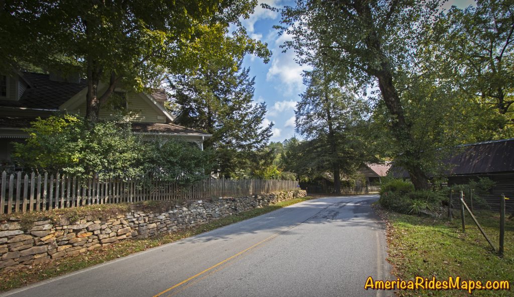
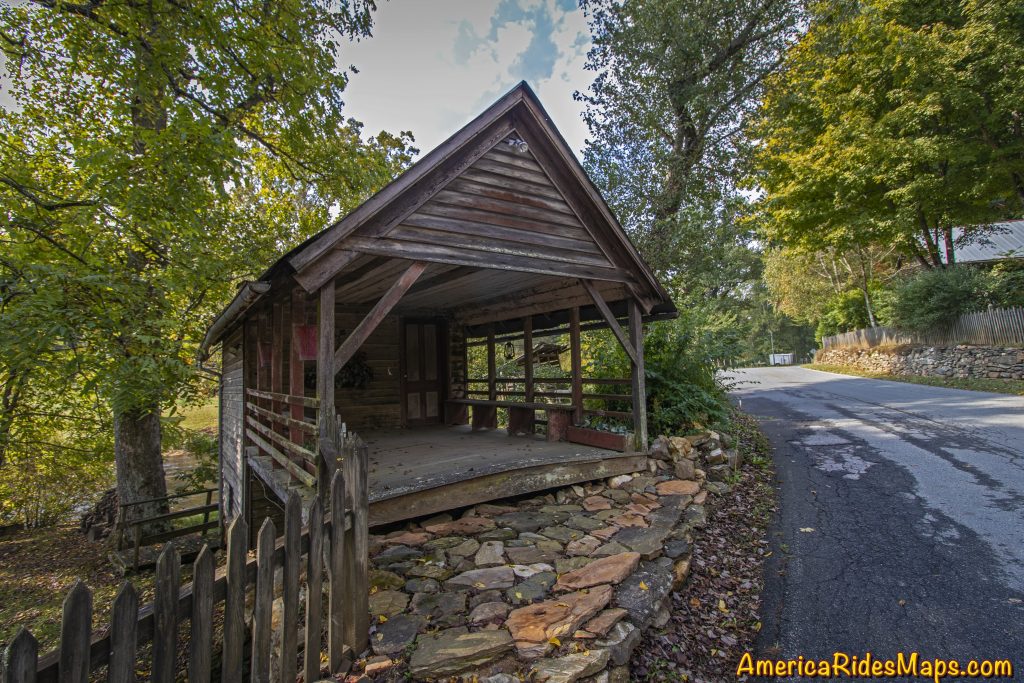
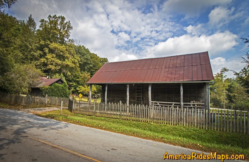
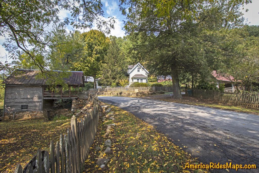
The road narrows to cut through this historic farm in Dial, Georgia.

Roadside Farm in Dial, GA

Roadside Farm in Dial, GA

Hearing a car approaching I’d stepped to the grass to let it pass. Though I’d been through several times before, something today made me appreciate this spot along the Toccoa River where the road narrowed to thread through the old wooden buildings of the homestead. The approaching car slowed then stopped, the window down.

“Beautiful, isn’t it?” came a voice from the driver.

Roadside Farm in Dial, GA

Roadside Farm in Dial, GA

“I used to manage this farm” the woman in the car said to me. Her broad smile conveyed her pride.

Roadside Farm in Dial, GA

Roadside Farm in Dial, GA

“Yes, it is beautiful, I just had to stop and take a few shots” I said, resisting the urge to snap a candid photo of her. It just didn’t seem polite.

She nodded acceptingly then added – “Watch out, there’s some crazy folks on this road”.

I smiled and added “I’m probably one of them”.

Roadside Farm in Dial, GA

Roadside Farm in Dial, GA

She laughed then continued on her way.

One of the most enjoyable things about cruising the backroads on your motorcycle are the wonderful sights and beautiful views you come across. The hundreds of roads that weave through the southern Blue Ridge Mountains hold many secrets. There are little spots here and there that touch us in special ways, appeal to things deep within us, reward us with emotions of appreciation and admiration. Don’t let them all pass by, savor the good ones.

Dial Road Interactive Map

Wayne Busch - AMERICA RIDES MAPS

Wayne Busch – AMERICA RIDES MAPS

Article by Wayne Busch, America Rides Maps

We produce detailed maps of the best roads to enjoy on your motorcycle travels in the Blue Ridge and Allegheny Mountains. Get the maps at America Rides Maps.com
Source: America Rides Maps Blog

A Motorcycle Ride in Coal Country, WV

  • 11/12/2019

Our motorcycle trip to West Virginia to explore the mountain back roads. The focus was on the south tip of the state – Coal Country.

Who: Jackie Busch, Wayne Busch, Yermo Lamers
What: Motorcycle Trip
When: October 20 – 23, 2018
Where: Glade Springs, WV, Blowing Rock, NC, Waynesville, NC
Why: Explore Roads in Southern West Virginia
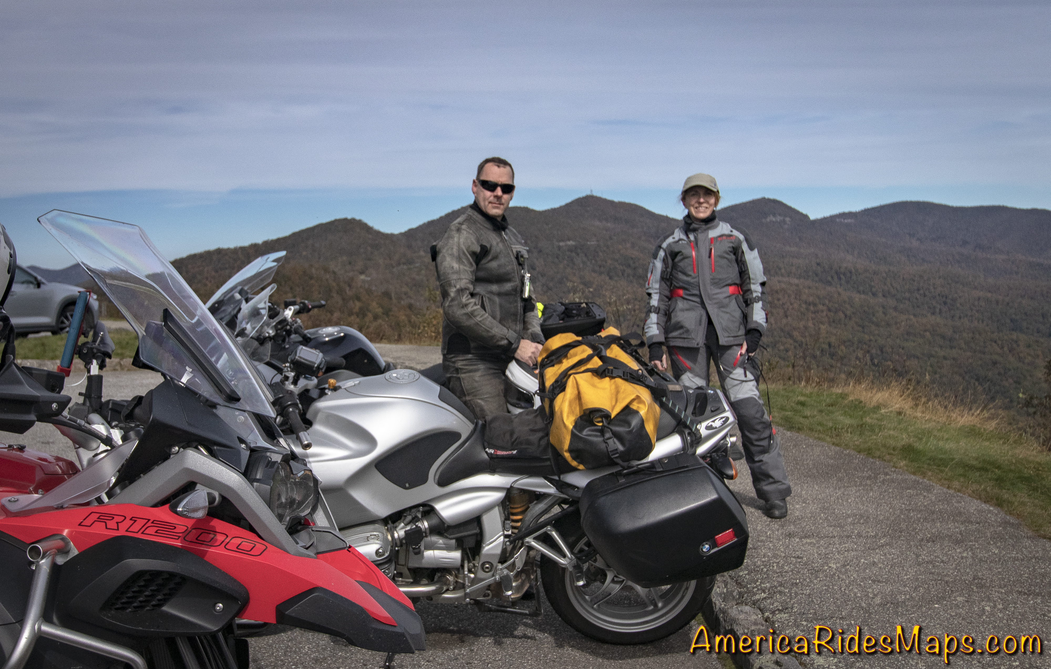
Jackie and Yermo

Jackie and Yermo


Saturday, October 20 – started with cold showers in the NC mountains. 
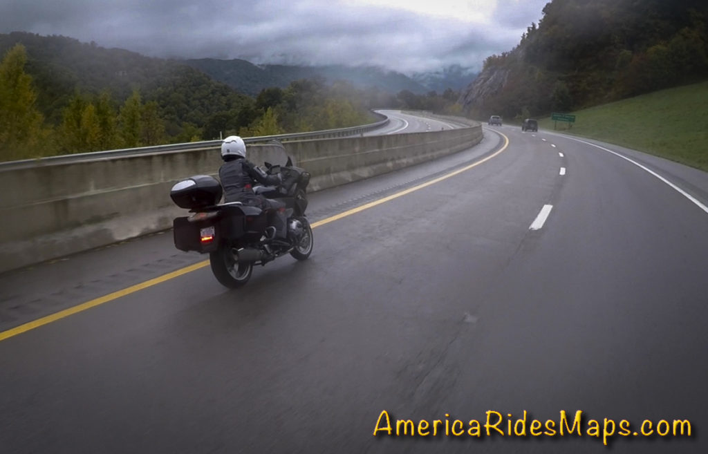
Jackie on I-26

Jackie on I-26

Morning found Jackie and I droning along I-40 under grey skies and a pelting of rain that came and went in soft waves. Warm and dry with our heated gear, we had a lot of miles to cover. Tonight and tomorrow night we’ll be staying at the The Resort at Glade Springs south of Beckly, WV.  First to Asheville, NC, then north on I-77 to Johnson City, TN, then northeast on I-81 to Bristol, VA. We stopped north of Bristol to top up the tanks and get some hot coffee at a Dunkin’ Doughnuts then peeled off the Interstate through Marion, VA to start our ride north on the mountain back roads.
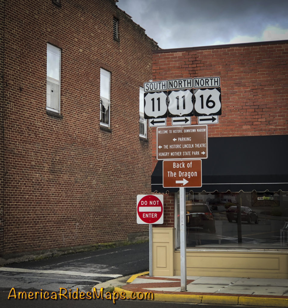
Tazwell, VA

Tazwell, VA

VA 16 is familiar turf“The Back of the Dragon”. The well promoted road winds through rocky cuts and long stretches of tight curves north to Tazwell, VA. We’ve done it before, it’s a fun motorcycle ride, one of the classics. The rain tapered off as went entered the hills and it was a decent ride at a wet-road pace.
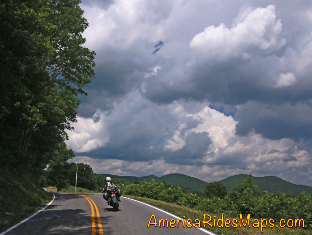
VA 16 - Back of the Dragon

VA 16 – Back of the Dragon

Reaching Tazwell, VA, we needed to arc north to Beckley, WV. VA 16  becomes WV 16  and leads to Beckley – it was the obvious route. We enjoyed nearly every mile of it. While the southern portion in VA gets all the attention, this extensive section north is better. WV 16 winds its way through long wooded valleys and twisty passes between roadside coal towns. It’s mostly a wide two lane road with good pavement, generously curvy. The mountains and valleys are seriously rugged, the scenery stunning, especially with the bright fall color that was now lighting up as the sun burned off the clouds. Passing lanes on grades are common letting you leapfrog the industrial traffic this road was built for.
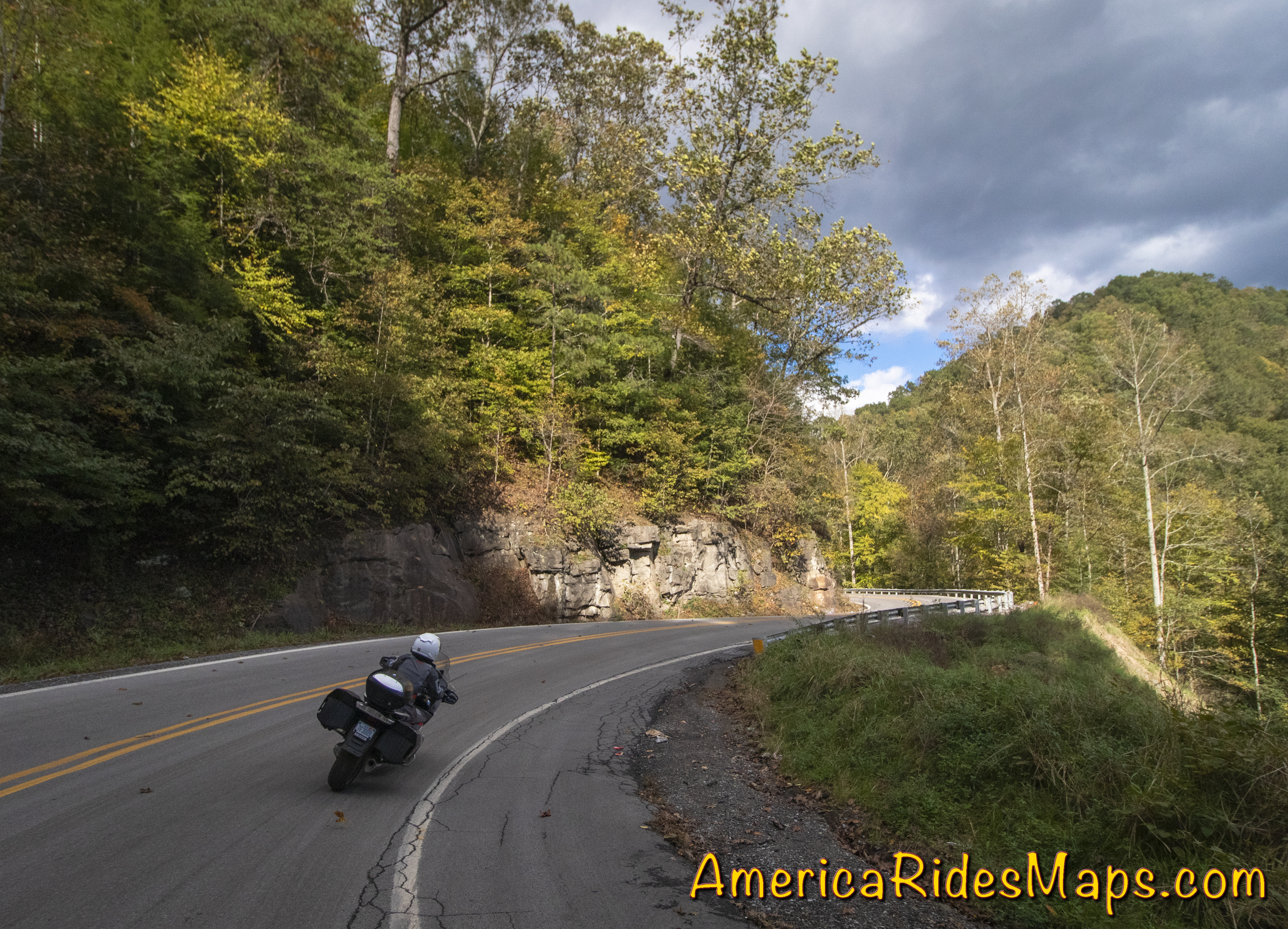
Following Jackie on WV 16

Following Jackie on WV 16

WV 16 is one of the best rides in southern WV. It’s a major road, you can make decent time on it. The experience is a good introduction to the area with coal mines, small mining towns, and miles and miles of dramatic rugged mountains. Near the middle of our ride, we dodge off WV 16 onto WV 97 for a while before returning to WV 16 again, a really sweet long stretch of curves we liked best. It’s common to find the road on one side of a river with railroad tracks running on the parallel shore, long trains of gray rail cars topped in black gold slinking along. Rows of aging roadside company houses cluster near mines and at cross roads. The are few amenities like fast food, motels, stores and shops. Small roadside businesses take care of local needs. Larger towns host the vacant buildings of past industrial prosperity. Traffic is as likely commercial as not, trucks and trailers of equipment moving between sites. You my hit the occasional snag but the chance to pass is usually coming up soon. The interstate highway will take you from Marion to Beckley in less time but it’s a longer distance on the main roads. This ride is so good the extra time it takes is worth it to get off the four lane highway and frolic in the turns.
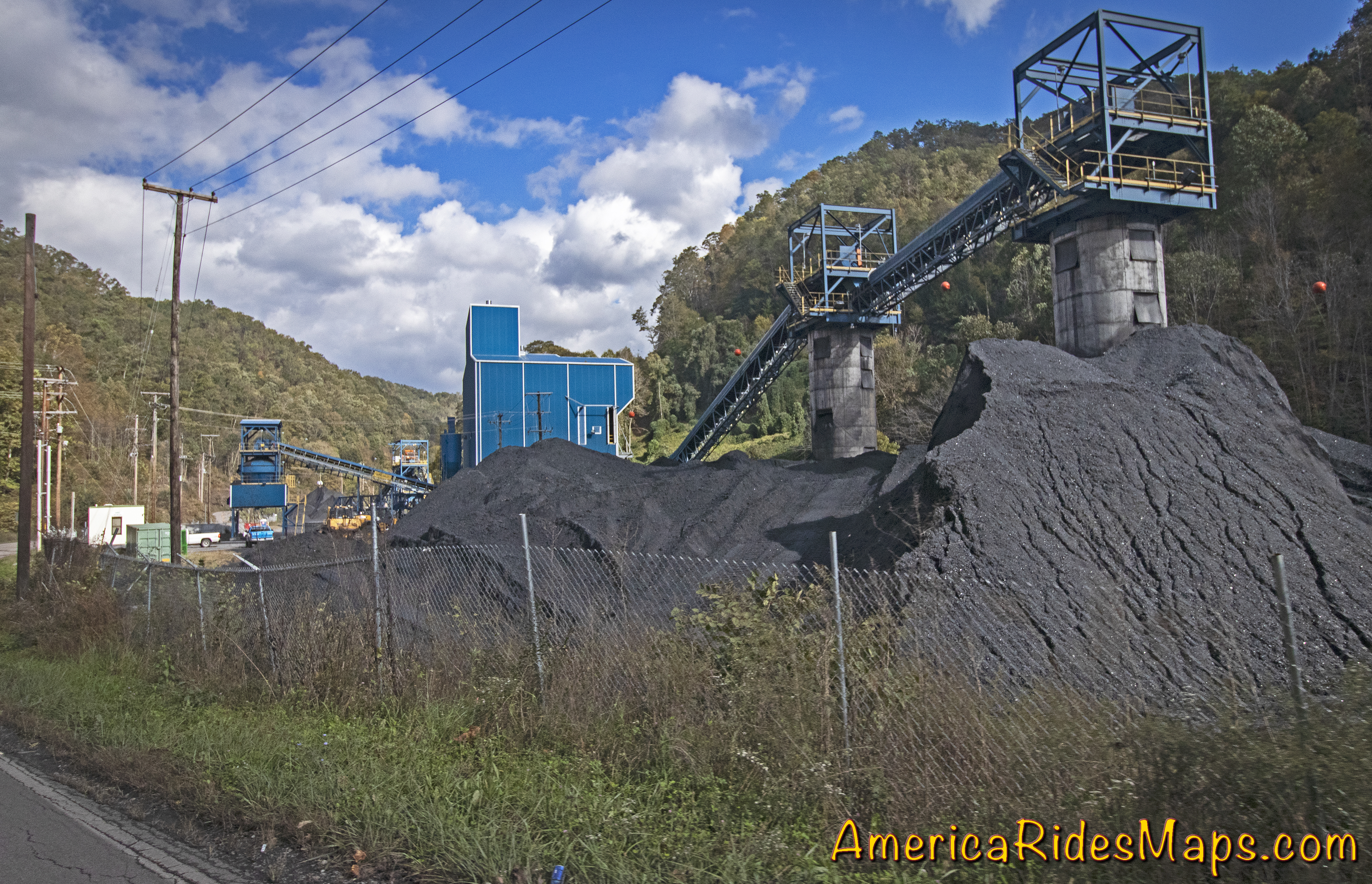
While the coal industry chugs along, one new business is surprisingly widespread – ATV rentals, tours, and facilities. We started seeing signs for the extensive Hatfield-McCoy Trail Systems and passing through ATV friendly towns where unlicensed vehicles roam the public roads unhindered. We passed businesses with fleets of the 4 wheeled toys, trucks with trailer loads of them, and witnessed several large groups of riders gathered at trailheads or emerging covered in gray muck. The bulk of the motorcycles I saw were light weight trail bikes, the machines you want for the more extreme trails, but they were vastly outnumbered by the 4 wheeled crowds. What little I saw of the trails was impressive – steep, wet, rocky climbs up from the road, or winding muddy roads full of big puddles. It looks like serious territory.
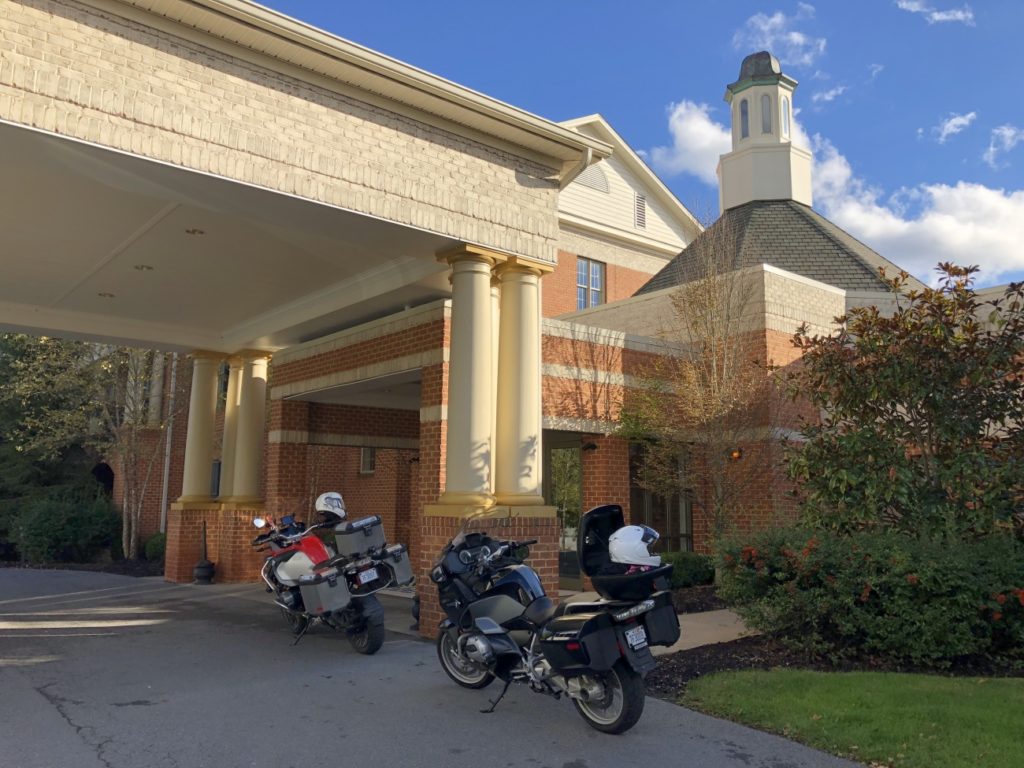
The Resort at Glade Springs

The Resort at Glade Springs

The sun grew low as we cut across a web of GPS led roads to The Resort at Glade Springs. It’s a golf resort south of Beckley which also caters to the public with a restaurant and events on the grounds. Currently, there was a Halloween attraction that was drawing visitors. We got the required passes at the gate then rode a mile or so to check in at the main lodge. It was not quite what I’d expected.
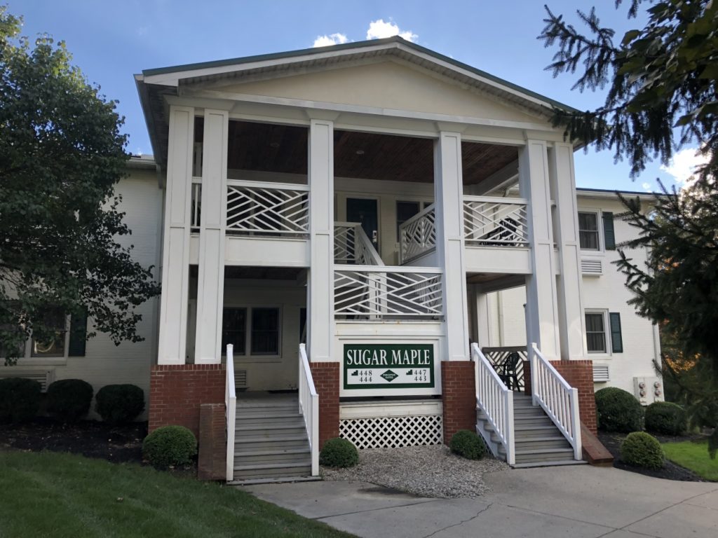
Our Executive Suite

Our Executive Suite

I was expecting an all-in-one-place, a room with a walk to dining and a bar. Instead, facilities were spread across the large property. The layout resembled a college campus. Breakfast was in the lodge. Our rooms were in a group of small 4 room buildings a short drive away. The bar and restaurant were a half-mile walk and it was getting cold. We got our exercise staying here. Yermo arrived not long after we did and we walked to the pub to top the evening.


Sunday, October 21 – Snow.
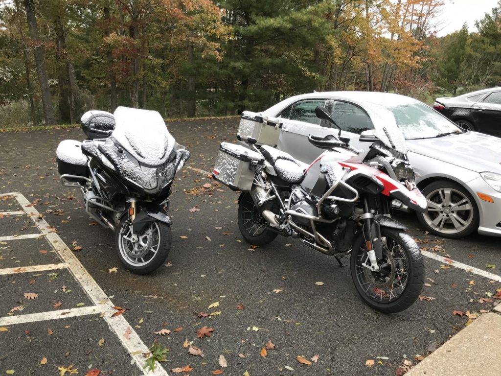
A dusting of snow

A dusting of snow

A strong front moved through overnight. We later learned 60,00 in the area lost power. Breakfast dragged on deciding how to play this day we’d been dealt. Even with heated gear it was pretty darned cold and there was concern for ice. Ultimately we chose to make a visit to a demonstration coal mine in Beckley and take a tour underground.
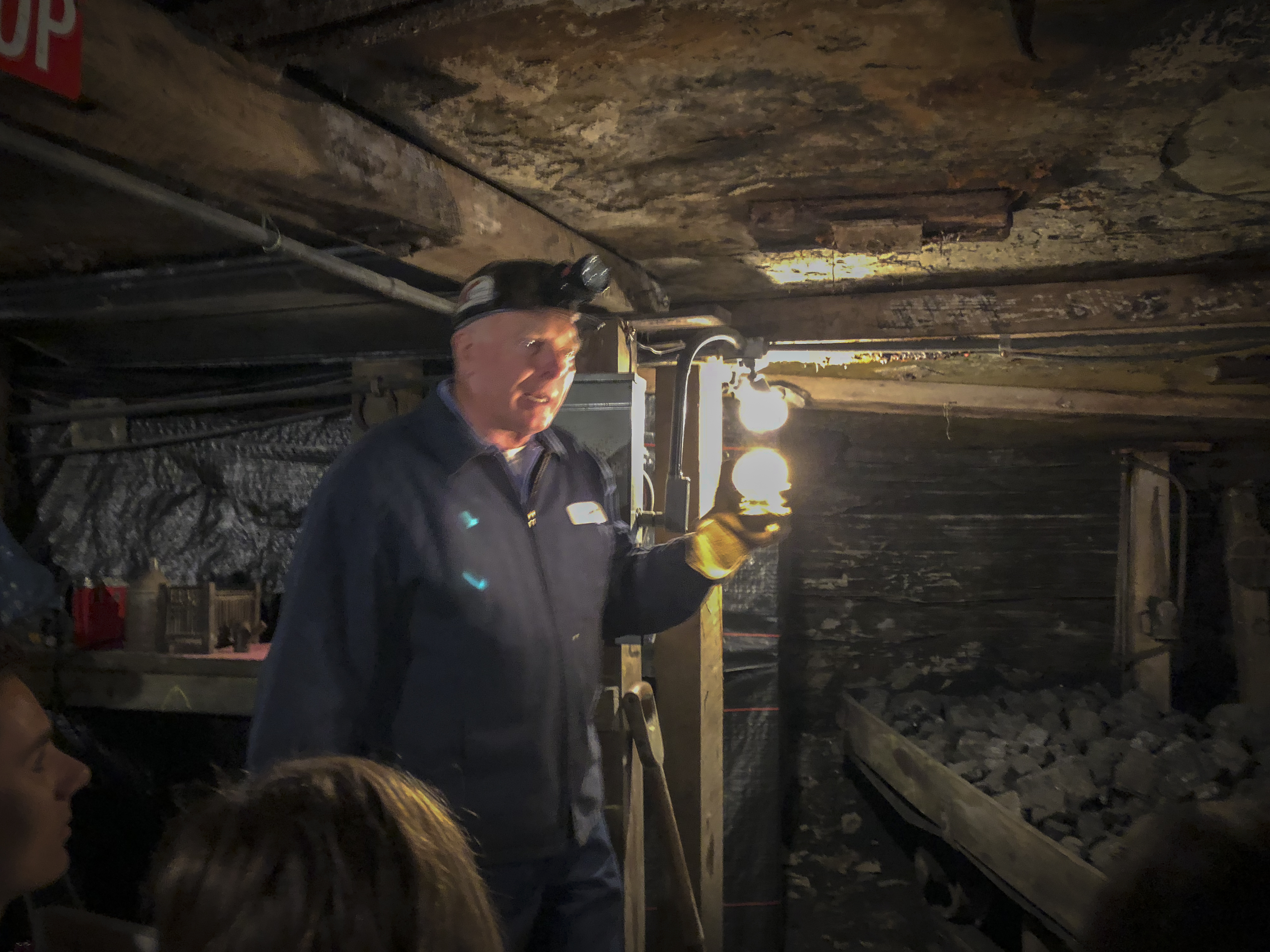
Inside a coal mine

Inside a coal mine

It took a frustrating hour to get a ramshackle cab then another half hour to get to the mine. It was a great experience. The tour starts at the museum and gift shop. We piled into mine cars fitted with seats and the engine drove us into the mine 1500 ft under ground. The train stopped periodically as our tour guide explained the equipment, history, and life of a coal miner along the way. We all enjoyed the experience and came away with a deeper appreciation of the area we were riding through.
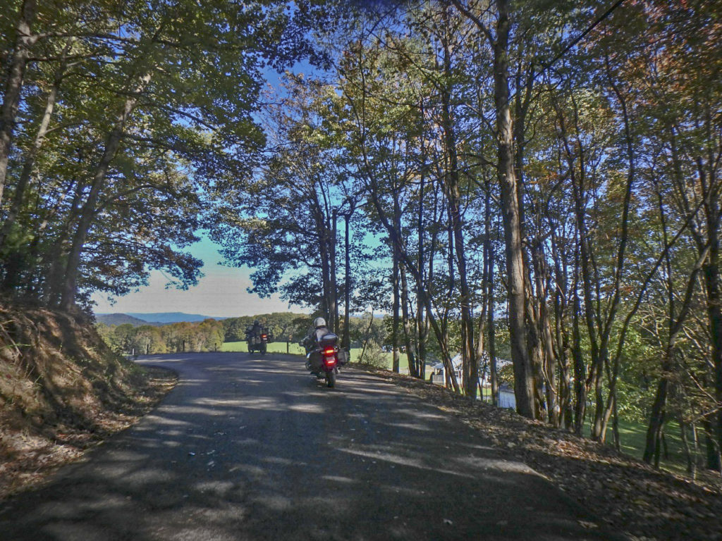
Mountview Rd, WV

Mountview Rd, WV

Returning to the resort with a couple hours of daylight left we suited up and plugged in.
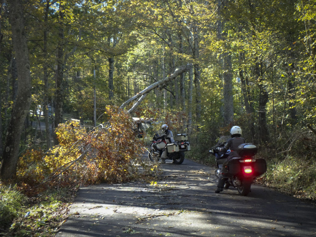
Ellison Ridge Rd - Ducking tree suspended by power lines

Ellison Ridge Rd – Ducking tree suspended by power lines

Heading south I first led the crew out a road our driver had mentioned as pretty, Mountview Road. It was OK, not a bad way to traverse between larger roads, but not exceptional. We got on VA 3 continuing south. Mountview Road had taken us a dozen or so miles east, I was looking for a way to loop us back west.
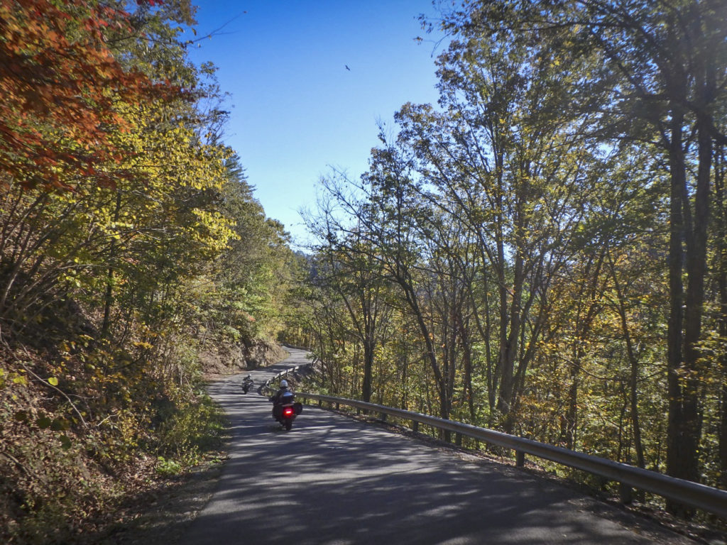
Ellison Ridge Rd, WV

Ellison Ridge Rd, WV

Coming into Nimitz I spied a small side road and I instinctively I cut right. Chances were high Ellison Ridge Road would be a waste of time, a long run to a dead end, but I went on and so did the single lane country road. It was paved though there were times it was hard to tell. Mile after mile we rode deeper into the hills passing farms and forest always expecting the end of the pavement around the next blind curve. The road was littered with blowdown from the night before, wash from the roadside, and wet areas. We passed under a fallen tree held aloft only by power lines. Crossing a small river the road climbed an endless steep and dirty grade, then coasted gradually down to meet the main road we sought. Ellison Ridge Road was 27 miles of adventure, what a ride!
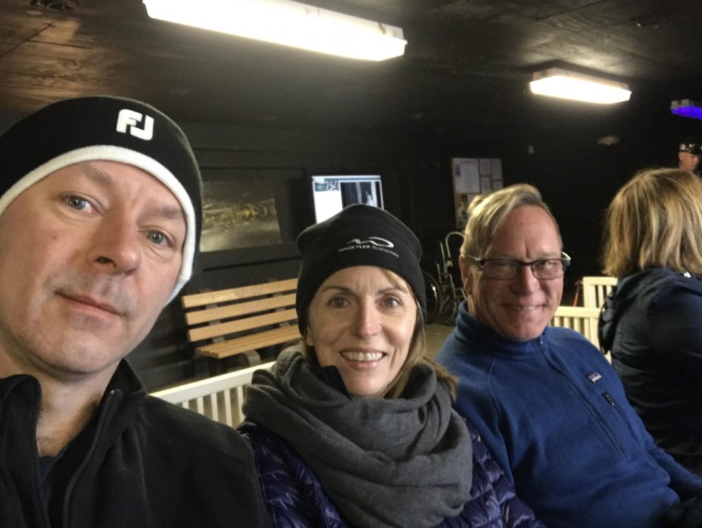
Yermo, Jackie, Wayne

Yermo, Jackie, Wayne

Heading back, we made a short detour to see the local “ski slopes”. Nothing but a muddy mess today, then returned to haunt the pub another night.


Monday, October 22 – Destination Blowing Rock, NC

We packed up, bundled up, and plugged in on another chilly morning. Our rooms are waiting tonight at the Chetola Resort in Blowing Rock, NC a few hours south. The bulk of our day is for exploring more of WV, then a run to Blowing Rock passing through Damascus, VA. We turned south for several miles to reach our first new WV back road – Odd Road.
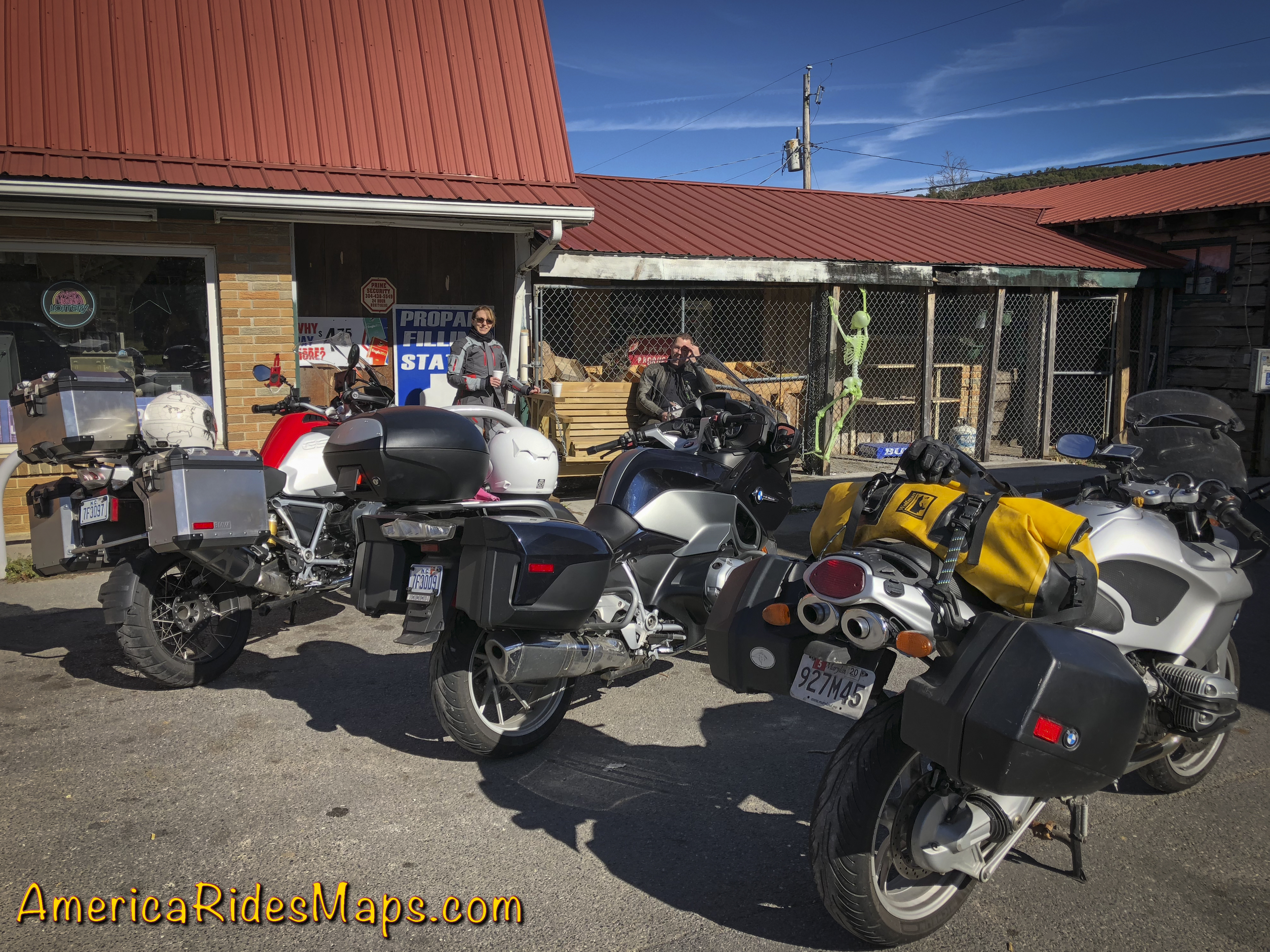
WV 10 - Gas Stop below Matoaka

WV 10 – Gas Stop below Matoaka

Odd Road was a great start. It quickly turned into a tight and twisty romp passing through the town of Odd then rolled on to meet WV 16. It was a lot of fun. We then followed WV 16 to WV 10 diving south to Matoaka. WV 10 is a larger two lane road with generally easy curves. There is a 6 mile section in the middle that is just wonderful, a beautiful section of tight curves and exposed rock walls. Needing gas, we continued on WV 10 for quite a stretch to reach a station. The gas break turned into an entertaining coffee break as 3 locals stopped to talk bikes with us. All had fondly owned BMWs at some point. The sun was out and the day warming.
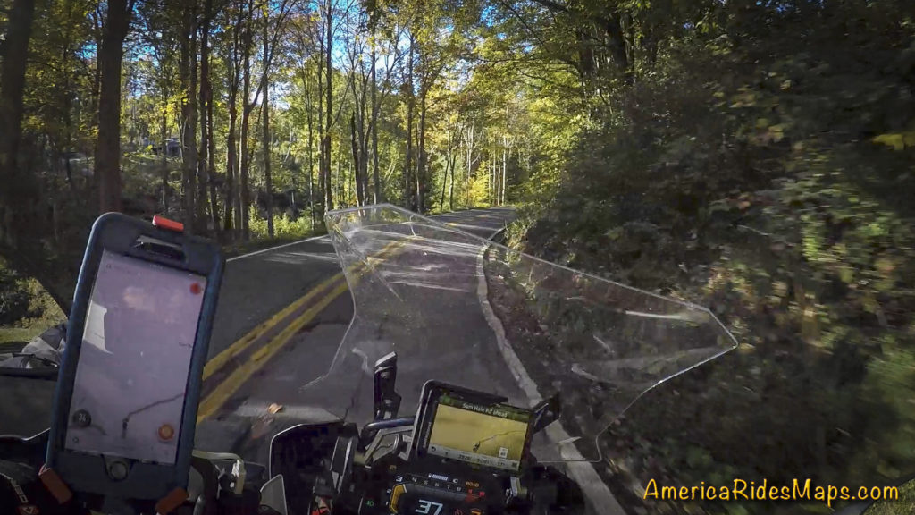
WV Odd Rd

WV Odd Rd

Tanks topped, I led the way back to Matoaka then veered west onto WV 71 – Lorton Lick Road. A small tight winding two lane road, WV 71 was beautiful and an adventure. We passed through a small settlement of close houses then rolled high on a bluff above a small river before we entered a long wooded stretch. The sunshine ignited the fall leaves and they blazed in color above us. We emerged onto US 52.
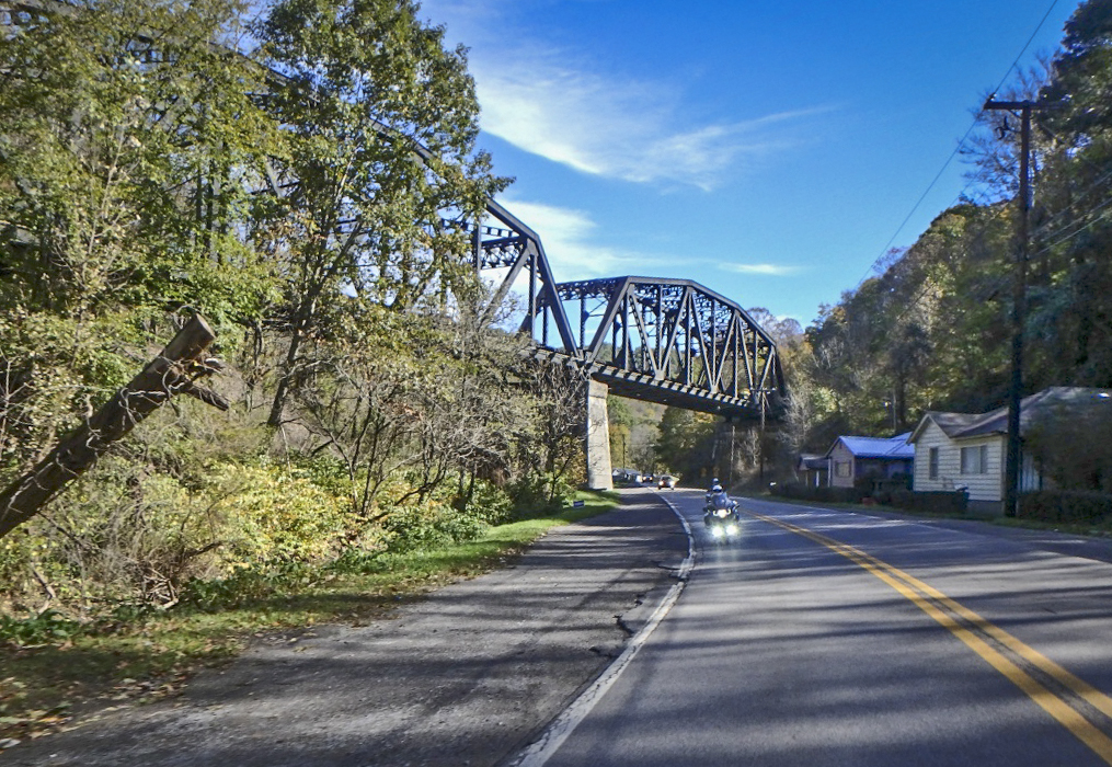
WV - US 52

WV – US 52

US 52 is a major road and not especially scenic overall. We used it to jump to WV 161.  A broad road with no centerline, two white lines mark the edges. It started with nice hairpins, then got slick and wet from the coal trucks from a couple mines along this route. We managed to skirt around one truck but not a second. It wasn’t long before it turned off and the rest of the ride was good. WV 161 is a useful road and a decent rides taking the coal trucks into account. One coal road leads to another, WV 161 intersected WV 103 and we turned north again. A bigger road, WV 103 – Riverside Drive carries more traffic.  It traces one side of a river with the railroad on the other passing a couple mines on the way to Welch.
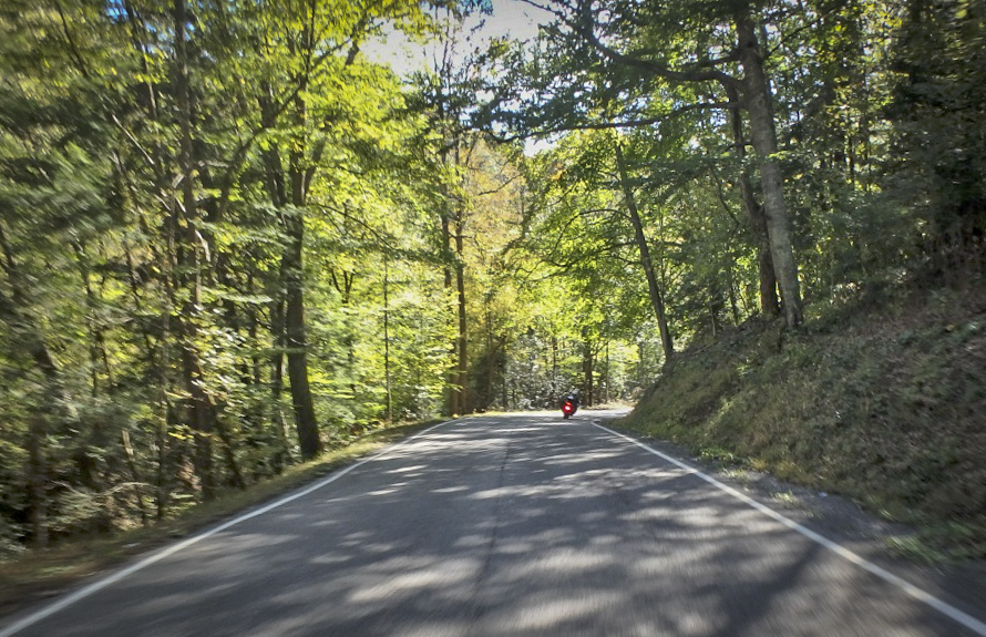
WV 638 - Dismal River Rd

WV 638 – Dismal River Rd

US 52 came in handy again taking us west to meet WV 80. This section of the main road is more wooded with nice flowing curves. It was well into the afternoon when we turned south on WV 80 for the twisty run flowing into WV 83. When 83 turned west I hopped onto WV 635 to continue due south. WV 635 was a nice road for a while then veered off as a smaller unmarked road. It seemed to be petering out. We passed ATV trails and signs ATV’s used these roads. Sure enough, miles out in the boondocks the pavement ended. Consulting the GPS I found a possible alternate route and we started backtracking to reach it.
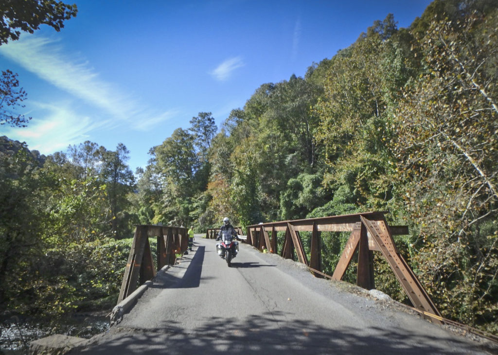
WV 7

WV 7

WV 636 didn’t look much better than WV 635 but it did point in the right direction so off we went. Tiny, twisty, technical and fun, the pavement continued on a true adventure road. WV 636 flowed into slightly larger WV 67 and as we reached Virginia it was time to head for the rooms.
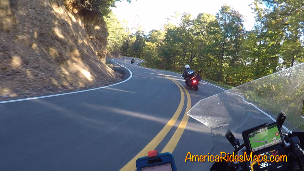
TN US 421 - The Snake

TN US 421 – The Snake

We worked our way south crossing the interstate then on to Damascus, Virginia. Shadows were getting long now and it was time to plug the heated gear in again as we whipped south into Tennessee on TN 133. At Shady Valley we turned east on US 421 to enjoy an evening ride on The Snake. It was a nice run, the golden sunlight of the evening making the trees glow. The road was nearly empty this late in the day. Leaving the Snake we passed through Mountain City then entered North Carolina. The congested main roads took us around Boone and on to Blowing Rock.
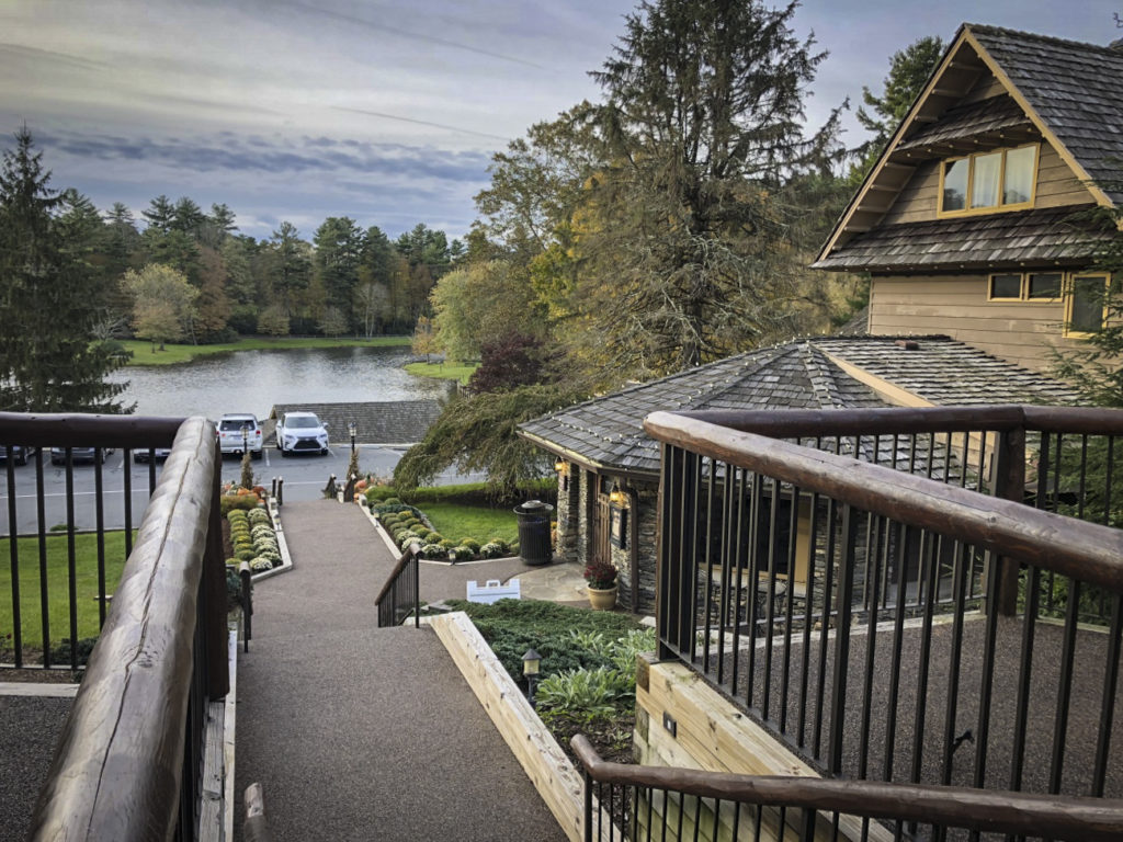
Chetola Lodge, Blowing Rock, NC

Chetola Lodge, Blowing Rock, NC

Rolling up to the Chetola Resort I was pleased to find just what I was looking for. It was a beautiful setting, the buildings posh, the warm glow from the pub windows beckoned as we checked in. Just what I wanted after a good day on the road.


Tuesday, October 23 – The Parkway of course!

You could tell early on it was going to be a nice day and we got off to a good start riding US 221 from Boone to Grandfather Mountain. This section of US 221 clings to the slopes below the Blue Ridge Parkway. It’s a fun and technical ride freshly paved in places. We paused for the photo below the Linn Cove Viaduct then enjoyed the rest of US 221 into Linville for fuel.
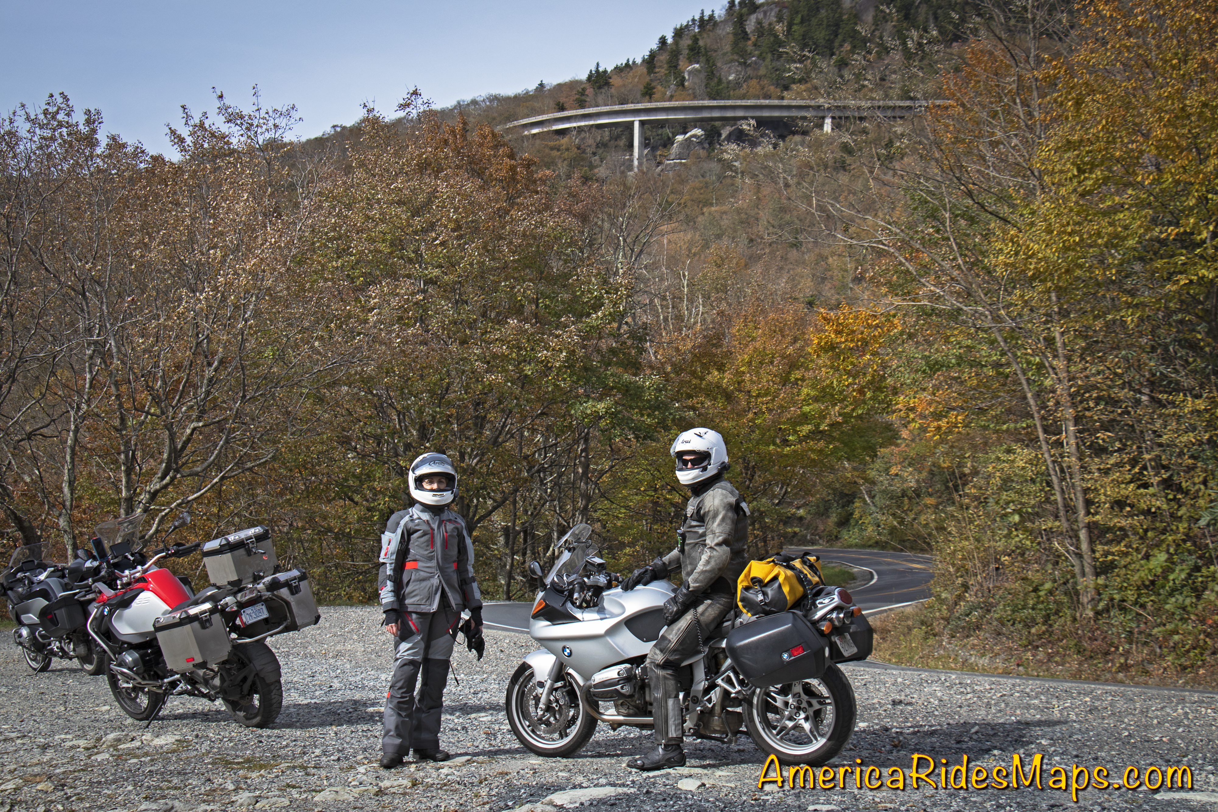
US 221 -Below the Linn Cove Viaduct

US 221 -Below the Linn Cove Viaduct

I handed Yermo my keys and we switched bikes. It was quite a transition getting on his BMW 1190 R after spending the last few days on my new BMW 1200 GSA. Linking to the Blue Ridge Parkway via tricky little Roseboro Road was a challenge on the unfamiliar ride, but after 20 minutes on the parkway I’d started to get more comfortable with the bike. The fall color was gorgeous as the day warmed. We flicked our way south through the bends enjoying the light mid-week traffic. After an hour or so we stopped and switched bikes again – I stayed on the 1190, Jackie got on my GSA 1200 and Yermo hopped on her 2017 BMW 1200 RT.
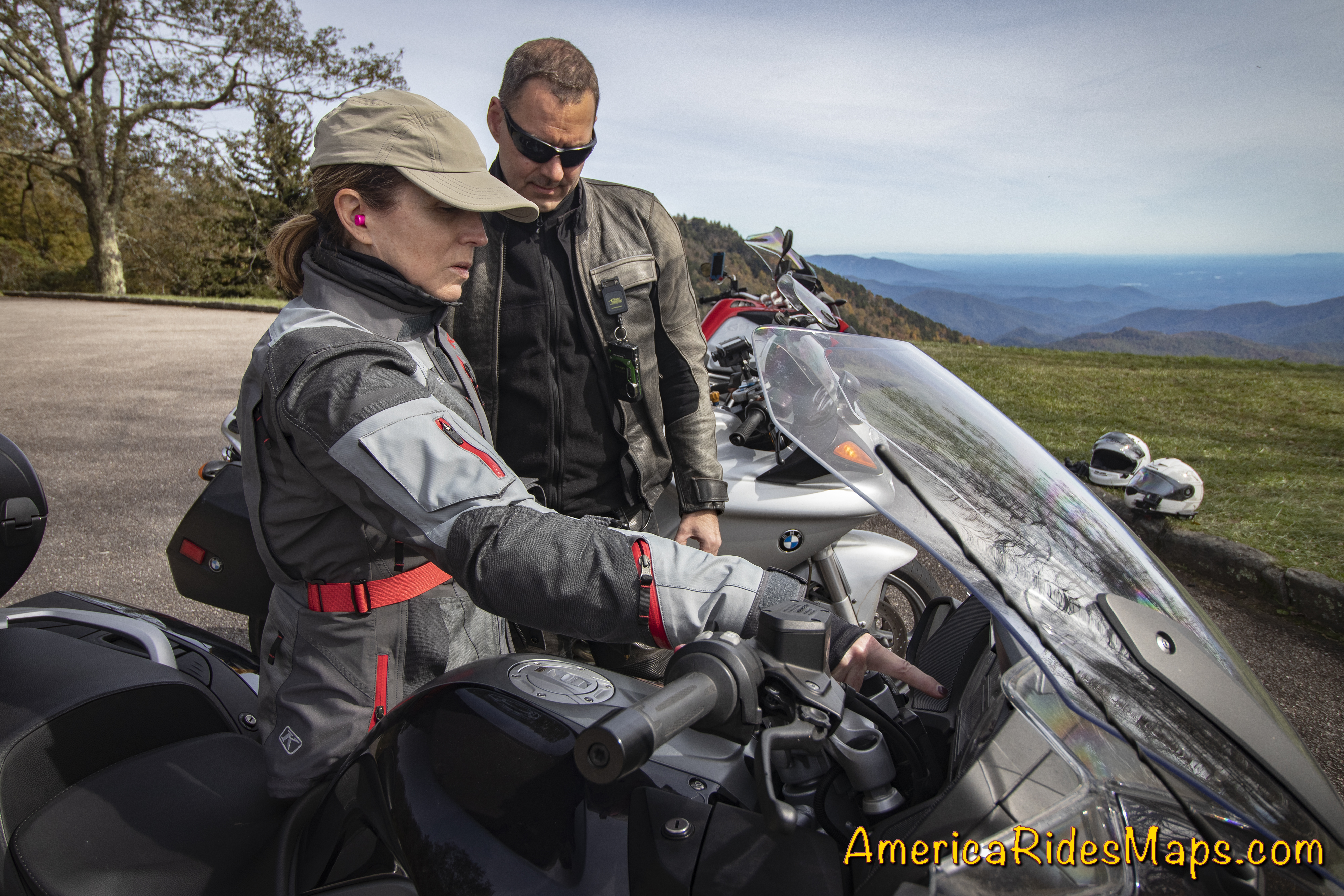
Jackie shows Yermo the controls.

Jackie shows Yermo the controls.

The day just got better and better. The fall leaves were at peak in places. The air was so clear, you could see forever. We passed up early chances to head for home to keep enjoying the high road and hit all the classic stops.

We left the Parkway  at US 19. It took us through Maggie Valley and home to Waynesville.


Impressions from this trip:

Our previous explorations in West Virginia have been in the hills and valleys west of the Shenandoah area. The southern tip of the state is more rugged and mountainous. The northern areas are more agricultural and pastoral, this region is both more industrial and and more rural. Coal mining dominates, there is little else. I’d expected to see vast extractive wastelands, and while there are roadside mines, most are out of sight. Instead, the mountains and valleys are ruggedly beautiful, winding rivers link gritty towns, forests dominate.
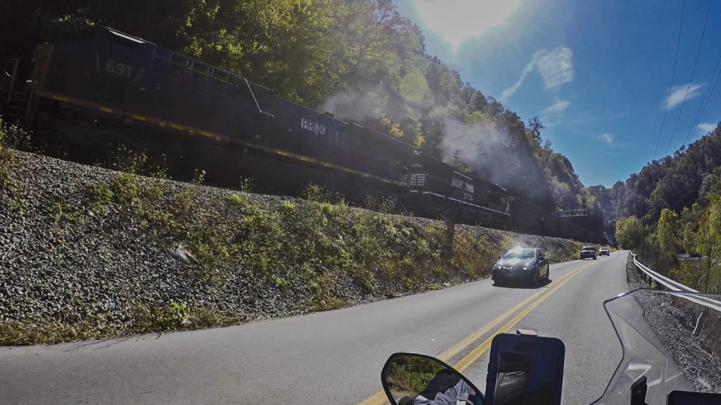
WV 103

WV 103

What a variety of roads! The riding here is outstanding. You’ll find few sections of four lane, two lane roads of various sizes dominate. The bulk of the roads are in excellent shape, seemingly built to accommodate the commercial traffic to and from the mines. There are many good single lane roads and we strayed on to a few “adventure roads” – paved, but just barely. Off road adventure looks to be the growing industry.
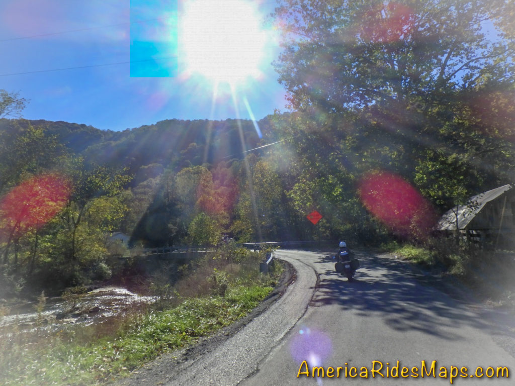
Ellison Ridge Rd, WV

Ellison Ridge Rd, WV

The challenge I see in this area is the lack of amenities. Towns are small and there is little in them. Next task is to look for the good spots, food, gas stations, and lodging, then explore the roads that link them.


Wayne BuschAmerica Rides Maps

Wayne Busch searches out the most entertaining roads in the Blue Ridge Mountains then records them on a series of maps which span the Southern Mountains.

There are more great motorcycle roads in the Blue Ridge and Smoky Mountains than anywhere else. I highlight the best roads then show you the best ways to connect them together into rides. More than a decade of searching has discovered more than 1000 good roads to enjoy. We continue to search so you may enjoy.

Review the maps, order online hereAmericaRidesMaps.com

Source: America Rides Maps Blog @ Miles-by-Motorcycle.com

https://miles-by-motorcycle.com/51999/blog/65203/a-motorcycle-ride-in-coal-country–west-virginia
Your Fall Motorcycle Leaf-peeping trip to the Smokies – Tips

Your Fall Leaf-peeping Motorcycle Trip to the Smokies – Tips

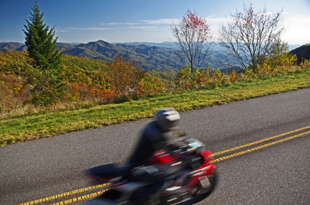
Some of the best views will be from the heights of the Blue Ridge Parkway.

Some of the best views will be from the heights of the Blue Ridge Parkway.

 It’s that time of year again, the brief lull before the start of the peak of the tourist season in the Smoky Mountains. It’s a good time to pass along some last minute tips and advice to those planning to come see natures spectacular autumn show.

Blue Ridge Parkway Fall Motorcycle

You don’t have to go far to find great scenery

Last minute advice – Get a room! If it’s your first visit to the Smoky Mountains on a fall motorcycle tour for leaf season, you don’t yet know how “last minute” this advice is. The nicest places to stay and most of the motorcycle friendly sites took reservations last year, they are probably booked. You can try calling, but you’re probably relegated to the second tier establishements. If you “wing it” you’ll be looking for adventure in the third tier or bouncing between crowded campgrounds.

Tanassi Creek Road

Tanassi Creek Road – all yours, no traffic!

Tip – you’ll be back. There is no way you can hit all the best roads on one trip, even two trips. Some are worth coming back and riding again. If you really like the experience and find a base camp that treats you well, book ahead for next year.

Last minute advice – when is peak leaf viewing? Depends and varies. Were I to pick one (OK, 2 dates) for the Smokies, it would be Oct 16-17. Leaf color depends on climate conditions over the year. It takes a cold snap to make the leaves snap and the right mix of wet and dry. Who knows?

Becky Mountain Road

Becky Mountain Road

Tip – Leaf season is longer than it seems – That “peak of color” date is misleading. Due to the changes in altitude, the leaf change occurs at different rates at different altitudes. There are several weeks to either side of the announced peak date when the leaves will be spectacular, but limited within the altitude. High areas change early, valleys change later. There is still good leaf color into November at the lower altitudes.

Last minute advice – What will the weather be like? While it’s typically a dryer time of year, it’s also one of those transitional periods where we fluctuate between a couple warm days then a few colder ones. Cold fronts usually come through hard and fast, warm ones kinda drift in with gentle rains. On nice sunny days the temperatures may rise well into the 60’s, even 70’s. But, a damp and cloudy day in the 50’s can feel mighty chilly when the winds pick up atop the mountains. Morning lows will generally be in the 40’s, though a cold snap will bring frost (and help the leaves have good color).

Ellijay Road - beautiful and fun!

Ellijay Road – beautiful and fun!

Tip – Bring warm gloves, a good jacket, and several layers. Mornings are typically foggy, an early start may mean the views are obscured. Don’t be in a rush to get to the mountaintops. As always, throw the rain suit in just in case. If you’ve got an open helmet, consider face protection.

Advice – What about the traffic? While millions will flock to the mountains to see the fall show, their patterns are predictable. Weekends, especially afternoons, will find the popular places like Great Smoky Mountains National Park, Chimney Rock, The Dragon, and the Parkways congested. Mornings are the better times to pass through the busier areas.

Photo-motorcycles-on-the-Blue-Ridge-Parkway

View from Waterrock Knob

Tip – try to hit those most popular areas during the week. They are definitely worth visiting, but you will enjoy them more if you can be riding, not idling. On the busiest days, there are still hundreds of great, fun, empty 2 lane back roads for you to enjoy riding, and they are all lined with colorful trees where the leaf-peepers rarely stray.

Advice – What should I watch out for? Be extra cautious when riding. Half the people out there may be tourists paying more attention to the scenery than the road. Be ready for the unexpected (like a car stopped dead in the road to take a photo on a curve). Same goes for you riders – use the numerous overlooks and pull offs to get the best views. Several motorcycles ride off the mountainsides each year when the driver was distracted by gorgeous the views. Pull over!

Blue Ridge Parkway Fall Motorcycle

Enjoy the ride but pull over to enjoy the scenery. Don’t ride off into the sunset – it’s a long way down.

Tip – when traffic is heavy, best to avoid it. Get off the main roads, divert around towns, and look for those tiny back roads others bypass. You’ll have much more fun, see things others never do, and discover reasons to come back and ride more during the off season. Just one or two of my pocket maps will insure you have the best motorcycle vacation ever – they show you all the great back roads.

Charlies Creek Road

Charlie’s Creek Road – Not only will you find some of the best hidden pockets of leaf color, but you’ll  have one of the best rides of your life.

____________________________________________________________________

wayne busch - Smoky Mountain Motorcycle Rider.com

Wayne Busch

– Wayne Busch lives in Waynesville, NC, where he produces the most detailed and comprehensive and up-to-date motorcycle pocket maps of the Blue Ridge and Smoky Mountains to help you get the most of your vacation experience. See them here – AmericaRidesMaps.com

Total Rider Tech Logo

Learn Total Control

Wayne is an advanced motorcycle instructor for Total Rider Tech teaching Lee Parks Total Control Advanced Rider Courses. Isn’t it time you looked into advanced rider training to ride more confidently and safely? It can transform your mountain riding experience.  Total Rider Tech

____________________________________________________________________

Best Motorcycle Rides in North Carolina – A sport bike loop

Best Motorcycle Rides in North Carolina – A sport bike loop ride

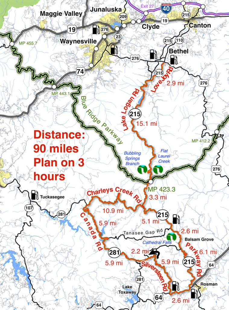
When I’m looking for a “dragon like” challenge close to home, this 90 mile loop satisfies every time!

Section of NC 215 near Lake Logan.

Section of NC 215 near Lake Logan. You’ll find some nice scenery on the popular road. The curves so far are just a warm up for what lies ahead.

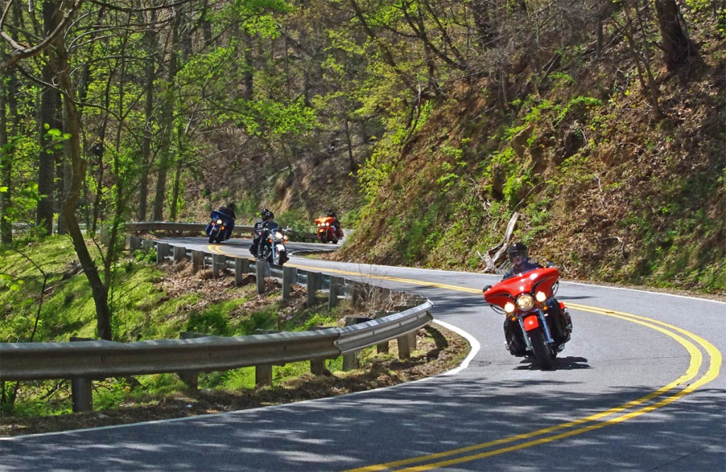
As much as I enjoy a ride on the infamous Tail of the Dragon at Deals Gap, it’s a bit of a ride to get out to it from the Waynesville / Maggie Valley area where I live. Fortunately, there are ample challenging roads nearby, and when I really want a peg-scraping ride, this is one of my favorite local loops. For those on sport bikes, it’s a must-do when you are in the area.

The higher you go the better it gets on NC 215.

The higher you go the better it gets on NC 215. The road crests where it meets the Blue Ridge Parkway, then plunges down the other side of the gap.

The map originates in the small crossroads town of Bethel, NC south of Waynesville, Canton, Maggie Valley, and Junaluska. It can also be done as a side loop off the Blue Ridge Parkway (exit at Beech Gap, MP 423.3, NC 215 – cuts 36 miles off the route).

Descending from the Blue Ridge Parkway on NC 215

The curves continue as you descend from the Blue Ridge Parkway with a brief break when you enter a valley. The curves that follow really kick it up!

______________________________________________________________________

Length: 90 miles plus your ride to the start in Bethel, NC.
Ride time: 3-4 hours
Difficulty: Very challenging, tight curves, climbs and descents, sustained, varied road surfaces, all paved

Photo-curve-on-Silversteen-Rd

Imagine miles and miles of curves like this one – a.k.a. Silversteen Road

Turn-by-turn route description

Start at traffic light in Bethel (junction US 276, NC 215, NC 110).

Follow NC 215  – starts as Love Joy Road. Easy section through farmland along river with a few sharp turns.

2.9 mi – Turn left @ stop sign to continue on NC 215. Junction Love Joy Road and Lake Logan Rd (NC 215).  Moderately difficult. Rolls through houses, some nice curves, section along Lake Logan very nice.

16.8 mi – Pass Sunburst Campground. Enter Pisgah National Forest. Start climb to Blue Ridge Parkway. Road gets more twisty here. Nice stop at a roadside waterfall. Beware loose gravel on road, especially in turns, most likely to be found in the highest sections. Difficult.

17.9 mi – Pass Blue Ridge Parkway ramp. Popular break spot, if not at the junction, go up to the parkway and turn right to reach a nearby overlook with lots of parking. Continue under the parkway on NC 215. Good views from the highest section. Road surface improves south of parkway. Difficult.

35 mi – Turn right @ stop sign onto US 64. Junction NC 215 (Parkway Road) and US 64. Just a short section on this sometimes busy road. Easy.

Photo-Charlies-Creek-Rd

Charlie’s Creek Rd – typical of the wonderfully empty and inviting rides that abound in the Smokies

37.7 mi  – Turn right onto Silversteen Road. Junction US 64 and Sliversteeen Rd. Sign warns of tight turns ahead, believe it! Difficult.

38.3 mi – Keep right on Silversteen Rd. Junction Silversteen Rd and Golden Road. Difficult.

43.6 mi – Sharp left turn to stay on Silversteen Road. Junction Silversteen Rd and Macedonia Church Road. If you don’t make this turn, you will end up back on NC 215. Difficult.

45.7 mi – Turn right @ stop sign onto NC 281. Junction Silversteen Road and NC 281 (Canada Road). Nice section, a little loose gravel in places. Difficult.

57.6 mi – Turn right onto Charlies Creek Road. Junction NC 281 (Canada Road) and Charlies Creek Road. Be on your guard, surprising turns on this road. Difficult.

Photo - wolf Creek Dam

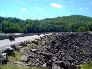
Wolf Creek Dam near the midpoint of NC 281, one of the scenic points on this great motorcycle ride.

68.4 mi – Turn left onto NC 215. Junction Charlies Creek Road and NC 215. Start back on a road you’ve been on previously.

89.7 mi – Follow NC 215 back to Bethel.

You’ll find gas stations in Bethel, on NC 215 on the south side of the Blue Ridge Parkway, and at the turn off US 64 onto Silversteen Road.

Jukebox Junction is a popular diner in Bethel. It’s mostly gas station food for the remainder of the ride.

Map of the ride

You’ll find these roads and many others in the surroundings on America Rides Maps motorcycle pocket map #6 – The Best Motorcycle Rides Near Great Smoky Mountains National Park – EAST.

____________________________________________________________________

wayne busch - Smoky Mountain Motorcycle Rider.com

Wayne Busch

– Wayne Busch lives in Waynesville, NC, where he produces the most detailed and comprehensive and up-to-date motorcycle pocket maps of the Blue Ridge and Smoky Mountains to help you get the most of your vacation experience. See them here – AmericaRidesMaps.com

Total Rider Tech Logo

Learn Total Control

Wayne is an advanced motorcycle instructor for Total Rider Tech teaching Lee Parks Total Control Advanced Rider Courses. Isn’t it time you looked into advanced rider training to ride more confidently and safely? It can transform your mountain riding experience.  Total Rider Tech

____________________________________________________________________

Feb 9, 2013 – Fresh photos of the landslide on the Cherohala Skyway

Feb 9, 2013 – Fresh photos of the landslide on the Cherohala Skyway

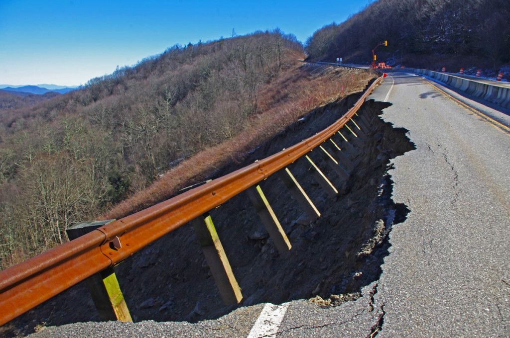
With temps nearing 60, I took the opportunity to ride out and see the landslide up close.

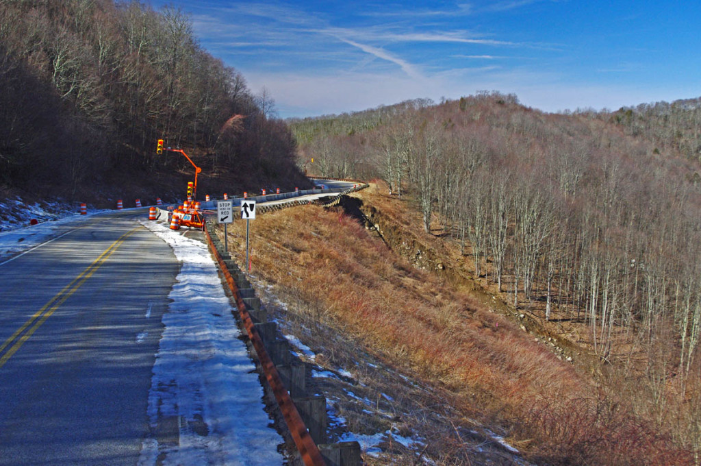
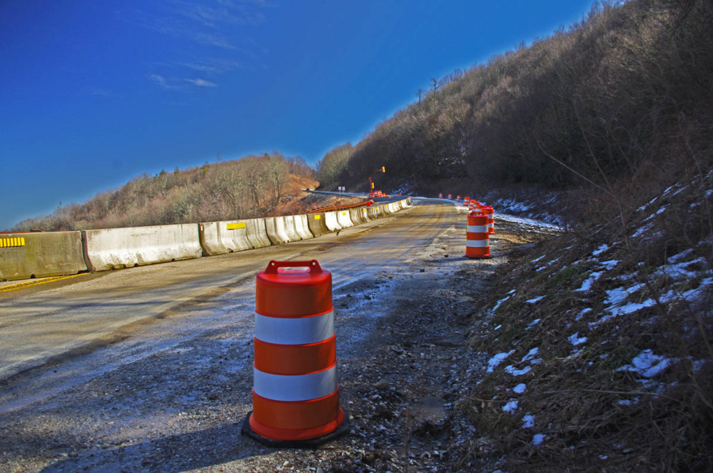
Landslide on the Cherohala Skyway - Temporary stoplights

Landslide on the Cherohala Skyway – Temporary stoplights regulate the flow through the area where one lane of this outstanding motorcycle ride is closed.

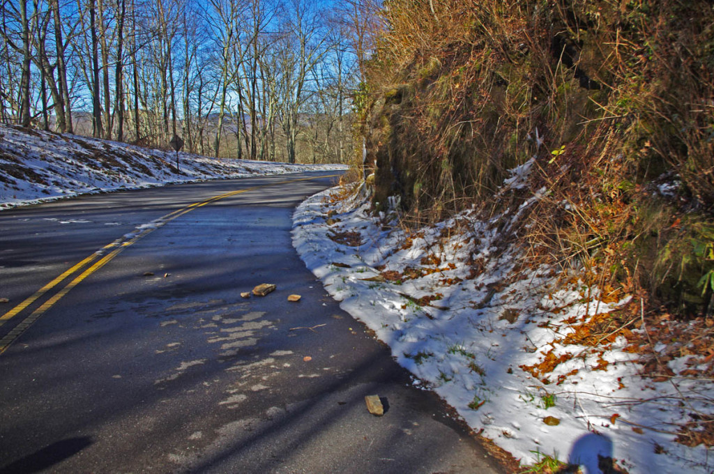
A few weeks ago the Smoky Mountain area was hit with drenching rains which caused a number of landslides. The most significant of them is on US 441 in the heart of Great Smoky Mountains National Park. Many of these situations have already been addressed, but some will have effects into the early motorcycle riding season.

Landslide on the Cherohala Skyway  - one lane is closed.

Landslide on the Cherohala Skyway – fortunately there was enough room for a detour, only one lane is closed.

We hope the worst is behind us, but realize we’re only half way through winter. There is still the potential for more slides as the freeze / thaw cycles break rock and this is the time of year when most of them happen. Heavy rain is unusual and this slide is quite extensive. I suspect a retaining wall will eventually be constructed, but I wouldn’t count on a quick fix on this remote section of road.

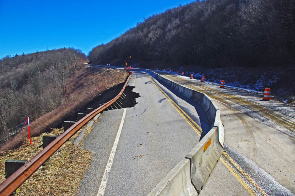
Landslide on the Cherohala Skyway - The guardrail hangs dramatically

Landslide on the Cherohala Skyway – The guardrail hangs dramatically over the abyss

The slide happened on the North Carolina section of the road about a mile from the border with Tennessee. There are big overlooks on this scenic road located on each side of the slide. It at about 4800 feet elevation though the highest parts of the road are well above 5000 feet high. Views are gorgeous.

Landslide on the Cherohala Skyway - The pavement is undercut

Landslide on the Cherohala Skyway – The pavement is undercut here, getting near the edge made me nervous lest it give way! You can see how extensive and deep the chasm is in this photo.

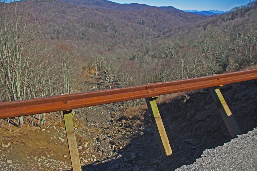
A lot of soil was lost. It doesn’t seem practical to try to fill it in, the area seems to go 800 – 1000 feet down the mountainside. It has undercut the pavement, getting close to the edge made me a little nervous!

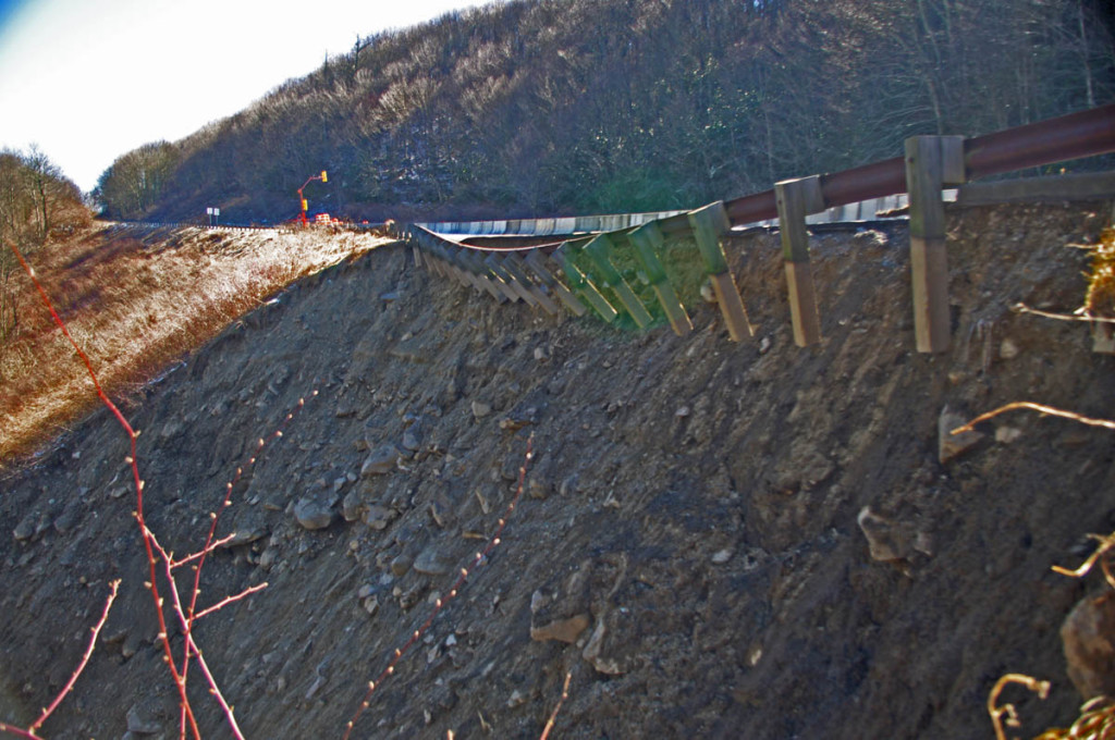
Landslide on the Cherohala  Skyway - remaining slope at the edges.

Landslide on the Cherohala Skyway – This photo shows just how much soil moved. You can see the difference compared to the remaining slope at the edges.

No telling why this section off the road let loose while others remain intact. It doesn’t appear much different or more steep than many other sections. It’s at one of the higher elevations so you wouldn’t think there was a lot of subterranean water flow, yet it happened.

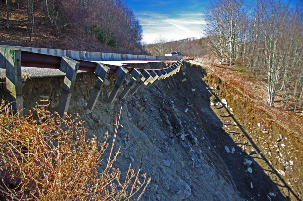
Landslide on the Cherohala Skyway - - A view from the other side

Landslide on the Cherohala Skyway – A view from the other side helps you realize just how big this slide is.

I don’t expect a quick fix. While this is a popular and scenic road, it is not a vital through-way. It’s about as far away from civilization as you can get in this area of the mountains. The North Carolina county in which it occurred is one of the poorest in the state, and there is far more impact on tourism related to the major landslide on US 441 in Great Smoky Mountains National Park.

Landslide on the Cherohala Skywway  For all the hype it's a minor inconvenience

Landslide on the Cherohala Skywway – For all the hype it’s a minor inconvenience on this outstanding motorcycle ride!

It’s not so bad! The traffic lights are quick. There is rarely much traffic on this outstanding motorcycle ride, its still one of the top 10 motorcycle rides in the US despite this minor inconvenience. I would not change my plans, heck, there’s one more unique thing to see on this ride. The overlook closest to the North Carolina side has bathrooms, so it’s a popular place for a break. DO IT!

____________________________________________________________________

wayne busch - Smoky Mountain Motorcycle Rider.com

Wayne Busch

– Wayne Busch lives in Waynesville, NC, where he produces the most detailed and comprehensive and up-to-date motorcycle pocket maps of the Blue Ridge and Smoky Mountains to help you get the most of your vacation experience. See them here – AmericaRidesMaps.com

Total Rider Tech Logo

Learn Total Control

Wayne is an advanced motorcycle instructor for Total Rider Tech teaching Lee Parks Total Control Advanced Rider Courses. Isn’t it time you looked into advanced rider training to ride more confidently and safely? It can transform your mountain riding experience.  Total Rider Tech

____________________________________________________________________

How long to ride the Blue Ridge Parkway on my motorcycle?

How long to ride the Blue Ridge Parkway on my motorcycle?

Budget at least 2 days for your motorcycle ride on the Blue Ridge Parkway –

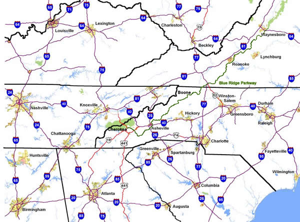
Map - How long to ride the Blue Ridge Parkway?

Getting to the Blue Ridge Parkway is a days ride for half the population in the US.

Blue-Ridge-Parkway-humback-rocks-overlook

Blue Ridge Parkway – Humpback Rocks Overlook in Virginia
While you can ride the entire 469.1 mile long Blue Ridge Parkway on your motorcycle trip in a single day, I strongly advise against it. I’ve done it, and trust me, you will not enjoy the experience like you should. It takes strategic planning and uncomfortable endurance to go end-to-end in a day on a motorcycle ride.

blue-ridge-parkway-spiral-curve-sign

Blue Ridge Parkway – Some tricky curves await on this great motorcycle ride!

The simple math is misleading – at an average speed of 45 mph and 469 miles to cover, it seems like a little over 10 hours of saddle time on your motorcycle tour does the trick. For many riders on a fully laden bike, the challenge of the mountain roads leads to a speed closer to 35 mph. You’ll also come across car traffic which finds this reduced speed more comfortable and few opportunities to pass.

photo-no-gas-sign-on-blue-ridge-parkway

This sign is a legacy to when gas was available on the Blue Ridge Parkway. It should now read “No gas next 400 miles”. There is no gas on the Blue Ridge Parkway.

Additionally, there is no gas on the entire ride. You’ll need to leave the parkway to fill up. Choose the wrong exit and that gas station may be 15 miles down a steep and twisty mountain road. Most of us like to eat, and there is only one Park Service Lodge left on the ride, so you’ll be diverting into nearby towns adding additional time.

So how do you do it best when time is tight?

I recommend starting at the north end in Waynesboro, Virginia. If you are going to try to cover as many miles as possible with few stops, do this in the Virginia section. The road is a bit more relaxed, the elevations not as high, and while the views are outstanding, they are not as spectacular as those in North Carolina. There are more wooded sections, and it gives you a chance to get used to the curves before you get into the more serious challenges to the south.
photo - Virginia blooms on the Blue Ridge Parkway
June on the Blue Ridge Parkway means flowers! A great time to enjoy the ride.

Rocky-knob-cabins

Blue Ridge Parkway – Rocky Knob Cabins – a nice stop but come prepared with your own food and drink.

Set your sights to get across the border and into North Carolina on that first day. You’ll still have time to stop at some of the nicer overlooks and if you’re making good time you can even visit some of the roadside attractions along the way. As you get near the border you’ll find lots of places to lay over for the night. In Virginia, I usually head for Floyd or Hillsville, or take one of the many cabins located near the Parkway. Be aware, if you do choose a cabin along the way, you’ll need to bring in your own food or eat before you get there. Chateau Morrisette has great food, and you can stuff a bottle in the bags to bring to the cabin.

photo - grandfather mountain on the Blue Ridge Parkway

Grandfather Mountain south of Boone starts the climb into the high mountains of North Carolina

Photo - View of the grounds at the Switzerland Inn

The Switzerland Inn – A beautiful Resort on the Blue Ridge Parkway, one of my favorite stops

On the North Carolina side of the border, most choose to stay in or around Boone. You’ll find lots of lodging options here, and plenty of good places to eat in town, though you will have to deal with the traffic. If you are making really good time, the last place I’d suggest is the Spruce Pine / Little Switzerland area, the Switzerland Inn is a fabulous stop right on the parkway with nice rooms and great food as is the Skyline Inn nearby. Once south of here, there is a long stretch of empty road before you come into the city of Asheville.

Savor your second day. Once you get south of Boone, you start to climb into the high mountains. This is the time to slow down, take advantage of the numerous overlooks, and get those photos. You’ll also hit some of the trickiest turns and curves. Take your time, relax, and enjoy.

Best Blue Ridge Parkway Overlooks - highest point

Best Blue Ridge Parkway Overlooks – highest point. The long sweeping overlook compliments the great sweeping views

Strategic planning is critical on the southern end of the Blue Ridge Parkway. You’ll be riding through long remote sections of road with few facilities nearby. I suggest fueling up in Asheville. You’ll find gas stations closest to the parkway here. It’s also a good place to stop for food, it’s hard to find a bad meal in Asheville. While it’s the second largest city on the Blue Ridge Parkway (after Roanoke, VA), it’s easy to navigate and a fun place to spend a little time. While the only remaining Park Service Lodge, the Pisgah Inn,  is just south of Asheville, and has great food and views, expect a wait to get served.

Blue Ridge Parkway-motorcycle-view

The southern end of the Blue Ridge Parkway is worth the wait. Take your time and enjoy!

blue-ridge-parkway-devils-courthouse

Blue Ridge Parkway – Devils Courthouse, one of many spectacular sights on the ride.

If you find yourself running short on gas towards the end of the ride, the next best option for fuel is Maggie Valley at US 19 / Soco Gap (MP 455.7). You also find food there, and the Wheels Through TIme Motorcycle Museum is worth the visit. Maggie Valley is the place I most recommend for staying near the end of the parkway as it is so well located for the wealth of great motorcycle rides in the surroundings, and there are lots of rooms available at good prices.

Arriving at the south end of the Blue Ridge Parkway near Cherokee, NC, you are at the southern entrance to Great Smoky Mountains National Park. Cherokee has a good number of rooms, but it’s also quite “touristy” so you’ll have some traffic to deal with. No alcohol on the reservation, and the best food is probably at Harrah’s Casino. While I’ve stayed there in the past, I suggest looking at all your options depending on which way your travels take you next.

Enjoy a Blue Ridge Parkway view on a motorcycle trip

Blue Ridge Parkway view – While 2 days will get you there, if you have more time you’ll find plenty to enjoy on a more relaxed motorcycle tour of one of the top 10 rides in the country.

____________________________________________________________________

Wayne Busch - AMERICA RIDES MAPS

Wayne Busch – AMERICA RIDES MAPS

– Wayne Busch lives in Waynesville, NC, where he produces the most detailed and comprehensive and up-to-date motorcycle pocket maps of the Blue Ridge and Smoky Mountains to help you get the most of your vacation experience. See them here – AmericaRidesMaps.com

____________________________________________________________________

Classic Motorcycle Roads Closed – a blessing?

Classic Motorcycle Roads Closed – a blessing?

Extreme rain causes flooding and washes out many favorite motorcycle rides – here’s an update and what it means for your motorcycle tour plans;

Note: we are hardly out of the woods – all this moisture in the soil could lead to more slides over time, and now with some hard freezes coming in, the freeze/thaw cycles could contribute to more problems as more rock is cracked, split, and loosened.

US 441 – Newfound Gap Road, Great Smoky Mountains National Park

Seems this road is always under construction, over the past year or two, to repair a slide near the top on the Tennessee side of the border. As the only road which crosses the park, right through the heart of it, it carries heavy traffic loads. Now, a large section has washed out about 9 miles north of Cherokee, and it will require a substantial and costly repair.

photo - slide closes park

photo source: Great Smoky Mountains National Park – Newfound Road US 441 hit by slide, park closes

Of all the damage from the recent weather, this is the most significant. While I do show this as a great motorcycle ride on my America Rides motorcycle pocket maps, it’s one of those “if you haven’t done it, you should ride it”, but it’s not one of my favorites due to the traffic, and I typically avoid it.

If you are planning to base a motorcycle vacation out of Gatlinburg / Pigeon Forge, you will now be forced to ride completely around the park to reach many of the best motorcycle rides. While there are some great motorcycle rides on the north side of Great Smoky Mountains National Park, you will also be dealing the the tourist traffic that  floods into this area. I suggest you look at options on the south side of the park instead. Map #8 details the best motorcycle rides free of traffic on the north side of GSMNP, but there are so many more on the south side you will get in more riding by basing your motorcycle trip on the quiet side of the park.

The Cherohala Skyway – NC 143/ TN 165

A significant slide on the North Carolina side of the border, about 1 mile from the state line has taken out one lane of the road and it has been closed. This is one of the nicest rides in the area, and the only road that crosses through this remote area of high mountains, a favorite scenic motorcycle ride often done as a loop ride with the infamous Dragon at Deals Gap.

Photo Source - Graham Star - Slide on Cherohala Skyway takes out 1 lane

Photo Source – Graham Star – Slide on Cherohala Skyway takes out 1 lane

This is a “wait and watch” situation right now to determine how stable the slope is over time. The good news is there is likely enough room for a temporary detour, though the work required to fix the problem will be extensive. I am hopeful, it will reopen before the riding season cranks up.

This road is featured on Map #7,  Map #8, and 12 Classic Deals Gap motorcycle rides.

US 19 – Near Burnsville

This is not a large slide in scope, but the issue is a “house sized boulder” which now sits blocking the road. Complicating the cleanup is a nearby house which is too close to permit blasting of the rock. Plan is to drill in to it and use expanding materials to break it up. I expect this problem will be cleared up relatively quickly.

yancey county slide

Photo source – Yancey County News – Large boulder blocking road

Detours use Jack’s Creek Road and Coxes Creek roads, this area is detailed on Map #5

Blue Ridge Parkway (near MP 455) Soco Gap area, near Maggie Valley

Reports of a small slide in this area seem to be over-hyped. I have hiked to it for inspection, and found a few rocks in the road which I could have cleared with one hand. No worries here.

photo - small slide on Blue Ridge PArkway

The rock slide reported near MP 455 is nothing to worry about. I could have taken care of it myself.

The most significant Blue Ridge Parkway closure in North Carolina is for slope stabilization near Mt. Mitchell. The road is closed here at least through April. You can download a free printable map of my suggested detours for motorcycles that give you other options here – http://smokymountainrider.com/Downloads/parkway-closure-2013.pdf

NC 63 – Leicester Road

I have not had personally investigated this slide, it is reported one lane has been affected. This is a popular motorcycle ride connecting to NC 209 (The Rattler), often used to make loop rides or access Asheville. The slide occurred in the best section of the road, the steep switchbacks that climb over the mountain. No further info on this one right now.

Great Motorcycle Rides in North Carolina - NC 209, a.k.a. "The Rattler" This is some of the best motorcycle riding you'll find in the world. These riders are looping back to NC 209 on NC 63.This is some of the best motorcycle riding you'll find in the world. These riders are looping back to NC 209 on NC 63.

Great Motorcycle Rides in North Carolina – These riders are looping back to NC 209 on NC 63.

Fortunately, there are many other options to make loop rides through this area, you’ll find them them extensively detailed on Map #6

So where are the blessings in all this bad news?

Most of the mess will be tended to by the time the real motorcycle riding season gets going. While 5 important roads are closed, some of them consistently on the “top 10 motorcycle rides” lists, it is only 5. I show nearly 200 other great motorcycle rides in this area, the blessing is you now have the opportunity to get away from the tourist traffic that flocks to these biker roads and discover some of little know and best scenic motorcycle rides detailed on my maps.

____________________________________________________________________

wayne busch - Smoky Mountain Motorcycle Rider.com

Wayne Busch

– Wayne Busch lives in Waynesville, NC, where he produces the most detailed and comprehensive and up-to-date motorcycle pocket maps of the Blue Ridge and Smoky Mountains to help you get the most of your vacation experience. See them here – AmericaRidesMaps.com

Total Rider Tech Logo

Learn Total Control

Wayne is an advanced motorcycle instructor for Total Rider Tech teaching Lee Parks Total Control Advanced Rider Courses. Isn’t it time you looked into advanced rider training to ride more confidently and safely? It can transform your mountain riding experience.  Total Rider Tech

____________________________________________________________________

Blue Ridge Parkway Motorcycle – Fall Leaf Color

Blue Ridge Parkway Motorcycle – Fall Leaf Color, October 12, 2012
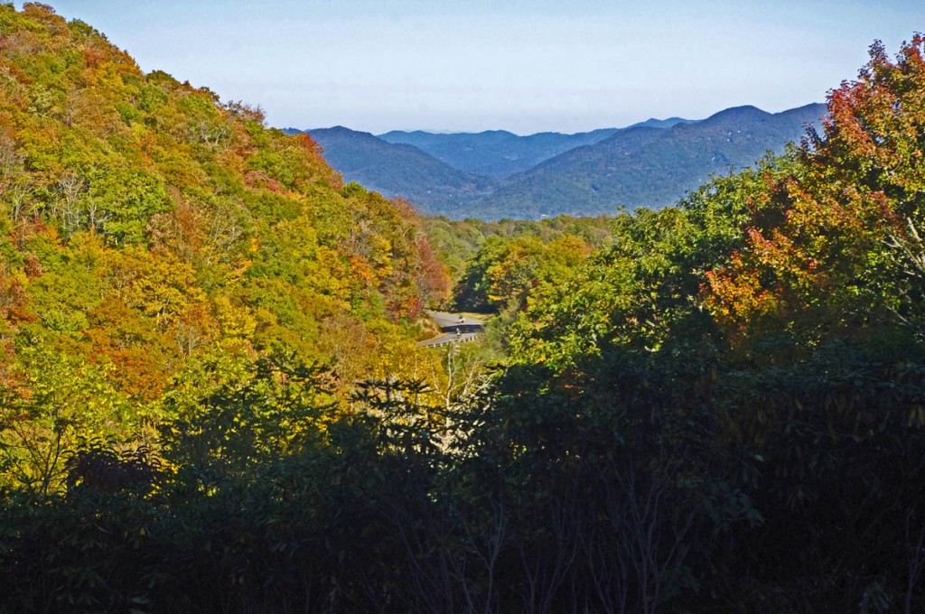
South section, Asheville to Cherokee

Blue Ridge Parkway Motorcycle - Fall leaf color

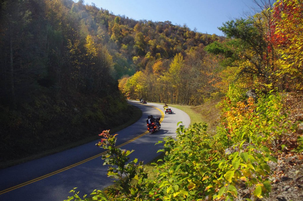
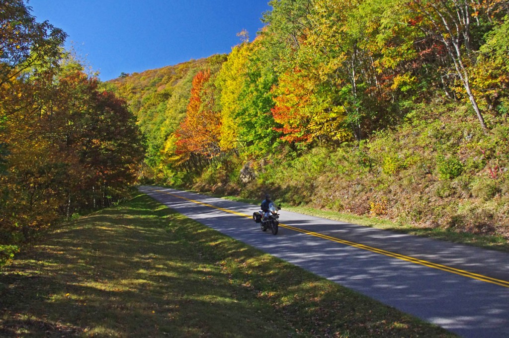
Blue Ridge Parkway Motorcycle – Fall leaf color; While the leaves have dropped some at the highest points, plenty remains just a little lower.

For bikers riding the Blue Ridge Parkway by motorcycle this year, it’s been another good fall showing of fall leaf color. The weather has been a bit “iffy” at times, but that’s not uncommon during this transitional period of the year.

Blue Ridge Parkway Motorcycle - Fall leaf color;

Blue Ridge Parkway Motorcycle – Fall leaf color; Even where some leaf loss has occurred, the views are still outstanding. Late in the day the golden sunlight really sets them off!

Friday, the colors were just getting near their peak at the highest elevations. A cold front over the weekend brought some wind and rain lingered into the week. Unfortunately the leaves were stripped in many exposed areas. Still, there is plenty remaining to make a motorcycle tour worth the time and effort.

Blue Ridge Parkway Motorcycle - Fall leaf color;

Blue Ridge Parkway Motorcycle – Fall leaf color; plenty of color yet to come at the lower elevations throughout the mountains. It usually lasts well into November.

Above 5000 ft. some color remains, but the real show now is a little further down. You’ll find excursions off the Blue Ridge Parkway onto the many great connecting motorcycle rides still yielding a spectacular view of natures glory.

Blue Ridge Parkway Motorcycle - Fall leaf color;

Blue Ridge Parkway Motorcycle – Fall leaf color; The lower elevations are just beginning to show the full spectrum of all the hues of the leafy rainbow.

Don’t miss opportunities to get off onto the back roads where there are some outstanding displays of not only great leaf color, but beautiful mountain scenes that reward the wanderer year-round.  AmericaRidesMaps.com will help you find them!

NC 215 fall leaf color - motorcycle rides nc

NC 215 fall leaf color – motorcycle rides nc – NC 215 has currently got some great shows of color as well as the scores of roads shown on America Rides Maps in the surrounding area. Be sure to check them out!

____________________________________________________________________

wayne busch - Smoky Mountain Motorcycle Rider.com

Wayne Busch

– Wayne Busch lives in Waynesville, NC, where he produces the most detailed and comprehensive and up-to-date motorcycle pocket maps of the Blue Ridge and Smoky Mountains to help you get the most of your vacation experience. See them here – AmericaRidesMaps.com

Total Rider Tech Logo

Learn Total Control

Wayne is an advanced motorcycle instructor for Total Rider Tech teaching Lee Parks Total Control Advanced Rider Courses. Isn’t it time you looked into advanced rider training to ride more confidently and safely? It can transform your mountain riding experience.  Total Rider Tech

____________________________________________________________________

Top 10 Motorcycle Rides – Pacific Coast Highway vs. Blue Ridge Parkway

We’ve all probably seen those lists of the top 10 motorcycle rides in the USA – typically a rehash of the same roads again and again. As the leading expert on motorcycle riding on the Blue Ridge Parkway I make an effort to get out and see those other top 10 motorcycle rides to see how they stack up to the one I consider best. I’ve just returned from riding the last good section of the Pacific Coast Highway in California and here’s my biased opinions of how they compare.

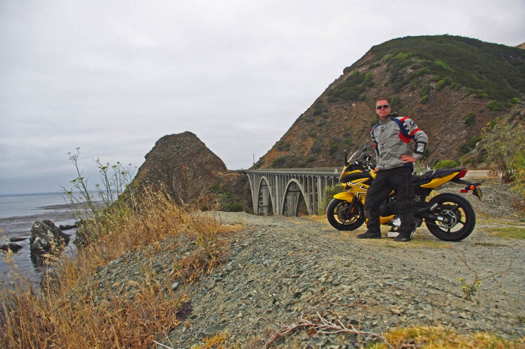
Top 10 Motorcycle Rides - Pacific Coast Highway vs. Blue Ridge Parkway

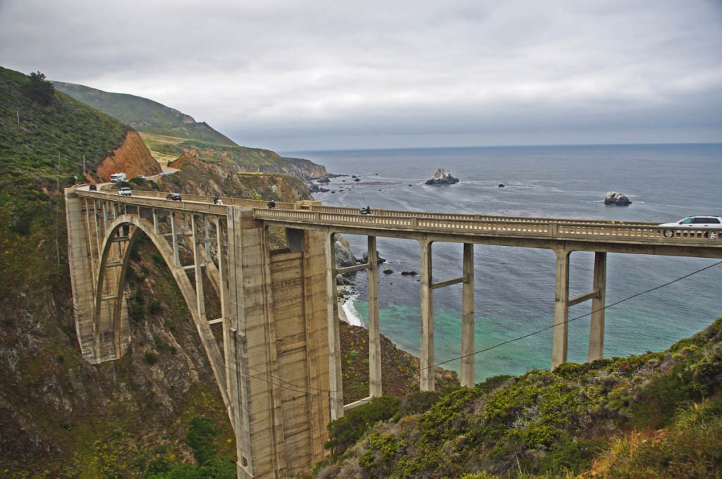
Top 10 Motorcycle Rides – Pacific Coast Highway vs. Blue Ridge Parkway – The stunning scenery is often enveloped in thick sea fog. Note the traffic mid-week mid-day. I’d imagine weekends are worse.

Over the years I’ve ridden all but one of the good sections of the Pacific Coast Highway. The fact that there are good and not-so-good sections on the long western ride is one major difference between the two roads – there are no “not-so-good” sections on the Blue Ridge Parkway. The scenery is stunning and beautiful as the coastal road traverses the high cliffs and rocky beaches along the western shore. The one remaining section I just finished riding is the Big Sur area in central California.

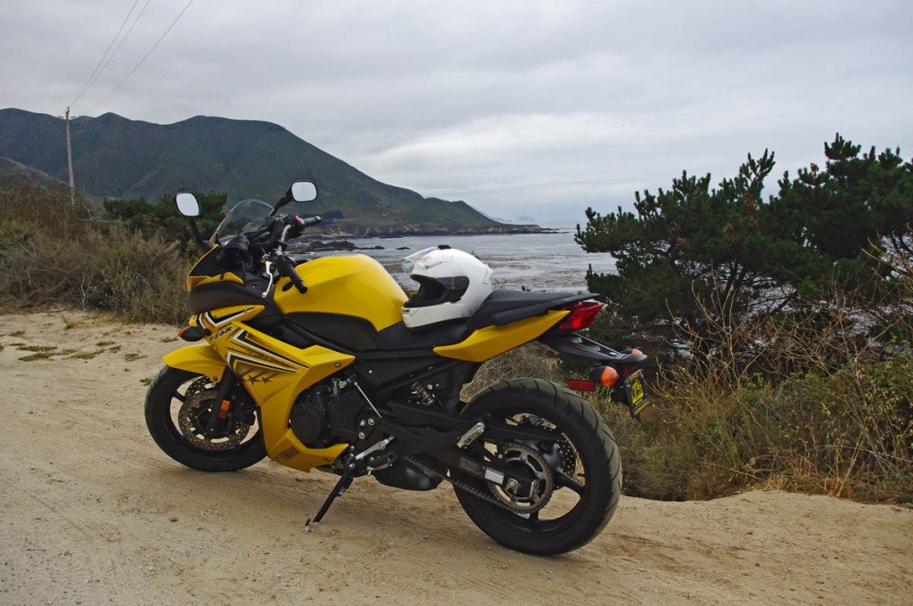
Top 10 Motorcycle Rides - Pacific Coast Highway vs. Blue Ridge Parkway

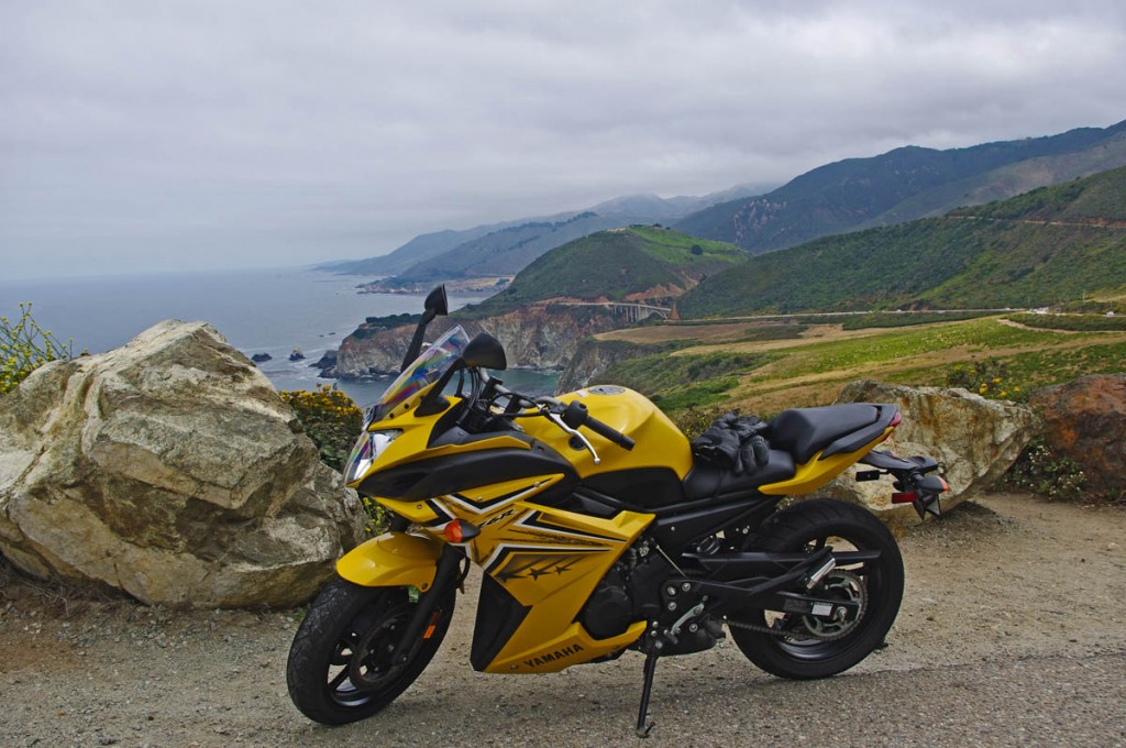
Top 10 Motorcycle Rides – Pacific Coast Highway vs. Blue Ridge Parkway – this trip I rented a 600cc entry-level sport bike in Los Angeles and headed north. For this ride, a performance bike is wasted, it’s much better suited to a big cruiser.

Located between San Francisco and Los Angeles, the Big Sur area is found just south of Carmel. Further south the seaside road is pretty built up with homes and businesses and sections of freeway and holds little appeal to me as a pleasant and scenic motorcycle ride. Same to the north as you get into the San Francisco area. While this area was nice, my top pick for the best section of the Pacific Coast Highway would be the section through Oregon, though this is a good one.

Top 10 Motorcycle Rides - Pacific Coast Highway vs. Blue Ridge Parkway -

Top 10 Motorcycle Rides – Pacific Coast Highway vs. Blue Ridge Parkway – The landscape is quite a contrast to the lush forests of the Blue Ridge Mountains. Where are the trees? Too dry and harsh.

Contrary to what you might expect, the Pacific Coast Highway is not entirely on the coast. It diverts inland in many places, away from the cold ocean waters into the rolling dry hills. To the north in Washington and Oregon, that sometimes takes you into the redwood forests, and a brief section did so near Big Sur. Mostly though, these inland diversions run you through the dry and rolling hills almost monotonous in appearance. You won’t find the lush green landscape of the eastern mountains covered with trees.

Top 10 Motorcycle Rides - Pacific Coast Highway vs. Blue Ridge Parkway -

Top 10 Motorcycle Rides – Pacific Coast Highway vs. Blue Ridge Parkway – There are plenty of places to stop alongside the road and savor the views. The sun poked through the clouds so rarely I never got a really clear photo.

While the terrain is almost desert dry, it’s more likely to be chilly than hot. The frigid waters of the Pacific cool the coastline even in the midst of July to where you’ll want some warm gear with you. The cold water also creates a thick sea fog which reaches far inland and usually doesn’t pull back to reveal the views until the afternoon. Riding early in the day is too often a disappointment when the thick fog hides the views you’ve come so far to see.

Top 10 Motorcycle Rides - Pacific Coast Highway vs. Blue Ridge Parkway

Top 10 Motorcycle Rides – Pacific Coast Highway vs. Blue Ridge Parkway – Of course, I poked my wheels down several of the few side roads that lead in from the coast – Carmel Valley Road was one of my favorites for challenging curves a good views.

The greatest contrast between the Blue Ridge Parkway and the Pacific Coast Highway is the amount of traffic. While there are curvy and engaging sections of the road, you’ll rarely be able to enjoy carving through them as there is almost always a car, RV, or commercial traffic to slow you down just when you want to crank it up. While there can be times of traffic on the Blue Ridge Parkway, the ride is constantly scenic, always 2 lane, and without interruption for it’s entire 469 mile length.

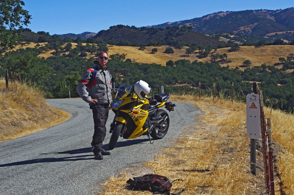
Top 10 Motorcycle Rides - Pacific Coast Highway vs. Blue Ridge Parkway

Top 10 Motorcycle Rides – Pacific Coast Highway vs. Blue Ridge Parkway – Once done with the coast, I went back to some of my favorite California riding, the mountains and twisty canyons that run through them. Much hotter in the interior.
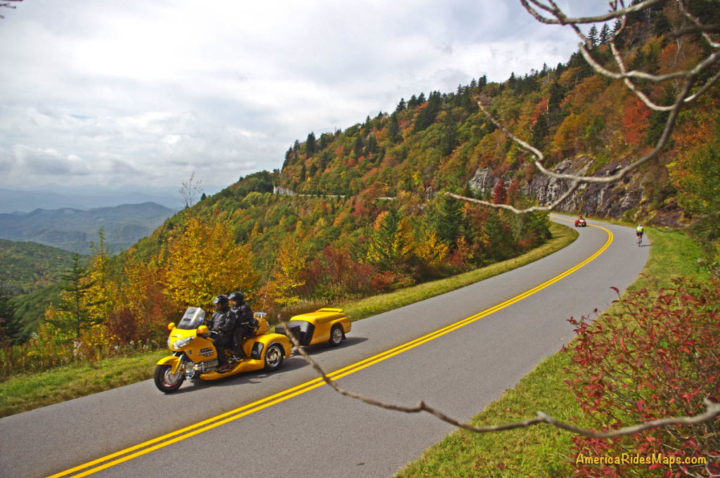
The Pacific Coast Highway should be on your bucket list of places to visit on your motorcycle tours. It deserves to be on the top 10 best motorcycle rides lists, principally for the scenery, but not the riding experience. There’s just too much traffic and diversions onto highway and through towns and cities. Honestly, I find riding the canyons and mountain passes in California much better riding on a motorcycle if you more enjoy an engaging and challenging road with little traffic impair your ride.
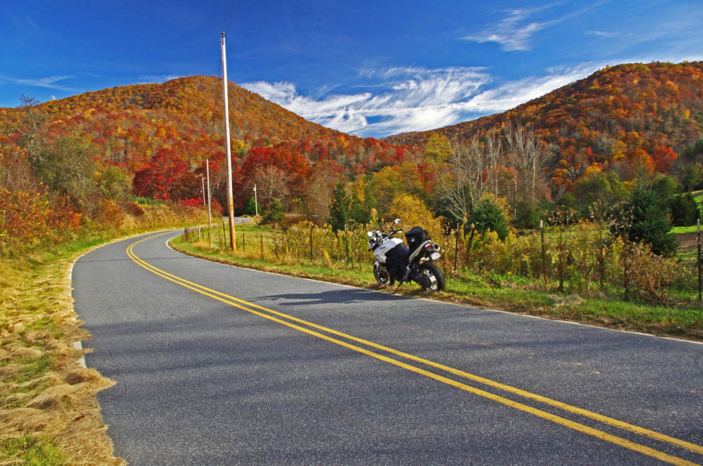
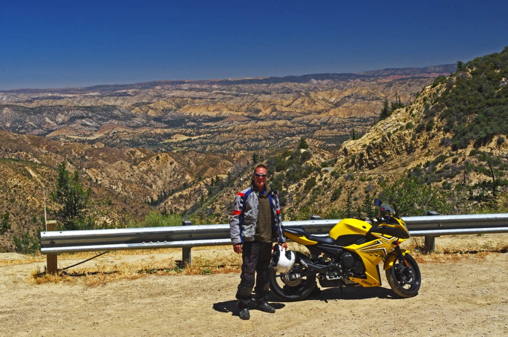
Top 10 Motorcycle Rides - Pacific Coast Highway vs. Blue Ridge Parkway

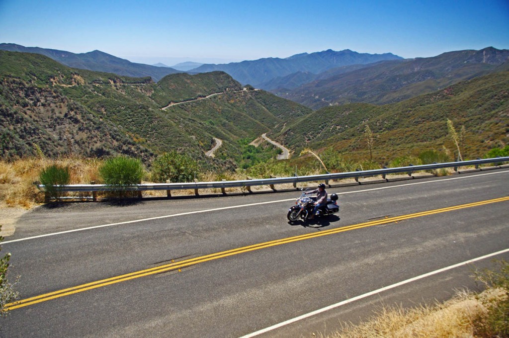
Top 10 Motorcycle Rides – Pacific Coast Highway vs. Blue Ridge Parkway – Looking back towards Santa Barbara you can sometimes see the Channel Islands from one of my favorite rides CA33 – the Mariposa Highway. It’s a twisty climb from Ojai and a lot of fun on a motorcycle.

I had a good experience renting from Racy Rentals in Los Angeles – if you’d like to see about a rental bike go to http://www.racyrentals.com/

____________________________________________________________________

wayne busch - Smoky Mountain Motorcycle Rider.com

Wayne Busch

– Wayne Busch lives in Waynesville, NC, where he produces the most detailed and comprehensive and up-to-date motorcycle pocket maps of the Blue Ridge and Smoky Mountains to help you get the most of your vacation experience. See them here – AmericaRidesMaps.com

Total Rider Tech Logo

Learn Total Control

Wayne is an advanced motorcycle instructor for Total Rider Tech teaching Lee Parks Total Control Advanced Rider Courses. Isn’t it time you looked into advanced rider training to ride more confidently and safely? It can transform your mountain riding experience.  Total Rider Tech

____________________________________________________________________

Best Blue Ridge Parkway Overlooks by Motorcycle

Best Blue Ridge Parkway Overlooks by Motorcycle – Highest Point

Richland Balsam Overlook
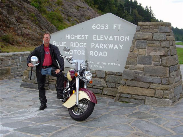
Elevation – 6053 feet
Milepost – 431.4 

Best Blue Ridge Parkway Overlooks - highest point

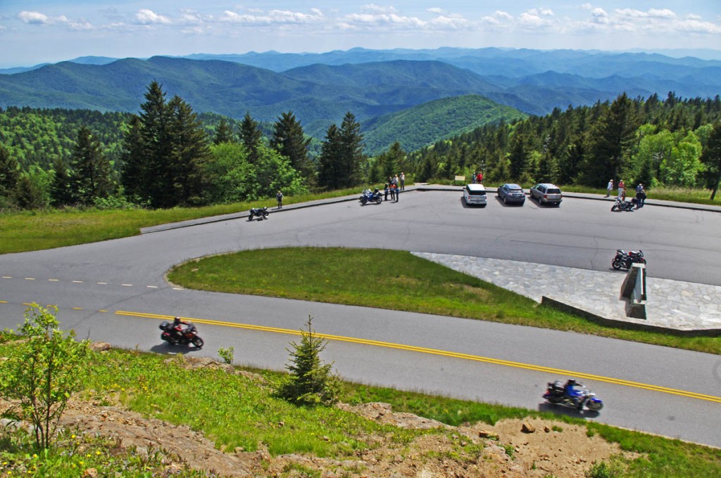
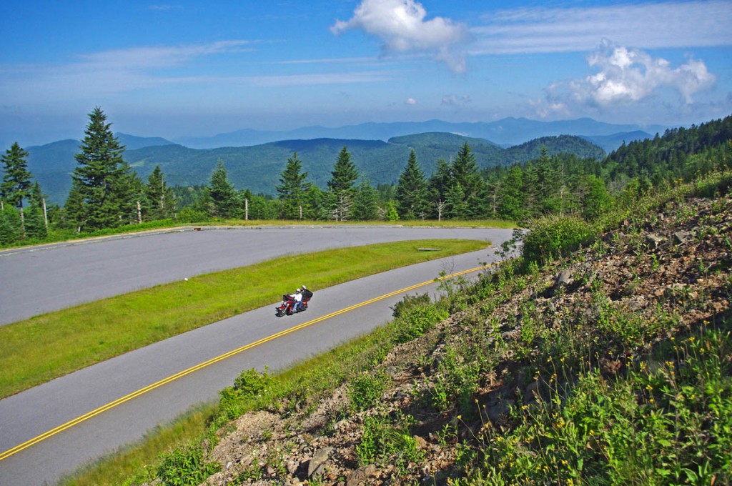
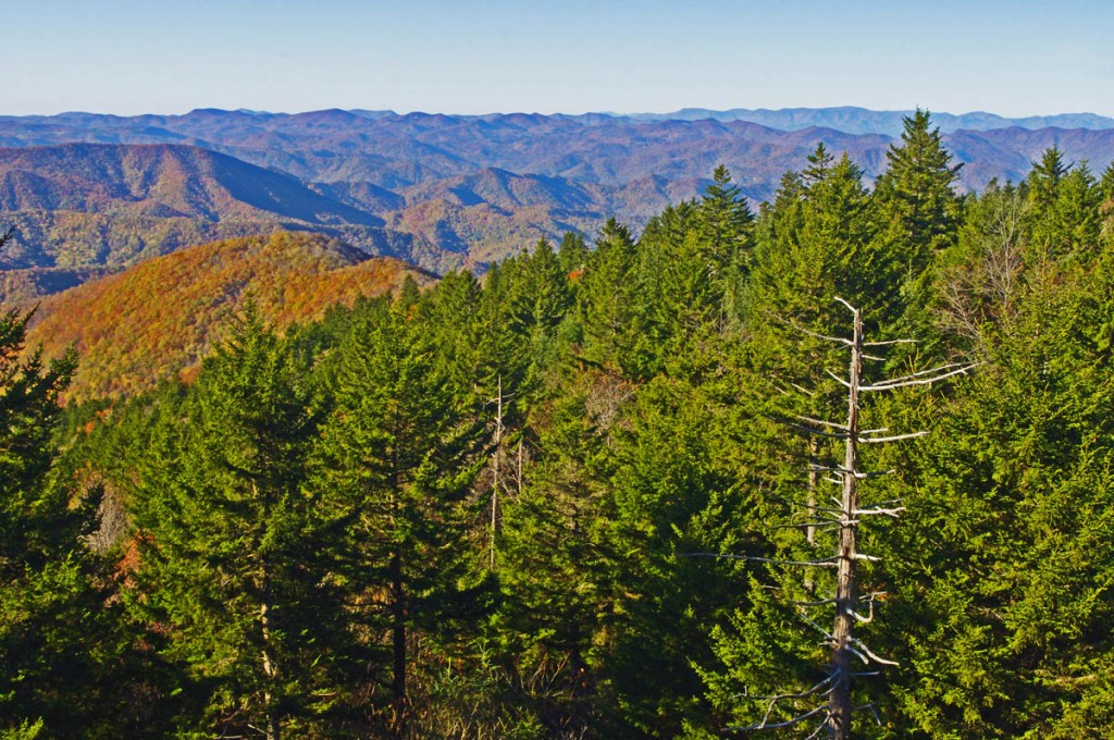
Best Blue Ridge Parkway Overlooks – highest point. The long sweeping overlook  provides expansive views of the mountains which comprise ‘The Land of the Waterfalls”

The highest point on the Blue Ridge Parkway is in North Carolina at milepost 431.4. Here, the nations top motorcycle ride reaches an elevation of 6053 feet as it carves it’s way along  the southern exposure of the Balsam mountain range.

Best Blue Ridge Parkway Overlooks by Motorcycle - highest point

Best Blue Ridge Parkway Overlooks by Motorcycle – Getting your picture with the sign at the highest point on the Blue Ridge Parkway is one of those “must have” photos from your trip to reach the long paved overlook which spans the radius of the curve around the mountain.

There is no dramatic climb to reach the long paved overlook which spans the radius of the broad curve around the mountain. The Blue Ridge Parkway maintains a steady altitude through this long remote and isolated section of the national park rarely dipping below 5000 feet. While the grades are gentle, the curves are full of surprises and the drop-offs along the roadside inspire a real respect for the altitude on this best motorcycle ride in the USA.

Best Blue Ridge Parkway Overlooks by Motorcycle - high point

Best Blue Ridge Parkway Overlooks by Motorcycle – peer into several states from the highest point on clear days, but it not place to be in bad weather

Only 37.7 miles from the southern end of the Blue Ridge Parkway at Great Smoky Mountains National Park near Cherokee, NC, a ride to the high point is an easy one to squeeze in even if you’re not on an end-to-end parkway ride on your motorcycle. From Asheville, Waynesville and Maggie Valley, it’s a wonderful way to spend a few hours riding a motorcycle on one of the the best scenic motorcycle rides you’ll find anywhere.

Best Blue Ridge Parkway Overlooks by Motorcycle - high point

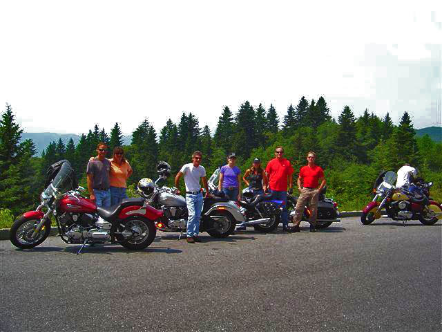
Best Blue Ridge Parkway Overlooks by Motorcycle – Few can resist a stop at the high point. The large parking area is able to handle the crowds, and it’s a great lace to get shots of large groups of riders.

As you might suspect, this spot is one of the most remote and isolated on your Blue Ridge Parkway motorcycle ride. It’s a long ride for gas, tank up before you go. The high parts get the wet weather first – if it looks cloudy from the valley, you may not see much when you get up high. It will be a lot cooler than down in the valley and more windy, be prepared.

Best Blue Ridge Parkway Overlooks by Motorcycle - high point

Best Blue Ridge Parkway Overlooks by Motorcycle – A fall view from the high point overlook. Clear days are just spectacular!

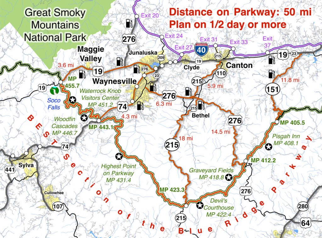
Map of the best section of the Blue Ridge Parkway

Blue Ridge Parkway Map best

Map of the best 50 mile section of the Blue Ridge Parkway shows the location of the high point and the ways to reach it from nearby towns. Click for larger image –

See a 360 degree panoramic view at Virtual Blue Ridge – http://www.virtualblueridge.com/parkway_tour/overlooks/00431b.asp

image-motorcycle-ride-map-cover

You’ll find the highest point on the Blue Ridge Parkway on America Rides Maps motorcycle pocket map

#6 The Best Motorcycle Rides Near Smoky Mountains National Park – EAST http://shop.americaridesmaps.com/6-The-Best-Motorcycle-Rides-Near-Smoky-Mountains-Park-EAST-NC017.htm

____________________________________________________________________

wayne busch - Smoky Mountain Motorcycle Rider.com

Wayne Busch

– Wayne Busch lives in Waynesville, NC, where he produces the most detailed and comprehensive and up-to-date motorcycle pocket maps of the Blue Ridge and Smoky Mountains to help you get the most of your vacation experience. See them here – AmericaRidesMaps.com

Total Rider Tech Logo

Learn Total Control

Wayne is an advanced motorcycle instructor for Total Rider Tech teaching Lee Parks Total Control Advanced Rider Courses. Isn’t it time you looked into advanced rider training to ride more confidently and safely? It can transform your mountain riding experience.  Total Rider Tech

____________________________________________________________________