Big Updates to Motorcycle Ride Maps 2019

2019 brings big changes to America Rides Maps motorcycle maps of the southern Appalachians – more area, more detail, and new maps!
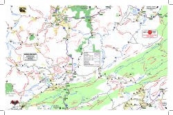
View of Map 11The desire to expand the areas covered by America Rides Maps into the Allegheny Mountains of West Virginia required a lot more work than expected. Since the maps connect and overlap, existing maps needed to be updated. I took this opportunity to include the most current data available and employ new skills learned since the last updates improving the detail and readability of what we currently had.
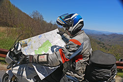
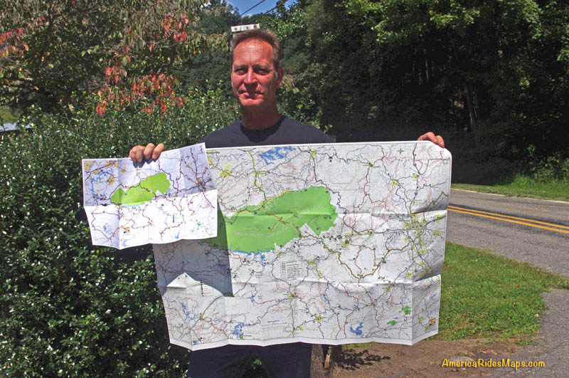
Wayne-with-mapWhen I began there were 13 pocket maps available. Now there are 16 motorcycle ride maps which cover the great motorcycle roads found in the southeast mountains. 5 existing maps were reworked and three new ones introduced. In addition, one of the two large format maps was completely overhauled in the process.

The first step was updating the 3 maps which cover Virginia – Map #1, Map #2, and Map #3.
For each of these maps we spent weeks on the road riding the old routes and scouting new ones, updating the information from direct experience and observation, visiting the sights, staying in the hotels and lodges, exploring and recording the new roads.

Map #1 – Great Rides Near the Start of the Blue Ridge Parkway Map 1 - Great Rides Near the Start of the Blue Ridge Parkway
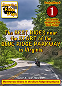
This map was expanded to cover a larger area including more of the border with West Virginia. The previous map cut off before it reached Marlinton, WV, it now extends further west. It also extends further south clipping more of Lynchburg. The old map did a good job covering the main roads, the new map focuses on including more of the smaller side roads which stem from them, we found a lot worth adding.

Map #2 The Roads Of Roanoke and BeyondThe Roads Of Roanoke and Beyond
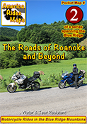
Map #2 got a significant shift to the west. The previous version covered more area east of Roanoke but there were few good roads there. The good riding is west of Roanoke so the focus shifted. Map #2 now extends well across the Virginia border into West Virginia adding a lot of new roads in a really beautiful riding area. We have some new favorite rides and places to visit and stay thanks to these explorations.

Map #3 North Carolina / Virginia Border RidesNorth Carolina / Virginia Border Rides
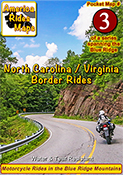
Map #3 was quite a challenge. It was expanded to cover more area both in Virginia and North Carolina. It was enlarged to include Pilot Mountain State Park & Hanging Rock State Park, a large section of the Blue Ridge Parkway, and get in the full run of VA 16 – “The Back of the Dragon”. This is one of our favorite areas to ride in and it is better represented and easier to understand than it was on the previous two overlapping maps.

Once the Virginia maps were ready we moved on to the new West Virginia maps which overlap and connect to them on the border.
Exploring West Virginia was a lot of work with a lot of rewards. I’ve not found such a variety of roads anywhere in the US. This first taste of it has us yearning to expand our coverage.

Map #10 West Virginia Border Rides – New River AreaWest Virginia Border Rides - New River Area
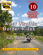
This new map covers the New River Gorge area and extends east to Snowshoe, West Virginia. The city of Beckley anchors the bottom left corner of the area shown. While compared to other maps there are not a lot of paved roads in large sections, more than 50 roads are featured and described and they are great rides. There are some outstanding scenic areas, lots of historic sights, and a handful of great little backroads for the adventurous rider to explore.

Map #11 West Virginia Border Rides – Coal CountryWest Virginia Border Rides - Coal Country
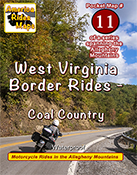
The highlight of this map is the region southwest of Beckley, West Virginia, where you find yourself riding in historic coal country. Numerous roads extend back through the mountains to reach the mines, a few of which are right on the roadway. It also covers the New River area south of Beckley and the scenic roads which wind along broad rivers through historic towns. It picks up VA 16 at the Tazwell end of The Back of the Dragon which continues as a great curvy ride into the city. More than 100 roads are highlighted and described.

Next, it was time to update one of the big maps.
Too much has changed over the last few years, the update was needed. The new maps looked so good I wanted to apply the new techniques so I rebuilt 100 Great Motorcycle Rides in the Smokies from scratch.

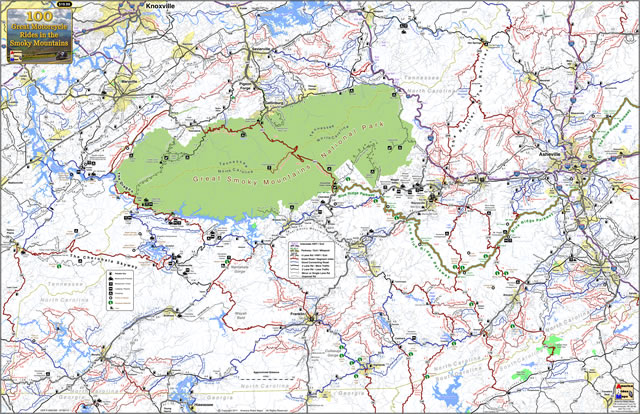
100 Great Motorcycle Rides in the Smoky MountainsPremium Map 100 Great Motorcycle Rides in the Smoky Mountains is my best work and best selling map. It was last updated in 2017. Nothing is as comprehensive or as detailed as this motorcycle ride map of the areas surrounding Great Smoky Mountains National Park but I knew I could do it better and I did. I had to add the new “missing link” section fo the Tennessee Foothills Scenic Parkway which was still in limbo at the last printing. Several motorcycle friendly locations on the previous version had gone out of business and there were new ones to be added. I wanted to push the limits and expand the map to include some really great roads not covered on any other map. Mission accomplished.

With the big map done, I used the data to expand another one of the pocket maps –

Map #8 – The Best Motorcycle Rides Near Smoky Park – NORTHBest Rides NORTH of Smoky Park
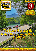
Once again I pushed to expand the map and add more roads. I also updated the points of interest and added a lot of new ones, several more waterfalls, motorcycle friendly stops, it’s a significant upgrade to this map of the area north of the park.

Finally, my attentions turn to the mountains of Northeast Georgia –

Map OR4 – The Best UNPAVED Roads in Northeast GeorgiaThe Best UNPAVED Roads in Northeast Georgia
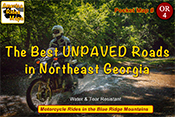
With 3 maps of the unpaved roads in the Smoky Mountains already completed, I set my sights on Northeast Georgia more than a year ago. Frustrated with the limitations of Forest Service maps of this rich off pavement riding area I knew I could do better. It took way too long to poke my wheels down every back road and trail I could find then sort them out, many adventures ensued. You won’t find a better dual sport map of this wonderful area.

Map #9 – The Best Rides in the North Georgia MountainsThe Best Rides in the North Georgia Mountains
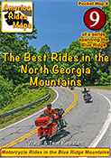
As I’d already built the base maps for the unpaved roads in NE Georgia, and discovered new stuff while exploring, it made sense to update the paved roads map as well. Expanded, more points of interest, more motorcycle friendly locations, etc. It really turned out nice.

I finished it all up as the winter weather arrived here in the Blue Ridge Mountains. With short days and freezing weather upon us I will now return to working on the digital versions of the maps and laying out the new explorations for the spring. It was a busy year. I hope the next one brings more road time. Don’t we all.

You can see the maps and order them online at AmericaRidesMaps.com
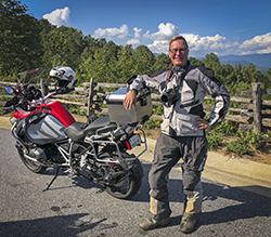
Wayne Busch - AMERICA RIDES MAPS
Wayne Busch – AMERICA RIDES MAPS

Printed in the USA on the highest quality waterproof and durable materials, these maps are specifically designed for the motorcycle traveler.

Pocket maps are easy to fold, fit in your pocket so they are always handy.

Order Online at
AmericaRidesMaps.com

100 Great Motorcycle Rides in the Smoky Mountains Map

100 Great Motorcycle Rides in the Smoky Mountains Map

America Rides Maps motorcycle pocket ride maps has a brand new map!

100 Great Motorcycle Rides  mapin the Smoky Mountains

New map! 100 Great Motorcycle Rides in the Smoky Mountains

This map mails out September 6, 2013. This is the first run of these new maps, supplies are limited! Reserve yours now.

Order online here – http://www.shop.americaridesmaps.com/100-Great-Motorcycle-Rides-in-the-Smoky-Mountains-SM100F.htm

———————————————————————————————-

100 Great Smoky Mountain Motorcycle Rides Map

100 Great Smoky Mountain Motorcycle Rides Map – both folded (road use) and unfolded (wall display) versions. Waterproof and durable. Red Roads are best, Blue Roads are best connectors.

12 Classic Deals Gap Motorcycle Rides pocket map

12 Classic Deals Gap Motorcycle Rides pocket map

  • Size: 24 x 36 inches
  • Waterproof and tear resitant
  • Folded and unfolded versions available
  • Supplies are limited!
  • Click here to order

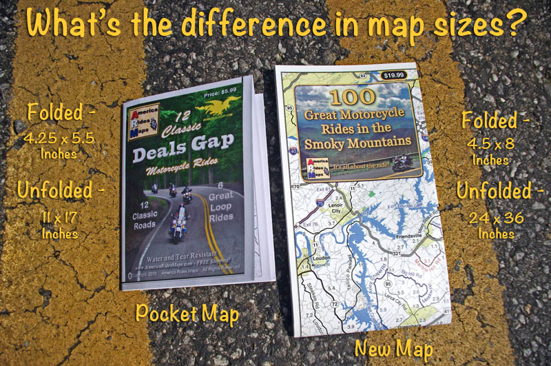
100 Great Smoky Mountain Motorcycle Rides is the “grown up” version of our most popular 12 Classic Deals Gap Motorcycle Rides pocket map. This new larger and more detailed map adds in all the great roads that are not featured on the smaller map, more than 100 of them.

Great Motorcycle Rides in the Smoky Mountains Map

Size comparison – pocket maps vs. new map unfolded. More detail, easy to read, tons more roads!

——————————————————————-


100 Great Motorcycle Rides in the Smoky Mountains Map

4.5 x 8 inches folded

ABOUT:

Discalimer –

  • There are way more then 100 great motorcycle rides on this map
  • Most of these roads are peripheral to the actual geologic formation of the Smoky Mountains

This new larger format map (24×36 inches) combines at least 3 pocket maps (#6, #7, #8)  and sections of 2 more (#5, #9) into one larger map that encircles and includes all the best motorcycle rides surrounding Great Smoky Mountains National Park.

This map stretches from Tellico Plains, TN in the west to include the Cherohala Skyway, The Dragon,  and connecting roads, to beyond Asheville, NC in the east. It dips into Georgia and South Carolina, and reaches as far north as Knoxville, TN. Within these borders lie some of the best motorcycle roads in the nation.

  • For the first time visitor – all the great motorcycle roads are at your disposal.
  • For the return visitor – expand on what you’ve already discovered
  • For the local – I bet you find something new

Buy this map now

————————————————————————————————-

And you’ll have to wait for it until September 6, 2013;

America Rides Maps notice

Maps will mail Sept 6

This maps just arrived from the printer and I’m about to leave on my motorcycle vacation. Yes, just like you, I need my motorcycle trips.

So all I can do is let you know when you can get them –

  • You can order now –
  • I will start mailing maps again on September 6, 1st Class or Priority Mail –
  • You should have your map by September 10, 2013

Order now

————————————————————————————————-

Where can I buy these maps NOW?

I’ve had no time to get them out to sellers so these are the few places they are available and in limited supply at that. Once I return from my motorcycle trip I’ll get more out to the other vendors.

http://www.shop.americaridesmaps.com/100-Great-Motorcycle-Rides-in-the-Smoky-Mountains-SM100F.htm

America Rides Maps motorcycle ride maps

How the maps compare in size –

Click here to shop online and see all the maps –

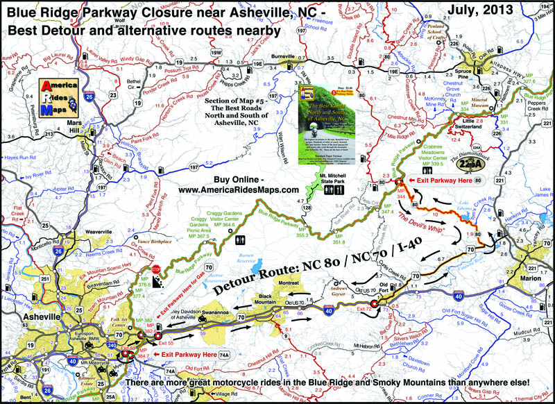
Blue Ridge Parkway Detour Route for Motorcycles – July, 2013

Blue Ridge Parkway Detour Route for Motorcycles – July, 2013

A section of the Blue Ridge Parkway north of Asheville, NC has closed due to a recent slope failure. Unprecedented rainfall in the region has triggered numerous slides, washed out roads and bridges, and caused some flooding in areas. The National Park Service detour routes traffic south and east of this long closed section of the parkway using US 221 through Marion, NC.

Photo courtesy National Park Service - Blue Ridge Parkway crack in road

Photo courtesy National Park Service – Blue Ridge Parkway crack in road at site of slope failure.

Usually, there is a better route than the “official Park Service Route”, as the park needs to factor in for the large RV’s which cannot easily negotiate steep climbs and sharp turns. Here is a map which highlights the most pleasant way for the motorcycle traveler to bypass the closed section of the Blue Ridge Parkway. It is also the most direct route so you miss as little as possible.

Blue Ridge Parkway detour map 2013

Blue Ridge Parkway detour map 2013

Use this link to a .pdf file of the map here to download or print it for free;

http://smokymountainrider.com/Downloads/Parkway-detour-map-2013.pdf

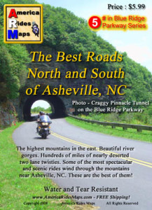
Map #5 - The Best Roads North and South of Asheville, NC

Map #5 – The Best Roads North and South of Asheville, NC

This road closure occurs on America Rides Maps Motorcycle Pocket Map #5 – “The Best Roads North and South of Asheville, NC”.  A section of Map #5 with the better detour route is highlighted. You’ll also see there are several other ways to go –  the red roads are best if you have the time.

America Rides Motorcycle Pocket Maps catalogue several hundred of the best motorcycle roads in the Blue Ridge Mountains from north Georgia to north Virginia so you get the most out of your visits. Great rides are linked together with the best connecting roads to keep you rolling on the most enjoyable 2 lane back roads you’ll find anywhere.

Get your maps here
____________________________________________________________________

wayne busch - Smoky Mountain Motorcycle Rider.com

Wayne Busch

– Wayne Busch lives in Waynesville, NC, where he produces the most detailed and comprehensive and up-to-date motorcycle pocket maps of the Blue Ridge and Smoky Mountains to help you get the most of your vacation experience. See them here – AmericaRidesMaps.com
Total Rider Tech Logo

Learn Total Control

Wayne is an advanced motorcycle instructor for Total Rider Tech teaching Lee Parks Total Control Advanced Rider Courses. Isn’t it time you looked into advanced rider training to ride more confidently and safely? It can transform your mountain riding experience.  Total Rider Tech

____________________________________________________________________

Best Motorcycle Rides in North Carolina – A sport bike loop

Best Motorcycle Rides in North Carolina – A sport bike loop ride

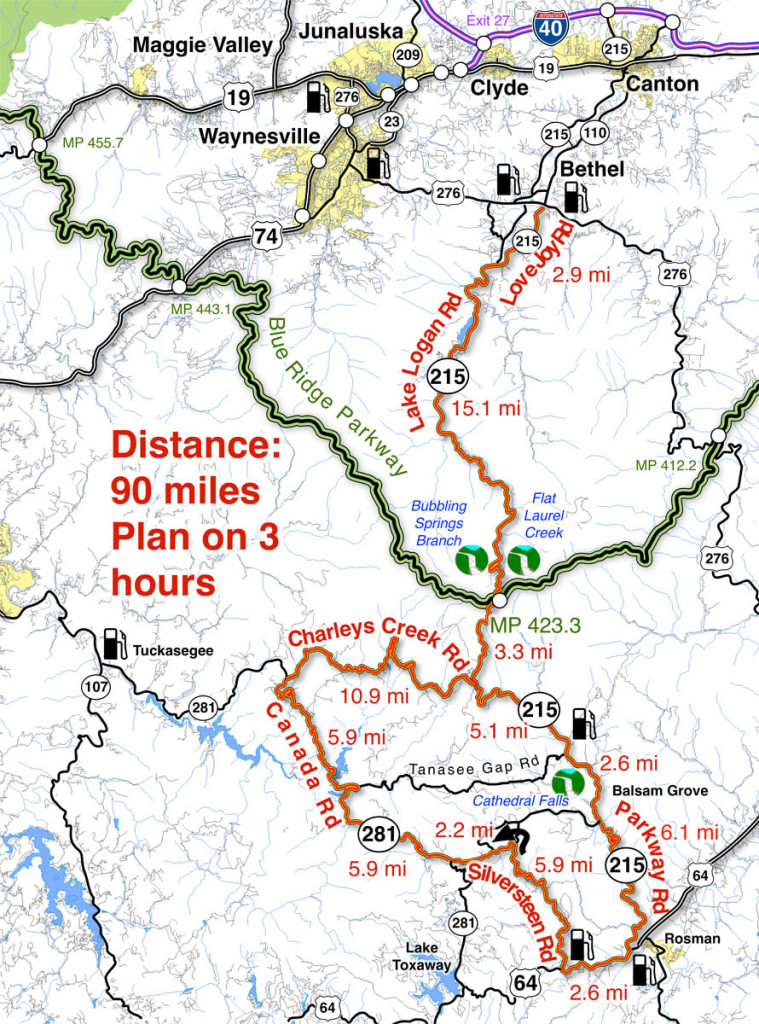
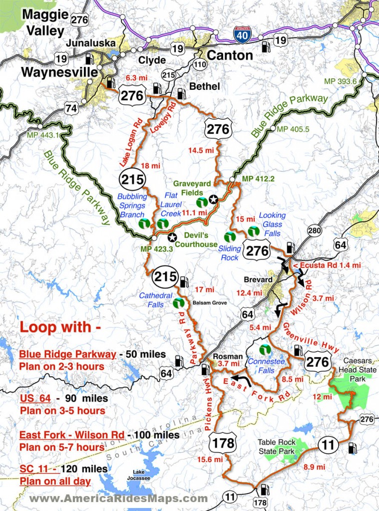
When I’m looking for a “dragon like” challenge close to home, this 90 mile loop satisfies every time!

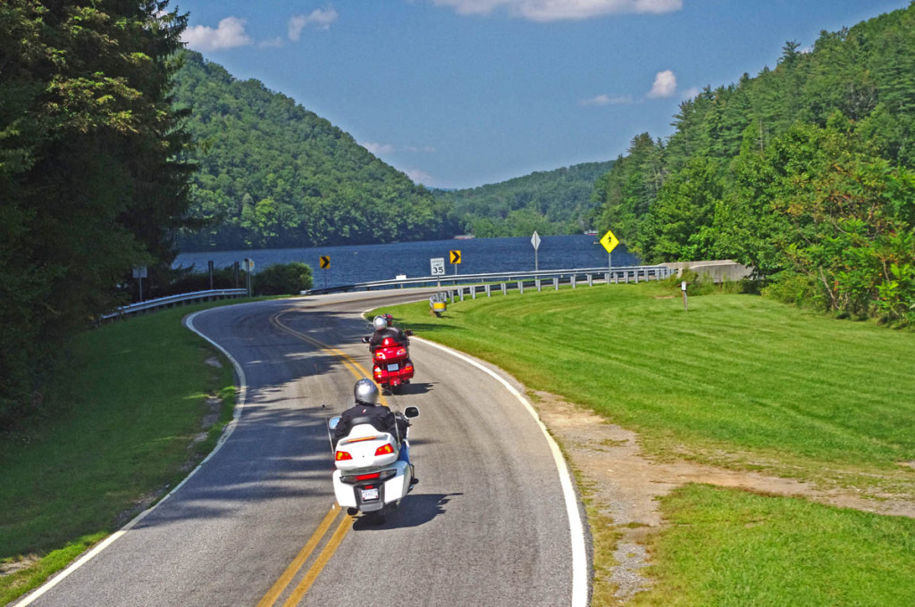
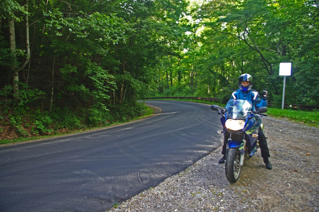
Section of NC 215 near Lake Logan.

Section of NC 215 near Lake Logan. You’ll find some nice scenery on the popular road. The curves so far are just a warm up for what lies ahead.

As much as I enjoy a ride on the infamous Tail of the Dragon at Deals Gap, it’s a bit of a ride to get out to it from the Waynesville / Maggie Valley area where I live. Fortunately, there are ample challenging roads nearby, and when I really want a peg-scraping ride, this is one of my favorite local loops. For those on sport bikes, it’s a must-do when you are in the area.

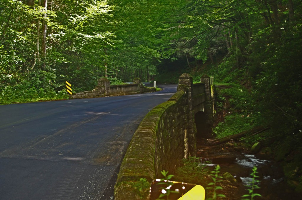
The higher you go the better it gets on NC 215.

The higher you go the better it gets on NC 215. The road crests where it meets the Blue Ridge Parkway, then plunges down the other side of the gap.

The map originates in the small crossroads town of Bethel, NC south of Waynesville, Canton, Maggie Valley, and Junaluska. It can also be done as a side loop off the Blue Ridge Parkway (exit at Beech Gap, MP 423.3, NC 215 – cuts 36 miles off the route).

Descending from the Blue Ridge Parkway on NC 215

The curves continue as you descend from the Blue Ridge Parkway with a brief break when you enter a valley. The curves that follow really kick it up!

______________________________________________________________________

Length: 90 miles plus your ride to the start in Bethel, NC.
Ride time: 3-4 hours
Difficulty: Very challenging, tight curves, climbs and descents, sustained, varied road surfaces, all paved

Photo-curve-on-Silversteen-Rd

Imagine miles and miles of curves like this one – a.k.a. Silversteen Road

Turn-by-turn route description

Start at traffic light in Bethel (junction US 276, NC 215, NC 110).

Follow NC 215  – starts as Love Joy Road. Easy section through farmland along river with a few sharp turns.

2.9 mi – Turn left @ stop sign to continue on NC 215. Junction Love Joy Road and Lake Logan Rd (NC 215).  Moderately difficult. Rolls through houses, some nice curves, section along Lake Logan very nice.

16.8 mi – Pass Sunburst Campground. Enter Pisgah National Forest. Start climb to Blue Ridge Parkway. Road gets more twisty here. Nice stop at a roadside waterfall. Beware loose gravel on road, especially in turns, most likely to be found in the highest sections. Difficult.

17.9 mi – Pass Blue Ridge Parkway ramp. Popular break spot, if not at the junction, go up to the parkway and turn right to reach a nearby overlook with lots of parking. Continue under the parkway on NC 215. Good views from the highest section. Road surface improves south of parkway. Difficult.

35 mi – Turn right @ stop sign onto US 64. Junction NC 215 (Parkway Road) and US 64. Just a short section on this sometimes busy road. Easy.

Photo-Charlies-Creek-Rd

Charlie’s Creek Rd – typical of the wonderfully empty and inviting rides that abound in the Smokies

37.7 mi  – Turn right onto Silversteen Road. Junction US 64 and Sliversteeen Rd. Sign warns of tight turns ahead, believe it! Difficult.

38.3 mi – Keep right on Silversteen Rd. Junction Silversteen Rd and Golden Road. Difficult.

43.6 mi – Sharp left turn to stay on Silversteen Road. Junction Silversteen Rd and Macedonia Church Road. If you don’t make this turn, you will end up back on NC 215. Difficult.

45.7 mi – Turn right @ stop sign onto NC 281. Junction Silversteen Road and NC 281 (Canada Road). Nice section, a little loose gravel in places. Difficult.

57.6 mi – Turn right onto Charlies Creek Road. Junction NC 281 (Canada Road) and Charlies Creek Road. Be on your guard, surprising turns on this road. Difficult.

Photo - wolf Creek Dam

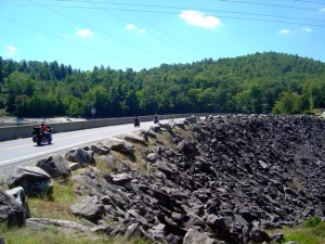
Wolf Creek Dam near the midpoint of NC 281, one of the scenic points on this great motorcycle ride.

68.4 mi – Turn left onto NC 215. Junction Charlies Creek Road and NC 215. Start back on a road you’ve been on previously.

89.7 mi – Follow NC 215 back to Bethel.

You’ll find gas stations in Bethel, on NC 215 on the south side of the Blue Ridge Parkway, and at the turn off US 64 onto Silversteen Road.

Jukebox Junction is a popular diner in Bethel. It’s mostly gas station food for the remainder of the ride.

Map of the ride

You’ll find these roads and many others in the surroundings on America Rides Maps motorcycle pocket map #6 – The Best Motorcycle Rides Near Great Smoky Mountains National Park – EAST.

____________________________________________________________________

wayne busch - Smoky Mountain Motorcycle Rider.com

Wayne Busch

– Wayne Busch lives in Waynesville, NC, where he produces the most detailed and comprehensive and up-to-date motorcycle pocket maps of the Blue Ridge and Smoky Mountains to help you get the most of your vacation experience. See them here – AmericaRidesMaps.com
Total Rider Tech Logo

Learn Total Control

Wayne is an advanced motorcycle instructor for Total Rider Tech teaching Lee Parks Total Control Advanced Rider Courses. Isn’t it time you looked into advanced rider training to ride more confidently and safely? It can transform your mountain riding experience.  Total Rider Tech

____________________________________________________________________

Best Motorcycle Rides North Carolina – Pisgah Triangles Repaved!

Fresh paving bumps this NC motorcycle ride to the top of list!

Freshly paved  –

  • US 276 from Fish Hatchery Road to the Blue Ridge Parkway (done)
  • US 276 from the Blue Ridge Parkway to Big East Fork (done)
  • NC 215 from Blue Ridge Parkway to Sunburst (in progress)

Unbelievable! Fantastic! Outstanding motorcycle ride!

US 276 – the Newly Paved Section

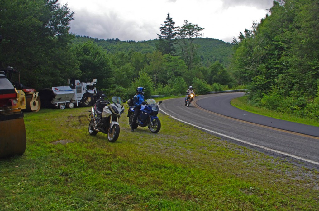
Note – while paving is done (it was a quality job) there is still fill work along the shoulders and pavement markings / lines need to be added so expect work crews in the area. It will take a bit for the gravel at the edges of the road to settle in, so you need to be watchful for loose stone in the curves for a while. 

We’ve just come in off a great North Carolina motorcycle ride on the newly paved sections of US 276 which connect Waynesville to Brevard just south of Great Smoky Mountains National Park in North Carolina. US 276 crosses the best and most scenic area of the Blue Ridge Parkway at the mid-point on this 30 mile ride.

Best North Carolina motorcycle rides - US 276

Best North Carolina motorcycle rides – Jackie gives a big “thumbs up” to the fresh paving on US 276 near the Blue Ridge Parkway

South of the Blue Ridge Parkway, the fresh paving invites motorcycle riders to snake all the way down from the parkway’s heights to popular Looking Glass Falls, one of the most visited roadside waterfalls in the southeast. Along the way you’ll find scenic areas like Pink Beds, informative and historic places like The Cradle of Forestry, and you might even want to plunge 60 feet down a waterfall for a chilly wake-up at Sliding Rock. The entire ride carves and switchbacks through the steep and wooded mountains of the Pisgah National Forest with whitewater streams, dark tree lined passages, and numerous pull-outs to stop ad savor the surroundings.

Best motorcycle rides North Carolina - US 276

Best motorcycle rides North Carolina – the south side of US 276 winds through thick forest

North of the Blue Ridge Parkway, US 276 drops more than 1000 feet in a 3 mile plunge from Wagon Road Gap (MP 412.2) to the trailhead at Big East Fork, then it flanks along the slopes of Cold Mountain following the Pigeon River to the Bethel Valley. This section of tight curves is one of the most sustained series of back-to-back turns you’ll come across anywhere AND it’s a steep grade to boot. For the motorcycle rider looking for a challenging stretch of road, this one has all you need!

Why is this important?

US 276 is one leg of a triangle which form a number of the best motorcycle rides in North Carolina I call The Pisgah Triangles. The other long leg of the triangle is NC 215. Several roads form third legs of a series of triangles crossing between NC 215 and US 276  within the upside down “V” formed. The roads which hold the most challenging, steep, curvy, and scenic sections of the rides are found near the top of the triangle and have been in poor repair making a challenging ride even more difficult. Once these sections of road are repaved, the quality of the motorcycle rides on The Pisgah Triangles will beat most, if not all of the best motorcycle rides in North Carolina.

Great Motorcycle Rides in North Carolina - Pisgah Triangles motorcycle map

Great Motorcycle Rides in North Carolina – Pisgah Triangles motorcycle map – At least 4 variations, the 3rd is my favorite.

See photos, map, and ride guide here – The Pisgah Triangles

The Final Piece is in the Works! – 

We were delighted to see the upper portions of NC 215 are also receiving a sweet smooth coating of fresh asphalt. There is still a good bit to be done as it’s a much longer run down to the Sunburst Campground at the edge of the national forest. Like US 276, NC 215 traces the course of the Little East Fork of the Pigeon River as it rushes down from the heights.

Best Motorcycle Rides North Carolina - NC 215

Best Motorcycle Rides North Carolina – Paving on NC 215 has started from the top down. You can see one lane done here, still a way to go.

Easy to find, convenient to ride, lots of options!

Both US 276 and NC 215 intersect the Blue Ridge Parkway on the highest and most scenic portion of the road. If you are riding the Blue Ridge Parkway it’s easy to hop off and play with these roads or if you are riding through, it’s a short cruise to loop back from the south end at Cherokee and enjoy. I believe most riders are going to enjoy these roads more than The Dragon at Deals Gap as they are not only curvy, but wonderfully scenic and carry very light traffic.

image-motorcycle-ride-map-cover

You’ll find these roads on America Rides Maps motorcycle pocket map #6 – The Best Motorcycle Rides EAST of Great Smoky Mountains National Park along with another 50 or so outstanding rides in the surrounding area and a guide to the numerous roadside waterfalls.

____________________________________________________________________

wayne busch - Smoky Mountain Motorcycle Rider.com

Wayne Busch

– Wayne Busch lives in Waynesville, NC, where he produces the most detailed and comprehensive and up-to-date motorcycle pocket maps of the Blue Ridge and Smoky Mountains to help you get the most of your vacation experience. See them here – AmericaRidesMaps.com
Total Rider Tech Logo

Learn Total Control

Wayne is an advanced motorcycle instructor for Total Rider Tech teaching Lee Parks Total Control Advanced Rider Courses. Isn’t it time you looked into advanced rider training to ride more confidently and safely? It can transform your mountain riding experience.  Total Rider Tech

____________________________________________________________________

Blue Ridge Parkway to Tail of the Dragon Map

Blue Ridge Parkway to Tail of the Dragon Map

Three roads are consistently on the top 10 motorcycle rides list – The Blue Ridge Parkway, the Dragon at Deals Gap, and the Cherohala Skyway. This map shows how connect them.

Blue Ridge Parkway to Tail of the Dragon Map

Blue Ridge Parkway to Tail of the Dragon Map – how to connect 3 of the best motorcycle rides – click for larger view

Many who ride motorcycles on the The Blue Ridge Parkway when motorcycle touring then go on to ride The Dragon at Deals Gap. If you can afford the time, you can make a nice loop ride which connects The Dragon and the Cherohala Skyway using TN 72 / 360.

Best Blue Ridge Parkway Overlooks - highest point

Best Blue Ridge Parkway Overlooks – highest point. The long sweeping overlook compliments the great sweeping views

The southern end of the The Blue Ridge Parkway is near Cherokee, NC. The map includes Maggie Valley / Waynesville as it’s one of the best locations to stay to enjoy the wealth of great motorcycle rides in the surrounding area.

Blue Ridge Parkway to Tail of the Dragon Map - riders come from around the world to experience the Dragon at Deals Gap.

Blue Ridge Parkway to Tail of the Dragon Map – riders come from around the world to experience the Dragon at Deals Gap.

Time / distances are from the eastern junction of the roads for riders starting from Maggie Valley / Waynesville. US 74 is the principal 4 lane road – scenic for a highway, the most direct route east / west. US 19 leads west from Maggie Valley, passes through Cherokee and Bryson City. It’s more curvy, passes through the Cherokee Indian Reservation, and takes a bit longer due to traffic.

Blue Ridge Parkway to Tail of the Dragon map - Cherohala skyway

Blue Ridge Parkway to Tail of the Dragon map – The Cherohala Skyway offers sweeping curves and views to match with scenic overlooks at 5000+ ft.

Approaching Deals Gap and The Dragon, NC 28 is also one of the top rated roads in the area a.k.a the Hellbender or Moonshiner 28 and leads you to the start of the best section of The Dragon near the NC / TN state line.

Blue Ridge Parkway to Tail of the Dragon map - NC 28

Blue Ridge Parkway to Tail of the Dragon map – NC 28 leads you to The Dragon. It traces the shoreline of Fontana Lake and is both beautiful and challenging.

So long as you are in the area, don’t forget about another well known motorcycle ride in Georgia – The Gauntlet. It’s only a short ride to reach it, and you’ll have experienced the best of the southern Blue Ridge motorcycle rides.

The Gauntlet Motorcycle Ride in Georgia

The Gauntlet Motorcycle Ride in Georgia – rounding a curve on GA 348

Several America Rides motorcycle pocket maps cover the Dragon / Cherohala area – see them here;

#7 The Best Motorcycle Rides SOUTH of GSMNP –http://shop.americaridesmaps.com/7-The-Best-Motorcycle-Rides-SOUTH-of-GSMNP-NC021.htm

#8 Best Rides NORTH of Smoky Park – http://shop.americaridesmaps.com/8-Best-Rides-NORTH-of-Smoky-Park-NC020.htm

12 Classic Deals Gap Motorcycle Rides – http://shop.americaridesmaps.com/12-Classic-Deals-Gap-Motorcycle-Rides-NC007.htm

____________________________________________________________________

wayne busch - Smoky Mountain Motorcycle Rider.com

Wayne Busch

– Wayne Busch lives in Waynesville, NC, where he produces the most detailed and comprehensive and up-to-date motorcycle pocket maps of the Blue Ridge and Smoky Mountains to help you get the most of your vacation experience. See them here – AmericaRidesMaps.com
Total Rider Tech Logo

Learn Total Control

Wayne is an advanced motorcycle instructor for Total Rider Tech teaching Lee Parks Total Control Advanced Rider Courses. Isn’t it time you looked into advanced rider training to ride more confidently and safely? It can transform your mountain riding experience.  Total Rider Tech

____________________________________________________________________

Best Blue Ridge Parkway Overlooks by Motorcycle

Best Blue Ridge Parkway Overlooks by Motorcycle – Highest Point

Richland Balsam Overlook
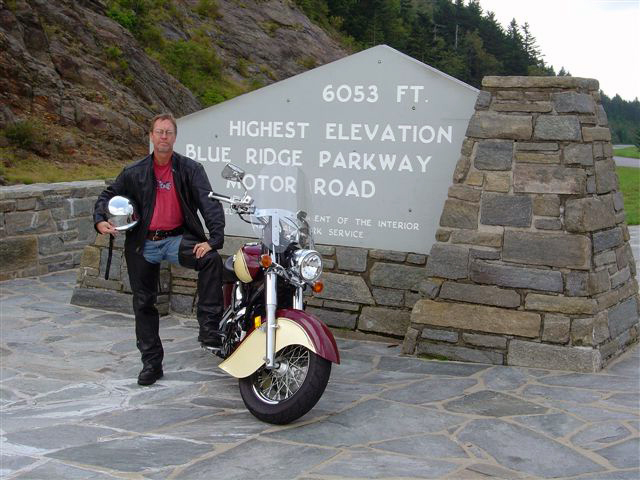
Elevation – 6053 feet
Milepost – 431.4 

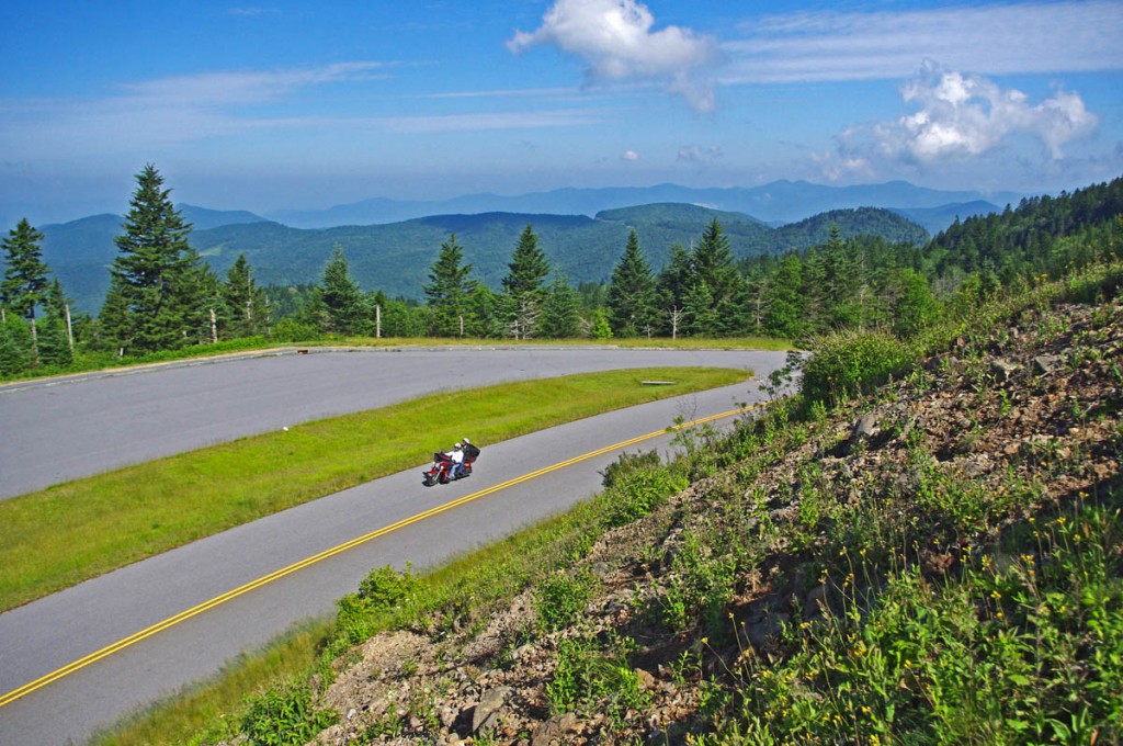
Best Blue Ridge Parkway Overlooks - highest point

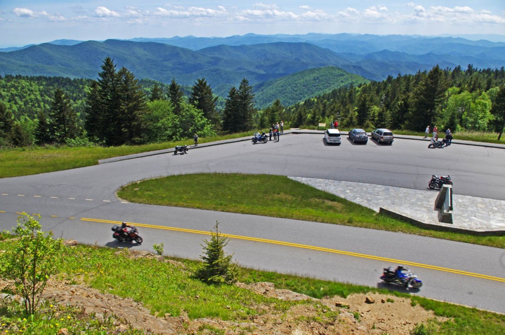
Best Blue Ridge Parkway Overlooks – highest point. The long sweeping overlook  provides expansive views of the mountains which comprise ‘The Land of the Waterfalls”

The highest point on the Blue Ridge Parkway is in North Carolina at milepost 431.4. Here, the nations top motorcycle ride reaches an elevation of 6053 feet as it carves it’s way along  the southern exposure of the Balsam mountain range.

Best Blue Ridge Parkway Overlooks by Motorcycle - highest point

Best Blue Ridge Parkway Overlooks by Motorcycle – Getting your picture with the sign at the highest point on the Blue Ridge Parkway is one of those “must have” photos from your trip to reach the long paved overlook which spans the radius of the curve around the mountain.

There is no dramatic climb to reach the long paved overlook which spans the radius of the broad curve around the mountain. The Blue Ridge Parkway maintains a steady altitude through this long remote and isolated section of the national park rarely dipping below 5000 feet. While the grades are gentle, the curves are full of surprises and the drop-offs along the roadside inspire a real respect for the altitude on this best motorcycle ride in the USA.

Best Blue Ridge Parkway Overlooks by Motorcycle - high point

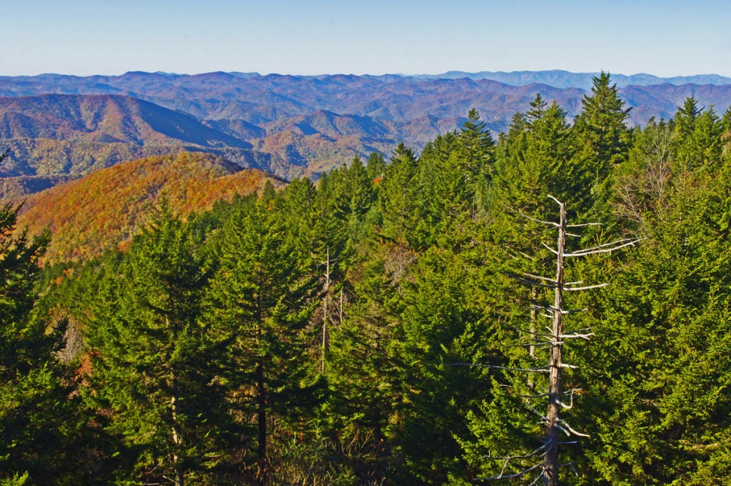
Best Blue Ridge Parkway Overlooks by Motorcycle – peer into several states from the highest point on clear days, but it not place to be in bad weather

Only 37.7 miles from the southern end of the Blue Ridge Parkway at Great Smoky Mountains National Park near Cherokee, NC, a ride to the high point is an easy one to squeeze in even if you’re not on an end-to-end parkway ride on your motorcycle. From Asheville, Waynesville and Maggie Valley, it’s a wonderful way to spend a few hours riding a motorcycle on one of the the best scenic motorcycle rides you’ll find anywhere.

Best Blue Ridge Parkway Overlooks by Motorcycle - high point

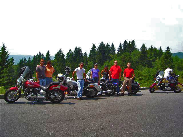
Best Blue Ridge Parkway Overlooks by Motorcycle – Few can resist a stop at the high point. The large parking area is able to handle the crowds, and it’s a great lace to get shots of large groups of riders.

As you might suspect, this spot is one of the most remote and isolated on your Blue Ridge Parkway motorcycle ride. It’s a long ride for gas, tank up before you go. The high parts get the wet weather first – if it looks cloudy from the valley, you may not see much when you get up high. It will be a lot cooler than down in the valley and more windy, be prepared.

Best Blue Ridge Parkway Overlooks by Motorcycle - high point

Best Blue Ridge Parkway Overlooks by Motorcycle – A fall view from the high point overlook. Clear days are just spectacular!

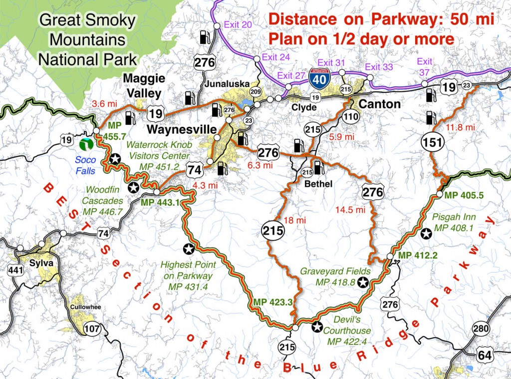
Map of the best section of the Blue Ridge Parkway

Blue Ridge Parkway Map best

Map of the best 50 mile section of the Blue Ridge Parkway shows the location of the high point and the ways to reach it from nearby towns. Click for larger image –

See a 360 degree panoramic view at Virtual Blue Ridge – http://www.virtualblueridge.com/parkway_tour/overlooks/00431b.asp

image-motorcycle-ride-map-cover

You’ll find the highest point on the Blue Ridge Parkway on America Rides Maps motorcycle pocket map

#6 The Best Motorcycle Rides Near Smoky Mountains National Park – EAST http://shop.americaridesmaps.com/6-The-Best-Motorcycle-Rides-Near-Smoky-Mountains-Park-EAST-NC017.htm

____________________________________________________________________

wayne busch - Smoky Mountain Motorcycle Rider.com

Wayne Busch

– Wayne Busch lives in Waynesville, NC, where he produces the most detailed and comprehensive and up-to-date motorcycle pocket maps of the Blue Ridge and Smoky Mountains to help you get the most of your vacation experience. See them here – AmericaRidesMaps.com
Total Rider Tech Logo

Learn Total Control

Wayne is an advanced motorcycle instructor for Total Rider Tech teaching Lee Parks Total Control Advanced Rider Courses. Isn’t it time you looked into advanced rider training to ride more confidently and safely? It can transform your mountain riding experience.  Total Rider Tech

____________________________________________________________________

Georgia Motorcycle Rides Map Updated

Georgia Motorcycle Rides Map Updated

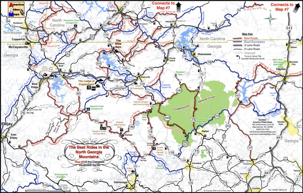
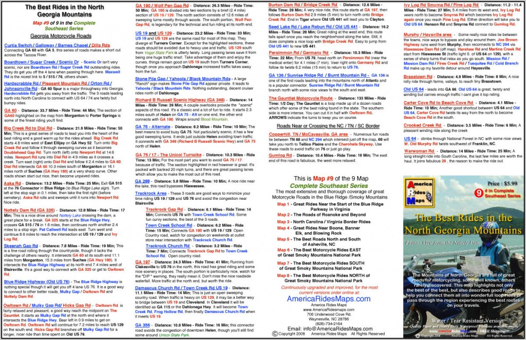
Georgia Motorcycle Rides MapAmerica Rides Maps#9 – The Best Rides in the North Georgia Mountains” motorcycle ride map has just been revised and updated for 2012. This pocket map identifies the best biker roads in the Blue Ridge Mountains of North Georgia and good secondary roads to connect them all together.

Other Motorcycle Ride Maps –

Blue Ridge Parkway Motorcycle Maps

Blue Ridge Parkway

This Georgia motorcycle ride map is the 9th map in a series that covers the best motorcycle rides in the Blue Ridge Mountains. Maps 1-6 of the series detail the Blue Ridge Parkway end-to-end. Maps 7 & 8 focus on the south and north sides of Great Smoky Mountains National Park and both include The Dragon at Deals Gap (Tail of the Dragon) and the Cherohala Skyway. Maps overlap and connect for easy navigation.

Scope – Area Covered on the Georgia Motorcycle Ride Map – 

The Best Rides in the North Georgia Mountains starts north of Jasper, Dahlonega, and Taccoa and extends across the border into North Carolina as far north as Murphy, NC. On the west edge, it’s bounded by 5 / 515 / 76 and the towns of East Ellijay, GA, McCayesville, GA, and Copperhill, TN. The East side of the map traces US 441 north through Tallulah Falls, Clayton and Dillsboro just clipping a tiny piece of South Carolina.

Georgia motorcycle rides map

Georgia motorcycle rides map – Best roads are shown in red, good ways to connect them and other suggested roads shown in blue.

More than 60 roads are highlighted for Georgia motorcycle touring riders. Best Motorcycle Rides are shown in Red. Good Connecting Roads are shown in Blue. Roads are selected based on the challenge of the ride, low traffic flow, scenic views and attractions, and have to stand out from surrounding roads to be considered. Emphasis is on finding the ways to stay off the 4-lane and major roads and connect the best rides together with the best ways to reach them.

So Whats NEW?

  • The original map had about 25 roads, this one has expanded to more than 60 nice motorcycle rides.
  • Road segment mileage is now shown to help you find the turns onto these hidden gems.
  • More out-of-the-way gas stations have been added, additional motorcycle friendly places and service providers have been added.
  • The Gauntlet Motorcycle Route is now indicated with arrows which show the turns from one road to the next.

Georgia Motorcycle Rides Map

Georgia Motorcycle Rides Map – The reverse side of the map gives descriptions of the highlighted roads to help you find which ones you want to ride most

Why are these maps IDEAL for MOTORCYCLE TOURING?

  • They focus on the best Georgia Motorcycle Rides and make them easy to find
  • These maps are done from the seat of a motorcycle – every road is ridden and experienced on 2 wheels.
  • Designed for function – 11 inches x 17 inches means they fit in your pocket so they are always right there for you to use, not stowed in a pack or saddlebag. Easy to fold, even with gloves on. High contrast, easy to read.
  • At $5.99 for the water and tear-resistant version, it’s THE BEST VALUE out there. No other maps are this comprehensive, this detailed, and this cheap.

How do I get one?

Order Online and get free shipping through the America Rides Maps Secure Online Store – Just click this link to start shopping:

http://shop.americaridesmaps.com/main.sc

– Maps are sent via 1st Class or Priority Mail, typical delivery in 2-3 days.

Maps are also available at:

The Biker Barn – http://www.thebikerbarn.com/

The Lodge at Copperhead – http://www.thelodgeatcopperhead.com/

Click here now to get this map —> http://shop.americaridesmaps.com/9-The-Best-Rides-in-the-North-Georgia-Mountains-GA007.htm  

____________________________________________________________________

wayne busch - Smoky Mountain Motorcycle Rider.com

Wayne Busch

– Wayne Busch lives in Waynesville, NC, where he produces the most detailed and comprehensive and up-to-date motorcycle pocket maps of the Blue Ridge and Smoky Mountains to help you get the most of your vacation experience. See them here – AmericaRidesMaps.com
Total Rider Tech Logo

Learn Total Control

Wayne is an advanced motorcycle instructor for Total Rider Tech teaching Lee Parks Total Control Advanced Rider Courses. Isn’t it time you looked into advanced rider training to ride more confidently and safely? It can transform your mountain riding experience.  Total Rider Tech

____________________________________________________________________

Best Motorcycle Rides in North Carolina – Short and Sweet

Best Motorcycle Rides in North Carolina – Short and Sweet 

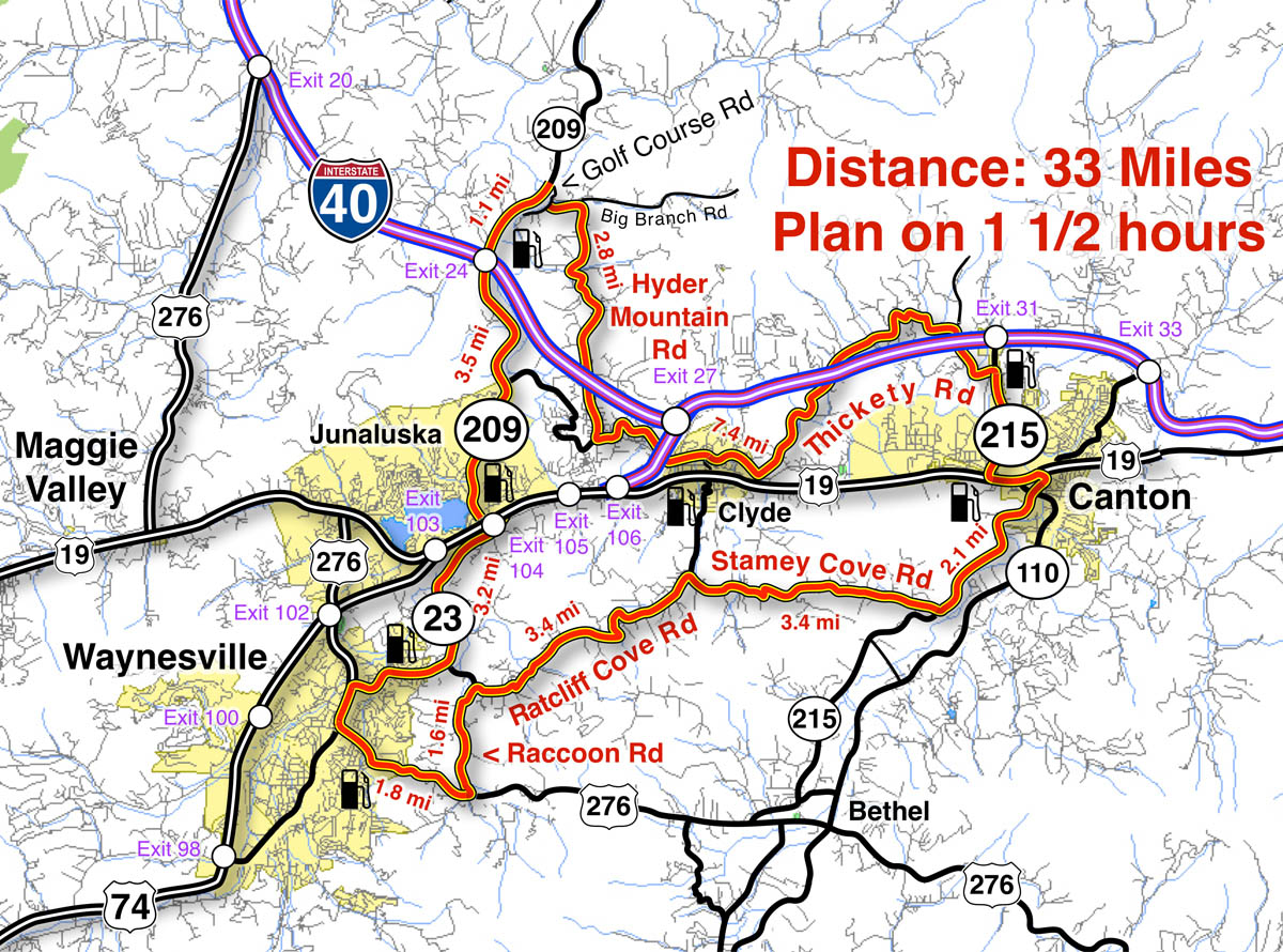
Great Motorcycle Rides in North Carolina - short and sweet map

Great Motorcycle Rides in North Carolina – short and sweet map shows a collection of roads in close to Waynesville and Maggie Valley so you’re never far from home

Not every great motorcycle ride in North Carolina has to be an epic adventure. Sometimes you just want a nice, easy, short cruise to add at the end of a day or squeeze in once a shower passes.

If you’re in Waynesville, Maggie Valley, Canton, out at the Blue Ridge Motorcycle Campground, or anywhere else in the vicinity, here’s a collection of roads that not only keep you close in to town, but are excellent motorcycle rides and scenic to boot. You don’t have to go far to find a great motorcycle ride in the Smoky Mountains.

Best motorcycle rides in North Carolina  - Ratcliff Cove

Best motorcycle rides in North Carolina – Ratcliff Cove view – Not only are these roads twisty and fun, they have wonderful views along the ride


Start at Highway 23 / 74 Exit 104 at Junaluska. Follow 4 lane US 23 (Asheville Highway) into Waynesvillle, then exit town on US 276. Follow Raccon Road to Ratcliff Cove Road then on to Stamey Cove Road. Follow NC 215 through Canton to Thickety Road. Take Hyder Mountain Road to NC 209 and return to start.

33 miles – 1 1/2 Hours – an Easy Ride

Route:

Start at Exit 104 Highway 23 / 74 at Junaluska.

Turn right @ traffic light towards Waynesville. Continue through traffic circle.

2.7 mi Continue straight @ traffic light onto Walnut Street. Junction US 23 and Walnut Street.

3.1 mi Turn left @ traffic light onto US 276 (Russ Avenue). Junction Walnut Street and US 276 (Russ Avenue). Head downtown.

3.3 mi Turn Right @traffic light. Junction US 276 (Russ Ave) and US 23 (Main Street). Pass through Waynesville.

3.7 mi Turn left @ traffic light onto US 276. Junction Main Street and US 276 south.

5.5 mi Turn left @ junction with Raccoon Road.

6.9 mi Turn right @ junction with Ratcliff Cove Road.

10.4 mi Turn right @ stop sign onto Stamey Cove Road. Junction Ratcliff Cove Road / Poison Cove Road / Stamey Cove Road)..

13.8 mi Turn left @ stop sign onto NC 215 towards Canton. Junction Stamey Cove Road and NC 215.

15.9 mi Turn left @ traffic light onto US 19 in Canton. Junction NC 215 and US 19.

16.5 mi Turn right @ traffic light onto NC 215. Junction US 19 and NC 215.

17.3 mi Turn left @ traffic light onto Champion Drive. Junction NC 215 and Champion Drive.

18.1 mi Turn left @ traffic light onto Thickety Road. Junction NC 215 and Thickety Road.

18.8 mi Turn left  @ stop sign to continue on Thickety Road. Junction Thickety Road and Crabtree Mountain Road.

23.4 mi Continue straight onto Hyder Mountain Road. Junction Charles Street in Clyde. Thickety Road becomes Hyder Mountain Road..

25.4 mi Turn right @ stop sign to continue on Hyder Mountain Road.

28 mi Turn left @ stop sign onto Big Branch Road. Junction Hyder Mountain Road and Big Branch Road.

28.2 mi Turn right @ stop sign onto Golf Course Dr. Junction Big Branch Road and Golf Course Dr..

28.4 mi Turn left @ stop sign onto NC 209.

33.2 mi Follow NC 209 to return to start.

Great Motorcycle Rides North Carolina – The Rattler Motorcycle Map

Great Motorcycle Rides North Carolina – The Rattler Motorcycle Map

Great Motorcycle Rides in North Carolina - NC 209, a.k.a. "The Rattler".

Great Motorcycle Rides in North Carolina - NC 209, a.k.a. "The Rattler". Do it as an out-and-back or make a nice loop ride - one of many ways to go on this great biker road

The Rattler Motorcycle Ride is one of the great motorcycle rides in North Carolina and is one to include in your Blue Ridge Parkway motorcycle adventure.

So you already know about the great motorcycle rides in the Smoky Mountains, maybe you’ve made a motorcycle tour of the Blue Ridge Parkway.

You’ve already tasted the Tail of the Dragon (if it didn’t take a bite out of you), and probably enjoyed the sweet curves of the Cherohala Skyway.

By now you realize there must be a ton of biker roads out there“So, WHAT’S NEXT?”

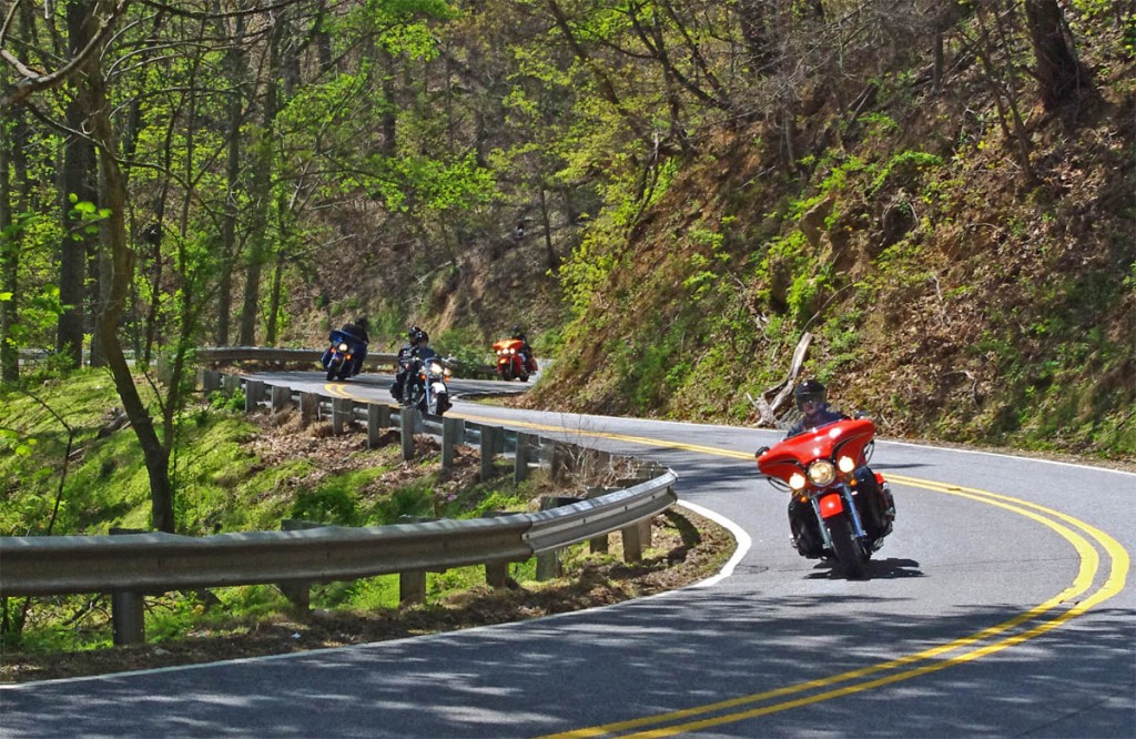
Great Motorcycle Rides in North Carolina - NC 209, a.k.a. "The Rattler" This is some of the best motorcycle riding you'll find in the world. These riders are looping back to NC 209 on NC 63.This is some of the best motorcycle riding you'll find in the world. These riders are looping back to NC 209 on NC 63.

Great Motorcycle Rides in North Carolina - NC 209, a.k.a. "The Rattler" - This is some of the best motorcycle riding you'll find in the world. These riders are looping back to NC 209 on NC 63.

Not one, but two motorcycle rides immediately spring to mind, so I flipped a coin. The Rattler won.

For years, this great motorcycle ride was well known amongst locals (and those in-the-know) as “209” or “Hot Springs”. It’s one of the default, always-good motorcycle rides that you can do over and over again and enjoy it every time. A few years back, it got named “The Rattler“. I don’t know who started that, but it stuck, and you can buy T-shirts along the route – I guess it’s official.

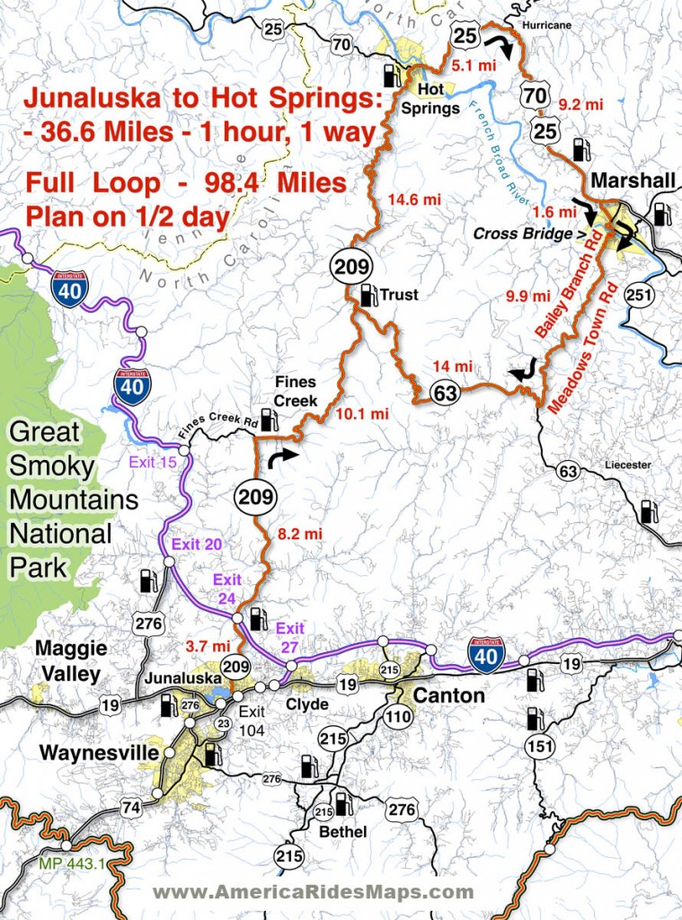
The Rattler motorcycle ride takes you on a 30+ mile jaunt through the mountains and valleys north of Maggie Valley and Waynesville to the tiny town of Hot Springs near the Tennessee border.

Great Motorcycle Rides North Carolina - The Rattler

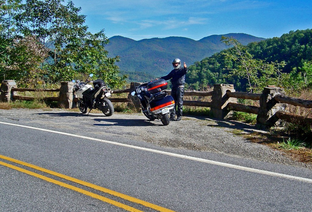
Great Motorcycle Rides North Carolina - The Rattler; Nice valley rides coursing along rushing streams, climbs over several mountain passes, and tight-tight twists as you approach Hot Springs

It’s a great “lunch ride” or “afternoon spin” as it only takes an hour or less to ride the twisty two lane. It’s also a “warm up” for those motorcycle touring fans who really know the area.

One you get to Hot Springs, you are surrounded with good motorcycle roads to choose from if you know where they hide.

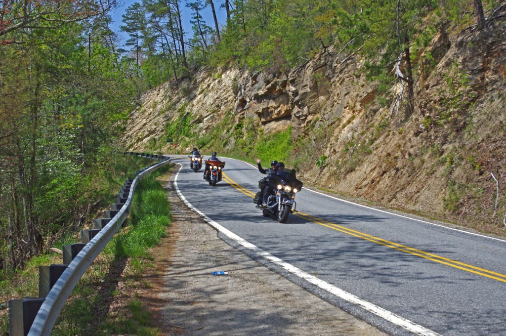
Great Motorcycle Rides in North Carolina - NC 209 The Rattler

Great Motorcycle Rides in North Carolina - NC 209 The Rattler - pastoral views of mountain farms and creeks, winding passes through forests, and some of the most challenging tarmac you'll ride wait for you in North Carolina on The Ratterl

Ride Guide –
36 miles to Hot Springs – About 1 hour ride to hot springs.
98 miles to do loop ride shown – 1/2 day ride.

Route: 

Start: Exit 104 on Highway US 74. Lowes store at this exit. Pass under US 74. Follow NC 209 north.

3.7 mi Cross I-40 at Exit 24. It’s an easy ride through the valleys for a few miles.

11.9 mi Turn Right onto Betsy’s Creek Road to continue on NC 209. Ferguson’s store / gas marks this corner. Lots of signs.

22 mi Junction NC 63. Note and pass through. – Store and gas at this junction. Popular spot for a break, loop returns here.

36.6 mi NC 209 ends at Hot Springs. Return as you came or continue on loop ride.

To continue on loop ride – 

Pass through Hot Springs. Cross the French Broad River and follow US 25 for 5 miles. US 25 will reach a stop sign.

41.7 mi Turn right @ stop sign to continue on US 25 / 70 towards Asheville.

50.9 mi Veer right into Marshall on Main Street. Follow into town.

61.6 mi Turn right at the traffic light in the center of Marshall and cross the bridge over the French Broad River.

You are now on Bailey Branch Rd. It will become Meadows Town Road. Meadows Town Road ends in 10 miles at NC 63.

71.5 mi Turn Right @ stop sign and follow NC 63 to return to the mid point of NC 209.

85.5 mi Turn left @ stop sign onto NC 209 and follow back to Junaluska to finish the ride.

98.4 mi End of ride

Here’s a 10 minute video that takes you through the ride step-by-step

__________________________________________________________________

Wayne Busch

Wayne Busch - Cartographer

Total Rider Tech Logo

Learn Total Control

– Wayne Busch lives in Waynesville, NC, where he produces the most detailed and comprehensive and up-to-date motorcycle pocket maps of the Blue Ridge and Smoky Mountains to help you get the most of your vacation experience. See them here – AmericaRidesMaps.com

Wayne is an advanced motorcycle instructor for Total Rider Tech teaching Lee Parks Total Control Advanced Rider Courses. Isn’t it time you looked into advanced rider training to ride more confidently and safely? It can transform your mountain riding experience.  Total Rider Tech
____________________________________________________________________