Best Motorcycle Rides in North Carolina – Secrets

Best Motorcycle Rides in North Carolina – Secrets

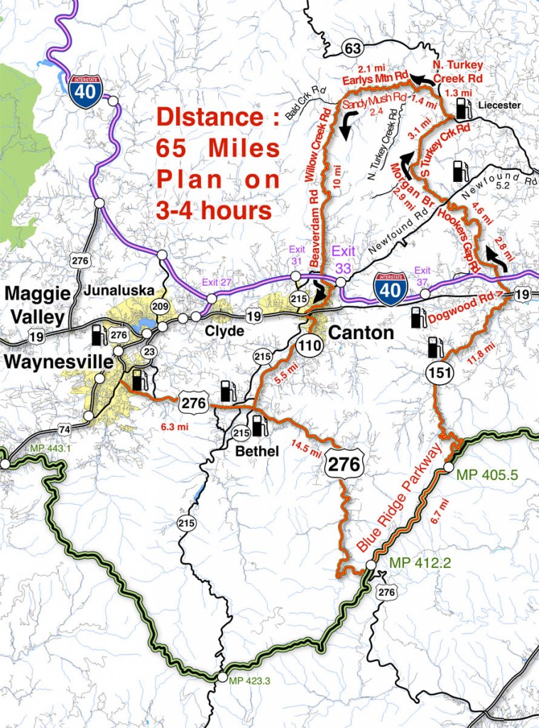
Here’s another bunch of the best motorcycle rides in North Carolina that few ever discover – it’s a nice loop ride that includes a section riding the Blue Ridge Parkway

Best Motorcycle Rides in North Carolina - Sandy Mush

Best Motorcycle Rides in North Carolina - This loop ride will surprise you with some very challenging roads, nice scenery, and places you'd never see otherwise.

The roads shown south of I-40 are pretty well known biker roads. US 276 runs from Waynesville to the Blue Ridge Parkway, always a popular North Carolina motorcycle ride. The section of the Blue Ridge Parkway shown includes Mt. Pisgah and The Pisgah Inn. NC 151 is legendary for it’s treacherous curves as it plunges towards  the valley that leads into Candler.
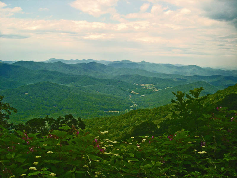
Best Motorcycle Rides in North Carolina - Pisgah View

Best Motorcycle Rides in North Carolina - the view from the Pisgah Inn on the Blue Ridge Parkway represents others on this section of the road - outstanding!

Most riders then point their wheels to I-40 or US 19 and miss out on the roads that lie north of I-40. This area gets little attention from motorcycle touring visitors who are lured to the more publicized roads elsewhere. To the east lie the suburbs of Asheville, the west is mostly rural valley farms.
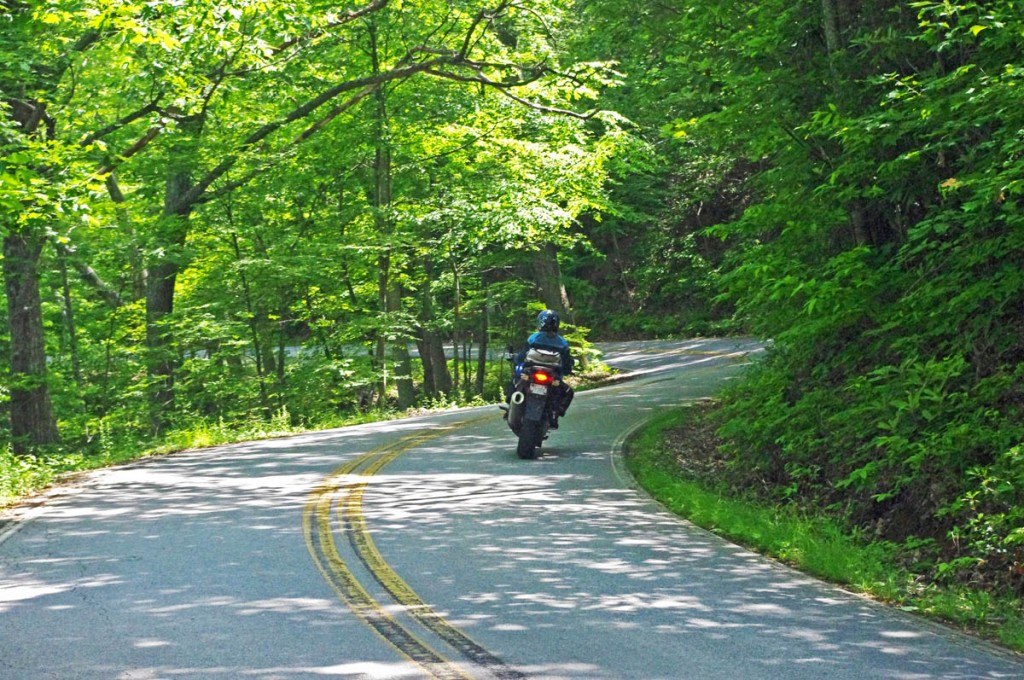
Best Motorcycle Rides in North Carolina - NC 151

Best Motorcycle Rides in North Carolina - The section of NC 151 which descends from the Blue Ridge Parkway is full of tricky curves.

The two primary roads north of I-40 are Newfound Road which runs from Canton to Leicester, and Leicester Rd (NC 63) which runs into Asheville. Both are decent rides, particularly the west end of NC 63 as it climbs out of the valleys to intersect NC 209 – The Rattler (Click for ride guide). Still, they are the most heavily used roads so this route avoids them in favor of the empty two lanes which provide a much more relaxing and fun scenic motorcycle ride.
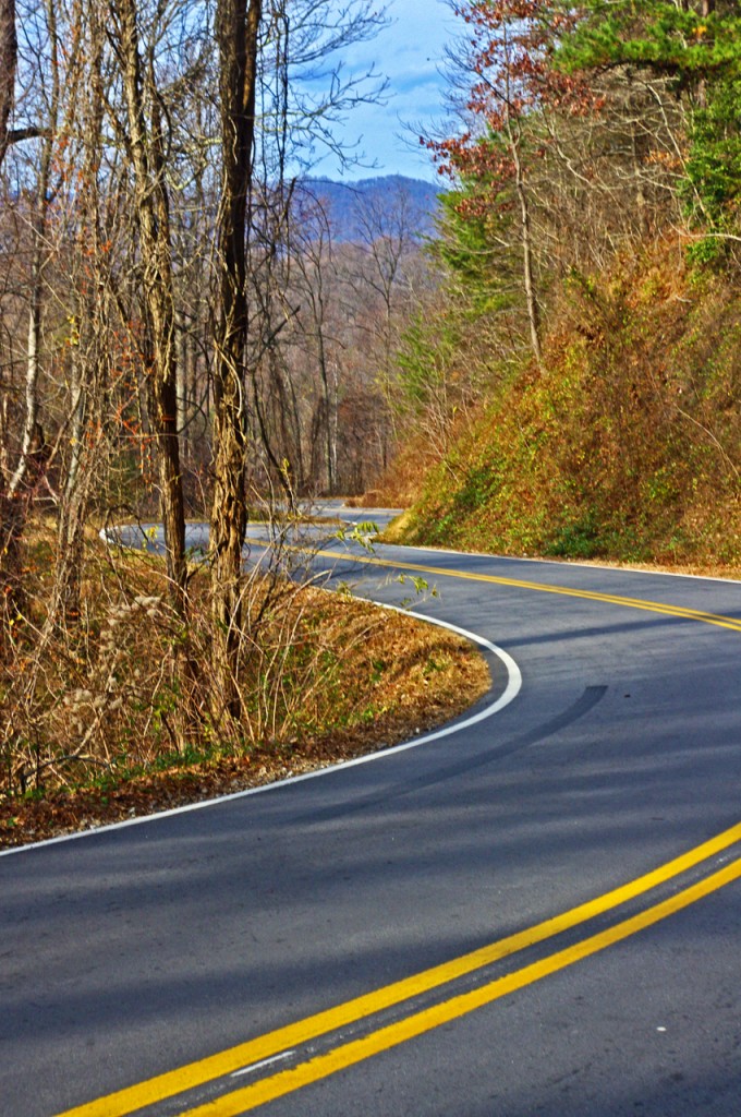
Best Motorcycle Rides in North Carolina - Hookers Gap Rd

Best Motorcycle Rides in North Carolina - Hookers Gap Rd has little traffic and wonderful curves as it climbs over a mountain.

You’ll want to pay attention to the map and watch for the turns as it’s easy to wander off on the maze of small surrounding roads. The turn onto Hookers Gap Rd is not well marked and the road can be hard to spot, but the ride is worth the effort. You’ll also find a short unpaved section of road where Morgan Branch Rd runs into S. Turkey Creek Rd. Be sure to veer right and take the high road where N. Turkey Creek meets Earlys Mountain Rd. NC 215 makes a nice alternative to NC 110 leading out of Canton.
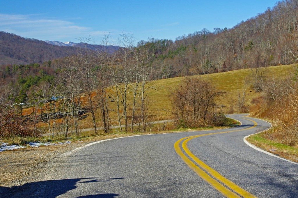
Best Motorcycle Rides in North Carolina - Earlys Mtn Rd

Best Motorcycle Rides in North Carolina - Earlys Mountain Road is one I often ride in winter. The valleys will be clear while snow covers the higher elevations. A nice ride any time of year!

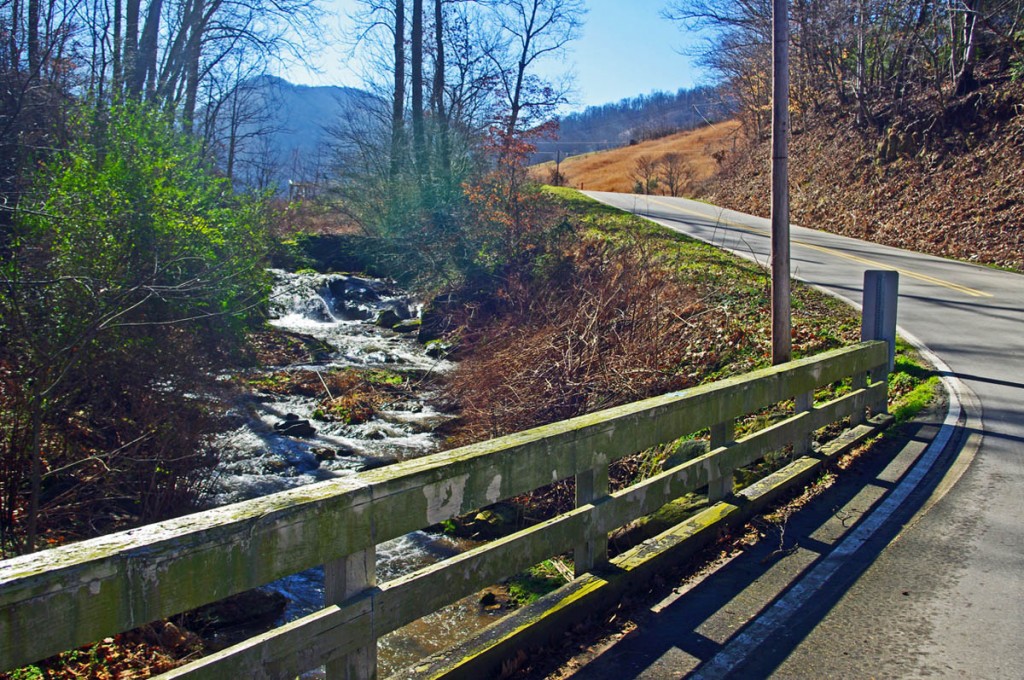
You’ll enjoy a variety of motorcycle riding experiences on this nice loop ride. The valley roads often follow along rushing streams or wind through twisty mountain passes. You’ll enjoy farms and pastures, the park atmosphere of the Blue Ridge Parkway, and the contrast of the massive paper mill when passing through Canton. There are historic buildings and timeless views.
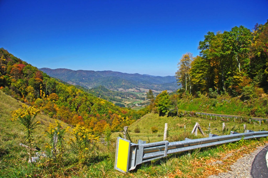
Best Motorcycle Rides in North Carolina - Beaverdam Rd

Best Motorcycle Rides in North Carolina - If you ride Beaverdam Road north from Canton when you crest the mountain the Sandy Mush Valley view explodes as you plunge down the steep hillside.

Step-by-step Route: (uses NC 215 instead of NC 110, either does the job)

  • Start in Canton. Follow NC 215 to Bethel.
  • 5.4 mi Turn left  @ stop sign onto Sonoma Road. Junction NC 215 and Sonoma Road.
  • 6 mi Turn right @ stop sign onto NC 110. Junction Sonoma Road and NC 110.
  • 6.4 mi Turn left @ traffic light onto US 276. Junction NC 110 / US 276 / NC 215. Follow to Blue Ridge Parkway.
  • 20.9 mi Left turn onto ramp to Blue Ridge Parkway.
  • 21 mi Turn right  onto Blue Ridge Parkway (towards Asheville). Follow to next exit.
  • 27.3 mi Turn left onto NC 151. Junction Blue Ridge Parkway and NC 151. Steep descent with tight switchbacks.
  • 39.1 mi Continue through traffic light @ US 19 onto Dogwood Road. Traffic light. Junction NC 151 and US 19.
  • 41.4 mi Turn right onto Hookers Gap Road. Junction Dogwood Road and Hookers Gap Road. Poorly marked, be alert for this turn.
  • 46.5 mi Cross Newfound Road @ stop sign to continue on Morgan Branch Road. Junction Hookers Gap Road and Newfound Road.
  • 49 mi Unpaved section of road for short distance. Cross single lane bridge.
  • 49.4 mi Turn right @ stop sign onto S. Turkey Creek Road.
  • 52.4 mi Turn left  @ stop sign onto NC 63 (New Leicester Highway). Junction S. Turkey Creek Road and NC 63.
  • 53.7 mi Turn left onto N. Turkey Creek Road. Junction NC 63 and N. Turkey Creek Road.
  • 55.1 mi Keep right on Earlys Mountain Road. Junction N. Turkey Creek Road and Earlys Mountain Road.
  • Earlys Mountain Road becomes Big Sandy Mush Road.
  • 59.6 mi Turn left onto Willow Creek Road. Junction Big Sandy Mush Road / Willow Creek Road / Bald Creek Road.
  • Willow Creek Road becomes Beaverdam Road
  • 69.6 mi Turn right @ stop sign onto Newfound Road and follow into Canton. Junction Beaverdam Road and Newfound Road.
  • 71 mi Stop sign. Junction Beaverdam Road and Main Street in Canton.
Best Motorcycle Rides in North Carolina - Willow Creek Rd

Best Motorcycle Rides in North Carolina - Willow Creek Rd has some pretty views and pretty challenging curves.

You can do this North Carolina motorcycle ride in half a day or less. It’s a good one to know about if you’re staying in Waynesville or Maggie Valley or at the Pisgah Inn on the Blue Ridge Parkway. It’s a nice one to fill the rest of the day if you visit Wheels Through Time Motorcycle Museum. If you get caught here during a rainy spell, it’s a quick one you can dart out and do between showers with easy options to run back for shelter if you get caught in a downpour.
Best Motorcycle Rides in North Carolina - old store

Best Motorcycle Rides in North Carolina - riding through historic farms and tiny towns that date back a hundred years or more.


Don’t underestimate these roads, they are plenty challenging and worth the time to investigate. You’ll see sights others miss, and experience a part of the mountains rarely visited. You’ll pass by homes and farms that have been there for hundreds of years and many generations. It’s a ride through the history and heritage of the Smokies. Enjoy!

______________________________________
Map #6These roads are just a few of the more than 50 great motorcycle rides found on America Rides Maps pocket map  #6 – The Best Motorcycle Rides EAST of Great Smoky Mountains National Park.

____________________________________________________________________
wayne busch - Smoky Mountain Motorcycle Rider.com

Wayne Busch

– Wayne Busch lives in Waynesville, NC, where he produces the most detailed and comprehensive and up-to-date motorcycle pocket maps of the Blue Ridge and Smoky Mountains to help you get the most of your vacation experience. See them here – AmericaRidesMaps.com

Total Rider Tech Logo

Learn Total Control

Wayne is an advanced motorcycle instructor for Total Rider Tech teaching Lee Parks Total Control Advanced Rider Courses. Isn’t it time you looked into advanced rider training to ride more confidently and safely? It can transform your mountain riding experience.  Total Rider Tech

____________________________________________________________________

Section of Blue Ridge Parkway May Reopen After All

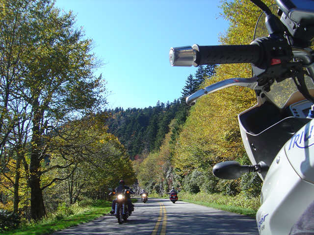
photo - Motorcycles on the Blue Ridge Parkway

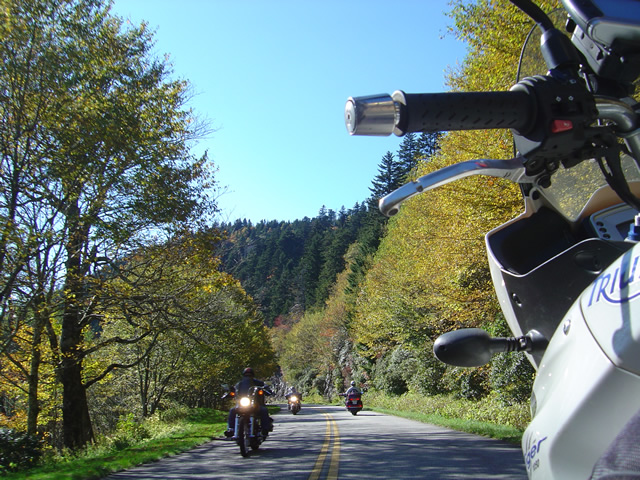
Motorcyclists enjoy the scenic section of the Blue Ridge Parkway near the closure site.

Good news for those of you planning your motorcycle trip. While I’m having some trouble finding hard confirmation on this from an “official” source,  it appears the National Park Service will be trying to open one lane of the Blue Ridge Parkway which has been closed due to an unstable slope. The section affected by the closure lies south of Asheville near milepost 400. Design plans to remove unstable material and bolt the slope have been crafted, and one lane could be open again by July of this year.

The current closure prevents access to the Pisgah Inn from Asheville, though it can be reached by backtracking from Wagon Road Gap (US 276) south of Waynesville.  As this section of the Blue Ridge Parkway makes the climb from the French Broad River Valley at Asheville to gain the highest elevations along the scenic roadway, it will be a welcome relief to have it opened and avoid any detours. Expect the remainder of the Blue Ridge Parkway to be open by the end of April barring discovery of any further problems and the continued enthusiasm of the clean up crews.

For the first time in a long while our nations most popular scenic motorcycle ride could be open from end-to-end, just in time to celebrate the 75th anniversary of the park.

What’s The Best Section of the Blue Ridge Parkway?

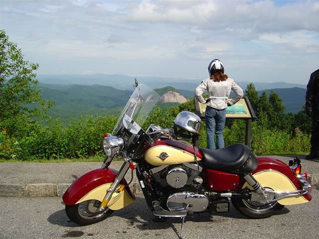
Photo - Admiring the view from the Looking Glass Rock overlook

Photo - Admiring the view from the Looking Glass Rock overlook

Easy question. It’s in North Carolina. I can almost see it from my window. I moved here to be close to it and enjoy it on my motorcycle. I know every twist and bump. The best section of the Blue Ridge Parkway with the best ride runs south from Asheville to Soco Gap near motorcycle friendly Maggie Valley.

Photo - As falls comes so do the bikes

Photo - As falls comes so do the bikes on the Blue Ridge Parkway

Why is it the best? It’s the highest and most scenic section. There are more great pull-outs here than any other stretch. Most of it is above 5000 feet. It has everything motorcycle riders come for. Waterfalls, impressive rock formations, winding tunnels, pristine wilderness, vast stretches of rolling mountains on every horizon, and one of the best places to eat on the parkway, the Pisgah Inn. When I used to run  motorcycle tours through this section I‘d always figure about 4 hours to hit the highlights and sometimes it was a tight schedule. If you see only one section of the Blue Ridge Parkway, this should be it.

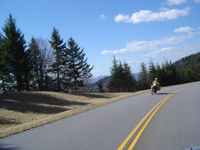
Photo - Early in the spring traffic is light and skies are clear

Early in the spring traffic is light and skies are clear on the Blue Ridge Parkway

Make this one of your prime destinations on your motorcycle vacation, but don’t limit yourself to the parkway while you’re here. You could spend weeks riding the fabulous roads which snake through the Smoky Mountains you see from those overlooks. They are packed with more waterfalls, scenery that will fill your camera, and some of the most challenging motorcycle roads you’ll ever ride.

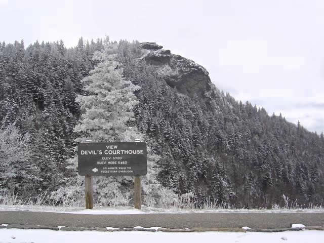
Photo - Devil's Courthouse snow covered in Winter

Spectacular Devil's Courthouse snow covered in winter

Impressive any time of year, I never take this section of the Blue Ridge Parkway for granted and visit almost every week. It never disappoints. It one of the most scenic motorcycle rides anywhere.

Blue Ridge Parkway On Ice – Photos / Video

With all the snow and cold weather we’ve had this winter, riding the motorcycle has been only a dream. This afternoon, we headed up to the Blue Ridge Parkway to enjoy it in full winter glory.

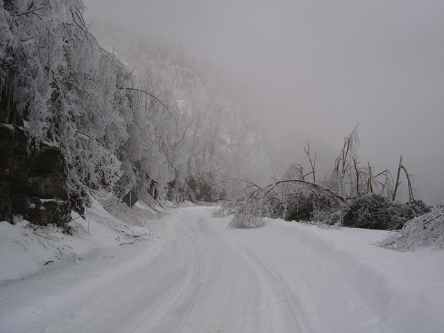
An ice storm hit last night. Damage was extensive.

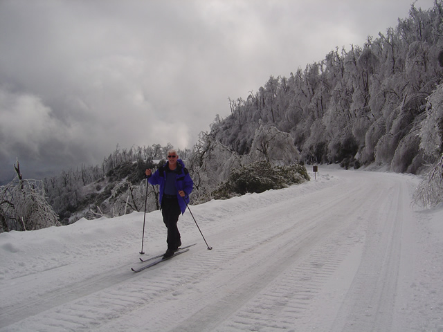
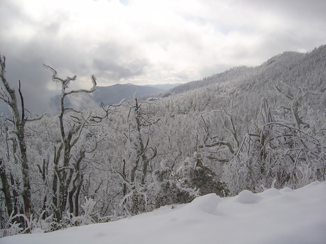
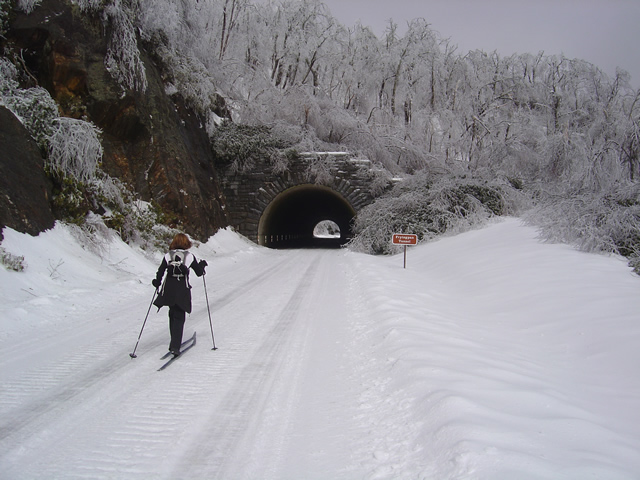
While “Snowmageddon” hit Washington we were largely spared it’s fury in the high mountains of western North Carolina. We picked up a few more inches here and there to what was already a significant accumulation. What we did get with this storm was ice. You can see the trees bent over from the weight of it.

Photo - skiing the parkway

Cross country skiing on the highest sections of the Blue Ridge Parkway

For those of us who live here, the Blue Ridge Parkway becomes our winter playground when it closes for the colder season. This section has seen park service traffic to maintain a communications tower. It made for nice skiing.

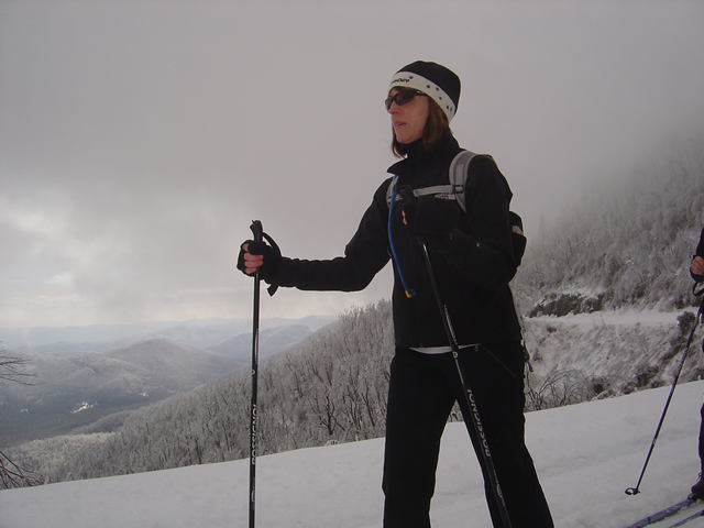
Jackie Skiing

When the snow is good, the skiing here is great

We started at Wagon Road Gap where US 276 and the Parkway meet at on of the highest crossings. From there, we headed east towards Asheville.

Ice was bringing down trees the whole time we were out.

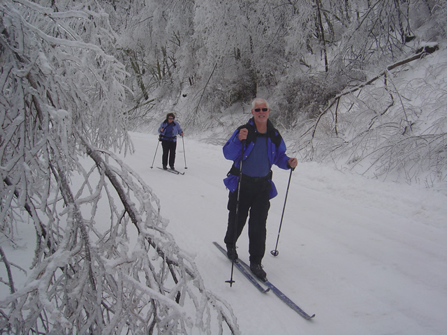
The coating of rhyme ice, while beautiful, was causing extensive damage. The surroundings were filled with the almost constant sound of limbs and even entire trees breaking from the weight of the ice. Large branches lay everywhere. In places, every tree had been snapped and I saw none higher than about 12 feet, their tops broken off. A hike in the woods would be deadly.

Heavy ice coats and brings down surrounding trees.

We skied as far as the Pisgah Inn near Mount Pisgah passing through the Frying Pan Tunnel. Along the way we ran into a convoy of rangers hauling in equipment to repair the communications tower which must have been damaged by the storm or its aftermath.

Jackie approaches the Frying Pan Tunnel.

Being one of the highest and most rugged sections of the Blue Ridge Parkway, there are more tunnels in this area than any other. Most are not very long, like this one, though the majority are curved. This is a spectacular scenic area in summer. What a contrast and compliment in winter.

The group pauses to take off skis to walk through the tunnel.

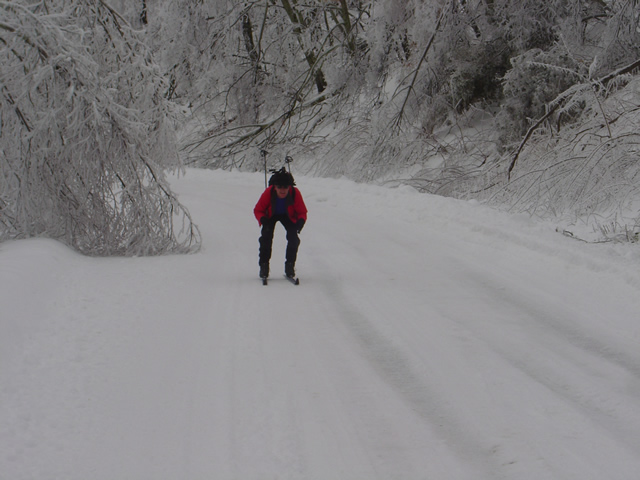
The nice thing about this route is it’s a very gentle climb from Wagon Road Gap to Mount Pisgah. Up hill on the way out, but downhill on the way back. Skiing takes on a whole new aspect when you change from uphill to downhill.

Wayne makes up some time on the downhill sections.

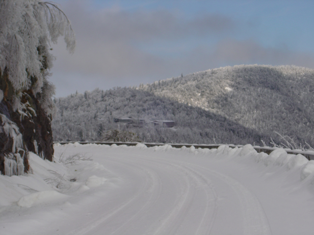
By the time we reached the Pisgah Inn it was shrouded in thick cloud and I couldn’t get any close up photos of it or Mt.Pisgah. The inn is closed of course, though the joke of the day was getting a beer and a meal once we reached it.

The Pisgah Inn seen from distance.

Few people ever see the Blue Ridge Parkway like this. It is admittedly a rare occurrence in recent times, at least until this year. Now it’s to the point we look at this a realize just how much snow has already melted and remember how deep it once was. We’ve not had ice like this though, and it will be spring before we realize just how much impact it had.

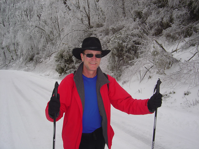
Wayne, the author,makes the most of a snowy winter

My wife shot some video of our excursion and posted it on You Tube. It really captures the scenery and the experience, and shows just how bad a skier I really am. Enjoy.

Found Some New Maps – Why Mine Are Better!

We celebrated my wife’s birthday last night with dinner at the Pisgah Inn a few miles south of Asheville, NC., up on the Blue Ridge Parkway. I know better than to reveal the details of which birthday this was, but I will disclose the meal was excellent, as good as the views from 5000 feet.

As we were leaving, I ducked into the gift shop and spied a series of maps I didn’t have. I use every possible resource when planning my routes, so I shelled out $10 each plus tax for 3 maps which covered the Blue Ridge Parkway and the areas surrounding it. These are nice maps, but I wondered, were they better than mine? Had I been outclassed by the competition? I think not.

These probably wont end up in my saddlebags. The fact that that’s where I’d choose to keep them is the first problem. They are just plain too big to toss in a pocket, too bulky. On looking at them I feel compelled to lay them out on a table. That’s hardly useful on the road. It’s hell if there’s a breeze. You could fit two or three of my maps in your pocket. A map in the saddlebag is a pain in the ass. You’ve got to stop, get off the bike, open the saddle bag, fish around to find it, unfold it, figure out which side of the map you’re supposed to be studying, find where you are, refold it, put it back in the saddlebag, yadda, yadda. I’ll take a manageable pocket map, thank you.

They are pretty maps to look at with all the topographic relief and subtle shading of greens and blues and browns. The major roads and highways are fairly easy to identify, though these are the roads I avoid. There’s little enjoyment in cruising down the Interstate or traversing the great four lane highways. Those little back roads that hold all the hidden secrets and great riding are just thin black lines lost in the shading and relief that adds to the artistic composition of the overall product. Like any great work of art, the devil is in the details and you really need to make the effort to pull it out. That’s not very useful on the road.

Still, if you spend the time studying it, you can pull out the back roads. But which ones are the good ones? Which ones should I link together to get from A to B? There are lots of squiggly lines on the map if you search for them. On my maps, the great rides stand out. Take this one, which leads to that one, and then follow this next one to get to where you’re going enjoying the best of them along the way. My maps tell you it’s 6.5 miles to the next road, it will take 19 minutes or so to do the ride, then 14.3 miles and 26 minutes on the next leg. You’ll know when you’ll be arriving at the restaurant I recommended on the map or pulling into the town where you plan to spend the night or arriving at the park or scenic overlook that’s worth your time to stop and see.

The most important info though, is something I strive to include on all my maps. Where are those out of the way gas stations? Let’s face it, some of you are looking at the big “E” after just a hundred miles or so. You could plan your rides hopping from town to town, any town of size has a gas station. Me, I prefer to just keep on rolling, avoiding the traffic lights, congestion, and speed traps that come with towns. You’d be a lot more adventurous if you didn’t have to worry about the dwindling petrol in your tank and have a lot more fun. I make sure to identify those backwoods oasis’s that keep you motoring along as well as those which flank the Blue Ridge Parkway and free you from that long fuel hose that tethers you to the main roads.

I bought some nice maps, a little better than the free versions you can pick up along the Blue Ridge Parkway or download from the Internet. These however, will go into the reference file with many, many others. I’ll pull them out to confirm locations of various points of interest and such. As a fellow cartographer, I can appreciate the effort. Yet when I head out, it will be my maps which I slip into a pocket, not a saddlebag, and whip out at a stop sign or overlook to go tearing off down some great ride through the mountains. I see things differently from a saddle with two wheels beneath me. I’m looking both for something more and something less. Just give me what I need, save the fluff for the cagers. I’ll be using America Rides Maps.

Wayne@americaridesmaps.com

>> Go To America Rides Maps.comhttp://americaridesmaps.com