Georgia’s Premier Motorcycle Ride & The Biker Barn

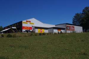
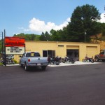
photo-The-Biker-Barn

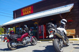
The Biker Barn - The Gauntlet Headquarters

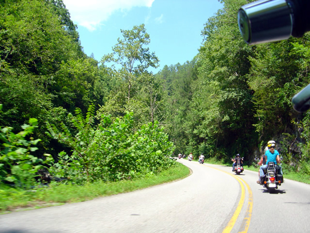
I’ve long had an affection for the motorcycle rides of north Georgia and now some of the best of them have been linked into a 133 mile long loop ride known as “The Gauntlet“. As it has gained notoriety, visitors from across the nation, even around the world have begun to flock to enjoy this serpentine romp through the hills and mountains of the Peach State.

Conceived and promoted by The Lodge at Copperhead and The Biker Barn near Blairsville, The Gauntlet strings together such notable rides as GA 60, GA 180, US 19 / 129, and others, routing you near or through Suches, Helen, Hiawasee, and Blairsville on roads which have long been favorite destinations for the two wheeled tourist.

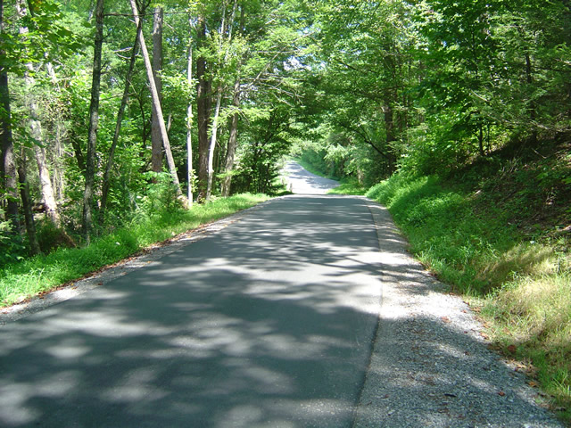
Photo-The-Biker-Barn-road-view

The Biker Barn is easy to find with gas nearby

For those approaching the Blue ridge Mountains from the south on their way to such legendary rides as the Cherohala Skyway and the Dragon at Deals Gap in Tennessee and North Carolina, The Gauntlet adds another classic and outstanding adventure to their touring itinerary. For those who come to play in the Smoky Mountains from the north, the Gauntlet gives them ample reason to make the quick hop across the southern border into Georgia’s motorcycle playground.

Yesterday, I took a ride down meet Lori and Brad Betters at The Biker Barn near Blairsville, the headquarters for your Gauntlet memorabilia and and souvenirs and purveyors of motorcycle gear and supplies. Located at one of the junctions on The Gauntlet loop marked by a traffic light with a convenient gas station nearby, The Biker Barn is one of those must-do pit stops on the challenging ride.

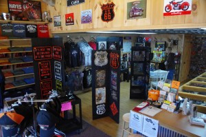
Photo-The-Biker-Barn-inside

The Biker Barn has what you need and what you want

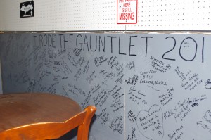
This popular rest stop at The Biker Barn is one of several gathering spots along the ride. There’s a “hang out” for bikers around the back side of the store where you can write your name on the wall with those who have come before you and leave your mark along with others from as far away as Alaska and beyond.

The well equipped store includes several versions of some very nice Gauntlet T-shirts, as well as leather wear, helmets, gear, and supplies. They also have an assortment of quality motorcycle trailers on hand if you’re looking for options to haul your bikes.

Photo-The-Biker-Barn-wall

Ride the Gauntlet and add your name to the wall at the Biker Barn

Of course they have maps and other info, and work in partnership with The Lodge at Copperhead which offers outstanding accommodations in the area.


The Biker Barn

The Lodge at Copperhead


Download a map of The Gauntlet here – http://www.gauntletga.com/downloads/Gauntlet_printable_map.pdf

_______________________________________________________________________________

Wayne Busch

Wayne Busch - Cartographer

Total Rider Tech Logo

Learn Total Control

– Wayne Busch lives in Waynesville, NC, where he produces the most detailed and comprehensive and up-to-date motorcycle pocket maps of the Blue Ridge and Smoky Mountains to help you get the most of your vacation experience. See them here – AmericaRidesMaps.com

Wayne is an advanced motorcycle instructor for Total Rider Tech teaching Lee Parks Total Control Advanced Rider Courses. It’s time you looked into advanced rider training to ride more confidently and safely, it will change your mountain riding experience. It worked so well for me I became an instructor! Total Rider Tech

_______________________________________________________________________________

You’ll find the roads of The Gauntlet and many more of north Georgia’s finest rides on America Rides Maps #9 – The Best Rides in the North Georgia Mountains


Hurricane Weekend in Maggie Valley on my Motorcycle

Photo-mt-mitchell-highest-in-east

A little cloudy and rainy was as bad as it got atop Mt. Mitchell

While curiousity got the best of me and I did cruise up to Mt. Mitchell to get a close look at the hurricane, the Smoky Mountain weather was beautiful for motorcycle rides and I took advantage of it with a bunch of local favorites. Judging from all the other bikes out on the road, a lot of coastal folks hopped on the hog and ran for the hills. It was a good decision.

Photo-Thunderhawg-motorcycle-rentals

Thunderhawg Motorcycle Rentals, Maggie Valley

Friday found me visiting my friends at ThunderHawg motorcycle rental which just opened at the corner of US 276 and US 19 after my ride north on the Blue Ridge Parkway to Mt. Mitchell. Peggy and Mark rent Harleys and it’s nice to have a local rental place again in Maggie Valley. They’ve got tons of info, maps, and they love to meet and greet motorcycle vacationers to the Smoky Mountains. Stop in and see them when you pass through.

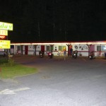
photo-aholiday-motel

A Holiday Motel - Saturday night

Saturday, I rode the Blue Ridge Parkway the other way to Cherokee and Bryson City to stop in at The Gear Head Inn, then hopped on some of the great roads south of there. I ended up at A Holiday Motel in Maggie Valley to pass the time while my wife ran in the 8K Maggie Valley Moonlight race.  Always popular with motorcycle vacationers, the A Holiday Motel was full of bikers who came to enjoy the splendid weather. The bonfire was going out front and I was able to cheer Jackie on and spend a little time with the riders. Dale from Wheels Through Time Motorcycle Museum came by with a couple of Australian visitors who had borrowed a couple of his antique Harleys.

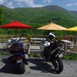
The view from Riders Roost Restaurant is awesome

The view from Riders Roost Restaurant is awesome

Sunday, I cruised NC 215 and US 276, then followed the Blue Ridge Parkway back to Maggie Valley to stop in at Riders Roost Restaurant in before we headed back up on the Blue Ridge Parkway to enjoy the crystal clear evening skies that came in after the storm.

No matter which way you point your wheels from Maggie Valley, you’ll find outstanding riding. The Best section of the Blue Ridge Parkway is right up the hill. It’s a great place to base out of for your motorcycle trip to the Smoky Mountains as so many great rides are within easy reach.

Check out AllRoadsLeadToMaggie.com when planning your visit. Maggie Valley is the heart of good motorcycle riding in the Smoky Mountains.

_______________________________________________________________________________

Wayne Busch

Wayne Busch - Cartographer

Total Rider Tech Logo

Learn Total Control

– Wayne Busch lives in Waynesville, NC, where he produces the most detailed and comprehensive and up-to-date motorcycle pocket maps of the Blue Ridge and Smoky Mountains to help you get the most of your vacation experience. See them here – AmericaRidesMaps.com

Wayne is an advanced motorcycle instructor for Total Rider Tech teaching Lee Parks Total Control Advanced Rider Courses. It’s time you looked into advanced rider training to ride more confidently and safely, it will change your mountain riding experience. It worked so well for me I became an instructor! Total Rider Tech

_______________________________________________________________________________

Favorite Blue Ridge Parkway Motorcycle Pit Stops – Chateau Morrisette, VA

Photo-Chateau Morisette on the Blue Ridge Parkway

Chateau Morrisette on the Blue Ridge Parkway

The romantic relationship we have with Chateau Morrisette winery on the Blue Ridge Parkway goes back to a motorcycle trip many years ago. Tired and hungry from a long day on the lower Virginia section of the Blue Ridge Parkway, we stumbled in looking for a bite to eat only to find the kitchen had just stopped serving for lunch. Our disappointment must have radiated as the chef emerged from the kitchen, took one look at us, and said, I’ll take care of them”.

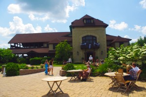
photo-Restaurant-terrace-at Chateau-Morrisette

The Restaurant Terrace

We were seated on the beautiful mediterranean style porch with it’s panoramic views of the rolling Virginia countryside. A short time later sandwiches arrived at the table and we devoured one of the best meals we’d had in days. I remember a delicious portabello mushroom  on crustini bread draped in a melted cheese which we accompanied by a glass of Black Dog Red wine and knew we’d found a  heavenly oasis.  I’ve never missed a chance to stop at the Chateau Morrisette since nor ever been disappointed.

Photo-tasting-room-at-chateau-morrisette

The tasting room

Over the years, the winery has grown in size and reputation. In times past it was one of the few landmarks you could easily identify from the Blue Ridge Parkway. Far out across one of those idyllic mountain farm fields, a long low series of signs spelled out the name of the winery in large letters. Gone now, the only way to find  it is to know where it is and watch for it. Success has meant one of the few advertisements along the Blue Ridge Parkway is no longer needed, and the parkway ethic is enhanced by it’s absence.

photo-terrace-at-chateau-morrisette

Live entertainment is common on weekends

While the restaurant remains much as I remember it, the new building at the vinyard is now the hub of activity. The regal architecture hosts the tasting room, gift shop, and is the sales outlet for the wines. The terrace outside is the gathering and resting place where patrons sit and enjoy their glasses of local vintage to the accompaniment of snacks and often live entertainment.

Photo-Chateau-Morrisette-Restaurant

Chateau Morrisette Restaurant

On a weekend visit you’re happy to be on a motorcycle where you can slip into corners in the crowded parking lot. There are frequent events, a stage on the beautiful grounds for concerts and such, it seems there’s always something going on at this popular destination.

Chateau Morrisette winery

Chateau Morrisette is locate at milepost 168.8 on the Blue Ridge Parkway south of Tuggles Gap. Look for Black Ridge Road, then spur off quickly onto Winery Road. You’ll arrive in 0.6 miles.

photo-Chateau-Morrisette-Wine

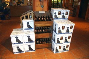
Chateau Morrisette's Black Dog Wines - Tasty

You’ll find Chateau Morrisette and all the surrounding great motorcycle rides in the area on America Rides Maps #3 of the Complete Blue Ridge Parkway seriesNorth Carolina / Virginia Border Rides.

_______________________________________________________________________________

Wayne Busch
Wayne Busch – Cartographer
– Wayne Busch lives in Waynesville, NC, where he produces the most detailed and comprehensive and up-to-date motorcycle pocket maps of the Blue Ridge and Smoky Mountains to help you get the most of your vacation experience. See them here – AmericaRidesMaps.com 


Great Motorcycle Rides North of Asheville Discovered

It’s not often I have such a successful day when out exploring for new motorcycle rides to add to my maps but Friday was one of the best. Most of the roads I evaluate don’t measure up against my strict standards – low traffic, engaging scenery, and a challenging and fun motorcycle ride. Nearly every road I explored turned out to be good enough to add to my map of “The Best Motorcycle Rides North and South of Asheville, NC”.

Photo - river north of asheville

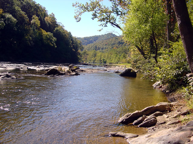
Most of todays rides were through the valleys near rivers. The twisty roads hug the banks.

The weather was ideal – atypically warm, sunny, and clear. The first hints of fall color were starting to emerge in places. Most of that is concentrated in the highest elevations right now, see the post to follow for some photos of the best color. The bulk of todays riding was searching out roads to link and connect to the already outstanding rides previously discovered.

Photo - river north of Asheville

I stopped here for a break along NC 197. It's a great ride as are the roads which connect to it.

I had been avoiding the area around US 19W due to the construction to widen the road to 4 lanes. Part of the mission was to discover the side roads which skirt around it. That construction will be going on for quite some time. I found a bunch of them.

Photo - The lake at roaring Creek, TN

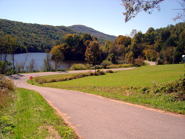
You can see a hint of fall color near this lake along Roaring Creek Road in Tennessee.

I also located a nice loop ride south of Johnson City, Tennessee, a good road to make loops near Roan Mountain, and quite surprising, still more great rides near Little Switzerland and the Diamondback. Much of the riding this trip was down low, through the valleys and along the rivers which are rides you can do pretty much all year round, places to go  after the Blue Ridge Parkway has closed for the winter season.

Photo - Stopped near Roan Mountain

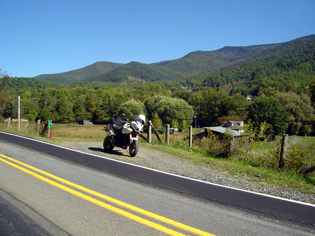
This road turned out to be a great way to make a loop ride when doing the popular ride over Roan Mountain. There is one very short but well maintained unpaved section.

I’ll be adding these new motorcycle rides to the map  The Best Motorcycle Rides North and South of Asheville, NC” this week. It’s almost done with the upgrade to the new and improved format slow but sure.

Photo - mountain view

The skies have been unusually clear lately and the long range views are outstanding.

I got some great photos of the start of the fall color in the higher elevations on the Blue Ridge Parkway. You’ll find some nice stuff starting near Boone and Banner Elk, in the area around Mt. Mitchell and the Black Mountains, not so much near Craggy Gardens, and then some north and south of Asheville. It’s still a little early, the peak will come next weekend, though it will continue through the lower elevations for a while. Next post will show you some color.

America Rides Mapshttp://americaridesmaps.com 

_______________________________________________________________________________

Wayne Busch

Wayne Busch - Cartographer


– Wayne Busch lives in Waynesville, NC, where he produces the most detailed and comprehensive and up-to-date motorcycle pocket maps of the Blue Ridge and Smoky Mountains to help you get the most of your vacation experience. See them here – AmericaRidesMaps.com


Video – The Diamondback Motorcycle Ride Near the Blue Ridge Parkway

http://www.youtube.com/watch?v=wmUlsQzX-fw

Ride along with Jackie (from America Rides Maps)  as she careens down the Diamondback Motorcycle Route. Accessed from the Blue Ridge Parkway, this is one of those side roads you should add to your motorcycle vacation plan. The Diamondback is one of the big three motorcycle rides in North Carolina, joining the Snake and the Dragon in the pantheon of classic and challenging rides. Included are scenes from the Switzerland Inn, one of the top motorcycle friendly destinations on the Blue Ridge Parkway.

You can find videos of other great Smoky Mountain motorcycle rides, video tips, and more at America Rides Maps YouTube channel – http://www.youtube.com/user/americaridesmaps

_______________________________________________________________________________

Wayne Busch

Wayne Busch - Cartographer


– Wayne Busch lives in Waynesville, NC, where he produces the most detailed and comprehensive and up-to-date motorcycle pocket maps of the Blue Ridge and Smoky Mountains to help you get the most of your vacation experience. See them here – AmericaRidesMaps.com


Pre 1916 Coast to Coast Motorcycle Race Going On? Here are the photos!

http://www.motorcyclecannonball.com/ – here are some of the photos I took this morning.

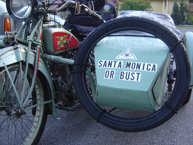
Photo - Cannonball motorcycle run

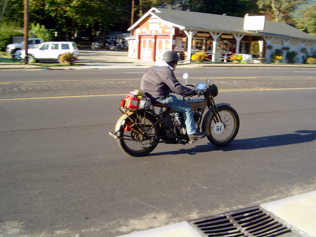
Bust? Highly likely

I can’t adequately describe this event so I’m just going to give you the link right off the bat. See for yourself, follow them as they progress, it’s just hard to believe it’s actually happening.

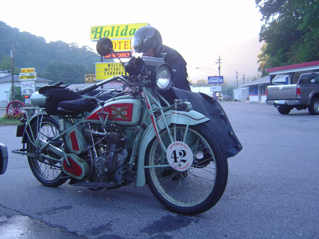
Photo - Cannonball Motorcycle run

7:30 AM and getting ready

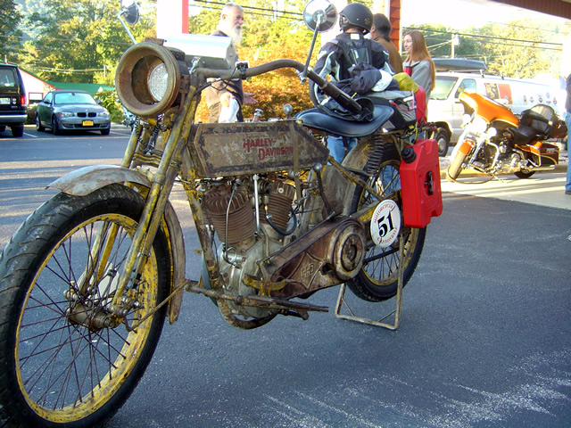
For those of us in western North Carolina, it’s not all that unusual to see vintage motorcycles from time to time thanks to Dale Walksler’s Wheels Through Time Motorcycle Museum in Maggie Valley.  Not only does he have one of the most extensive collections of early motorcycles, and a historical representation of the Harley Davidson line, but they all run and he races them. More than once I’ve been cruising through Maggie Valley when he pulls up alongside on one of the vintage motorcycles out for a spin.

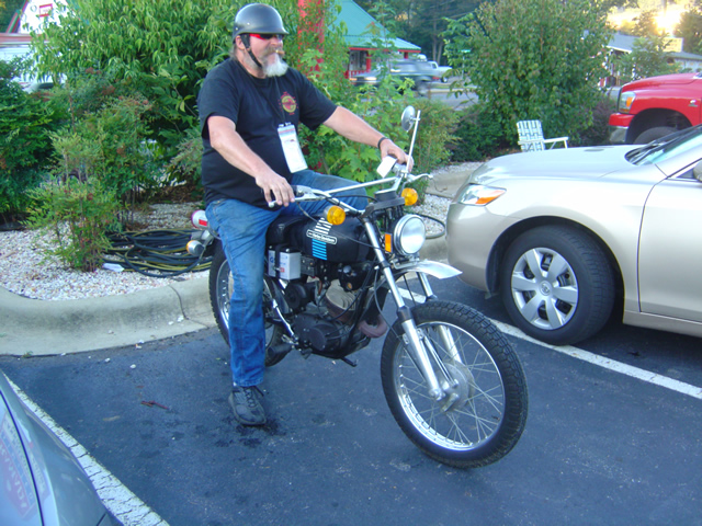
Photo - Cannonball Motorcycle run

Not all the bikes were vintage - THIS WAS MY FIRST ROAD BIKE! 1974 Harley Davidson 90cc

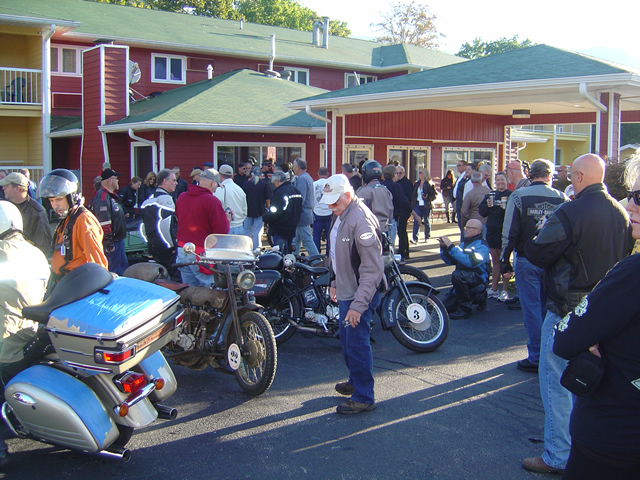
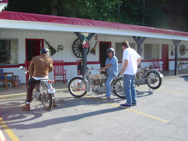
I watched the bikes straggle in last night. They filled the A Holiday Motel in Maggie Valley as well as 2 others. I got to talk with the support crews and some of the riders.

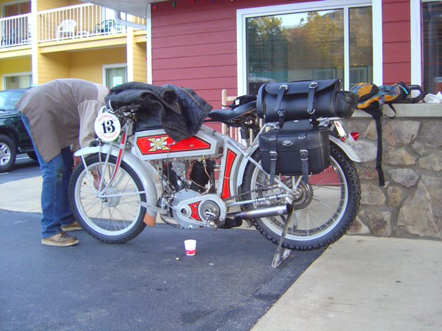
Photo - Cannonball Motorcycle Run

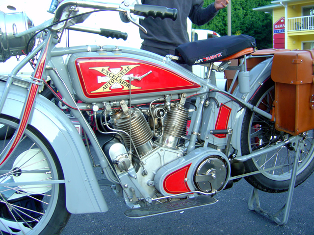
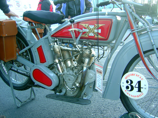
Excelsior Motorcycles were well represented

What’s it like riding one of these? They’re lucky to hit 50 mph so you don’t get windblown. The seats are fairly springy. It’s not all that bad – so they say.

Photo - Cannonball Motorcycle Run

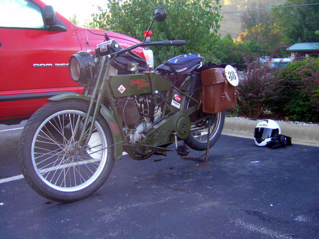
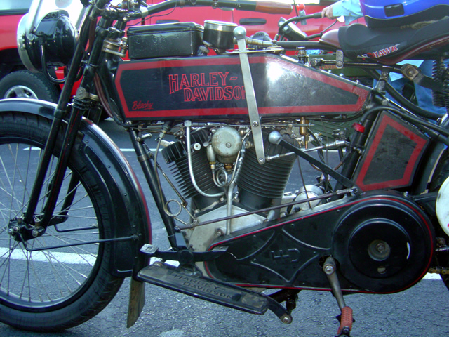
Plenty of early Harleys

On the other hand, going up hills is a challenge. I think those pedals get used. Things fall off – like brakes.

Photo - Cannonball Motorcycle Run

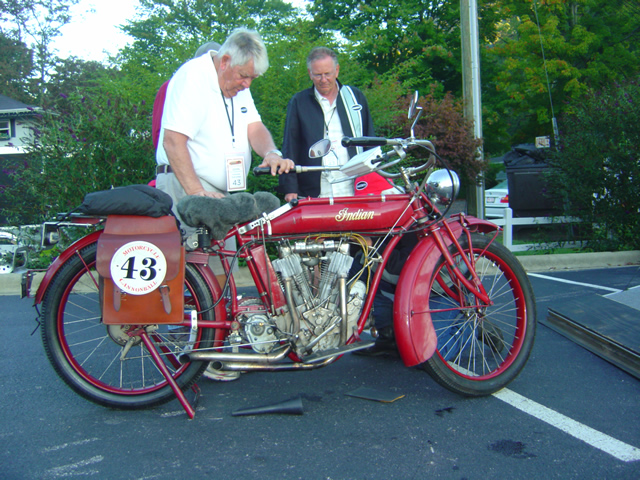
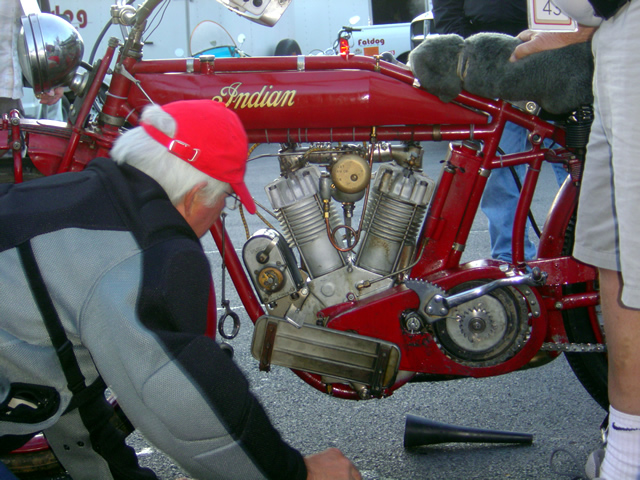
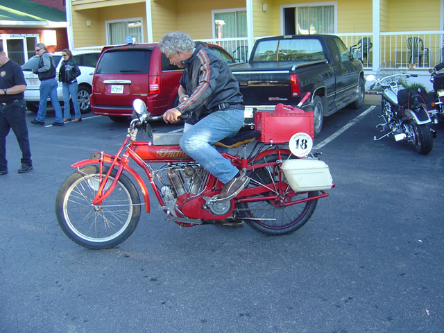
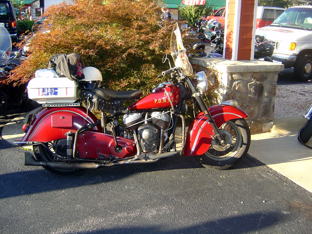
Lots of Indian Motorcycles

Electrical problems, particularly magnetos, are a problem that can stop you dead and tough to resolve.

Photo - Cannonball Motorcycle Run

Somehow they got the magneto repaired on this Indian.

A lot of these guys were up till the early morning hours in Wheels Through Time repairing the bikes to keep them running.

Photo - Cannonball Motorcycle Run

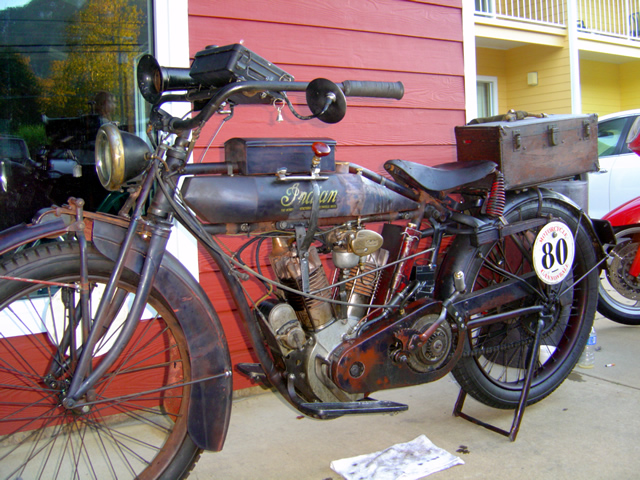
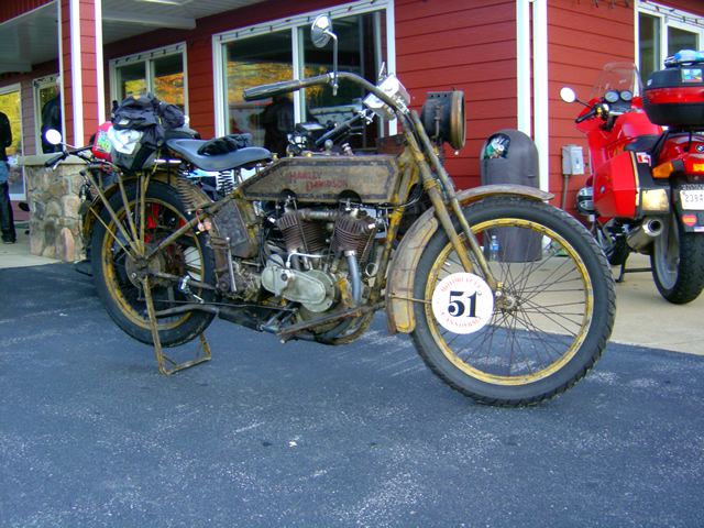
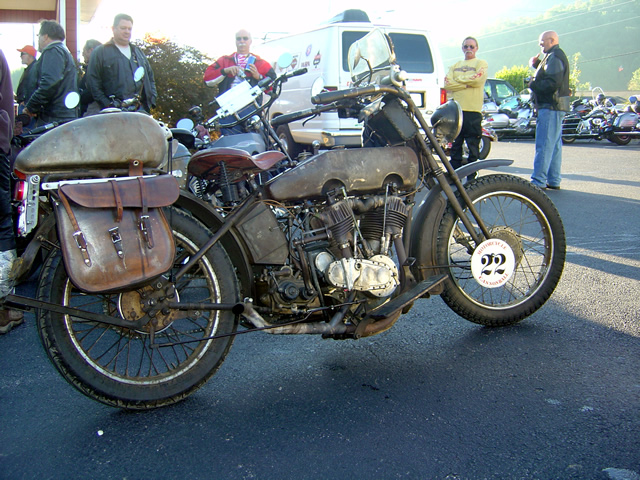
Not all the bikes were restored to original condition

It was interesting to see what it took to make these bikes run. The right fuel mix, careful coaxing and monitoring, and a lot of attention.

Photo - Cannonball Motorcycle Run

Some bikes were in mint condition

Photo - Cannonball Motorcycle Run

Would you race this baby across the country?

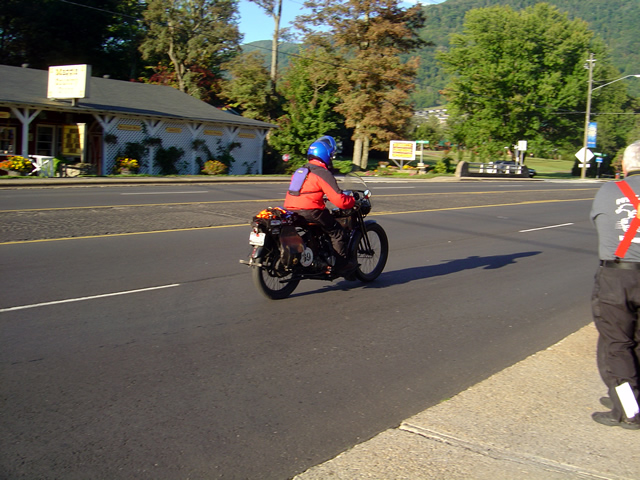
48 bikes started the race. Some had already dropped by this 3rd day. Will any make the west coast?

Photo - Cannonball Motorcycle Run

Getting them started is a challenge

They average about 200 miles per day. The longest day is 300 miles. No interstates. Only one rest day. Holy cow.

Photo - Cannonball Motorcycle Run

I wouldn't know where to start to work the controls

I hope they make it. I’d like to see it become an annual event, though I don’t know how long the bikes could make repeated trips.

Photo - Cannonball Motorcycle Run

You couldn't pay enough to duplicate the finish on this machine.

Photo - Cannonball Motorcycle Run

The detailing on this machine attests to its authenticity

It’s something to see motorcycles nearly 100 years old not only running, but racing.

Photo - Cannonball Motorcycle Run

Best to get an assistant to do the starting

Photo - Cannonball Motorcycle Run

Is that a "cheater tank" on this Harley?

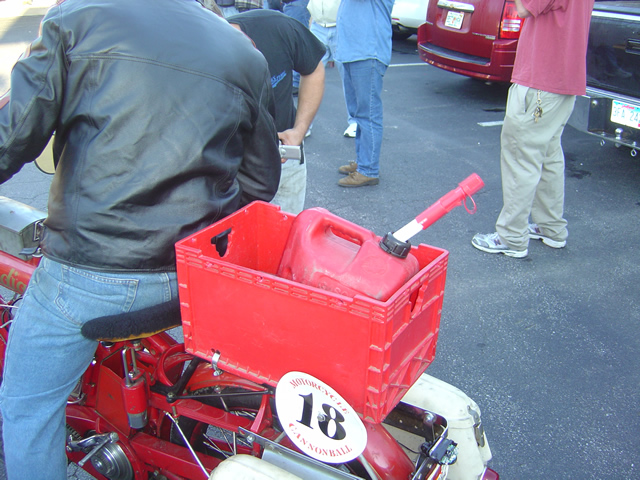
Some of these guys were stopping to fill up every 20 miles.

Photo - Cannonball Motorcycle Run

With VERY limited range, this was the way to go.

Photo - Cannonball Motorcycle Run

A police escort helps

it’s pretty cool to see these old bikes. It’s even cooler to see them run. But when you see them take off down the road to race, it just defies coolness and becomes something beyond.

Photo - Cannonball Motorcycle Run

People came from surrounding states to see the event.

Follow the progress, read the trails and tribulations of the riders a thttp://www.motorcyclecannonball.com/


Photo - Cannonball Motorcycle Run

The race is on!

Photo - Cannonball Motorcycle Run

Another racer hits the road

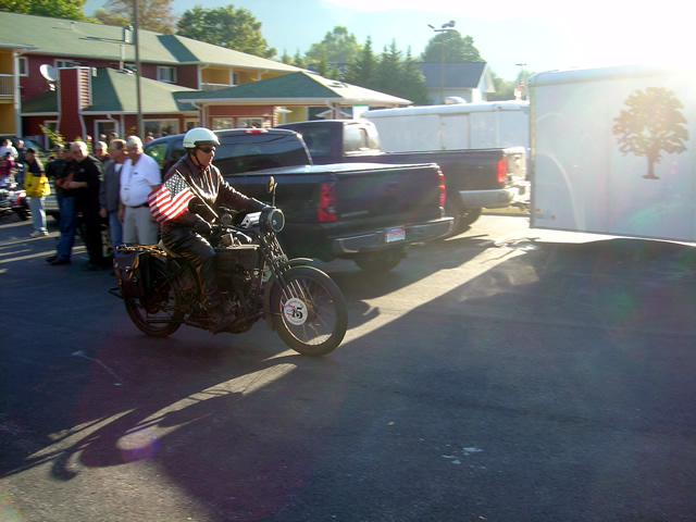
Photo - Cannonball Motorcycle Run

Dude, that flag is gonna slow you down!

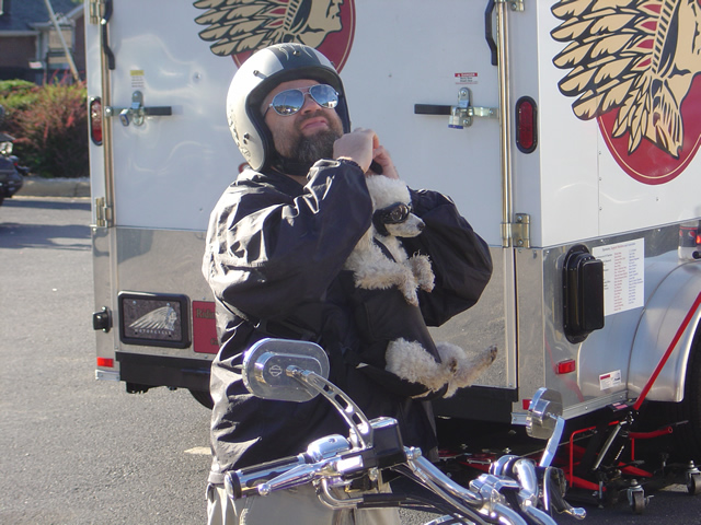
Photo - Cannonball Motorcycle Run

Horsepower Ok. Dog power - disqualified.

If you like this you need to pay a visit to Wheels Through Time Motorcycle Museum in Maggie Valley, NC.

_______________________________________________________________________________

Wayne Busch

Wayne Busch - Cartographer


– Wayne Busch lives in Waynesville, NC, where he produces the most detailed and comprehensive and up-to-date motorcycle pocket maps of the Blue Ridge and Smoky Mountains to help you get the most of your vacation experience. See them here – AmericaRidesMaps.com


Cannonball Vintage Motorcycles in Maggie Valley

I just got a couple photos this evening, bikes were still coming  in and heading to Wheels Through Time motorcycle museum on the Cannonball cross country vintage motorcycle race.

Photo - vintage Harley

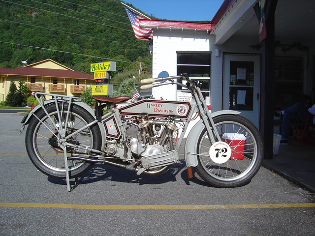
One of three similar vintage Harleys in the Cannonball motorcycle race.

I’ll head over first thing in the morning when things get organized and the bikes are all together to head out and get some more pics. They’ve taken all the rooms at the A Holiday Motel in Maggie Valley.

The bikes were just rolling in this evening. Too scattered for good photos. More in the morning.

The bikes were just rolling in this evening. Too scattered for good photos. More in the morning.

_______________________________________________________________________________

Wayne Busch

Wayne Busch - Cartographer


– Wayne Busch lives in Waynesville, NC, where he produces the most detailed and comprehensive and up-to-date motorcycle pocket maps of the Blue Ridge and Smoky Mountains to help you get the most of your vacation experience. See them here – AmericaRidesMaps.com


Motorcycle Touring the Blue Ridge Parkway in One Day – What was it Like?

On Thursday I rode the Blue Ridge Parkway on my motorcycle from the start at Waynesboro, Virginia, 469 miles to the southern end at Great Smoky Mountains National Park in North Carolina. As I progressed I paused to snap photos and posted them on Facebook and Twitter. Here’s a recap of the experience;
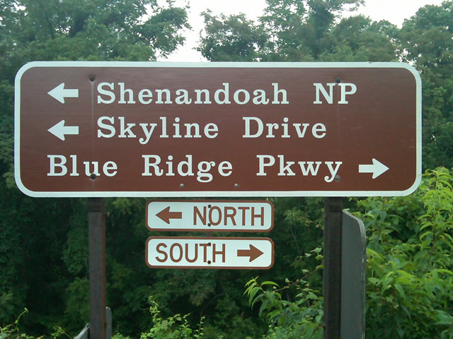
Photo - sign at start of Blue Ridge Parkway

The Blue Ridge Parkway starts where the Skyline Drive ends near Waynesboro, Virginia.

I chose to start at the north end as I knew I’d need to leave at daybreak. The morning fog has been so heavy at the southern end I didn’t want to chance it slowing me down or making for pictures of nothing but white mist. I spent the previous night in Richmond and left before 5 AM to make the 1 1/2 hour ride to Waynesboro in the darkness.
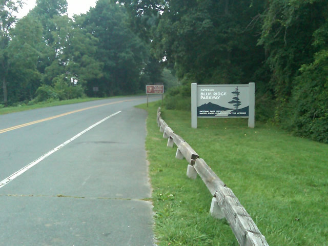
Photo - sign at the start of the Blue Ridge Parkway in Virginia

I took these photos the previous day as I expected it would be too dark to take them on the actual trip. I was right.

I fueled up in Waynesboro, grabbed a cup of coffee and a pack of doughnuts to sustain me, and headed on my way. It would be the last time I stopped to eat or drink. 469 miles is a long way at the 45 mph speed limit. I had no time to waste. At least that was my attitude early on.
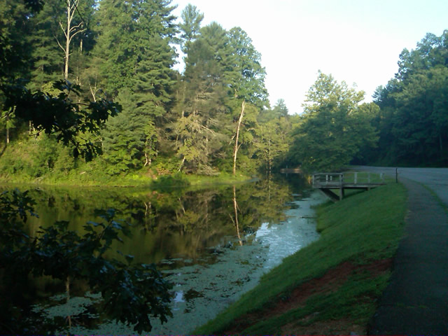
Photo - morning at the lake on Otter Creek

The sun comes up at the lake on Otter Creek. Easy ride so far.

I had the road to myself in the early morning twilight. Within a few minutes I’d seen both deer and turkey. The road starts a gradual climb to elevation here though nothing like the heights reached further south. With no other traffic on the road, my speed crept up a bit, something I’d fight the remainder of the trip. As you get comfortable and into the rhythm of the road, the temptation to take things at your more comfortable pace is always there taunting you. Knowing how far I had left to go didn’t help.
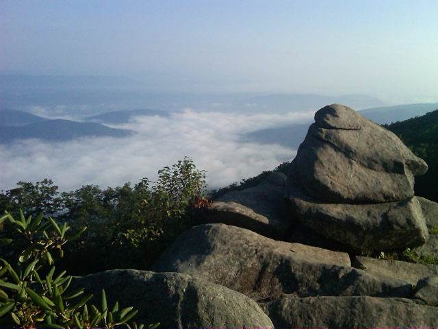
Photo - Above the clouds approaching Roanoke

I paused at this overlook to top up on oil, lube what was left of the chain, and take a few moments to savor the views I was rushing by.

I was also facing the challenge of not knowing if my chain would last the trip. It was already shot before I left, adjusted to the end of the swingarm, far beyond the normal limit. It now sagged precariously and was making noises that had me wondering when it would snap. I’d never seen a chain smoke when lubed before, and I took advantage of opportunities to slather it with lubricant whenever my concerns peaked. I prayed it would not jump the sprockets when carving through a turn and catapult me into a rock face or over a precipice.
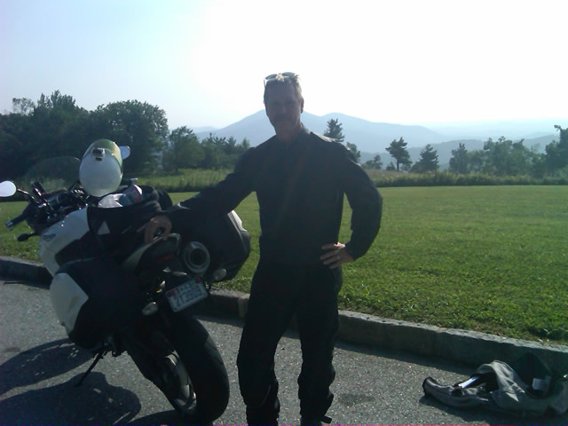
Photo - me and my bike along the Blue Ridge Parkway

A fellow biker snapped this photo of me at a rest stop. Riding from Florida to Maine and back, he and his wife were enjoying the parkway on their return.

Traffic remained surprisingly light through the morning with few holdups to pass slower vehicles. I watched the parkway wake up, the rangers and maintenance crews come to work and start their labors. Finding cell phone coverage to post my photos was always a challenge. You never know when it will be available, sometimes there in what looks like the most unlikely spots, other times absent where you think it should be a strong signal.
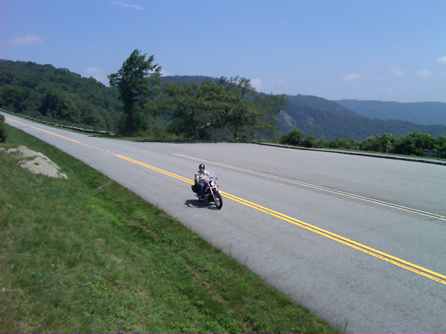
Photo - near Doughton Park

By mid morning there were plenty of other motorcycles on the road. This photo was taken somewhere near Doughton Park.

My first stop for gas necessitated a detour into Floyd, VA. Knowing where the nearest gas stations are is one reason I map the area so throughly. You can waste a lot of time looking for them if you don’t know which way to go. While in Floyd I popped in for a minute to see Derek at the Hotel Floyd, one of my favorite places to stay.
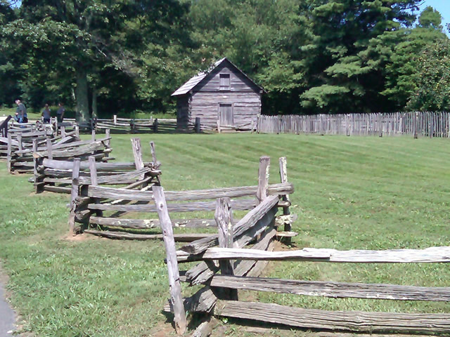
Photo - Historic cabin on the Blue Ridge Parkway

There are a few historic cabins along the road in southern Virginia.

As I crossed into North Carolina and entered the high mountains I knew cell phone coverage would be much more limited. The curves tightened up bit and the road was often wet from spotty showers. It would be another day with temps approaching near 100 in the valleys, but at elevation things remained tolerable so long as I was moving. I somehow avoided all but a slight peppering of rain which felt wonderful at the time.
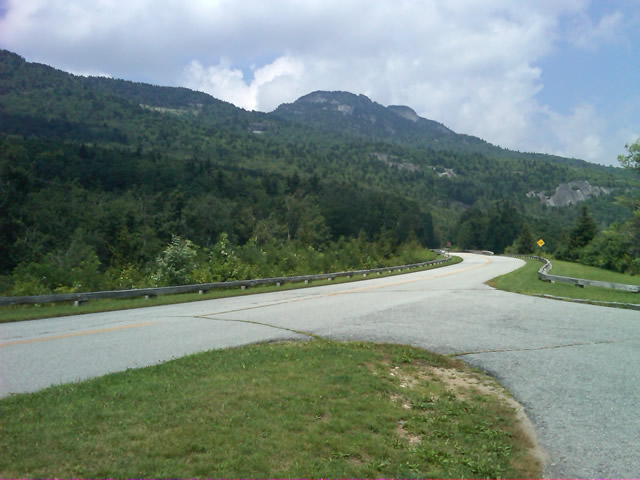
Photo - Grandfather Mountain

Passing Grandfather Mountain I felt I was back on home turf though still a long, long way to go.

Delays had been brief so far, and I planned my next fuel stop to coincide with a quick stop to say hello at the Switzerland Inn in Little Switzerland, one of my favorite places to eat or overnight. I fueled up in Spruce Pine. It was tempting to get a good meal, but I forced myself to press on. The real hold ups came as I approached Asheville. Tree crews and road construction caused significant delays and I hit the “commuter section” during evening rush hour.
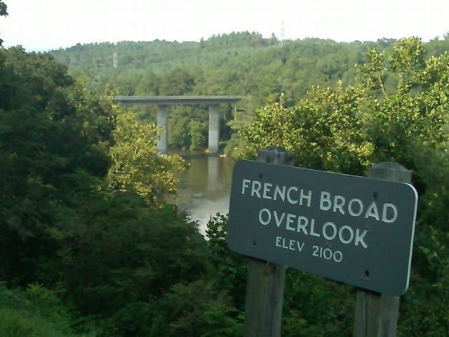
Photo - French Broad River Overlook

It was a great relief to finally cross the French Broad River southwest of Asheville and begin the climb to the highest and most scenic section of the Blue Ridge Parkway.

The sun was drawing near the horizon as I carved my way along the high ridge tops of the section of the Blue Ridge Parkway I consider my back yard. Thunderheads lurked and the road was wet in places, but my luck continued.
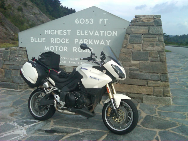
Photo - at the highest point on the Blue Ridge Parkway

Reaching the highest point on the Blue Ridge Parkway, I knew there was less than 40 miles to go to reach my goal.

I reached the southern end of the 469 mile ride with daylight to spare and took a pause at the Oconoluftee Visitor Center in Great Smoky Mountains National Park. I grabbed a few photos but found the battery was now dead on my cell phone. Here they are now –
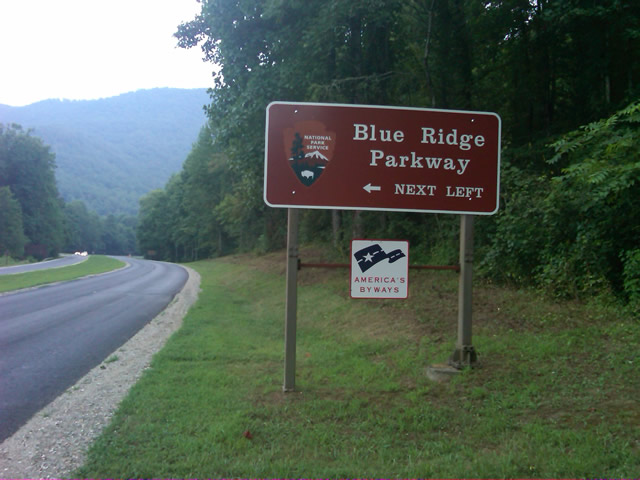
Photo - start of the Blue Ridge Parkway in North Carolina

The Southern end of the Blue Ridge Parkway near the Oconoluftee Visitor Center.

While my Blue Ridge Parkway in a day adventure was completed, I still needed to get home. Noting the evening traffic, I chose to avoid going into Cherokee and got back on the Blue Ridge Parkway now headed in the opposite direction. I rode through to Soco Gap, then passed through Maggie Valley to finally get to my home in Waynesville.
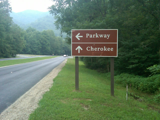
Photo - sign at the southern end of the Blue Ridge Parkway

Go through Cherokee or back the way I'd come? I chose to return home via the Blue Ridge Parkway of course.

My chain lasted the trip. My rear tire is bald. It’s time for some service on the engine. New parts are on order and it will take this week to get the bike roadworthy again. Next week? I might just poke into east Tennessee. I’ve too long ignored the area between Great Smoky Mountains National Park and Knoxville. If I can locate at least a dozen good rides there it will warrant a new motorcycle pocket map. I discovered some great roads along the Virginia / West Virginia border on this trip, several of which will be added to existing America Rides Maps. It will take a few more trips north to determine how the map of that region will lay out but it will come. For now, it’s catch up on the work I left, update the existing maps with the new rides I discovered, and make preparations for the roads ahead.

America Rides Maps on Facebook

America Rides Maps on Twitter

America Rides Maps – the best motorcycle pocket maps money can buy

_______________________________________________________________________________

Wayne Busch

Wayne Busch - Cartographer


– Wayne Busch lives in Waynesville, NC, where he produces the most detailed and comprehensive and up-to-date motorcycle pocket maps of the Blue Ridge and Smoky Mountains to help you get the most of your vacation experience. See them here – AmericaRidesMaps.com


Dumb Things to Do on Your Motorcycle – Cades Cove Bears on a Saturday

I don’t know what possessed me to ride through Great Smoky Mountains National Park on a warm, sunny, Saturday, but then I’m kinda getting in the spirit to do more dumb things on my motorcycle this week – more on that plan later. Nonetheless, I had a new tire to scrub in so I took off for the Dragon at Deals Gap to do the deed. Arriving early in the afternoon, I found it pleasantly low in traffic. Most everyone had already made their passes and headed out to explore the surroundings and I had a good run through it thanks to my brother riders who waved me to slow down when approaching the police stationed along the route. I arrived at the overlook with the new front tire looking like someone had taken a cheese grater to the shoulders and satisfied with the performance of the new Michelin Pure rubber which now adorned both ends of my ride.

I stopped in to see Jody at the Punkin Center Motorcycle Campground who was deeply engaged in a mid afternoons relaxation on the porch, and had to pass on the cool one offered as I had miles to before I reached home. We talked briefly of roads and riding, then I set out for the Foothills Parkway which runs along the Northwest border of Great Smoky Mountains National Park .

Photo - Cades Cove, Gear Smoky Mountains National Park

A view from the Cades Cove Loop Road which rings the valley in Great Smoky Mountains National Park

The Foothills Parkway has never impressed me much, but then my standards of comparison are skewed from all the time I spend on the Blue Ridge Parkway. I passed through Townsend, then fell in line with the cattle herd that staggers it’s way through the park. Regardless of the speed limit, there is always some plod who thinks the posted speed is at least 10 mph too fast and there are a dozen cars in front of you. Oblivious to the landslide of perturbed drivers riding up his bumper, he motors right past pull off after pull off where he could let the traffic pass. It’s all part of the experience.

Photo - the Cades Cove Loop Road in Great Smoky Mountains National Park

Freshly paved, the scenic loop road around Cade's Cove is a great place to see the wildlife that is so plentiful here

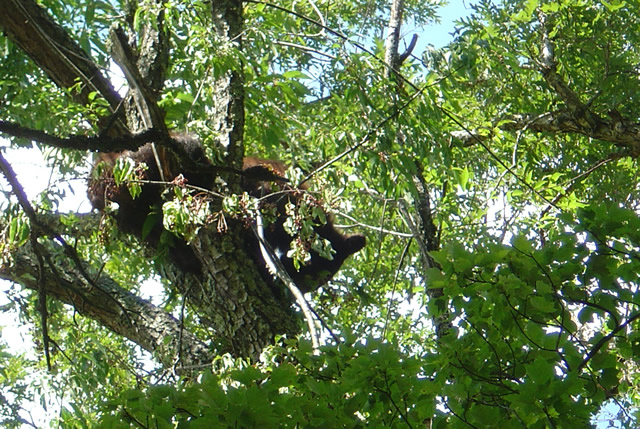
The purpose of my visit was to lay eyes on the newly paved sections of road so I made a detour out to Cades Cove to see the Loop Road. I started, stopped, started, stopped, started (you get the idea) out the freshly paved single lane but quickly realized at this pace I could throw away my watch and use a calendar to figure when I’d get home. I took the first opportunity to shortcut the loop with Sparks Road, an unpaved cut more or less straight across the valley. Nearing the South end of it, I saw the first bear up in a cherry tree gorging on the summer fruit and stopped to snap a photo.

Photo - bear in tree in Great Smoky Mountains National Park

One of several bears I saw on my short visit. They were high in the cherry trees gorging on the summer fruit.

Reaching the south side of the loop road, I fell back into the herd which was held up by another bear spied in another cherry tree at which point people just abandon their cars in the road and walk out to stand beneath the bruin for a telephoto of the bears ass. It’s all part of the experience.

Photo - riding with the herd on River Road

Just one of a long like of bikers on River Road in Great Smoky Mountains National Park

The ride back from Cades Cove, along River Road, then across the park on 441 need not be detailed, it was as was already described. All the way. All the time. I finally escaped onto the Blue Ridge Parkway scooting around the next plodder who was doing 20 mph in the 45 mph section with a quick twist and flick, then fell in with another bike that was obviously not a tourist. I felt it my duty to ride along at a matching pace as a safety backup just in case his enthusiasm wasn’t matched by the talent it took to lay a bike through the turns like he was and someone had to make a 911 call. I’m always there for you bro.

Which brings us back to more dumb things to do on your motorcycle. One day this week I’m going to ride the 469 mile long Blue Ridge Parkway from end to end. In one day. That’s really dumb, like seeing how fast you can have sex. The goal is not to see how fast I can do it, though my competitive nature would naturally lead to that extreme.  Nor do I want to establish a benchmark which will invite challenge by setting a time. I’m building in a safeguard to prevent me from giving in to that temptation. I’m going to force myself to stop once every hour, take a photo, and tweet my location and situation when I have cell phone reception.

I was hoping to go south to north on Tuesday, but the morning fog has been so heavy lately it might not only delay me, but the photos I take will show nothing but white for the first couple hours. It looks like I’ll come from the North end south on Thursday instead. Don’t ask why, it’s something to do with the summer heat no doubt.

Plan on following me on my Parkway-in-a-day tour this Thursday.

_______________________________________________________________________________

Wayne Busch

Wayne Busch - Cartographer


– Wayne Busch lives in Waynesville, NC, where he produces the most detailed and comprehensive and up-to-date motorcycle pocket maps of the Blue Ridge and Smoky Mountains to help you get the most of your vacation experience. See them here – AmericaRidesMaps.com
 

Motorcycle Touring the Blue Ridge Parkway – Crabtree Falls Visitor Center – Is it worth the stop?

So what does the Crabtree Falls Visitor Center offer those on a motorcycle tour of the Blue Ridge Parkway and is it worth a stop?

Image located at http://www.ncwaterfalls.com/crabtree1.htm

Image from NC Waterfalls site -http://www.ncwaterfalls.com/crabtree1.htm. For detailed info and more photos use the link.
http://www.ncwaterfalls.com/crabtree1.htm
If you pull into the Crabtree Falls Visitor Center near milepost 339.5 on the Blue Ridge Parkway expecting to see a dramatic and breathtaking cascade you’ll be disappointed. The waterfall is a mile hike distant down a rough trail, not the ideal venue for riding boots and gear. Should you want to see the falls, come prepared to change into something more appropriate for the hike to reach it. Of course, if you’re spending a night at the campground (71 tent and 22 RV sites, May – October, $14) it’s a must do.

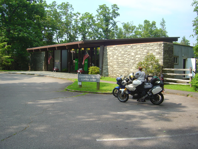
Photo - Visitor Center at Crabtree Falls

The Visitor Center at Crabtree Falls on the Blue Ridge Parkway

The Visitor Center serves as a convenience store for the campground and parkway traffic. You can get snacks and sandwiches, drinks, and limited supplies.

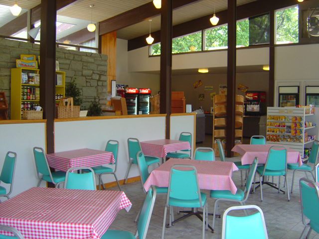
Photo - seating area at the Crabtree Falls Visitor Center

Seating area at the Crabtree Falls Visitor Center where you can savor your snacks

There’s an indoor seating area as well as a porch, though I would consider the views of a small clearing surrounded by trees all that inspiring. Still, it’s a nice and quiet place to spend a break.

Photo - Gift Shop at Crabtree Falls Visitor Center

One section of the Gift Shop at Crabtree Falls Visitor Center

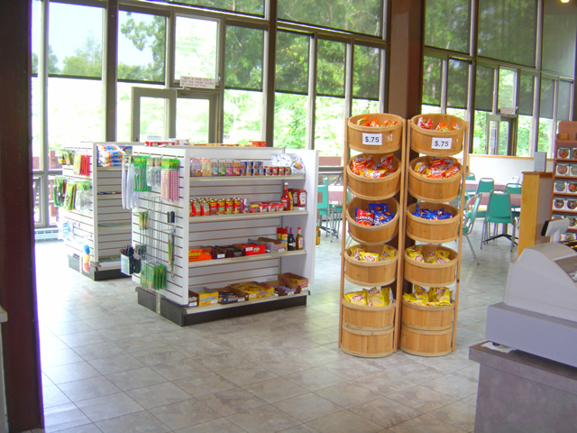
The Visitor Center at Crabtree Falls is as much a gift shop as it is a convenience store with the usual craft and parkway related items.

Photo - Inside the visitor center at Crabtree Falls

Supplies are limited, but you won't starve if you come in off the road looking to camp.

So is it worth a stop on your motorcycle vacation? If you’re making your motorcycle trip by camping along the way it might just be the nice quiet campground that you’re looking for. It’s certainly a good pit stop for those passing through who need break, a bathroom, and a little something to sustain them on their way.

For info about other waterfalls on or near the Blue Ridge Parkway look at Virtual Blue Ridge -Parkway Waterfalls.

If you’re really into seeing roadside waterfalls, check out America Rides Maps 2 map bundle – The Carolina Waterfall Tour with nearly 2 dozen roadside cascades to enjoy with little if any walking.

http://www.youtube.com/watch?v=eBrB5lrtZ9I

_______________________________________________________________________________

Wayne Busch

Wayne Busch - Cartographer


– Wayne Busch lives in Waynesville, NC, where he produces the most detailed and comprehensive and up-to-date motorcycle pocket maps of the Blue Ridge and Smoky Mountains to help you get the most of your vacation experience. See them here – AmericaRidesMaps.com