Two Blue Ridge Parkway Attractions at Roanoke, VA

It’s too easy to ride past two great Blue Ridge Parkway attractions at Roanoke – Mill Mountain and Roanoke Mountain. Both are just south of the city and worth a visit. The Park Service roads which lead to them are well marked.
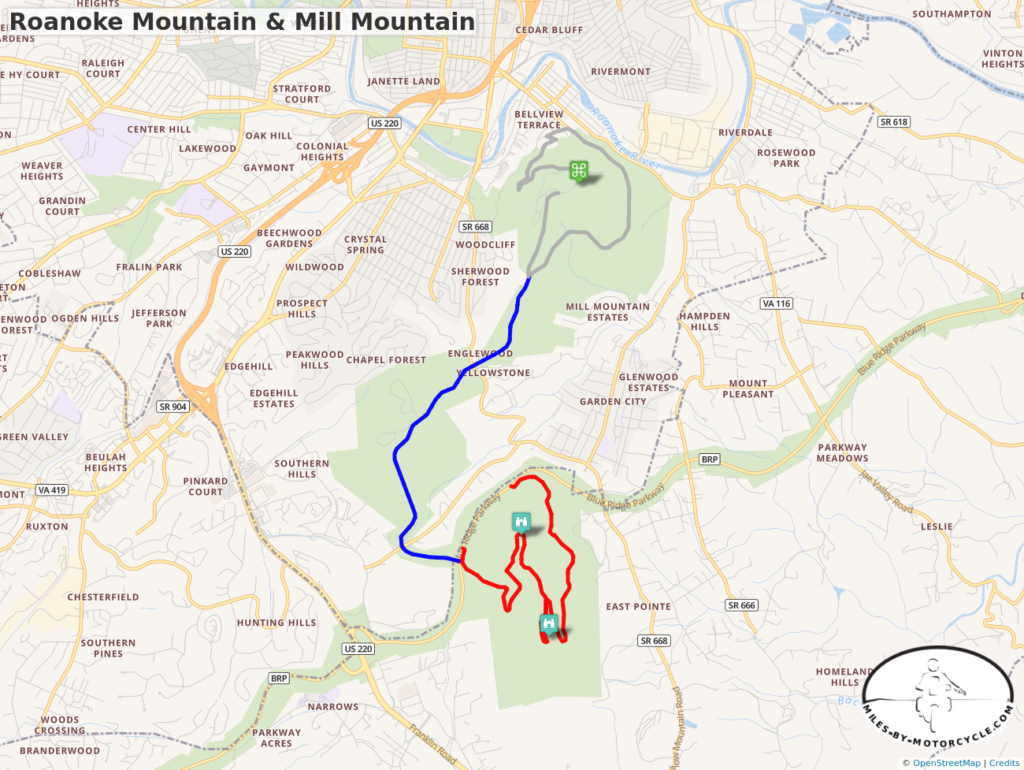
Roanoke Mtn and Mill Mtn Map

Roanoke Mountain Loop Road at Milepost 120.3 is on the east side of the parkway. The 3.75 mile single lane one-way paved road winds up then down the mountain to reconnect with the Blue Ridge Parkway. There is an overlook at the top of the mountain but the better view is from the Mill Mountain Overlook on the climb up. It takes about 20 minutes to ride it though I always stop at the overlook.
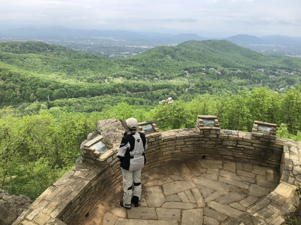
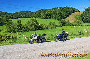
Roanoke Mountain - Mill Mountain Overlook

Mill Mountain is home to the famous Roanoke Star which looms above the city. You reach it via the Mill Mountain Parkway at Milepost 120.5. Mill Mountain Parkway is virtually identical to riding the Blue Ridge Parkway, gently curving and climbing to the spur road (Mill Mountain Spur, Prospect Rd SE) that leads to the park at the top. Just walk around the corner from the parking lot and you stand beneath the largest star in the world overlooking the city below.
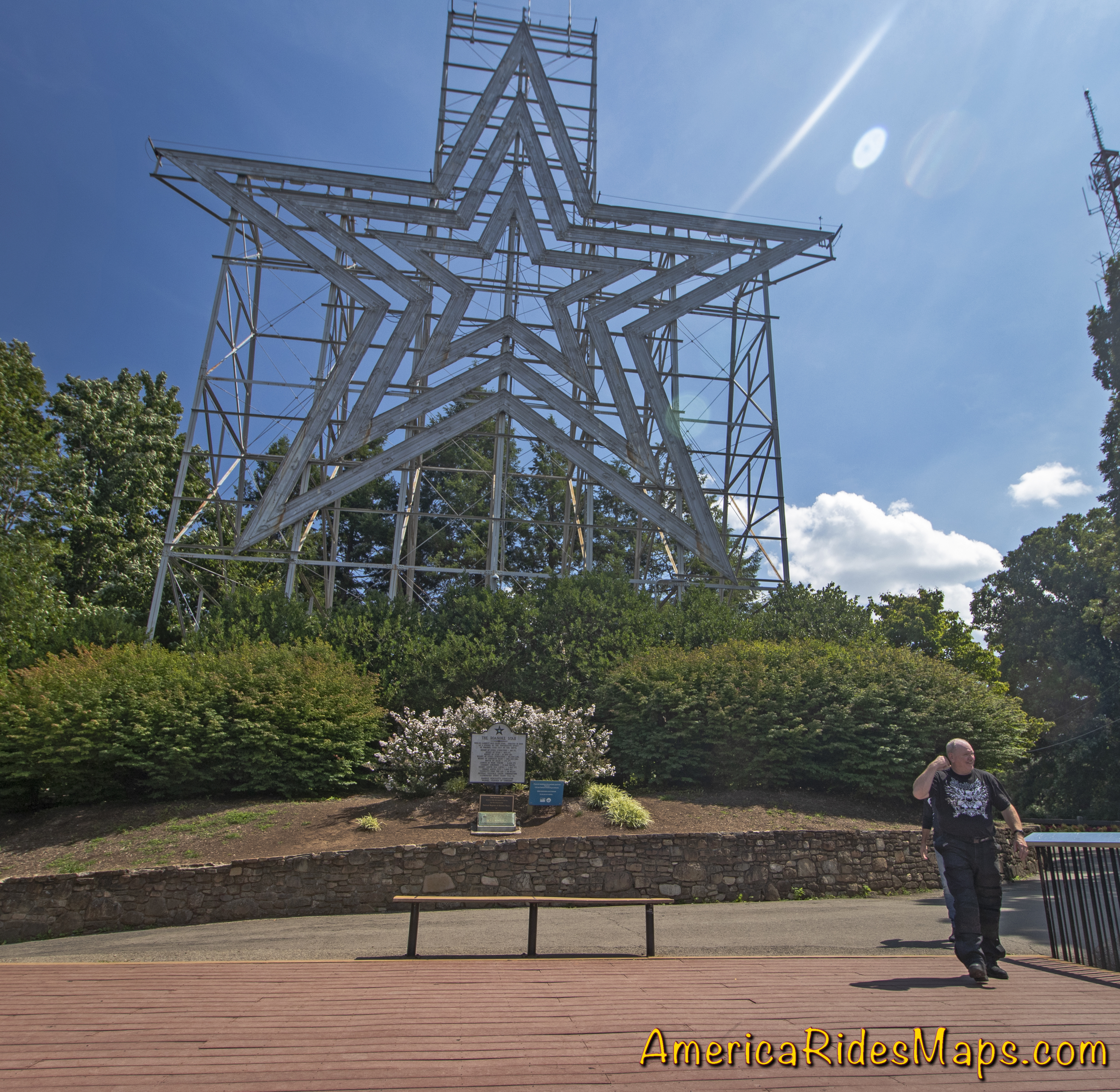
Mill Mountain Star, Roanoke, VA

A zoo, gardens, and visitor center are nearby. It takes about 10 minutes to ride from the parkway to the star. Beyond the spur road, Mill Mountain Parkway becomes JP Fishburn Parkway leading into the city.
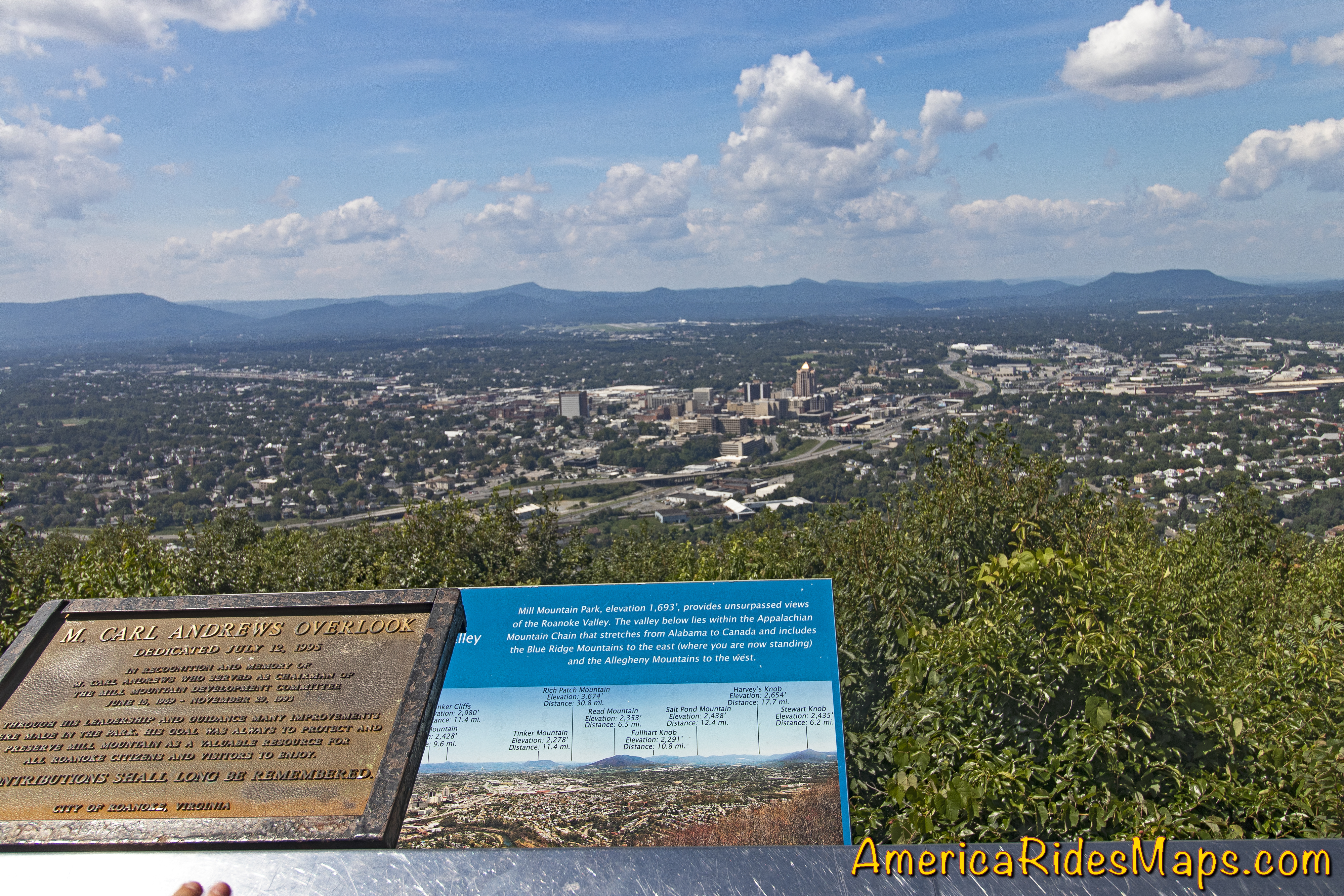
Mill Mountain View - Roanoke

Both of these attractions offer better views than you’ll find from the parkway as well as a unique experience.
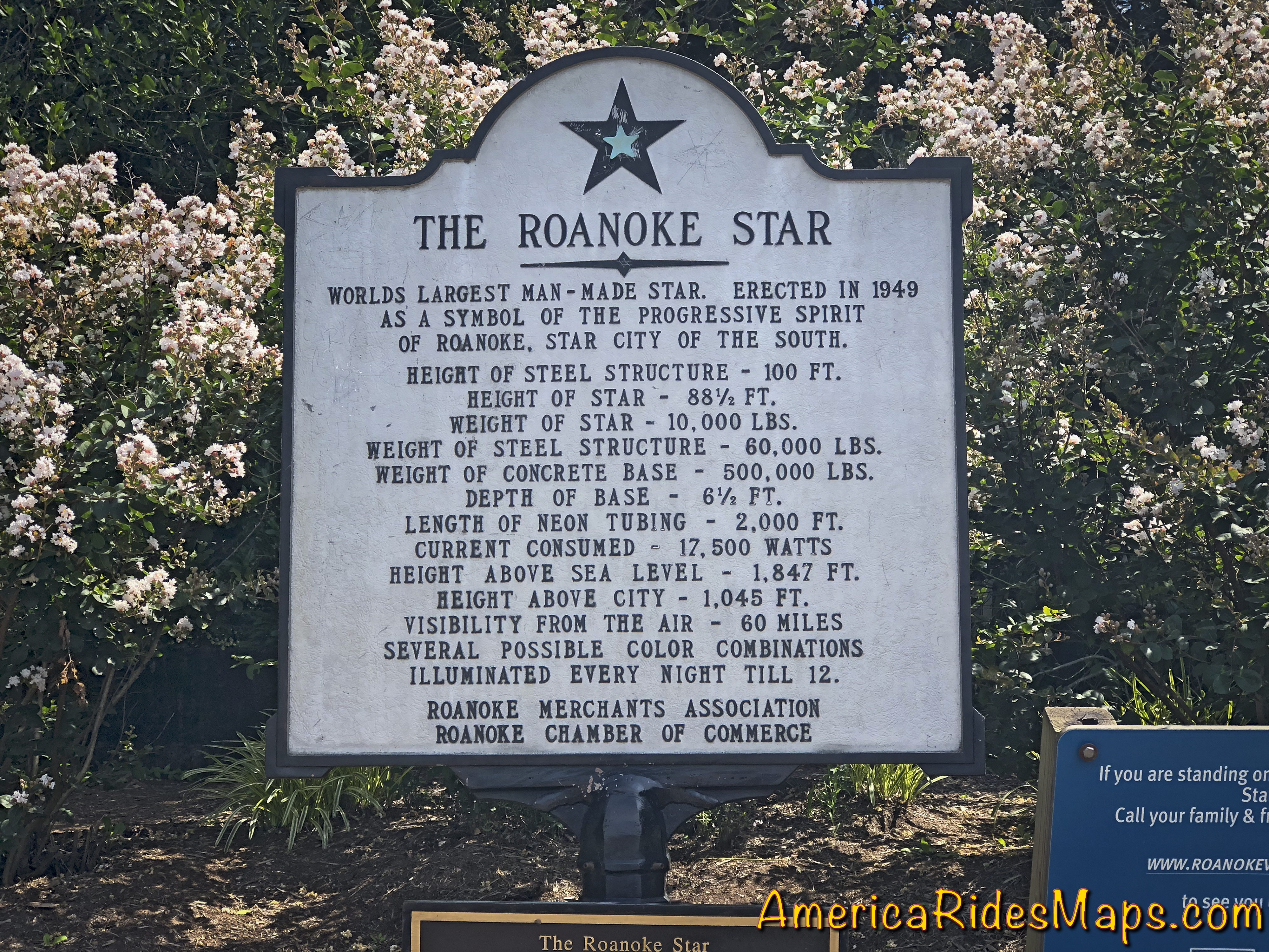
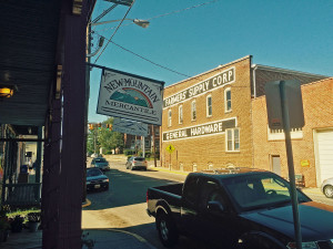
Mill Mountain Sign

This area is detailed on America Rides Maps Map #2The Roads of Roanoke and Beyond


Wayne BuschAmerica Rides Maps

Wayne Busch searches out the most entertaining roads in the Blue Ridge Mountains then records them on a series of maps which span the Blue Ridge Mountains.

There are more great motorcycle roads in the Blue Ridge and Smoky Mountains than anywhere else. I highlight the best roads then show you the best ways to connect them together into rides. More than a decade of searching has discovered more than 1000 good roads to enjoy. We continue to search so you may enjoy.

Review the maps, order online hereAmericaRidesMaps.com

Source: America Rides Maps Blog @ Miles-byMotorcycle.com
https://miles-by-motorcycle.com/51999/blog/60608/two-blue-ridge-parkway-attractions-at-roanoke–va

Motorcycle Loop ride near Floyd, VA

Motorcycle Loop ride near Floyd, VA

Downtown Floyd, VA

Downtown Floyd, VA

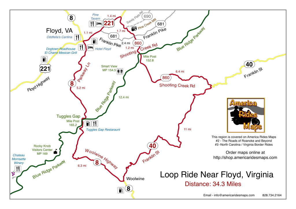
This motorcycle loop ride near Floyd, Virginia intersects the Blue Ridge Parkway at two points. You can do either half (north or south of the parkway) or the whole 34.3 miles.

The small and historic town of Floyd, Virginia is located about 5 miles from the Blue Ridge Parkway, about 160 miles into the 469 mile ride. Noted for it’s celebration of local music, the picturesque shops, and a few very good places to eat and stay, Floyd makes a nice layover on your Blue Ridge Parkway motorcycle tour.

Southern Virginia Countryside

Southern Virginia Countryside

This motorcycle loop ride gives you a nice taste of the variety of great roads found in the southern Virginia region which surround the town of Floyd. Rolling hills, pastoral farms, lazy rivers and streams predominate the landscape. You’ll find both relaxed cruising, tight and twisty climbs, and tiny little back roads sneaking through the hills. It’s an opportunity to slip into town and refuel your bike and belly, or make a spicy diversion off the relaxed riding of the park road.

Shooting Creek Road

Shooting Creek Road

Directions (clockwise):

Starting in downtown Floyd where VA 8 and US 221 cross, follow US 221 north 2.5 miles to reach Shooting Creek Road (VA 860).

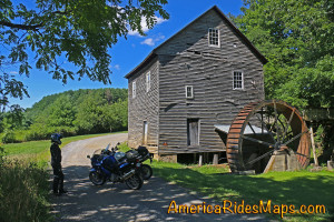
Shooting Creek Road is a tiny back road which leads out through the farmland then into the woods as it traces along the waterway. If you watch for unpaved VA 690 at a sharp curve, you’ll see the Pine Creek Mill, a nice stop for a photo.

Pine Creek Mill

Pine Creek Mill

Shooting Creek Road crosses Franklin Pike then continues south to reach the Blue Ridge Parkway. It is poorly marked at the parkway. Cross the park road and continue south to reach VA 40.

VA 40 has both easy cruising and some very tight curves as it takes you east to Woolwine to meet VA 8.

VA 8 will take you north climbing to reach the Blue Ridge Parkway at Tuggles Gap. You’ll find both easy cruising and some exciting hairpins are you reach the crest. Pass under the parkway and continue back into Floyd.

Motorcycle loop ride map near Floyd, VA

Click for full size

————————————————————————————

wayne busch - Smoky Mountain Motorcycle Rider.com

Wayne Busch

– Wayne Busch lives in Waynesville, NC, where he produces the most detailed, comprehensive, up-to-date motorcycle pocket maps of the Blue Ridge and Smoky Mountains to help you get the most of your vacation experience. See them here – AmericaRidesMaps.com

Motorcycle Friendly Places – Paint Bank General Store, VA

Photo-Paint-Bank-General-Store

Morning at the Paint Bank General Store, Paint Bank, VA

Though it’s only 1/2 hour west of Roanoke, the tiny hamlet of Paint Bank on Highway 311 sits like a jewel surrounded by rolling green hills and pastoral country that makes the busy city seem a million miles away. This is spectacular motorcycle riding country and bikers flock here to enjoy the long winding rides through narrow valleys which lead south towards Blacksburg, Christiansburg, and Pembroke. The beautiful wilds of West Virginia lie just over the western horizon, and the roads north twist and turn through forests teaming with wildlife.

Photo-Paint-Bank-General-Store

A for-real General Store! Cool!

Jackie and I came in from the north on VA 615, a ride through woods so wild we had to cruise with care to avoid all the critters in the roadway. Deer and turkey were abundant, a slew of painted turtles awaited their doom on the pavement, a fox, hawks, and all sorts of other animals either watched us pass or darted off into the greenery as we approached.  We paused in Newcastle for a rest, then pointed our wheels west on 311 to make the curvy fabulous climb and descent over Potts Mountain into the valley to arrive at scenic Paint Bank.

Photo-Paint-Bank-General-Store-motorcycles

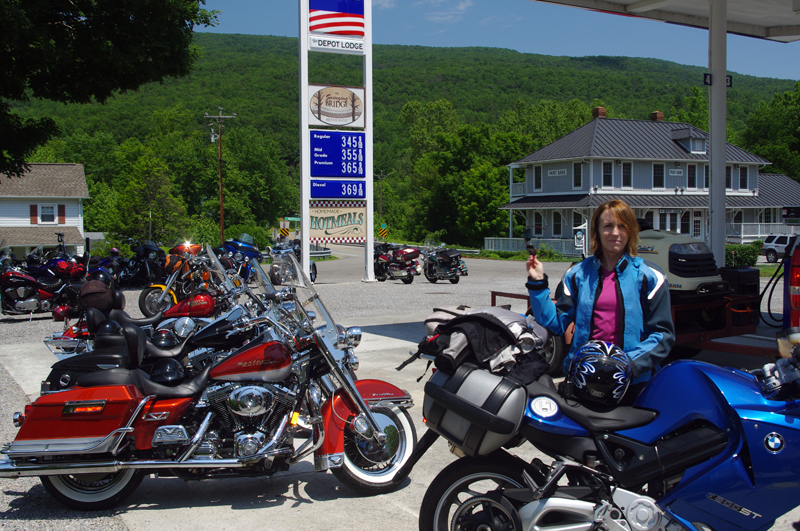
The lunch crowd has arrived!

Eager to get on to the next curvy climb we stopped at the Paint Bank General Store for a potty break and to top off our tanks, but as the noon hour approached we soon abandoned our ride into West Virginia to return to the Paint Bank General Store, lured back by the promise of tasty locally raised buffalo burgers in the inviting and charming rustic setting of the Swinging Bridge Restaurant.

Photo-Swinging-Bridge-restaurant

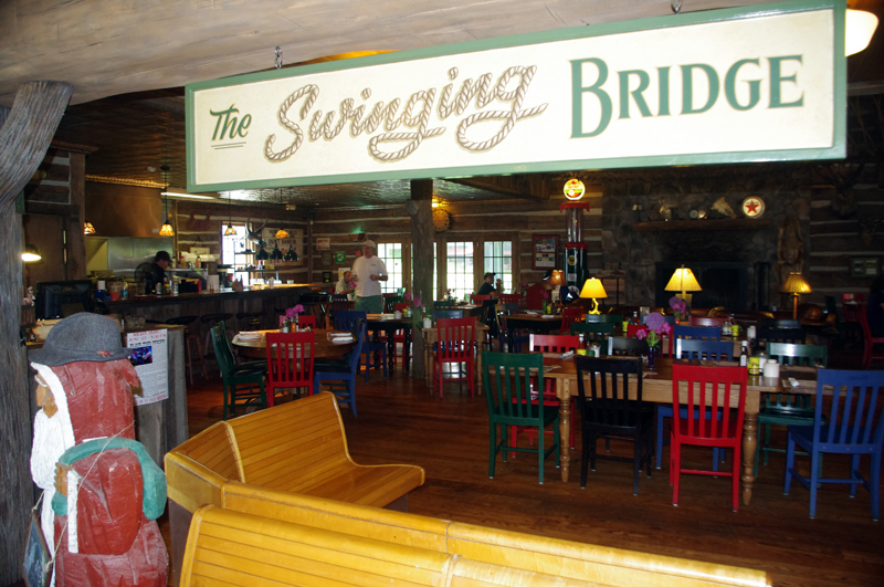
The buffalo burgers were great!

In the short time we’d been gone the parking lot at the Paint Bank General Store had been taken over by motorcycles with the same ambitions as us and more arrived every few minutes. “Motorcycle parking only” signs lined the periphery of the  lot and the crowd of bikes spilled over to fill the remaining space. Some milled about on the porch, others hosed the bugs off their chrome with the convenient hose, but most found their way to the restaurant to enjoy the food and comfortable atmosphere.

Photo-Paint-Bank-General-Store

Bikers flock here for lunch

The Paint Bank General Store – A unique place in a beautiful setting with gas and good food surrounding by outstanding motorcycle rides and biker friendly. What more do you need?

Paint Bank General Store

Swinging Bridge Restaurant

Paint Bank info

Photo-Paint-Bank-General-Store

Great food, wonderful riding, the Paint Bank General Store and Swinging Bridge Restaurant was one of the highlights of our Virginia motorcycle riding

Photo-Swinging-Bridge-Restaurant

Great food in a fun and relaxing atmosphere at the Swinging Bridge Restaurant located in the back of the Paint Bank General Store.

_______________________________________________________________________________

Wayne Busch
Wayne Busch – Cartographer
– Wayne Busch lives in Waynesville, NC, where he produces the most detailed and comprehensive and up-to-date motorcycle pocket maps of the Blue Ridge and Smoky Mountains to help you get the most of your vacation experience. See them here – AmericaRidesMaps.com 

Motorcycle the Blue Ridge Parkway – Peaks of Otter Lodge

Photo-Peaks-of-Otter-restaurant

The Lodge and Restaurant at Peaks of Otter

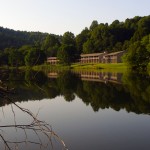
The Peaks of Otter Lodge and Restaurant located at milepost 86 on the Blue Ridge Parkway offers the motorcycle traveler a serene and beautiful setting in the Virginia mountains –

Photo-Peaks-of-Otter-across-lake

The setting is serene and relaxing

Jackie and I paid our first Blue Ridge Parkway motorcycle touring visit to the Peaks of Otter Lodge this past weekend and give it a good, though not outstanding recommendation. In some ways it outshines the other Blue Ridge Parkway lodges we’re familiar with, in others it falls just a little short.

Photo-view-from-room-at-Peaks-of-Otter-Lodge

View from our room

Like the other Blue Ridge Parkway lodges, it immerses you in a remote and isolated setting. The nearest town is Bedford, less than 10 miles distant. The city of Roanoke is 25 miles further south on the Blue Ridge Parkway. The climb to reach the Peaks of Otter on the Blue Ridge Parkway is one of the most beautiful stretches of heavy woodlands in the Jefferson National Forest with glimpses of the surrounding mountains, the piedmont to the east, and the Shenandoah Valley to the west from the occasional overlooks.

Photo-Peaks-of-Otter-lobby

The Lodge lobby is nice

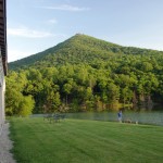
There is a Blue Ridge Parkway Visitor Center nearby, a campground, hiking trails, historic sights, and a picnic area. Set on a  small lake in the bowl between two of the three peaks that give the area it’s name, the views on every horizon are stunning and often mirrored in the still waters of the alpine pond. A gentle trail offers a 20 minute walk around the lake to admire the hollow from all perspectives.

Photo-Peaks-of-Otter-bar

Extra points for having a nice bar

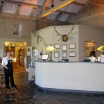
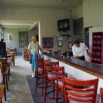
The Lodge does stand above the other parkway inns in it’s rich and welcoming appearance. The gift shop is attractive, and the bar is such a welcome touch after a hot days ride. The restaurant overlooks the lake with captivating, at times enchanting views of the natural panorama. Unfortunately the restaurant is where the Peaks of Otter Lodge fell short for us.

Photo-Peaks-of-Otter-Dining-view

Captivating views from the dining room

The food does not hold a candle to the that served at the Pisgah Inn, the Blue ridge Parkway Lodge south of Asheville, NC. Service was great, pleasant and attentive wait staff insured we got what we needed. The setting is outstanding with the views but the musak was some sad mix of nursing home dirge and “One Flew Over the Kukoo’s Nest” which distracted from the atmosphere. A place this nice deserves a chef, not a cook and a new set of CD’s for the player – please throw the Victrola in the deep part of the lake.

Photo-Peaks-of-Otter-lodging

Rooms are clean and comfortable

The facilities are well maintained and spotlessly clean. The grounds were  manicured with precision and care. The rooms were comfortable as were the beds, and quiet. It makes for a peaceful and relaxing stay.

Overall, a stay at the Peaks of Otter Lodge on the Blue Ridge Parkway is welcoming and relaxing on your motorcycle vacation. Taking the dining experience to the next level would make it outstanding.

ADD – I have one big request from the Park Service: It’s the 21st century, how about a little catch up? I don’t mind not having TV, it makes the rooms quiet and draws you out of them to embrace the natural experience and beauty. Cell service comes and goes with the breeze, and the wind rarely blows – you’ll be chucking quarters into the pay phone to reach the rest of civilization. Isn’t it time to embrace our new reality and offer a wireless network?

Other Reviews from Trip Advisor

_______________________________________________________________________________

Wayne Busch
Wayne Busch – Cartographer
– Wayne Busch lives in Waynesville, NC, where he produces the most detailed and comprehensive and up-to-date motorcycle pocket maps of the Blue Ridge and Smoky Mountains to help you get the most of your vacation experience. See them here – AmericaRidesMaps.com 


NEW MAP! – The Roads of Roanoke and Beyond

I’ve just finished the latest map, The Roads of Roanoke and Beyond. It’s the second of the three map Blue Ridge Parkway – Virginia Series and catalogs 90 miles of the Blue Ridge Parkway as well as more than 2 dozen great roads in the surrounding area. There are also more than 20 good “connector roads” which give you shortcuts or the best routes to reach my top rated rides.

It was an exciting moment when I transferred the overlapping data from this newest map to the raw data file of the last map in the series. I’ll be completing it as quickly as I’m able. Once done, America Rides Maps will offer the most comprehensive collection of great rides along the entire 469 mile length of the Blue Ridge Parkway and enough great riding to give you years of motorcycle touring pleasure.

The race is on as fall weather closes in on us. There’s a lot of preparation before I load up and motor north to begin the reconnaisance. Shorter days mean less miles covered and cooler weather will also bring it’s challenges. I need to locate a new base to work out of. There will be challenges, but I’m looking forward to them.

Little time to take a breath or relax, got to keep pushing to get it done. For now, another milestone has been passed.

You Never Know Until You Ride It

I‘m back from my most recent trip mapping Virginia. It was one heck of an expedition averaging more than 500 miles per day on my motorcycle, mostly on two lane back roads. Areas I thought would be really good turned out to have little appeal. The area I thought would largely be a waste of time turned out to be one of the best. You never know until you ride it, that’s why I do what I do.

I revisited some sections on the last map which overlap into this one which revealed previous roads connected to fabulous new roads. I’ll be making some minor changes to “
North Carolina / Virginia Border Rides” to reflect these new discoveries. There are some outstanding rides you really shouldn’t miss which cross the borders of these two maps.

The central point of this second Virginia map is the city of Roanoke. The
Blue Ridge Parkway cuts through the heart of the map touching on the very edges of the city. I explored a few roads close in to the city. While most of us don’t get on the bike to ride the urban landscape, should you be staying near, there are a couple rides in close you may want to do to catch a nice view or a sunset from up high. Surprisingly few paved roads connect to the Blue Ridge Parkway on this map, so knowing where they are and which way the closest gas station is will be helpful.

The highest ridges of the mountains and the Blue Ridge Parkway run in close to the city. The character of them changes as you move north leaving the rolling hills of southern Virginia behind to enter the more mountainous and scenic peaks north of the city. Roads to the south side quickly entered rolling but relatively flat country and while there are more roads, I found fewer and fewer of them engaging me and making me want to come back and ride them again. I have a lot to eliminate based on this reconnaissance.
On the other hand, north of the city is the place I enjoyed most. Here the various mountain ranges are distinct, separated by long valleys. The roads which run through these long vallies are far more curvy than they appear on a map and some of the views are wonderful. Be warned though, I’m going to try to describe some of these roads as “adventure” roads. Some will like them better than others.
As I ripped along them on a bike built for this kind of terrain, bouncy, tight, sometimes technical in demeanor, I thought about what it would be like riding shotgun on a big cruiser, fully loaded, doing more hanging on than enjoying the beautiful scenery. I think your passenger might find the experience a bit demanding if done at a hurried pace. I’ll try to identify these roads for you. On the other hand, at a relaxed pace and with the camera handy, I felt like I was riding through a national park at times. I can’t help but recommend them.

There’s one more map to go in this series to fully cover the entire range of the Blue Ridge Parkway and the surrounding areas. I’ll do my best to crank this one out by the end of the week. For the first time this year I plugged in my heated gear and really needed it as I climbed the high passes from Tennessee into North Carolina on the midnight ride home. It’s going to be regular kit from now on. I have once again paused on the West Virginia border and stared into what looks like the promised land. I’m pretty sure I know where the sequel to these maps will lie.

Wayne@americaridesmaps.com

>> Go To America Rides Maps.com http://americaridesmaps.com

Freakin' Rain

Lubed up, oiled up, aired up, filled up, loaded up, new tire, new brakes, new plans, the bike sits aimed towards the horizon in the driveway poised and eager to depart, a mere key turn from hundreds of miles of open road adventure. I am so ready to go – nowhere.

“You’re not really going tomorrow are you?” my mother queried incredulously when I called her to babysit my pooch. “Have you seen the forecast?”

“Looked at it a few days ago” I answered. “Thursday appeared to be the best of the week.”

“Let me check the Weather Channel again”, she replied, ” I’ll call you back”.

My wife, just home from work, overheard the conversation. A few minutes later she commented with cautious hesitation, “You’d better take a look at the weather”. I shuffled the newspaper around on the kitchen table looking for the forecast. ON THE COMPUTER“, she urged with more authority.

“I can handle a little rain, it’s got to be better than the last trip”, came my retort, tinged with some irritation that my well laid scheme may be going awry. “I’ve got to get this map done!”

She walked over to her desk and woke up her laptop.

“What cities do you check?”, she asked from the other room.

“Pull up here, and Roanoke, Virginia”, I called out in reply. I tried to ignore the potential disappointment that was theatening to intrude into my private universe and challenge my intentions.

“You’d better come look at this”, she called out a few minutes later.

I went into the den and sat on the couch where I could look over her shoulder. She had the Weather Channel pulled up and started the video of the forecast. I listened and watched as the commentator confirmed just how screwed I was. Rain covering much of the eastern United States. The moisture from the storm in Florida had been caught between two cold fronts bringing still more rain and storms. Dry and clear weather moving in from the west in a few days.

Expletives were muttered with the usual eyebrows raised in response. Not one to give up gracefully, I constructed a male ego preserving response to reinforce what I tough guy I really am.

“If I didn’t need a photo for the map cover, I’d still go” I said with irritated bluster. “I can handle a little rain. Still don’t have a good shot that represents the area well, though. Can’t get that picture if the weather is bad”. Culpable excuse ticked off the disappointment list.

“You can go over the weekend once the weather clears” my wife stated with female reason and clarity. “It’s just a couple of days”. I’ll never know what it’s like to live without testosterone. How does anything get done?

Mom called back. “You’d better look at the weather again”

“I know, I know, you don’t need to watch the dog tomorrow” I informed, “Looks like another day of doing chores here. I’ll go in a couple days”.

Freakin’ rain. Better get outside before it comes full on and get something manly done.

Wayne@americaridesmaps.com

>> Go To America Rides Maps.comhttp://americaridesmaps.com