Waiting to Hear About the Asheville Bikefest and the Blue Ridge Motorcycle Run

Photo - The Headquarters building

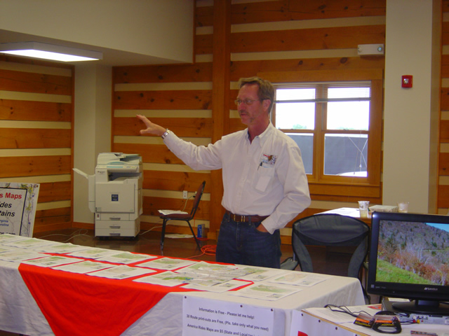
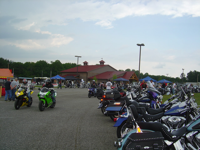
The big log building in the background was the headquarters for the event - as Route Master I rarely left it.

From before the gates opened to well after they closed, I spent the last four days at the Asheville Bikefest and yet I never really saw it. As Route Master for the event I was stationed in the luxurious air conditioned headquarters building and tasked with helping folks get out and ride the fantastic motorcycle roads in the surrounding area. I rarely stepped outside nor ventured far from my post.

Photo - the Route Master at work

A printer, 30 routes, and me at work helping you find the best rides and routes.

Flanked by two long tables stacked with 30 motorcycle ride routes for people to choose from, I spent much of my time running back and forth to the printer to maintain the supply. There were great motorcycle rides in most every point of the compass, up and down the Blue Ridge Parkway, and to several of my personal favorite motorcycle roads. It kept me busy. When my wife came down Saturday to help me out, I urged her to take a few minutes and grab some photos. She probably saw more of the event than I did.

Photo - vintage Triumph Bonneville

A vintage Triumph Bonneville parked right out front - I rode one of those back in the day and find myself back on a Triumph today. Great bikes!

I met folks from as far away as Maine, New York, Florida, and a whole lot from South Carolina and Virginia. Considering the remnants of the Myrtle Beach Bike Rally were going on simultaneously, it was encouraging to see so many who had chosen to come here instead, a sure sign that beach venue has lost it’s luster. Most who came seemed to be local. It was a surprising turnout considering all the competing events in the region and up and down the Blue Ridge Parkway.
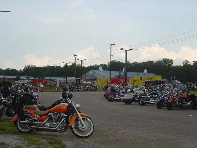
Asheville-Bikefest-pics

Yamaha / Star / Boss Hoss and other big rigs set up in one corner. There was a steady stream of demo rides the whole time.

I expect more photos soon. I saw some wild ones from The Anti Team Stunt Show with the bikes in flames. When I caught the last of them on Sunday, they were pulling out all the stops and those boys went home with some painful souvenirs.

Photo - stunts provided by the Anti Team

Three stunt shows each day from the Anti Team kept getting better and better. They kept finding more stuff to blow up or burn, sometimes themselves.

I was there, but I can’t tell you much about it. I was too busy. I’ll post more as it comes in. If you made it, let me know what you thought and I’ll try to do even better next year. Unlike others, this event is all about the great motorcycle riding and should be one you add to your motorcycle vacation plans.

See some cool videos of the show at http://theantiteam.com

For routes and maps: http://americaridesmaps.com

50 Great Motorcycle Roads Near the Tail of the Dragon

Photo - Jackie and her BMW

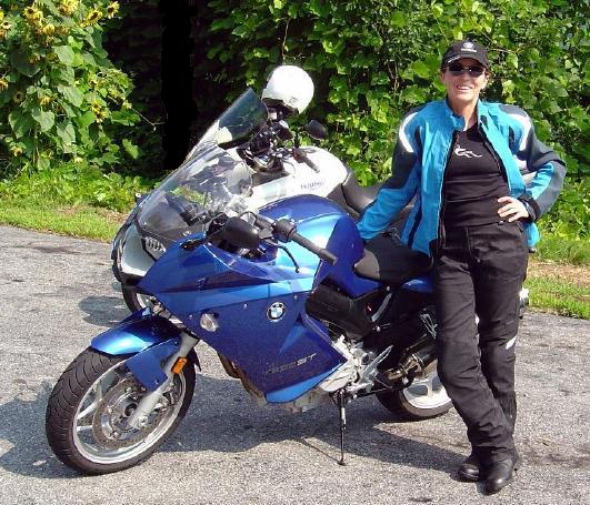
Even #1 Riding Partner, my wife Jackie (a.k.a. BMW Girl), has not ridden all the roads - yet!

I was wondering this morning just how many great motorcycle rides I’d discovered in the areas I’ve suggested as alternatives since the Tail of the Dragon at Deals Gap closed due to the recent rock slide.

So far, I’ve posted info about several areas;

Photo - Jackie rides

Does this bike make my butt look FAST?

I pulled out my America Rides Maps and starting counting. I hit 50 long before I got to the last maps that covered the great motorcycle riding areas I’d been describing. Closer to 70, probably more. I tried not to count rides where the road changes names along it’s course twice or even three times. It gets a little confusing, there are just so many.

Don’t let the rock slide at the Tail of the Dragon obstruct your motorcycle vacation planning. It could be a blessing in disguise. After all, Deals Gap is not known for it’s scenery, mountain views, waterfalls, or picturesque countryside. Imagine what waits just over the hill.

Visit  or contact http://americaridesmaps.com for more info.
Tail of the Dragon Closed? More Motorcycle Rides Nearby – Asheville

Asheville, sometimes locally referred to as “AsheVegas” has long been a destination for those seeking refuge from the lowlands in a beautiful mountain setting. Great scenery, a thriving cosmopolitan culture, historic buildings, a wonderfully diverse menu of great eateries, the plethora of microbreweries that have earned it the “Beer City” award, and an artsy / musical / film undercurrent have endeared this “Portland of the South” to visitors for generations. Small enough too be easy to get around yet large enough to still be truly called a city, it has something to offer most every visitor, but none so much as the motorcycle traveller.

Photo - Dining at the Grove Park Inn

Fine dining at the Grove Park Inn in Asheville, one of many great places to visit and eat.

Pivotal in the historic creation of the Blue Ridge Parkway which wraps the border of town, it sits in the French Broad River Valley cradled by mountains on every horizon. The tallest mountain in the east, Mt. Mitchell, is close enough that bicycle races are held to it from town and you can find enjoyably steep and serpentine roads climbing from the very heart of the city.

While the city itself is an attraction, it’s the grand mountains which surround it that make it a worthy destination for those seeking great motorcycle rides. Too many are satiated with a relaxing cruise along the Blue Ridge Parkway and miss out on the fabulous and challenging rides found on every point of the compass. I’ve already hinted at those to the northwest near Hot Springs and the “Land of the Waterfalls” to the southwest in earlier posts.

Photo - Lake Lure

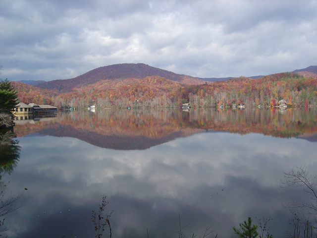
Scenic Lake Lure, south of Asheville, in the Hickory Nut Gorge

One of the most popular areas to visit is south of the city, the Hickory Nut Gorge area. Home to Bat Cave, Lake Lure, and Chimney Rock, it’s a Mecca for tourists and sightseers with it’s stunning scenery and attractions. Don’t be lulled into complacency as you make the approach on the long flowing valley roads – once you hit the mountains the curves, climbs, and descents begin as does the fun. While the main roads may be choked with traffic at times, those who venture off them onto the back roads will discover some amazing rides and the company of local motorcycle riders who flock to enjoy them.

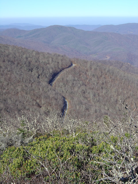
Photo - View from NC 80

Early winter view from NC 80, one of the most challenging rides east of Asheville

Looking west, still more great rides present, many of which are worth the time and travel to enjoy them. Recently dubbed ‘The Diamondback” (you’ll be hearing more about these rides soon), a combination of loops using NC 80, US 226, US 226A, NC 180, the Blue Ridge Parkway, and other roads will give the motorcycle tourer everything he’s come for whether you’re cruising along enjoying the sights or looking to to get a knee down and drag some pegs.

Photo - Winter View from atop Roan Mountain looking into Tennessee

Winter View from atop Roan Mountain looking into Tennessee, north of Asheville

My personal favorite area though lies north of the city. It’s a vast region, crossing the border into Tennessee and will give you some of the longest and most enjoyable rides through the highest peaks and deepest valleys in the east. Sparsely populated, dotted with small towns, the twisting two lane back roads which lace through this area are mostly devoid of traffic and waiting for you to enjoy in solitude. Because most choose to take the Interstates which bypass this rugged region, it’s a hidden gem which gets bypassed and lies mostly undiscovered.

From the city, the Blue Ridge Parkway courses northwest towards Virginia. The roads which intersect it lead out into the surroundings and make it an avenue for including on great long loop rides all along it’s course.

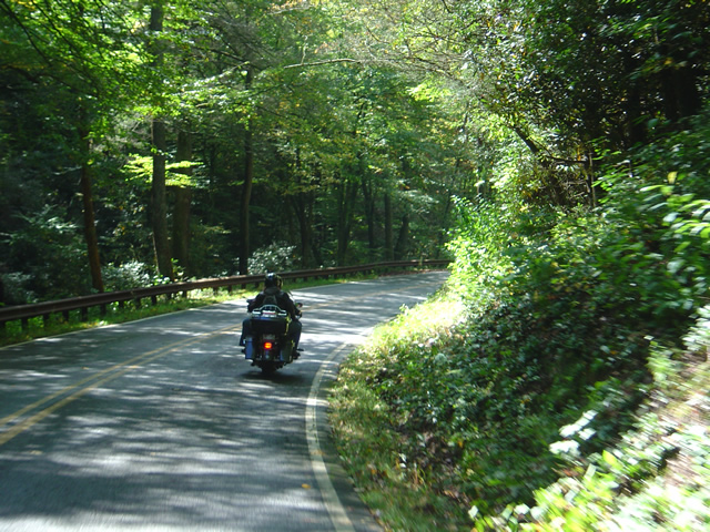
Photo - Bike riding north of Asheville

Long winding rides through lush mountain scenery devoid of traffic lie north of Asheville

Long rides, short rides, nice cruises or challenging curves, stunning sights, great scenery, and a motorcycle friendly city at the hub, the mountains surrounding Asheville should be on your motorcycle radar. Home to the Asheville Bikefest May 13 – 16, it’s one more place to add to your list of great motorcycle destinations.

Tail of the Dragon Closed – Great Rides Nearby – Hot Springs

No new info on the rock slide which has closed the Tail of the Dragon at Deals Gap. In a previous post I suggested some great rides nearby in the “Land of the Waterfalls” and provided a video sample. It’s just one great spot near the Tail of the Dragon with great motorcycle rides nearby, here’s another.

Photo - View of Hot Springs, NC

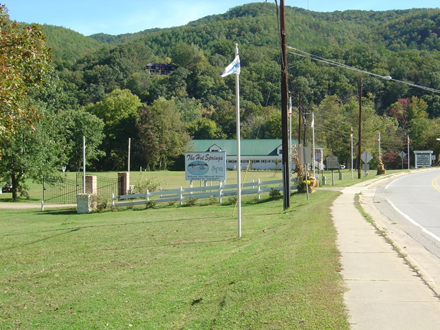
Hot Springs, NC - A town so small it fits on one photo.

This time I’m going to direct you to an area which sees little traffic, yet contains some fabulous and challenging motorcycle rides with some enjoyable sights and scenery. It’s an area most motorcycle tourists either drive right past on their way into the region or sample only the most notable road. Trust me, there is a lot there to explore and enjoy.

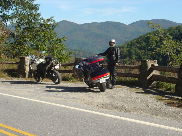
Photo - A roadside view near Hot Springs

Pausing to admire the view near Hot Springs, NC

I urge you to spend some time riding the great roads found in the mountains east of Great Smoky Mountains National Park. The Smoky Mountains do not end at the border of the park, in fact they continue their long run northward reaching their greatest heights north of Asheville, North Carolina at Mt. Mitchell, highest peak in the east just off the Blue Ridge Parkway. The mountains between the park and Mt. Mitchell are spectacular and beautiful, the valleys dotted with rural farms and tiny hamlets, sections of wild national forest, and roads which trace the serpentine courses of rushing mountain streams.

Photo - entrance to the Hot Springs Spa

Entrance to the Hot Springs Spa - Natural Mineral Baths and Massage

The hub of this great motorcycle riding area is the small and historic town of Hot Springs. It’s a good place to pause for lunch, do a little sightseeing, and maybe pay a visit to the natural hot springs which give the town its name. Long popular with hikers (the Appalachian Trail passes through town), fly fisherman, and whitewater rafters and kayakers on the French Broad River, it’s also a popular local motorcycle watering hole as it’s a convenient ride from Asheville.

Photo - French Broad River at Hot Springs

The French Broad River flows through Hot Springs

Honestly, there’s not a lot to the town. No traffic light. One gas station. A few shops and restaurants, a campground, and of course the Hot Springs Spa. You can capture the whole thing in a photo. It’s the roads and the beautiful countryside which surrounds that makes it worth the visit.

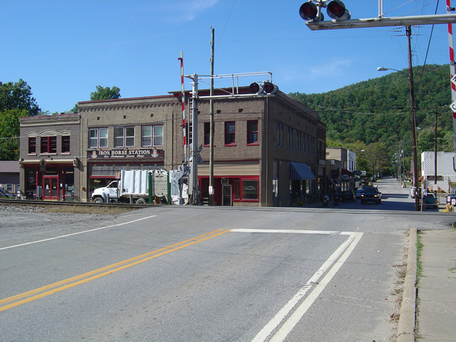
Photo - Iron Horse Station, Hot Springs

Iron Horse Station - One of several places to grab a bite and quench your thirst in Hot Springs.

If you take but one ride into the area, do the classic section of NC 209 which runs from Lake Junaluska to the heart of town. It’s such a nice ride. It takes about an hour one way. It’s a local classic. Be aware there is plenty more out there if you know where to look for it.

Photo - Fall Color at Lake Junaluska

One of the best rides, NC 209, starts near Lake Junaluska

I’ve been working on a video to showcase the area, though the severe winter pretty much closed the door on that for a long while. I’ll be getting back to it ASAP. Here’s the sample that gives you a good idea of what to expect:

http://www.youtube.com/watch?v=3hsCLMCIUOo

For more detail on the area look to America Rides Maps ” East of the Smokies, West of Asheville, All Around Hot Springs” map which catalogues about 400 miles of the best roads in this small area.

Don’t worry, there’s still more great riding alternatives to come in future posts. Closing the Tail of the Dragon opens the door to you discovering just how much you’ve been missing.

New Rock Slide Affects Motorcycle Vacation Plans to Smokies

Add yet another rock slide to the long list of road closures in the mountains of western North Carolina and eastern Tennessee. This one in particular will affect many motorcycle vacation plans to visit one of the most popular and well known rides in the region, the infamous Tail of the Dragon on US 129 at Deals Gap. Located along the western border of Great Smoky Mountains National Park, the 13 mile stretch of US 129 with it’s 311 curves draws hundreds of thousands of motorcycle and sports car enthusiasts each year who come to experience the challenging stretch of road.

It’s been an exceptional year for rock slides in the Smokies, the most notable being the massive slide along the eastern edge of Great Smoky Mountains National Park which has closed Interstate 40 for months. With both the east and west routes around the park closed, the only route allowing north-south travel from Tennessee to North Carolina is US 411 which cuts through the heart of the park and it too has been the scene of slides. US 441 is presently open, though cleanup continues on the northern spur road.

The Tail of the Dragon is still accessible from the North Carolina side. From Tennessee, the best route is through Tellico Plains and onto the Cherohala Skyway. Expect increased traffic loads on TN 68 approaching Tellico Plains due to yet another rock slide on US 64-74 in the Ocoee River Gorge which has shifted traffic onto it. As far as I can tell, it is still possible to reach Pumpkin Center from Vonure on the north end of the Dragon via the popular Dragon – Cherohala loop ride. Still, even more traffic will now be using these roads and you may want to reconsider visiting the area until things improve.

I’ve been reporting on the status of all the rock slides and road closures in my newsletter which you’ll find archived here – http://budurl.com/3smm. As there are so many, so widely scattered, it may be the easiest place to find all the information without bouncing around to various DOT sites (they are rarely as up to date). With so much going on, I’ll probably post an extra edition or two to keep you apprised of the situation and help with your motorcycle vacation plans. There is a lot going on you need to be aware of including the progress on the clean up to the Blue Ridge Parkway after severe winter storm damage, the closed section there, and all the roads which have been closed in Great Smoky Mountains National Park for paving.

If you have early year travel plans to Robbinsville, Townsend, Gatlinburg, Pigeon Forge, Great Smoky Mountains National Park, or Franklin, I suggest you consider them carefully. Better alternative destinations for motorcycle touring would include Maggie Valley and Asheville. I’m am working with local lodgers to find you the best deals and affordable as well as luxury motorcycle friendly accommodations. I’ll be stepping up those efforts. Please email me for help. The changes in traffic patterns have severely impacted their business and there are some deals to be had. Watch the blog as I review them.

Finally, for America Rides Maps patrons, I want you to be aware these rock slides have impacted 3 of the 4 loop rides on the most popular map “Maggie Valley to Deals Gap and the Cherohala Skyway”. I strongly urge you to look at the “Waterfall Package” for the best alternative. These two maps will lead you into some of my favorite areas unaffected by the changing traffic patterns and open up a wealth of fantastic rides which are too often overlooked. These roads are the first place I head when looking for great riding, the first place I take tour groups, and hold everything you’ve come to expect from a motorcycle vacation in the Smokies.

What’s The Best Section of the Blue Ridge Parkway?

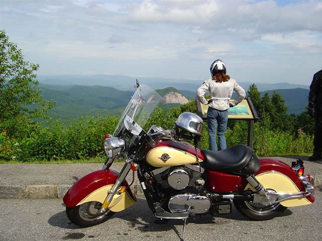
Photo - Admiring the view from the Looking Glass Rock overlook

Photo - Admiring the view from the Looking Glass Rock overlook

Easy question. It’s in North Carolina. I can almost see it from my window. I moved here to be close to it and enjoy it on my motorcycle. I know every twist and bump. The best section of the Blue Ridge Parkway with the best ride runs south from Asheville to Soco Gap near motorcycle friendly Maggie Valley.

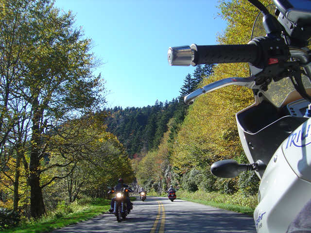
Photo - As falls comes so do the bikes

Photo - As falls comes so do the bikes on the Blue Ridge Parkway

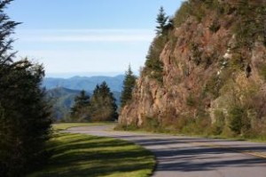
Why is it the best? It’s the highest and most scenic section. There are more great pull-outs here than any other stretch. Most of it is above 5000 feet. It has everything motorcycle riders come for. Waterfalls, impressive rock formations, winding tunnels, pristine wilderness, vast stretches of rolling mountains on every horizon, and one of the best places to eat on the parkway, the Pisgah Inn. When I used to run  motorcycle tours through this section I‘d always figure about 4 hours to hit the highlights and sometimes it was a tight schedule. If you see only one section of the Blue Ridge Parkway, this should be it.

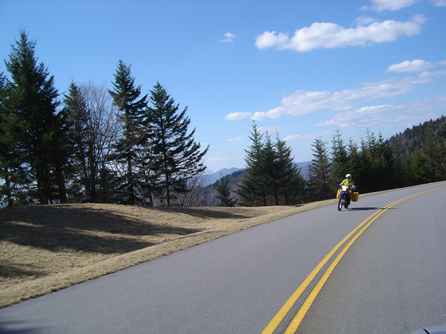
Photo - Early in the spring traffic is light and skies are clear

Early in the spring traffic is light and skies are clear on the Blue Ridge Parkway

Make this one of your prime destinations on your motorcycle vacation, but don’t limit yourself to the parkway while you’re here. You could spend weeks riding the fabulous roads which snake through the Smoky Mountains you see from those overlooks. They are packed with more waterfalls, scenery that will fill your camera, and some of the most challenging motorcycle roads you’ll ever ride.

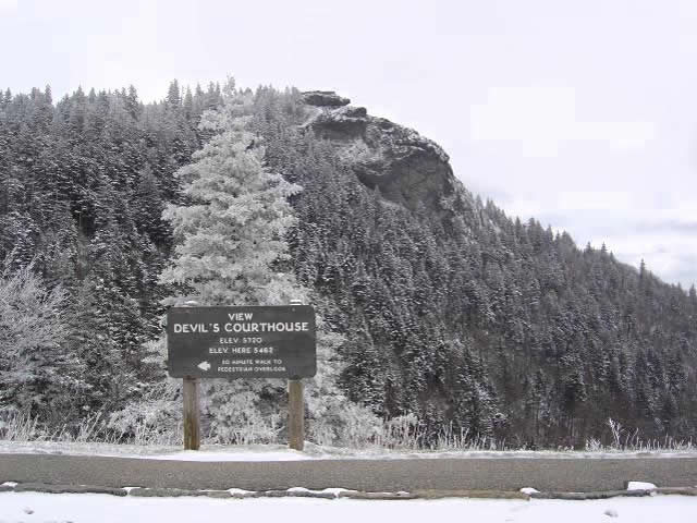
Photo - Devil's Courthouse snow covered in Winter

Spectacular Devil's Courthouse snow covered in winter

Impressive any time of year, I never take this section of the Blue Ridge Parkway for granted and visit almost every week. It never disappoints. It one of the most scenic motorcycle rides anywhere.

True History – How The Blue Ridge Parkway Was Stolen

photo - view from Waterrock Knob, one of the highest sections in North Carolina

Morning clouds blanket the valleys in this view from Waterrock Knob in North Carolina

The concept of the Blue Ridge Parkway was to build a scenic connection between Shenandoah National Park in Virginia and Great Smoky Mountains National Park in North Carolina. Even before it was approved by Congress, controversy reigned over the route and clouded the possibility the nations favorite ride would ever be built.

There were strong proponents for building the scenic highway from three states – Virginia, North Carolina, and Tennessee. Originally, they more or less worked together to get the idea launched. Virginia’s route was fairly clear. It would course south from Shenandoah National Park following the highest ridges of the Smoky Mountains. The problem came on which way to go once the border with North Carolina was reached. Great Smoky Mountains National Park is divided right down the middle between Tennessee and North Carolina sharing equal portions in each state. In which state would the parkways southern end of this now classic ride reach Great Smoky Park?

Photo - a view of the Blue Ridge Parkway

Nothing in Tennessee can compare to the views from the North Carolina section of the Blue Ridge Parkway

Tennessee argued the route should be shared between the three states arriving on the north side of Great Smoky Mountains National Park about 40 miles south of Knoxville. North Carolina had different ideas, and a powerful lobby arose from the city of Asheville who wanted the road to pass near it. Reeling from the depression, Asheville felt it’s future relied on tourism and without the parkway, it would would not survive.

Two routes were laid out. North Carolina proposed following the highest passages through the tallest mountains in the east, a route which would not only maximize the views, but come right by Asheville. Tennessee chose a route further north which included both mountains and scenic valleys highlighting various features along the way. It would leave Asheville, the only city of size in the Carolina mountains, in isolation.

Right up to the last minute, it appeared the three state route would prevail. In the end though, it was the powerful and well connected proponents from Asheville who convinced the legislature to favor the route which avoided Tennessee entirely thereby stealing the road from Tennessee.

Riding the parkway it’s easy to see the right choice was made. The highest, most scenic and breathtaking views are found in the North Carolina sections both north and south of Asheville. What a different park we would have now had it been otherwise.

Update on the Blue Ridge Parkway Repairs

Photo – Waiting to pass a construction zone

Somehow I must have set the GPS to “find the most traffic” and it was working fabulously. I suppose everyone else had done the same as I hit one logjam after another on my way home from Virginia earlier this week. Still, as I left Banner Elk, I though it might be a while before I passed this way again and I was curious to see how the construction on the Blue Ridge Parkway was progressing.

I’d already bypassed the detour near Boone and Blowing Rock. No need to visit that section anyway. They are replacing a section of roadbed and there’s no way to get a close look at what’s going on, nor did I want to take the time to ride up and see how the bridge work was coming to the north. The big project however was more or less on my route home – at least it was now. Anything to get off the clogged roads and unwind.

The section I was interested in lies between Mt. Mitchell State Park and Asheville. This section of the parkway was closed all of last year when a piece slid off the mountainside. That portion has been rebuilt and the project has now shifted to repairing the adjacent areas of road which had deteriorated badly. Layers of pavement had peeled away like old paint and there were some areas where small sinkholes had left huge dips in the roadway. Honestly, it was getting pretty rough and it’s nice to see it receiving the attention it needs.

I was initially under the impression the job was mostly just resurfacing. This visit revealed there are many areas where the entire roadbed is being rebuilt. It’s being done in a piecemeal fashion, probably the worst sections getting attention first. Cruising down the southbound lane, the worst of the two, I was pleased to hit gloriously smooth portions that had already been repaired. These would be followed by others which had yet to see attention and still more which would probably not require much of anything. Sporadically, I came to construction areas, most of which were flanked by idled equipment this late into the evening. A few of the overlooks had been resurfaced along the drive.

It was pretty easy going until I passed Craggy Gardens. The last of the crews was still going full steam on a good sized section of road and I found myself pulling up to a line of stopped traffic waiting for the pilot vehicle to take them through the single open lane. It was just a few minutes until it came by with a long line of cars in tow. I waited my turn then fell into the queue behind our chaperon. As we passed, the opposite lane was being filled with fresh subsoil as the road was rebuilt from the very base. Work this extensive should endure. I doubt this will be anywhere close to finished until next spring season.

I left the Parkway near Asheville only to get caught up in another traffic jam on the south side of the city. Didn’t matter much anymore. I’d been on the bike since 4 AM and I could see the familiar mountains of home on the horizon. I’d get there soon enough.

Blue Ridge Parkway – Open May 15

After a nearly two year closure due to landslides near the highest mountain in the east, Mt. Mitchell, the park service has announced the expected opening of this closed section of the Blue Ridge Parkway on May 15 (subject to change). This section is located about 30 miles north of Asheville, NC.

The Craggy Gardens Visitor Center at milepost 364 which never opened last year will reopen as will one lane of the parkway. Visitors can expect delays as the traffic will alternate using the one open lane.

Weather could impact the opening date, and is always a factor in closing sections of the parkway. Locally, the highest section of the Blue Ridge Parkway between Asheville and Cherokee continues to be closed for winter, though I expect it will open any day now. We’ve had a sustained period of warmer weather which should have allowed the ice to clear from the dozen or more tunnels that grace this rugged and beautiful southern portion of the road. It’s not so much the snow that’s a problem here, but the accumulation of ice which persists in the cool shade of the tunnels long after the days have warmed.

Barring any significant slides which need attention, the gates should be unlocked soon.

Wayne@americaridesmaps.com
>> Go to America Rides Maps.comhttp://americaridesmaps.com