Blue Ridge Parkway Detour Route for Motorcycles – July, 2013
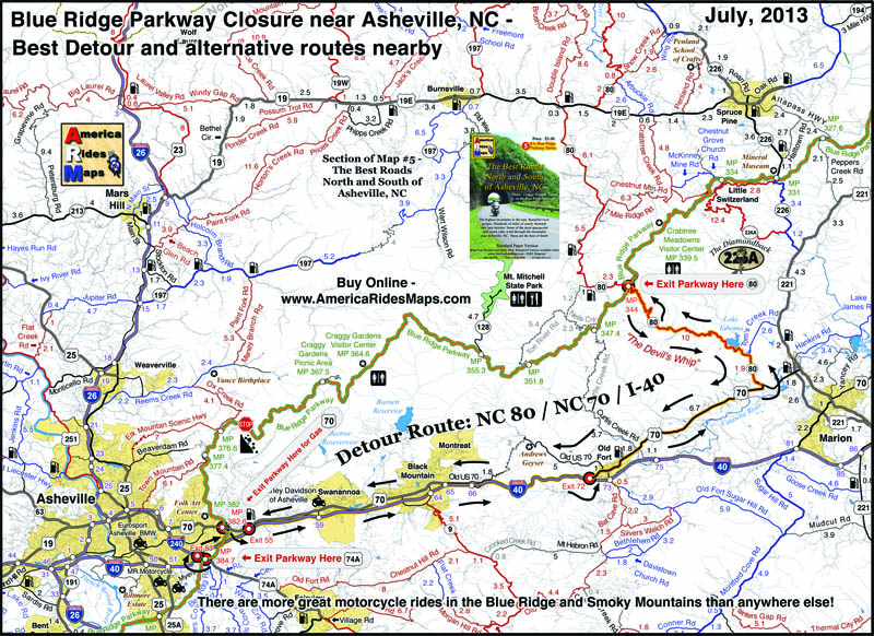
A section of the Blue Ridge Parkway north of Asheville, NC has closed due to a recent slope failure. Unprecedented rainfall in the region has triggered numerous slides, washed out roads and bridges, and caused some flooding in areas. The National Park Service detour routes traffic south and east of this long closed section of the parkway using US 221 through Marion, NC.
Usually, there is a better route than the “official Park Service Route”, as the park needs to factor in for the large RV’s which cannot easily negotiate steep climbs and sharp turns. Here is a map which highlights the most pleasant way for the motorcycle traveler to bypass the closed section of the Blue Ridge Parkway. It is also the most direct route so you miss as little as possible.
Use this link to a .pdf file of the map here to download or print it for free;
http://smokymountainrider.com/Downloads/Parkway-detour-map-2013.pdf
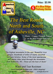
This road closure occurs on America Rides Maps Motorcycle Pocket Map #5 – “The Best Roads North and South of Asheville, NC”. A section of Map #5 with the better detour route is highlighted. You’ll also see there are several other ways to go – the red roads are best if you have the time.
America Rides Motorcycle Pocket Maps catalogue several hundred of the best motorcycle roads in the Blue Ridge Mountains from north Georgia to north Virginia so you get the most out of your visits. Great rides are linked together with the best connecting roads to keep you rolling on the most enjoyable 2 lane back roads you’ll find anywhere.
Get your maps here
____________________________________________________________________
– Wayne Busch lives in Waynesville, NC, where he produces the most detailed and comprehensive and up-to-date motorcycle pocket maps of the Blue Ridge and Smoky Mountains to help you get the most of your vacation experience. See them here – AmericaRidesMaps.com
Wayne is an advanced motorcycle instructor for Total Rider Tech teaching Lee Parks Total Control Advanced Rider Courses. Isn’t it time you looked into advanced rider training to ride more confidently and safely? It can transform your mountain riding experience. Total Rider Tech
____________________________________________________________________


Wayne,
Things like posting FREE detour routes for your maps is one of the many reasons customers like me are so loyal. Thanks pal !!!
Greg
Pingback: Blue Ridge Parkway Tips - Page 2 - Yamaha FZ6R Forums - International FZ6R / XJ6 Motorcycle Community Forum
Wayne,
Thank you so much for posting this detour. We came from Chicago and we are in York, PA ready to start on the Skyline Dr on Monday. Posting this without asking for any compensation is reason enough for me to obtain all of your maps for our return trip to the area.
Thanks Again
1- Find a product to promote, something you feel passionate about and that you know people will
want to buy it. But unfortunately not every request will
get approved. There are other ways to improve your ranking in Googlemaps, the purpose
of this blog post is not to tell you EVERYTHING Frederick Web Promotions can do to improve your ranking,
the purpose of this particular blog post is to:.
Feel free to visit my site … Google